- Noosa Heads, Queensland
-
Noosa Heads
Noosa, Queensland
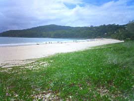
The beach along the town of Noosa Heads.Population: 3658(2006 census)[1] Postcode: 4567 Area: 12.5 km² (4.8 sq mi) Location: 138 km (86 mi) N of Brisbane LGA: Sunshine Coast State District: Noosa Federal Division: Wide Bay Suburbs around Noosa Heads: North Shore Coral Sea Coral Sea Noosaville Noosa Heads Sunshine Beach Lake Weyba Castaways Beach Sunrise Beach Coordinates: 26°23′53″S 153°05′35″E / 26.398°S 153.093°E
Noosa Heads is one of the three major centres of the Noosa region on the Sunshine Coast, Queensland, Australia. It is located 136 kilometres (85 mi) north of Brisbane, the state's capital. The Noosa River forms one boundary of the town, the headlands of the Noosa National Park another. Behind is Noosaville and Noosa Junction (these urban areas run into each other).
Noosa Heads hosts a population of koalas, which are often seen in and around Noosa National Park. Koalas are present all year around.[citation needed] The koala population in Noosa is in decline.[2]
Contents
History
The shire's tourism exponentially grew shortly after the Second World War, when gold miners from Gympie took vacation in the Noosa Shire.
In the 1800s, Noosa's early wealth came from the timber and milling industries with tourism developing in the late 1920s. The town has been the site of many tussles between developers and those seeking to preserve the town. Since the seventies, people have continued to migrate from southern states.
Transport
Noosa Heads is the tourist heart of Noosa district, with many restaurants and hotels. The main street is Hastings Street, which lies directly behind the seashore. Buses to elsewhere in the Sunshine Coast depart from Noosa Heads bus station.
Surfing
Noosa Heads' main attraction is its beaches. Its main beach and its small bays around the headland are common surfing locations which are known on world surfing circuits. One of its major surfing contests involves the Noosa Festival of Surfing. This festival attracts large numbers of longboarders.
See also
References
- ^ Australian Bureau of Statistics (25 October 2007). "Noosa Heads (Noosa Shire) (State Suburb)". 2006 Census QuickStats. http://www.censusdata.abs.gov.au/ABSNavigation/prenav/LocationSearch?collection=Census&period=2006&areacode=SSC33146&producttype=QuickStats&breadcrumb=PL&action=401. Retrieved 2008-03-19.
- ^ (17 November 2010) Where the bloody hell are Noosa's koalas?. Brian Williams. The Courier Mail.
External links
- University of Queensland: Queensland Places:Noosa Heads and Noosaville
- Official Tourism Noosa website
Surfing areas of Australia Agnes Water | Bells Beach | Bondi Beach | Byron Bay | Cronulla | Gold Coast | Jan Juc | Manly | Margaret River | Maroubra | Newcastle | Noosa Heads | Northern Beaches (Sydney) | Shark Island | Shipstern Bluff | Sunshine Coast | Surfers Paradise | Thirteenth Beach | TorquayCategories:- Suburbs of the Sunshine Coast, Queensland
- Coastal towns in Queensland
- Headlands of Australia
- Surfing locations in Queensland
- Beaches of Queensland
Wikimedia Foundation. 2010.


