- Champhai district
-
Champhai district 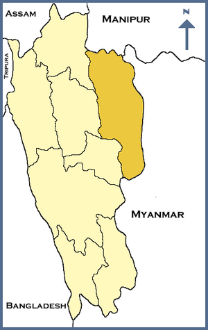
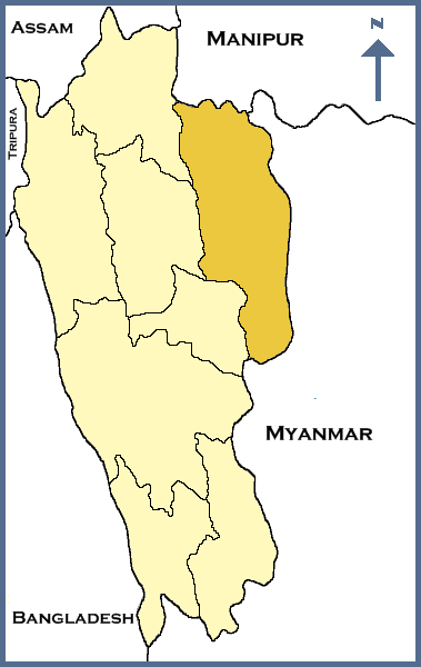
Location of Champhai district in MizoramState Mizoram,  India
IndiaHeadquarters Champhai Area 3,186 km2 (1,230 sq mi) Population 108,392 (2001) Population density 32 /km2 (83 /sq mi) Literacy 91.19% Sex ratio 944 Lok Sabha Constituencies Mizoram Assembly Seats 5 Official website Champhai district is one of the 8 districts of Mizoram state in India. The district is bounded on the north by Churachandpur district of Manipur state, on the west by Aizawl and Serchhip districts, and on the south and east by Myanmar. The district occupies an area of 3185.83 km². Champhai town is the administrative headquarters of the district.
Contents
Climate
Champhai district has a moderate climate. In winter the temperature varies from 10°C to 20°C and in summer, the temperature varies between 15°C and 30°C.
Divisions
The district comprises 4 Rural Development Blocks: Champhai, Khawbung, Khawzawl, and Ngopa. The district has 5 Legislative Assembly constituencies. These are Champhai, Khawbung, Khawhai, Khawzawl, and Ngopa. There are 88 inhabited villages in this district.
Demographics
According to the 2011 census Champhai district has a population of 125,370 ,[1] roughly equal to the nation of Grenada.[2] This gives it a ranking of 610th in India (out of a total of 640).[1] The district has a population density of 39 inhabitants per square kilometre (100 /sq mi) .[1] Its population growth rate over the decade 2001-2011 was 15.66 %.[1] Champhai has a sex ratio of 981 females for every 1000 males,[1] and a literacy rate of 93.51 %.[1]
The major religious groups in this districts are: the Christians (105,061), the Hindus (2,248) and the Muslims (432).
Flora and fauna
In 1991 Champai district became home to Murlen National Park, which has an area of 200 km2 (77.2 sq mi).[3] It is also home to the Lengteng Wildlife Sanctuary, which was established in 1999 and has an area of 120 km2 (46.3 sq mi).[3]
References
- ^ a b c d e f "District Census 2011". Census2011.co.in. 2011. http://www.census2011.co.in/district.php. Retrieved 2011-09-30.
- ^ US Directorate of Intelligence. "Country Comparison:Population". https://www.cia.gov/library/publications/the-world-factbook/rankorder/2119rank.html. Retrieved 2011-10-01. "Grenada 108,419 July 2011 est."
- ^ a b Indian Ministry of Forests and Environment. "Protected areas: Mizoram". http://oldwww.wii.gov.in/envis/envis_pa_network/index.htm. Retrieved September 25, 2011.
External links

Kolasib district Churachandpur district, Manipur Aizawl district 
Myanmar  Champhai district

Serchhip district Districts of Mizoram Coordinates: 23°28′28″N 93°19′32″E / 23.47444°N 93.32556°E
Categories:- Districts of Mizoram
- Champhai district
- India geography stubs
Wikimedia Foundation. 2010.