- Kolasib district
-
Kolasib district 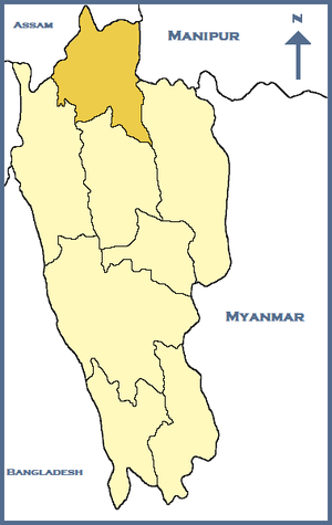
Location of Kolasib district in MizoramState Mizoram,  India
IndiaHeadquarters Kolasib Area 1,382.51 km2 (533.79 sq mi) Population 60,980 (2001) Lok Sabha Constituencies Mizoram Assembly Seats 3 Official website Kolasib district is one of the 8 districts of Mizoram state in India.
Contents
Geography
The district is bounded on the north and northwest by Hailakandi district of Assam state, on the west by Mamit district, on the south and east by Aizawl district and on the northeast by Cachar district of Assam state. The district occupies an area of 1382.51 km². Kolasib town is the administrative headquarters of the district.
Divisions
The district has 2 R.D. Blocks, Kolasib and Thingdawl. The district has 3 assembly constituencies, Bilkhawthlir, Kawnpui and Kolasib.
Demographics
According to the 2011 census Kolasib district has a population of 83,054 ,[1] roughly equal to the nation of Andorra.[2] This gives it a ranking of 622nd in India (out of a total of 640).[1] The district has a population density of 60 inhabitants per square kilometre (160 /sq mi) .[1] Its population growth rate over the decade 2001-2011 was 25.92 %.[1] Kolasib has a sex ratio of 956 females for every 1000 males,[1] and a literacy rate of 94.54 %.[1]
References
- ^ a b c d e f "District Census 2011". Census2011.co.in. 2011. http://www.census2011.co.in/district.php. Retrieved 2011-09-30.
- ^ US Directorate of Intelligence. "Country Comparison:Population". https://www.cia.gov/library/publications/the-world-factbook/rankorder/2119rank.html. Retrieved 2011-10-01. "198 Andorra 84,825 July 2011 est."
External links

Hailakandi district, Assam Cachar district, Assam Churachandpur district, Manipur 
 Kolasib district

Mamit district Aizawl district Champhai district Districts of Mizoram Categories:- Districts of Mizoram
- Kolasib district

Wikimedia Foundation. 2010.