- Lunglei district
-
This article is about the district. For its eponymous headquarters, see Lunglei.
Lunglei district 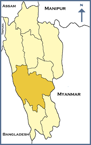
Location of Lunglei district in MizoramState Mizoram,  India
IndiaHeadquarters Lunglei Area 4,538 km2 (1,752 sq mi) Population 137,155 (2001) Population density 30 /km2 (78 /sq mi) Lok Sabha Constituencies Mizoram Assembly Seats 7 Official website Lunglei district is one of the 8 districts of Mizoram state in India. As of 2011 it is the second most populous district in the state (out of 7), after Aizawl.[1]
Contents
Origin of name
The district is named after its headquarters, Lunglei. Lunglei, sometimes spelled Lungleh, in Mizo means a bridge of rock. It derived its name from a bridge like rock found in the riverine area around the Nghaish, a small tributary of the river Tlawng.
Geography
The district is bounded on the north by Mamit and Aizawl districts, on the west by Bangladesh, on the south by Lawngtlai district, on the southeast by Saiha district, on the east by Myanmar and on the northeast by Serchhip District. The district occupies an area of 4538 km². Lunglei town is the administrative headquarters of the district.
Divisions
The district has 4 R.D. Blocks, Bunghmun, Hnahthial, Lunglei and Lungsen. The district has 7 assembly constituencies. These are South Tuipui, Lunglei North, Lunglei East, Lunglei West, Lunglei South, Thorang and West Tuipui.
Demographics
According to the 2011 census Lunglei district has a population of 154,094 ,[2] roughly equal to the nation of Saint Lucia.[3] This gives it a ranking of 597th in India (out of a total of 640).[2] The district has a population density of 34 inhabitants per square kilometre (88 /sq mi) .[2] Its population growth rate over the decade 2001-2011 was 12.29 %.[2] Lunglei has a sex ratio of 944 females for every 1000 males,[2] and a literacy rate of 89.4 %.[2]
References
- ^ "District Census 2011". Census2011.co.in. 2011. http://www.census2011.co.in/district.php. Retrieved 2011-09-30.
- ^ a b c d e f "District Census 2011". Census2011.co.in. 2011. http://www.census2011.co.in/district.php. Retrieved 2011-09-30.
- ^ US Directorate of Intelligence. "Country Comparison:Population". https://www.cia.gov/library/publications/the-world-factbook/rankorder/2119rank.html. Retrieved 2011-10-01. "Saint Lucia 161,557 July 2011 est."
External links

Mamit district Aizawl district Serchhip district Bangladesh 
Myanmar  Lunglei district

Lawngtlai district Saiha district Districts of Mizoram Categories:- Districts of Mizoram
- Lunglei district
- India geography stubs

Wikimedia Foundation. 2010.