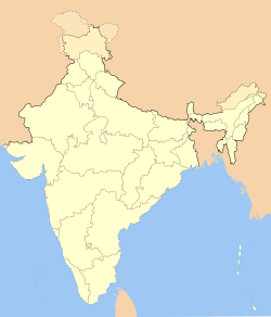
Champhai

Champhai
Champhai
—  town  —
Champhai
Location of Champhai
in Mizoram
Coordinates 23°18′N 92°50′E / 23.3°N 92.83°E / 23.3; 92.83Coordinates: 23°18′N 92°50′E / 23.3°N 92.83°E / 23.3; 92.83
Country India
State Mizoram
District(s) Champhai
Population

Density

20,185 (2001)

6 /km2 (16 /sq mi)

Time zone IST (UTC+05:30)
Area

Elevation

3,185.3 square kilometres (1,229.9 sq mi)

1,678 metres (5,505 ft)

Website Champhai.nic.in

Champhai is a border town in Mizoram state, in far eastern India. It is the headquarters of Champhai District, one of the eight districts in the state. It is located on the Indo-Myanmar border and is situated in a strategically important location. Because of this, it is the main business corridor for India and Myanmar in the area.

Champhai seen from the south across the Champhai Valley, with Zotlang in the foreground

The area of Champhai is 3,185.83 square kilometres (1,230 sq mi). The average annual rainfall is 1,814 millimetres (71.4 in).


External links


Wikimedia Foundation. 2010.

Игры ⚽ Поможем написать реферат

Look at other dictionaries:

  • Champhai district — This article is about the district. For its eponymous headquarters, see Champhai. Champhai district Location of Champhai district in Mizoram …   Wikipedia

  • Champhai college — History The Government Champhai College, Champhai, Mizoram was established originally as a private college in 1971 by the philanthropists of Champhai town and neighboring villages. The founders objective was providing collegiate education to the… …   Wikipedia

  • Ngopa —   town   …   Wikipedia

  • Sinlung — Ethnic group group=Sinlung poptime= Estimated 5 million popplace=India ndash; Manipur, Mizoram, Assam, Meghalaya, Tripura langs=Hmar, Lushai, Paite, Kuki, Zo, Vaiphei, Chin English rels=Christianity, Judaism related=Lushai Chin Kuki Mizo… …   Wikipedia

  • March 1966 Mizo National Front uprising — Part of Insurgency in Northeast India Map of Mizoram state (formerly Mizo district) …   Wikipedia

  • Pu Zoramthanga — For the boxer, see Pu Zoramthanga (boxer)Infobox Indian politician name = Zoramthanga birth date = birth date|1944|7|13|mf=y birth place =Samthang village, Mizoram residence = Aizawl, Mizoram death date = death place = constituency = Champhai… …   Wikipedia

  • Mizoram —   State   Aizawl …   Wikipedia

  • Churachandpur district — This article is about the district. For its eponymous headquarters, see Churachandpur. Churachandpur   district   …   Wikipedia

  • Murlen National Park — is a national park located in the Champhai district Mizoram in India. The size of the park area is 200 km². The park is situated about 245 km east of Aizawl, and is close to the Chin Hills. It covers an area of approximately… …   Wikipedia

  • Khawhai — Infobox Indian Jurisdiction native name = Khawhai | type = city | latd = 23.37 | longd = 93.12 locator position = left | state name = Mizoram district = Champhai leader title = leader name = altitude = 1369 population as of = 2001 population… …   Wikipedia

Share the article and excerpts

Direct link
Do a right-click on the link above
and select “Copy Link”