- Concord, Ontario
-
For other uses, see Concord (disambiguation).
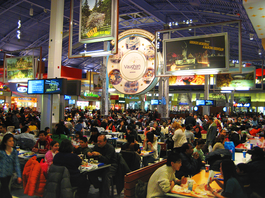
Concord — Unincorporated community — The Vaughan Mills food court during Boxing Day.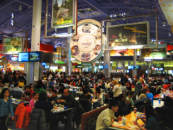
Coordinates: 43°48′30″N 79°28′8″W / 43.80833°N 79.46889°WCoordinates: 43°48′30″N 79°28′8″W / 43.80833°N 79.46889°W Country Canada Province Ontario Regional Municipality York City Vaughan Government - City mayor Maurizio Bevilacqua Population (2001)[1] - Total 8,255 Time zone EST (UTC-5) - Summer (DST) EDT (UTC-4) Forward sortation area L4K Area code(s) 905 and 289 Concord is an unincorporated suburban industrial community in the City of Vaughan in York Region, located north of Toronto, Ontario, Canada. According to the 2001 Census, the community has 8,255 residents (including the community of Carrville).[1]
It is accessed by two superhighways: Highway 407 and Highway 400. Concord is located in the City of Vaughan, west of Thornhill, and north of Toronto. Concord is bordered by Steeles Avenue to the south, Black Creek to the west (roughly Highway 400), the Upper West Don River to the northwest (roughly Dufferin Street and Rutherford Road).
Contents
Geography
- Location
- Latitude: about 43.81 N
- Longitude: about 79.5 W
- Area codes: 1-905,
Surrounding communities
- Woodbridge
- Maple
- Thornhill
- Downsview (City of Toronto)
History
Prior to the 1950s, when Highway 400 was first opened, Concord was an agricultural community, covered mostly by farmlands. Housing developments also began in the 1950s east of Keele Street, as well as construction of a CN railway by-pass of Toronto with a 4 km freight yard. This decade also saw an industrial park also added near Jane Street.
In the 1970s, the industrialization of the northern part of the Greater Toronto Area began. The industrial area east of Keele Street consisted of industrialized buildings and a plaza within Highway 7, with industrial buildup continuing into the 1980s. A residential area, Glen Shields, was built in the 1970s and the 1980s in the southeast, west of Dufferin. 1992 also saw the commencement of the construction of Highway 407, which opened in 1997, with three Concord interchanges. Planned streets for housing extending to Rutherford Road. In the early 2000s, the construction of Vaughan Mills began, being completed in 2004.
Until the opening of Canada's Wonderland, Concord had a total of one interchange at Highway 7, it had two until the early-1990s when a partial interchange at Langstaff was opened. Three more interchanges were opened on the 407 Express Toll Route (ETR) in 1997. Today, a partial interchange with Vaughan Mills opened. Today, Concord had 8 interchanges, of which 3 are with the toll highway, 2 are partial, 1 with the superhighway and the other 2 are in the 400. The plan for an interchange on Centre Street was included but it was later removed.
Much of Concord is industrial while empty spaces remain in the southern part and within the Black Creek and the 407 and the CN line. Mixed forests are located in the north and within Black Creek and along the Don River. One tract of forest is located to the northwest. All main roads except for Langstaff east of Creditstone Road are 4-lane roadways,
Concord is an industrial hub, second only to Mississauga in size and capacity in the Province of Ontario.[citation needed] Many large multi-national and domestic corporations have headquarters in Concord. Its access to several major highways and the strength and skill of its workforce is a key factor in the locations of these businesses.
Education
- Glen Shields Public School
- Forest Run Public School
- Our Lady of the Rosary Catholic School
References
- ^ a b "Population by Age and Community - 2001". City of Vaughan. http://www.city.vaughan.on.ca/business/stats/population/population3.cfm. Retrieved 2006-10-04.[dead link]
City of Vaughan Communities Carrville • Coleraine • Concord • Elder Mills • Edgeley • Hope • Kleinburg • Maple • Langstaff • Nashville • Peace Village • Pine Grove • Purpleville • Sherwood • Sunset Corners • Teston • Thornhill • Vellore • Weston Downs • Wilshire • WoodbridgeCommunities in other York Region municipalities: King • Markham • Richmond Hill • Vaughan • Whitchurch–StouffvilleGreater Toronto Area Largest city: TorontoRegions 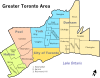
Cities Towns Ajax • Aurora • Caledon • East Gwillimbury • Georgina • Halton Hills • Markham • Milton • Newmarket • Oakville • Richmond Hill • WhitbyTownships and municipalities External links
Categories:- Neighbourhoods in Vaughan
- Location

Wikimedia Foundation. 2010.