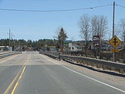
- Huron Shores
-
Huron Shores — Township — Municipal building in Iron Bridge Coordinates: 46°17′N 83°12′W / 46.283°N 83.2°WCoordinates: 46°17′N 83°12′W / 46.283°N 83.2°W Country  Canada
Province  Ontario
District Algoma Established 1999 Government – Type Town – Mayor Gil Reeves – MP Carol Hughes (NDP) – MPP Michael Mantha (NDP) Area[1] – Land 455.33 km2 (175.8 sq mi) Population (2006)[1] – Total 1,696 – Density 3.7/km2 (9.6/sq mi) Time zone EST (UTC-5) – Summer (DST) EDT (UTC-4) Postal code P0R 1H0 Area code(s) 705 Website www.huronshores.ca Huron Shores is a township in the Canadian province of Ontario, located along the North Channel of Lake Huron in the Algoma District.
The municipality was created in 1999 through the amalgamation of the former townships of Thessalon, Thompson, and Day and Bright Additional, and the former village of Iron Bridge. The town of Thessalon, although surrounded by Huron Shores, is not part of the township.
The township had a population of 1,696 in the Canada 2006 Census. The township's current mayor is Gil Reeves, who succeeded Ted Linley in the 2010 municipal election.
Contents
Communities
The main communities in the township are Iron Bridge, Sowerby and Little Rapids. Smaller communities include Ansonia, Day Mills, Dayton, Dean Lake, Eley, Livingstone, Livingstone Creek, Maple Ridge, Nestorville, Sherwood and Sunset Beach.
Originally named Tally-Ho for the call that the lumberjacks would make upon reaching a trading post, Iron Bridge was renamed in the early 1900s after the bridge built over the nearby Mississagi River. Its most notable tourist attractions are its snowmobile trails, nearby wilderness areas for hunting and fishing, and the Voyageur Hiking Trail which passes through the town of Iron Bridge.
As a formerly independent village, Iron Bridge retains the status of designated place in Canadian censuses. It had a population of 614 in the Canada 2006 Census.
Demographics
Population:[2]
- Population in 2006: 1696
- Population in 2001: 1794
- Population total in 1996: 1877
- Day and Bright Additional: 217
- Iron Bridge: 777
- Thessalon: 758
- Thompson: 125
- Population in 1991:
- Day and Bright Additional: 249
- Iron Bridge: 823
- Thessalon: 771
- Thompson: 119
Total private dwellings (excluding seasonal cottages): 718
Languages:
- English as first language: 93.5 %
- French as first language: 2.4 %
- English and French as first language: 0 %
- Other as first language: 4.1 %
References
- ^ a b Shores&SearchType=Begins&SearchPR=01&B1=All&Custom= "Huron Shores community profile". 2006 Census data. Statistics Canada. http://www12.statcan.gc.ca/census-recensement/2006/dp-pd/prof/92-591/details/page.cfm?Lang=E&Geo1=CSD&Code1=3557035&Geo2=PR&Code2=35&Data=Count&SearchText=Huron Shores&SearchType=Begins&SearchPR=01&B1=All&Custom=. Retrieved 2011-04-15.
- ^ Statistics Canada: 1996, 2001, 2006 census
External links

Unorganized North Algoma District 
Plummer Additional 
Blind River  Huron Shores (surrounds Thessalon and Thessalon 12 IR)

North Channel of Lake Huron /
Drummond Island (U.S.A.), Cockburn IslandUnorganized West Manitoulin Algoma District, Ontario Cities 
Towns Townships Dubreuilville • Hilton • Hornepayne • Huron Shores • Jocelyn • Johnson • Laird • Macdonald, Meredith and Aberdeen Additional • North Shore • Plummer Additional • Prince • St. Joseph • Tarbutt and Tarbutt Additional • Wawa • White RiverVillages Hilton BeachFirst Nations Batchewana • Garden River • Hornepayne • Michipicoten • Missanabie • Mississauga • Sagamok • Serpent River • ThessalonIndian reserves Chapleau 61 • Garden River • Goulais Bay • Gros Cap • Gros Cap Village • Missanabie • Mississagi River • Obadjiwan • Rankin Location • Sagamok • Serpent River • Thessalon • Whitefish IslandLocal services boards Aweres • Batchawana Bay • Goulais and District • Hawk Junction • Missanabie • Peace Tree • Searchmont • Wharncliffe and KynochUnorganized areas Categories:- Municipalities in Algoma District, Ontario
- Township municipalities in Ontario
Wikimedia Foundation. 2010.


