- Blind River, Ontario
Infobox City
official_name = Town of Blind River
other_name =
native_name =
nickname =
motto =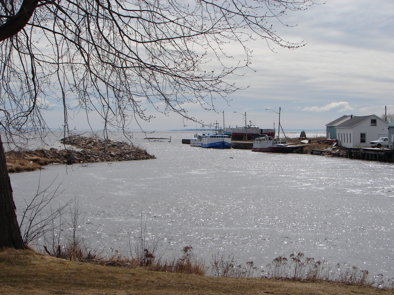
imagesize =
image_caption = The harbour on the North Channel in Blind River.
flag_size =
image_
seal_size =
image_shield =
shield_size =
image_blank_emblem =
blank_emblem_size =
mapsize =
map_caption =
pushpin_
pushpin_label_position =
subdivision_type = Country
subdivision_name =Canada
subdivision_type1 = Province
subdivision_name1 =Ontario
subdivision_type2 = District
subdivision_name2 = Algoma
subdivision_type3 =
subdivision_name3 =
subdivision_type4 =
subdivision_name4 =
government_type = Town
leader_title = Mayor
leader_name =Bob Gallagher
leader_title1 = Governing Body
leader_name1 = Blind River Town Council
leader_title2 =MP
leader_name2 =Brent St. Denis (LPC)
leader_title3 =MPP
leader_name3 =Mike Brown (OLP)
leader_title4 =
leader_name4 =
established_title = Incorporated
established_date =
established_title2 =
established_date2 =
established_title3 =
established_date3 =
area_magnitude =
unit_pref =
area_footnotes =
area_total_km2 = 520.59
area_land_km2 =
area_water_km2 =
area_total_sq_mi =
area_land_sq_mi =
area_water_sq_mi =
area_water_percent =
area_urban_km2 =
area_urban_sq_mi =
area_metro_km2 =
area_metro_sq_mi =
population_as_of = 2006
population_footnotes =ref label|Stats_Canada|1|1(sc)
population_note =
settlement_type = Town
population_total = 3780
population_density_km2 = 7.3
population_density_sq_mi =
population_metro =
population_density_metro_km2 =
population_density_metro_sq_mi =
population_urban =
population_density_urban_km2 =
population_density_urban_mi2 =
timezone = EST
utc_offset = −5
timezone_DST = EDT
utc_offset_DST = −4
latd=
longd=
elevation_footnotes =
elevation_m =
elevation_ft =
postal_code_type =
postal_code =
area_code =705
website = [http://www.blindriver.ca/ Town of Blind River]
footnotes =Blind River is a town situated on the North Channel of
Lake Huron in theAlgoma District, Ontario ,Canada . Thetown was named after the nearby Blind River. Blind River celebrated itscentennial in 2006.History
French
explorer s discovered the North Channel and made it a renownedvoyageur route.Fur trade rs,logger s andmine rs followed to seeknatural resources . A furtrading post was established by theNorth West Company in 1789 at the mouth of theMississagi River . When the fur trade slowed about 1820, theHudson's Bay Company purchased the North West Company. A number oftrapper s settled along the rivers flowing intoLake Huron . One of these rivers, just three miles east of the Mississagi mouth, was called Penewobecong which translates to "smooth rock or sloping". The voyageurs named this river the Blind River because the mouth was not visible along thecanoe route. The name Blind River was adopted by thesettlement that grew at the mouth of the river.The logging industry developed because of the accessibility of
timber along the Blind River and Mississagi watersheds. The industry was spurred by acopper discovery in the mid 1800s in Bruce Mines. The firstsawmill was built beside the mouth of the Blind River at the current site of the Old Mill Motel. The protectedestuary of the east arm of the Blind River as well as the deep water offshore offered a good location for the mill. The sawmill provided timber and planks for the copper mine. By 1906 when Blind River had been incorporated as a town, a second larger sawmill had been erected on the west arm of the Blind River. Today the west arm is the location of the Blind River Marine Park. In 1929 the Carpenter Hixon Company built a state-of-the-art pine sawmill producing 89 million board feet oflumber in its first year. Through boom and bust the mill survived under the name McFadden Lumber Company for over forty years as the largest white pine sawmill east of theRocky Mountains , with an annual capacity of 120,000,000 board feet (280,000 m³) of lumber (an output never reached in actual production.) The Great Mississauga Fire of 1948 led to a depletion of timber, difficult economic conditions and the eventual closing of the mill in 1969. The lumber history is commemorated in theTimber Village Museum .In 1955
uranium was discovered near Blind River. The first uranium mine began operation as the Pronto mine inAlgoma Mills . Although its life was short-lived, its significance was that it led to the discovery of the entire Blind River-Elliot Lake uranium mining camp. In 1983 a uraniumrefinery was built just west of Blind River. This uranium refinery is owned and operated by theCameco Corporation which processes uranium concentrates from all over the world intouranium trioxide .Population and economy
The town had a population of 3,780 in the
Canada 2006 Census . Its main businesses are tourism, fishing, logging, anduranium refining.Transportation links are
Highway 17 (part of theTrans-Canada Highway in Ontario), the Huron Central Railway operating on the leasedCanadian Pacific Railway line that runs through the town, and theBlind River Marine Park , a town-owned marina servicing pleasure craft. The town also provides services to the surrounding communities through its District Health Centre, two high schools (W.C. Eaket Secondary School and École sécondaire catholique Jeunesse nord) and three elementary schools (Blind River Public School, St. Mary's Catholic Public School and École catholique St. Joseph).Blind River has seven churches, as well as a Kingdom Hall located just outside of the town, and a variety of merchants and service industries.
Blind River has many beaches on Lake Huron, including Fourth Sand, Sellers Park, Boom Camp, Forest Glen Beach, as well as many others.
Blind River is home to a large
uranium refinery operated by theCameco Corporation , which is situated just outside of town as well as a world renowned golf course by the name of Huron Pines Country Club.Blind River is located at coor dm|46|11|N|82|57|W|city.
ports and culture
*The town is home to the
Blind River Beavers of theNorthern Ontario Junior Hockey League .*
Neil Young makes reference to Blind River in his song "Long May You Run"; a story about the demise of his 1948Buick Roadmaster hearse.Well, it was back in Blind River in 1962
When I last saw you alive
But we missed that shift on the long decline
Long may you run.*Hometown of the character Mary Pilant played by
Kathryn Crosby , she was listed as Kathryn Grant, in the filmAnatomy of a Murder External links
* [http://www.blindriver.ca/ Town of Blind River]
Wikimedia Foundation. 2010.