- Johnson, Ontario
-
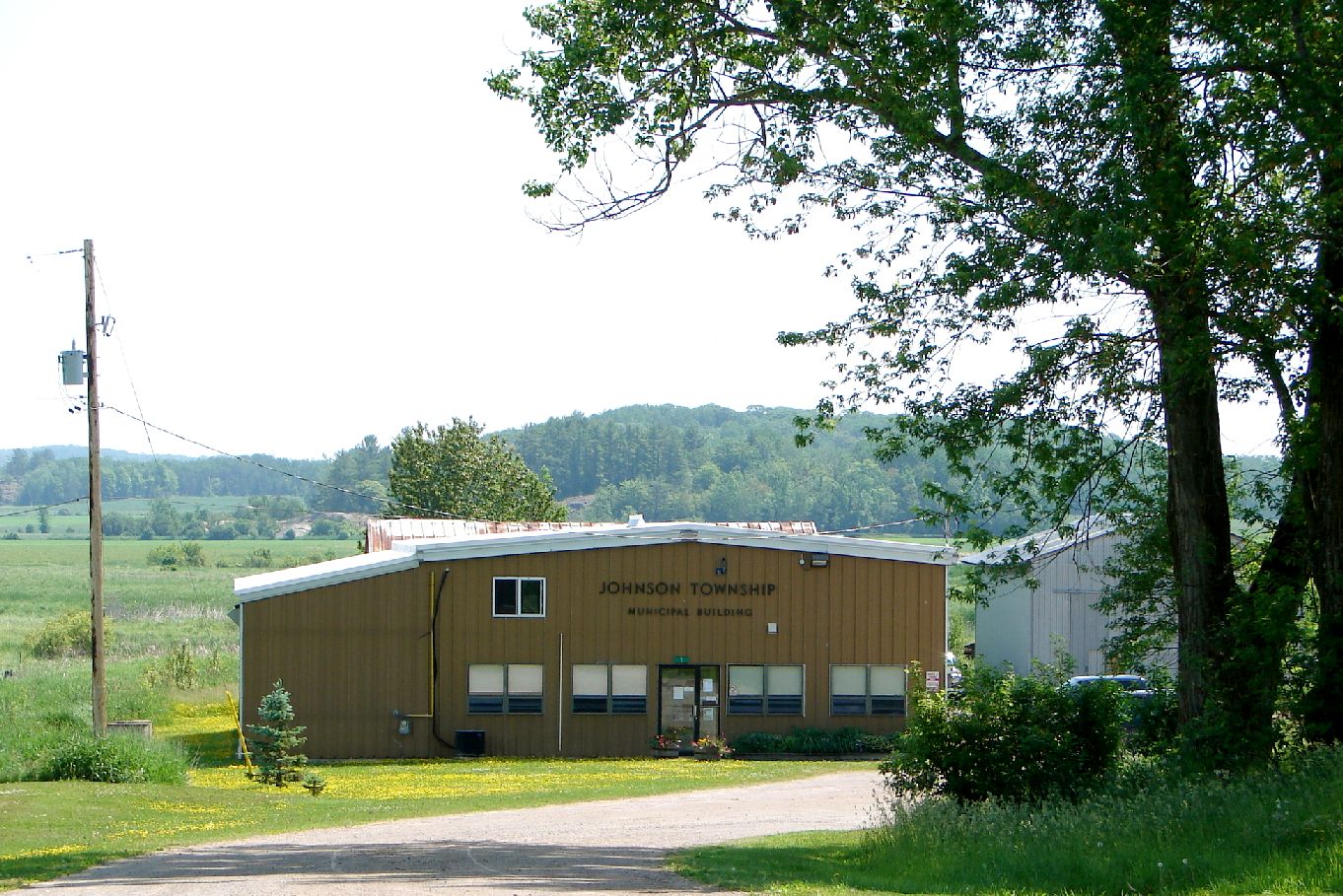
Johnson — Township — Municipal building in Desbarats

 Johnson
Coordinates: 46°20′N 83°56′W / 46.333°N 83.933°WCoordinates: 46°20′N 83°56′W / 46.333°N 83.933°W Country  Canada
Province  Ontario
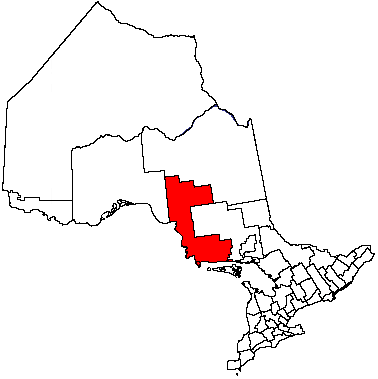
District Algoma Established Government – Type Township – Mayor Ted Hicks (2010-Present) Edith Orr (2006-2010) – MP Bryan Hayes (CPC) – MPP Michael Mantha (NDP) Area[1] – Land 119.67 km2 (46.2 sq mi) Population (2006)[1] – Total 701 – Density 5.9/km2 (15.3/sq mi) Time zone EST (UTC-5) – Summer (DST) EDT (UTC-4) Postal code P0R 1E0 Area code(s) 705 and 249 Website www.johnsontwp.ca Johnson is a township in the Canadian province of Ontario, located within the Algoma District. The township had a population of 701 in the Canada 2006 Census.
Contents
Communities
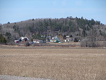
Desbarats, the main community in the township, is located on Highway 17, 54 km east of Sault Ste. Marie.
Located in Desbarats is Central Algoma Secondary School, a high school of 450+ students which serves a catchment area extending from Echo Bay to Thessalon.
 Desbarats
West of Desbarats on Highway 17 is Ripple Rock, a unique rock cut that was uncovered with the blasting of the rock cuts through northern Ontario for the creation of the Trans-Canada Highway. The ripples in the rock were created two billion years ago by waves in a shallow body of water. It was buried and through pressure it became sandstone.
Puddingstone Road in Johnson Township was named for the geological phenomenon of puddingstone, found in the area as well as at nearby St. Joseph Island. Puddingstone is a mixture of different sized grains and pebbles held together by finer sand. The type found in this area is St. Joseph Island Puddingstone, which contains red and brown pieces of jasper.
Since the early 2000s, about 20 Mennonite families from Southern Ontario moved to the Desbarats area. Along with other local farmers, they sell their produce at the Desbarats Farmers' Market on Friday evenings and Saturday mornings.
Demographics
Population trend:[2]
- Population in 2006: 701
- Population in 2001: 658
- Population in 1996: 729
- Population in 1991: 685
References
- ^ a b "Johnson community profile". 2006 Census data. Statistics Canada. http://www12.statcan.gc.ca/census-recensement/2006/dp-pd/prof/92-591/details/page.cfm?Lang=E&Geo1=CSD&Code1=3557016&Geo2=PR&Code2=35&Data=Count&SearchText=johnson&SearchType=Begins&SearchPR=01&B1=All&Custom=. Retrieved 2011-04-14.
- ^ Statistics Canada: 1996, 2001, 2006 census
External links

Laird Macdonald, Meredith and Aberdeen Additional Tarbutt and Tarbutt Additional 
Plummer Additional  Johnson

St. Joseph Channel /
St. Joseph, Hilton (St. Joseph Island)Algoma District, Ontario Cities 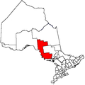
Towns Townships Dubreuilville • Hilton • Hornepayne • Huron Shores • Jocelyn • Johnson • Laird • Macdonald, Meredith and Aberdeen Additional • North Shore • Plummer Additional • Prince • St. Joseph • Tarbutt and Tarbutt Additional • Wawa • White RiverVillages Hilton BeachFirst Nations Batchewana • Garden River • Hornepayne • Michipicoten • Missanabie • Mississauga • Sagamok • Serpent River • ThessalonIndian reserves Chapleau 61 • Garden River • Goulais Bay • Gros Cap • Gros Cap Village • Missanabie • Mississagi River • Obadjiwan • Rankin Location • Sagamok • Serpent River • Thessalon • Whitefish IslandLocal services boards Aweres • Batchawana Bay • Goulais and District • Hawk Junction • Missanabie • Peace Tree • Searchmont • Wharncliffe and KynochUnorganized areas Categories:- Municipalities in Algoma District, Ontario
- Township municipalities in Ontario


Wikimedia Foundation. 2010.