- Culver Line (New York City Subway)
-
Culver Line 
The F travels over the whole length as a local train. Several stations are also served by the G.Overview Type Rapid transit System New York City Subway Termini North of Jay Street – MetroTech
Coney Island – Stillwell AvenueStations 21 Operation Opened 1919–1954 Owner City of New York Operator(s) New York City Transit Authority Character Underground and elevated Technical No. of tracks 2–4 Track gauge 4 ft 8 1⁄2 in (1,435 mm) Electrification Direct current traction The Culver Line is a rapid transit line of the B Division of the New York City Subway, extending from Downtown Brooklyn south to Coney Island, Brooklyn, New York City, United States. From its beginning at an interlocking north of Jay Street – MetroTech, where Culver Line trains can access the IND Sixth Avenue Line or IND Eighth Avenue Line, south to Church Avenue in Kensington, the line is mostly a four-track subway, though it rises to cross over the Gowanus Canal on the only above-ground structure on the original Independent Subway System. In Kensington, the line rises onto a three-track elevated structure built by the Brooklyn Rapid Transit Company as part of the Dual Contracts. When this ramp was opened in 1954, the older route from Kensington northwest to Sunset Park remained as the Culver Shuttle until it was closed in 1975. The final portion of the line in Coney Island is on the lower level of a double-decked elevated structure, with the BMT Brighton Line above.
The local tracks of the Culver Line are served by the F service, as well as the G between Bergen Street and Church Ave. The express tracks are not regularly used as of 2010[update].
The elevated part of the Culver Line, operated as part of the BMT division until 1954, now carries only the F, a former IND service, and is chained[1] and signaled[2] as part of the IND. However, BMT radio frequency B1 is used on the elevated portion of the line south of Church Avenue.[citation needed]
Contents
Extent and service
Jay Street to Church Avenue
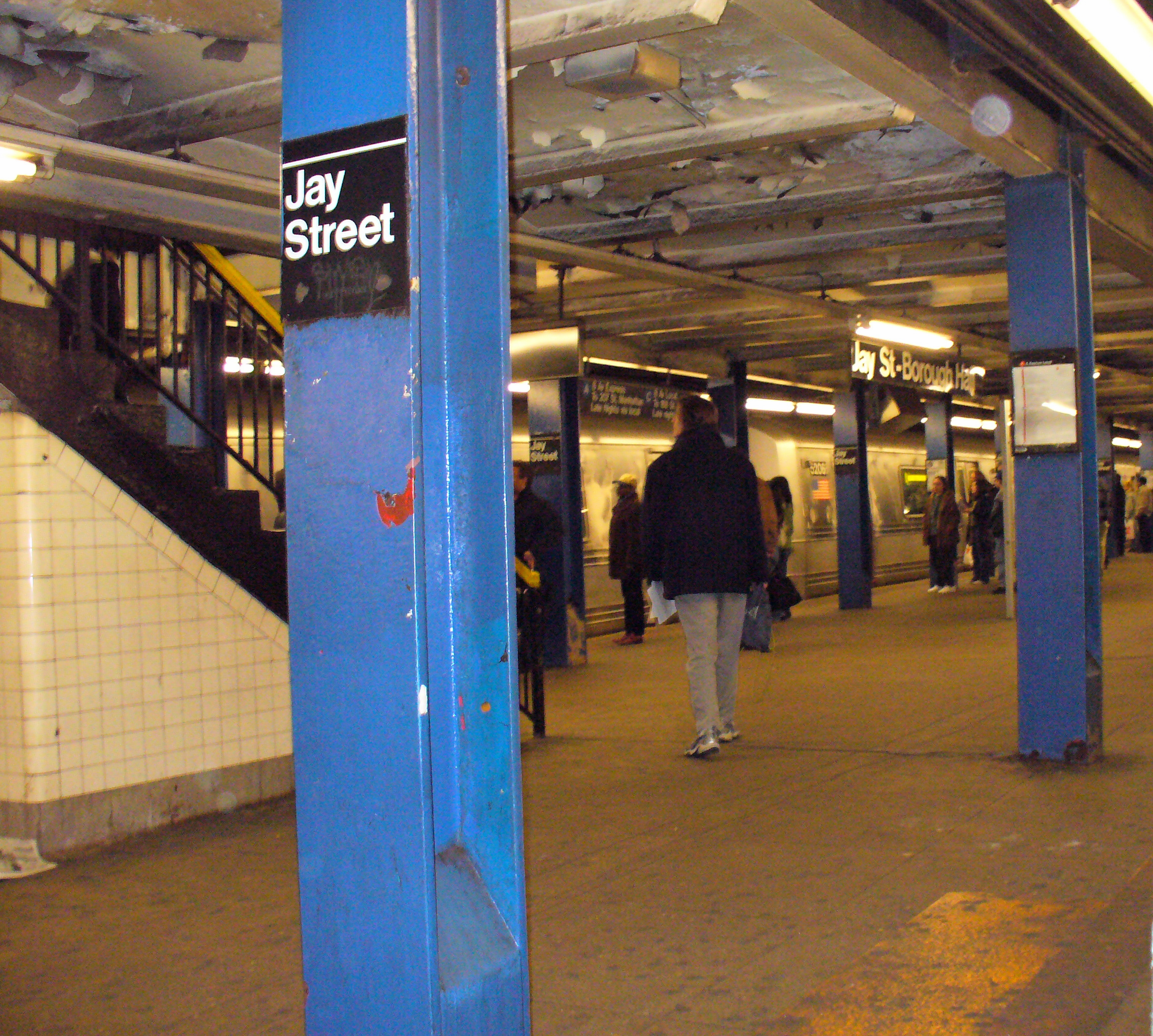
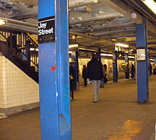 Jay Street – MetroTech
The Culver Line is served by the F as a local for its entire length. The portion of the route from Bergen Street south to Church Avenue is also served by the G Brooklyn–Queens Crosstown service. Both routes run all the time.
Despite the fact that there are two express tracks on the northern part of the route and one on the southern, with express stations distributed along the line, there is no express service on the Culver Line at the present time. Hope for early restoration of expresses was thwarted by a serious signal fire at Bergen Street that is still under repair. In fact, the issue came to a head in June 2007, when a petition for express service reached 2,600 signatures and gained media attention. The MTA has stated that the Culver Viaduct will undergo repairs until 2012, rendering the express tracks useless until then. Nevertheless, they are looking into the issue and a possible short-term solution. [1]
Culver Viaduct
The north part of the Culver Line is a four-track line, entirely underground except for Smith–Ninth Streets and 4th Avenue stations, the only above-ground section of the original IND system. A massive steel and concrete viaduct spans the Gowanus Canal. This structure is now referred to as the Culver Viaduct or Culver Line Viaduct. The line then proceeds east to Park Slope where the local tracks diverge to a station at 15th Street and Prospect Park West while the express tracks take a direct route beneath Prospect Park. The line then parallels the route of the original Culver Line surface railroad into Church Avenue station, last stop of the original IND service. Four tail tracks continue underground as a terminal facility, and four more tracks ascend the Culver Ramp.
The IND Culver Line was originally designated the Brooklyn Line but has also been called the Smith Street Line[2], Church Avenue Line or South Brooklyn Line. The express tracks beneath Prospect Park are sometimes referred to as the Prospect Park Line.
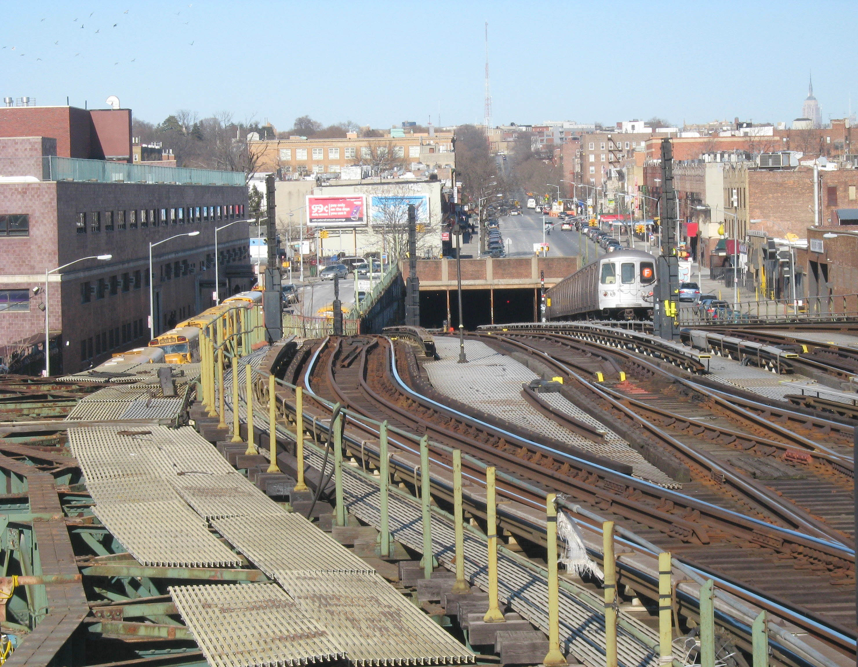
The four-tracked Culver Ramp, located on McDonald Avenue between Cortelyou Road and Avenue C, connects the subway portion of the IND Culver Line with the former BMT Culver Line elevated structure. Despite being a part of the IND Division, the Culver elevated portion is controlled by BMT radio dispatch, so train operators change between the IND (B-2) and BMT (B-1) radio frequencies at this point.
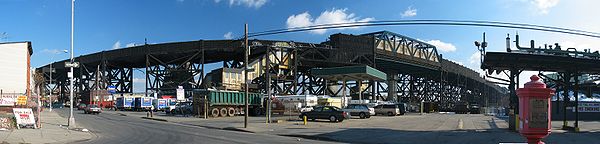 The Culver Viaduct
Ditmas Avenue to Coney Island
 Culver Line leaves Coney Island – Stillwell Avenue underneath the BMT Brighton Line.
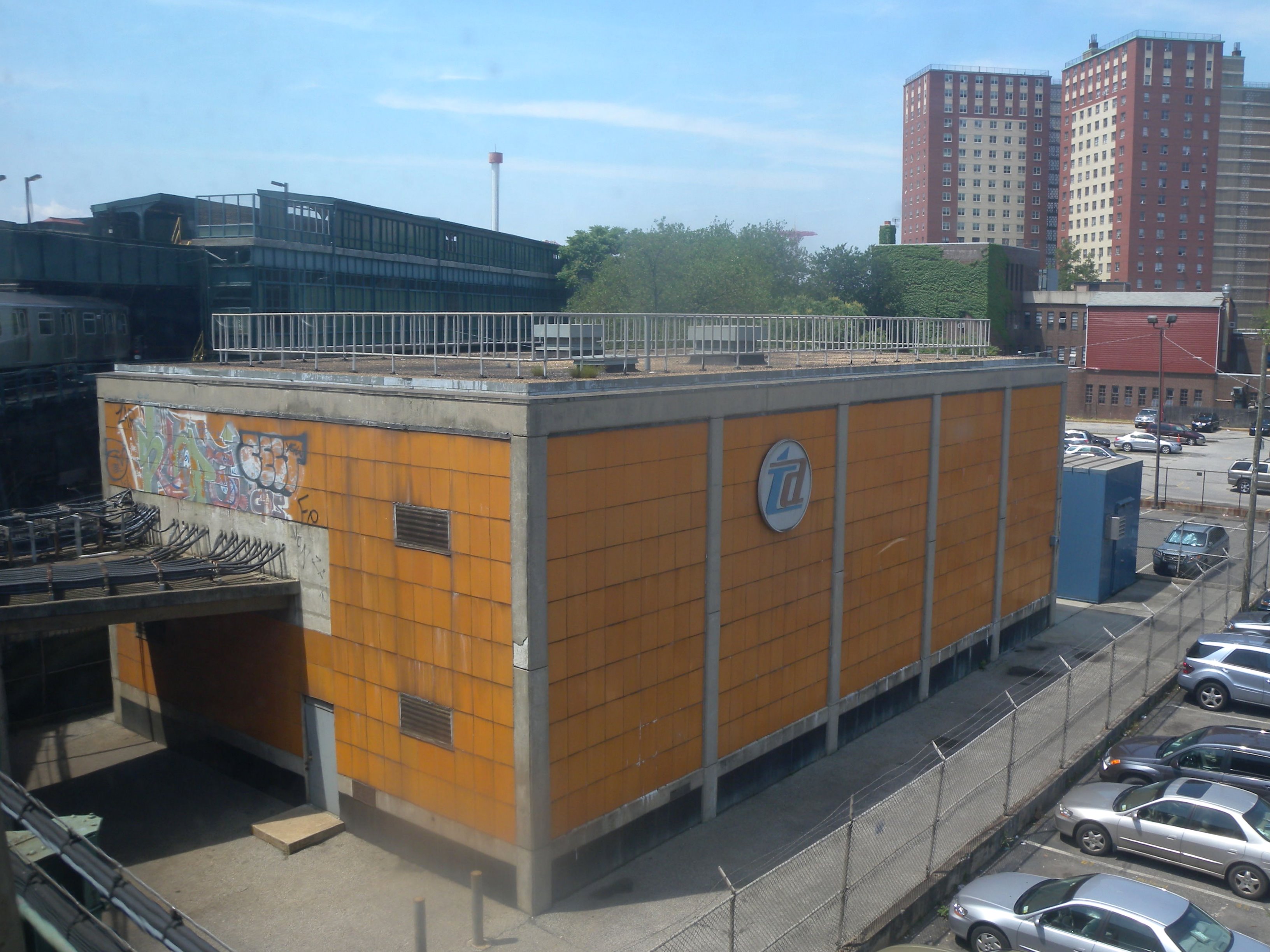
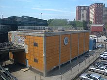 Coney Island power substation
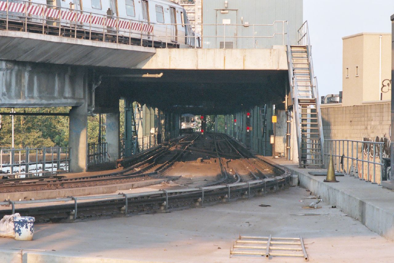
At Ditmas Avenue, the Culver Ramp ends and the underground line becomes elevated. This is a three-track Dual Contracts elevated on the former BMT line over McDonald (formerly Gravesend) Avenue. After Avenue X station, a ramp diverges to the surface for access to the Culver Yard of the Coney Island Yards complex. At this point the Culver Line narrows to a two-track structure bearing one more station – Neptune Avenue – before curving into West Eighth Street – New York Aquarium station on Coney Island. Formally, the Culver Line ends as the track curve enters the lower level of the double-decked station, and the chaining track designation changes from IND tracks B1 and B2 to BMT tracks A1 and A2 of the Brighton Line. However, there is no longer a connection to the Brighton Line at this point, and for all practical purposes the Culver Line continues into tracks 5 and 6 of the Coney Island – Stillwell Avenue Terminal.
In the 1990s and 2000s, the center express track in this section has occasionally been used for non-revenue testing.
History
BMT Culver Line (1875–1954)
Main article: Culver Line (surface) Stub of elevated line formerly running west at Cortelyou Road
 Route designation on BMT D Triplex equipment
The original Culver Line was opened by the Prospect Park and Coney Island Railroad, along the surface of McDonald Avenue (then Gravesend Avenue) from Greenwood Cemetery (where it connected with horse car lines including the Vanderbilt Avenue Line, operated by the PP&CI until 1886[3]) to Coney Island, on June 25, 1875.[4][5] The PP&CI began serving the Union Depot at 36th Street, where transfer could be made to the Fifth Avenue Elevated, on June 7, 1890, by using the Prospect Park and South Brooklyn Railroad from a junction at Parkville.[6] During a period of Long Island Rail Road control, from 1893[7] to 1899,[8] a ramp at 36th Street was opened in 1895, allowing Brooklyn Elevated Railroad trains to operate over the Culver Line to Coney Island.[9] The Brooklyn Rapid Transit Company (BRT), by then the owner of the Brooklyn Elevated, leased the Culver Line (to the Brooklyn Heights Railroad) on June 18, 1899, and began using it to take not only elevated trains but also trolleys to Coney Island.[8]
As part of Contract 4 of the Dual Contracts, between the city and the BRT, a three-track elevated railway was built above the Culver Line from the Fifth Avenue Elevated southeast and south to Coney Island. At Ninth Avenue, the elevated replacements for the Culver Line and West End Line met, with access from both lines to the Fifth Avenue Elevated and Fourth Avenue Subway to the northwest.[10] At 3:00 a.m. on March 16, 1919, the first portion of the new elevated structure opened from Ninth Avenue southeast and south to Kings Highway. Except for the omission of a station at 15th Avenue, all of the station locations from the surface line were preserved as elevated stations. The Culver Line was operated as a branch of the Fifth Avenue Elevated, with a free transfer at Ninth Avenue to the West End Line into the Fourth Avenue Subway.[11][12][13][14] An extension to Avenue X was opened at noon on May 10, 1919.[15][16] The line, the last of the four to Coney Island, was completed on May 1, 1920, at which time the Brooklyn Rapid Transit Company was forced to cut the fare from ten to five cents.[17][18] This construction tied into the existing lower level of the BMT Brighton Line east of West Eighth Street – New York Aquarium.[citation needed] Some Culver Line (5) trains began using the Fourth Avenue Subway to the Nassau Street Loop in Lower Manhattan when that line opened on May 30, 1931;[19] the Fifth Avenue Elevated was closed on May 31, 1940.[20] Trolleys continued to use the surface tracks on McDonald Avenue until 1956.[citation needed]
IND Brooklyn Line (1933–1954)
One of the goals of Mayor John Hylan's Independent Subway System (IND) was a line to Coney Island, reached by a recapture of the BMT Culver Line. To connect this line to the Eighth Avenue Line – the main trunk of the IND – a subway line, variously known as the Jay–Smith–Ninth Street Line,[21] Church Avenue Line,[22] Brooklyn Line,[22] or South Brooklyn Line,[23] was to run from Brooklyn Borough Hall south under Jay Street, Smith Street, Ninth Street, and several other streets to Church Avenue, where a ramp would lead onto the elevated BMT Culver Line.[24][25][26] The first short section of the line opened on March 20, 1933, taking Eighth Avenue Express A trains south to Bergen Street.[27] The rest of the line opened to the "temporary" terminal at Church Avenue on October 7, 1933.[28] A bridge over the Gowanus Canal replaced earlier plans for a tunnel due to cost considerations, resulting in the only above-ground section of the original IND.[21]
 Looking down the ramp
 Climbing the ramp
Culver Ramp
Recapture of the BMT Culver Line elevated structure in order to institute IND service to Coney Island was a high priority of New York City planners. Recapture proved unnecessary since the Culver Line and the rest of the BMT and IRT passed into City hands in 1940 as a fruit of Unification, the takeover of the privately-owned BMT and IRT by the City, which built and owned the IND.
Construction of the Culver Ramp between the Church Avenue and Ditmas Avenue stations began in 1941, but had to be abandoned because of the advent of World War II, delaying completion and opening until 1954.
On October 30, 1954, the connection between the IND Brooklyn Line at Church Avenue and the BMT Culver Line at Ditmas Avenue opened. This allowed IND trains to operate all the way to the Coney Island – Stillwell Avenue terminal in a service announced as Concourse–Culver and advertised as direct Bronx–Coney Island service.
IND Culver Line (1954–present)
The city acquired the BMT as part of the 1940 unification of the three systems into one. Construction of the Culver Line Connection began in 1941,[citation needed] but was delayed by World War II.[29] It was finally completed and opened on Saturday, October 30, 1954, and the IND Culver Line name was extended to Coney Island.[30] The D Bronx Concourse Express train was sent over the new connection, as the first IND service to reach Coney Island. BMT Culver Line (5) trains were truncated to Ditmas Avenue, the south end of the connection, operating through to Manhattan (Nassau Street Loop) during the day, and terminating at Ninth Avenue at other times.[31][32] This Culver Shuttle became full-time on May 28, 1959,[33] and was closed on May 10, 1975, replaced by a transfer to the B35 bus route.[34] The elevated portion has been re-chained as part of the B2 division, but still uses B1 division radio frequencies.[citation needed]
Station listing
Station service legend 
Stops all times 
Stops all times except late nights 
Stops late nights only 
Stops rush hours only Time period details Neighborhood
(approximate)
Station Tracks Services Opened Transfers and notes begins as continuation of the IND Sixth Avenue Line local tracks (F  )
)Downtown Brooklyn Jay Street – MetroTech all F February 1, 1933 IND Fulton Street Line (A C  )
)
BMT Fourth Avenue Line (N R )
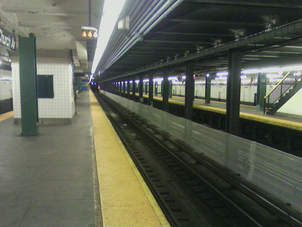
R )Express Tracks begin (No regular service) Merge from the IND Crosstown Line (G ) into local tracksCobble Hill Bergen Street all F G March 20, 1933 upper level – Local (in service)
lower level – Express (not currently in service)Carroll Gardens Carroll Street local F G October 7, 1933 Gowanus Smith–Ninth Streets local October 7, 1933 Station closed for reconstruction Fourth Avenue local F G October 7, 1933 BMT Fourth Avenue Line (D N R ) at Ninth StreetPark Slope Seventh Avenue all F G October 7, 1933 Windsor Terrace 15th Street – Prospect Park local F G October 7, 1933 All Coney Island and Church Avenue-bound trains skip this station due to reconstruction. Fort Hamilton Parkway local F G October 7, 1933 All Coney Island and Church Avenue-bound trains skip this station due to reconstruction. Kensington Church Avenue all F G October 7, 1933 southern terminal of G trainConnecting tracks to Church Avenue Yard Southbound express track merges into southbound local track and bi-directional express track creating a 3 track line (formerly the BMT Culver Line) Sunset Park Ninth Avenue all Culver Shuttle March 16, 1919[11]] Stopped on lower level, which closed on May 11, 1975. Transfer was available to the BMT West End Line. Fort Hamilton Parkway local Culver Shuttle March 16, 1919[11] Closed on May 11, 1975, Demolished 1985. Kensington 13th Avenue local Culver Shuttle March 16, 1919[11] Closed on May 11, 1975, Demolished 1985. Ditmas Avenue local F March 16, 1919[11] Borough Park 18th Avenue all F March 16, 1919[11] Avenue I local F March 16, 1919[11] Bay Parkway local F March 16, 1919[11] Avenue N local F March 16, 1919[11] Gravesend Avenue P local F March 16, 1919[11] Kings Highway all F March 16, 1919[11] southern terminal of some F trains during rush hours Avenue U local F May 10, 1919[15][16] Avenue X local F May 10, 1919[15] Express track ends merging into southbound local track and continuing into Coney Island Yard Coney Island Neptune Avenue all F May 1, 1920[citation needed] West Eighth Street – New York Aquarium all F May 19, 1917[citation needed] BMT Brighton Line (Q )Coney Island – Stillwell Avenue all F May 30, 1919[citation needed] BMT Brighton Line (Q )
BMT Sea Beach Line (N)
BMT West End Line (D)See also
References
- ^ New York City Subway Chaining
- ^ City of New York Office of the Comptroller, Dilemma in the Millenium: Capital Needs of the World's Capital City, August 1998, signal system data table (page 197) from the New York City Transit Authority
- ^ "A Big Lease". Brooklyn Daily Eagle: p. 4. December 21, 1885. http://eagle.brooklynpubliclibrary.org/Default/Scripting/ArchiveView.asp?BaseHref=BEG/1885/12/21&Page=4&skin=BE.
- ^ "Prospect Park and Coney Island R. R.". Brooklyn Daily Eagle: p. 3. June 19, 1875. http://eagle.brooklynpubliclibrary.org/Default/Scripting/ArchiveView.asp?BaseHref=BEG/1875/06/19&Page=3&skin=BE.
- ^ Brian J. Cudahy, How We Got to Coney Island: The Development of Mass Transportation in Brooklyn and Kings County, pp. 74–76
- ^ "The New Union Depot". Brooklyn Daily Eagle: p. 19. June 15, 1890. http://eagle.brooklynpubliclibrary.org/Default/Scripting/ArchiveView.asp?BaseHref=BEG/1890/06/15&Page=19&skin=BE.
- ^ "Corbin Buys the P.P. and C.I.R.R.". Brooklyn Daily Eagle: p. 1. January 24, 1893. http://eagle.brooklynpubliclibrary.org/Default/Scripting/ArchiveView.asp?BaseHref=BEG/1893/01/24&Page=1&skin=BE.
- ^ a b "Transit Co. Leases P.P. and C.I. Road". Brooklyn Daily Eagle: p. 1. June 17, 1899. http://eagle.brooklynpubliclibrary.org/Default/Scripting/ArchiveView.asp?BaseHref=BEG/1899/06/17&Page=1&skin=BE.
- ^ "Connecting Two Railroads". Brooklyn Daily Eagle: p. 2. August 6, 1895. http://eagle.brooklynpubliclibrary.org/Default/Scripting/ArchiveView.asp?BaseHref=BEG/1895/08/06&Page=2&skin=BE.
- ^ New York Public Service Commission, New Subways For New York: The Dual System of Rapid Transit, June 1913
- ^ a b c d e f g h i j k New York Times, B.R.T. Will Open Culver Line Elevated Road as Far as Kings Highway on Sunday Next, March 9, 1919, page 23
- ^ New York Times, Culver Line Open Today, March 16, 1919, page 8
- ^ Frederick J. H. Kracke, Public Service Commissioner, New York Times, New Rapid Transit Link in Operation, March 16, 1919, page 106
- ^ New York Times, Culver Elevated Opens, March 17, 1919, page 21
- ^ a b c New York Times, New Transit Line Opened, May 11, 1919, page 25
- ^ a b New York Times, New Culver Extension, May 18, 1919, page 116
- ^ New York Times, Coney Fare Cut Saturday, April 28, 1920, page 6
- ^ New York Times, 5-Cent Fare to Coney, May 1, 1920, page 18
- ^ New York Times, Nassau St. Service Outlined by B. M. T., May 21, 1931, page 29
- ^ New York Times, Last Train is Run on Fulton St. 'El', June 1, 1940, page 11
- ^ a b "Gay Midnight Crowd Rides First Trains in New Subway". New York Times: p. 1. September 10, 1932. http://select.nytimes.com/gst/abstract.html?res=FA0D13F7395513738DDDA90994D1405B828FF1D3.
- ^ a b New York Times, Subway Expansion to Cost $400,000,000 Proposed for City, December 15, 1947, page 1
- ^ Project for Expanded Rapid Transit Facilities, New York City Transit System, dated July 5, 1939
- ^ New York Times, New Subway Routes in Hylan Program to Cost $186,046,000, March 21, 1925, page 1
- ^ New York Times, Plan to Recapture Culver Line Ready, July 12, 1932, page 9
- ^ New York Times, The City Subway System for Which Aid is Asked, December 3, 1933, page X13
- ^ New York Times, City Subway Adds Link, March 21, 1933, page 4
- ^ New York Times, City Subway Extended, October 7, 1933, page 16
- ^ New York Times, 200 City Projects Face Standstill Due to Priorities, August 18, 1941, page 1
- ^ New York Times, Adequate Transit Promised for City, October 29, 1954, page 25
- ^ New York Times, Bronx to Coney Ride in New Subway Link, October 18, 1954, page 34
- ^ New York Times, Bronx-Coney Line is Opened by IND, October 31, 1954, page 73
- ^ The Third Rail, April–June 1975: Culver Shuttle Closes
- ^ New York Times, Brooklyn's Culver Shuttle Makes Festive Final Run, May 12, 1975, page 20
External links
 External videos
NYC Subway Culver Viaduct Rehabilitation Project, Metropolitan Transportation Authority; January 12, 2010; 1:48 YouTube video clip - NYCsubway.org – IND Crosstown Line
- NYCsubway.org – BMT Culver Line
- The Prospect Park and South Brooklyn Railroad Company and The Culver Shuttle (Arrt's Arrchives)
New York City Subway lines A
DivisionManhattan/QueensBronxBrooklynFormerB
DivisionBMTManhattan/QueensEastern divisionSouthern divisionFormerManhattan/BronxBrooklyn/QueensFutureSecond AvenueFormerConnections Purpose-BuiltChrystie Street (BMT/IND) · 60th Street (BMT/IND) · 63rd Street lines (BMT/IND) · Astoria / Flushing lines (BMT/IRT) · Coney Island – Stillwell Avenue station (BMT/IND)Yards207th Street Yard (IND/IRT) · Coney Island Complex (BMT/IND) · Concourse Yard (IND/IRT) · Linden Shops (BMT/IRT/LIRR)OtherLines with colors next to them are trunk lines; trunk lines determine the color of New York City Subway service bullets. A dark gray color indicates a shuttle.
Note that this is a list of New York City Subway lines, not services.Categories:- New York City Subway lines


![[2]](http://www.subwaywebnews.com/Photo%20Archive/Jaystation.jpg)
Wikimedia Foundation. 2010.