- Masonville, Iowa
-
Masonville, Iowa — City — Location of Masonville, Iowa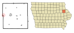
Coordinates: 42°28′47″N 91°35′26″W / 42.47972°N 91.59056°WCoordinates: 42°28′47″N 91°35′26″W / 42.47972°N 91.59056°W Country  United States
State  Iowa
IowaCounty Delaware Area – Total 0.3 sq mi (0.9 km2) – Land 0.3 sq mi (0.9 km2) – Water 0.0 sq mi (0.0 km2) Elevation 1,020 ft (311 m) Population (2000) – Total 104 – Density 315.3/sq mi (121.8/km2) Time zone Central (CST) (UTC-6) – Summer (DST) CDT (UTC-5) ZIP code 50654 Area code(s) 563 FIPS code 19-50205 GNIS feature ID 0458848 Masonville is a city in Delaware County, Iowa, United States. The population was 104 at the 2000 census. The city is located on the western border between Delaware and Buchanan counties.
Contents
Geography
Masonville is located at 42°28′47″N 91°35′26″W / 42.47972°N 91.59056°W (42.479755, -91.590591)[1].
According to the United States Census Bureau, the city has a total area of 0.3 square miles (0.78 km2), all of it land.
Demographics
As of the census[2] of 2000, there were 104 people, 49 households, and 32 families residing in the city. The population density was 315.3 people per square mile (121.7/km²). There were 55 housing units at an average density of 166.8 per square mile (64.4/km²). The racial makeup of the city was 99.04% White, and 0.96% from two or more races. Hispanic or Latino of any race were 4.81% of the population.
There were 49 households out of which 18.4% had children under the age of 18 living with them, 44.9% were married couples living together, 18.4% had a female householder with no husband present, and 32.7% were non-families. 26.5% of all households were made up of individuals and 18.4% had someone living alone who was 65 years of age or older. The average household size was 2.12 and the average family size was 2.42.
In the city the population was spread out with 14.4% under the age of 18, 18.3% from 18 to 24, 26.0% from 25 to 44, 26.9% from 45 to 64, and 14.4% who were 65 years of age or older. The median age was 41 years. For every 100 females there were 67.7 males. For every 100 females age 18 and over, there were 81.6 males.
The median income for a household in the city was $32,000, and the median income for a family was $40,625. Males had a median income of $30,313 versus $16,667 for females. The per capita income for the city was $20,166. There were 3.0% of families and 5.1% of the population living below the poverty line, including no under eighteens and 15.4% of those over 64.
Notable natives
- Robert Gallery - NFL player
References
- ^ "US Gazetteer files: 2010, 2000, and 1990". United States Census Bureau. 2011-02-12. http://www.census.gov/geo/www/gazetteer/gazette.html. Retrieved 2011-04-23.
- ^ "American FactFinder". United States Census Bureau. http://factfinder.census.gov. Retrieved 2008-01-31.
Municipalities and communities of Delaware County, Iowa Cities 
Townships Adams | Bremen | Coffins Grove | Colony | Delaware | Delhi | Elk | Hazel Green | Honey Creek | Milo | North Fork | Oneida | Prairie | Richland | South Fork | Union
Unincorporated
communitiesPetersburg | Robinson | Rockville
Footnotes ‡This populated place also has portions in an adjacent county or counties
Categories:- Cities in Iowa
- Populated places in Delaware County, Iowa

Wikimedia Foundation. 2010.