- Earlville, Iowa
Infobox Settlement
official_name = Earlville, Iowa
settlement_type =City
nickname =
motto =
imagesize =
image_caption =
image_
imagesize =
image_caption =
image_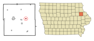
mapsize = 250px
map_caption = Location of Earlville, Iowa
mapsize1 =
map_caption1 =subdivision_type = Country
subdivision_name =
subdivision_type1 = State
subdivision_name1 =
subdivision_type2 = County
subdivision_name2 = Delaware
government_footnotes =
government_type =
leader_title =
leader_name =
leader_title1 =
leader_name1 =
established_title =
established_date =unit_pref = Imperial
area_footnotes =area_magnitude =
area_total_km2 = 1.4
area_land_km2 = 1.4
area_water_km2 = 0.0
area_total_sq_mi = 0.5
area_land_sq_mi = 0.5
area_water_sq_mi = 0.0population_as_of = 2000
population_footnotes =
population_total = 900
population_density_km2 = 636.3
population_density_sq_mi = 1648.0timezone = Central (CST)
utc_offset = -6
timezone_DST = CDT
utc_offset_DST = -5
elevation_footnotes =
elevation_m = 304
elevation_ft = 997
latd = 42 |latm = 28 |lats = 55 |latNS = N
longd = 91 |longm = 16 |longs = 14 |longEW = Wpostal_code_type =
ZIP code
postal_code = 52041
area_code = 563
blank_name = FIPS code
blank_info = 19-23430
blank1_name = GNIS feature ID
blank1_info = 0456106
website =
footnotes =Earlville is a city in Delaware County,
Iowa ,United States . The population was 900 at the 2000 census.Geography
Earlville is located at coor dms|42|28|55|N|91|16|14|W|city (42.482074, -91.270456)GR|1.
According to the
United States Census Bureau , the city has a total area of 0.6square mile s (1.4km² ), all of it land.Demographics
As of the
census GR|2 of 2000, there were 900 people, 338 households, and 248 families residing in the city. Thepopulation density was 1,648.0 people per square mile (631.8/km²). There were 355 housing units at an average density of 650.0/sq mi (249.2/km²). The racial makeup of the city was 98.78% White, 0.11% African American, 0.33% Native American, 0.22% Asian, 0.33% from other races, and 0.22% from two or more races. Hispanic or Latino of any race were 1.11% of the population.There were 338 households out of which 36.7% had children under the age of 18 living with them, 60.4% were married couples living together, 8.3% had a female householder with no husband present, and 26.6% were non-families. 21.9% of all households were made up of individuals and 13.0% had someone living alone who was 65 years of age or older. The average household size was 2.66 and the average family size was 3.13.
In the city the population was spread out with 30.0% under the age of 18, 7.3% from 18 to 24, 27.9% from 25 to 44, 18.8% from 45 to 64, and 16.0% who were 65 years of age or older. The median age was 37 years. For every 100 females there were 98.7 males. For every 100 females age 18 and over, there were 97.5 males.
The median income for a household in the city was $38,194, and the median income for a family was $43,333. Males had a median income of $30,398 versus $20,625 for females. The
per capita income for the city was $14,855. About 6.0% of families and 6.6% of the population were below thepoverty line , including 6.7% of those under age 18 and 8.1% of those age 65 or over.Economy
The town lacks any internal grocery stores, dental facilities, or hardware stores, but does contain two taverns, a swimming pool, and a public school.fact|date=August 2007
References
External links
Wikimedia Foundation. 2010.