- Colony Township, Delaware County, Iowa
-
Colony Township — Township — Location in Delaware County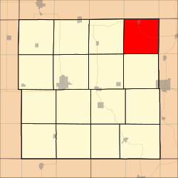
Coordinates: 42°36′24″N 91°11′14″W / 42.60667°N 91.18722°WCoordinates: 42°36′24″N 91°11′14″W / 42.60667°N 91.18722°W Country  United States
State  Iowa
IowaCounty Delaware Area - Total 36.29 sq mi (94 km2) - Land 36.29 sq mi (93.98 km2) - Water 0.01 sq mi (0.02 km2) 0.02% Elevation 1,001 ft (305 m) Population (2000) - Total 863 - Density 23.8/sq mi (9.2/km2) GNIS feature ID 0467641 Colony Township is a township in Delaware County, Iowa, USA. As of the 2000 census, its population was 863.[1]
Contents
Geography
Colony Township covers an area of 36.29 square miles (94 square kilometers); of this, 0.01 square miles (0.02 square kilometers) or 0.02 percent is water.
Cities and towns
Unincorporated towns
- Holy Cross
(This list is based on USGS data and may include former settlements.)
Adjacent townships
- Mallory Township, Clayton County (north)
- Millville Township, Clayton County (northeast)
- Liberty Township, Dubuque County (east)
- New Wine Township, Dubuque County (southeast)
- Bremen Township (south)
- Oneida Township (southwest)
- Elk Township (west)
- Elk Township, Clayton County (northwest)
Cemeteries
The township contains four cemeteries: Oak Hill, Platt, Saint Patrick and Zion.
Major highways
References
External links
Municipalities and communities of Delaware County, Iowa County seat: Manchester Cities Colesburg | Delaware | Delhi | Dundee | Dyersville‡ | Earlville | Edgewood‡ | Greeley | Hopkinton | Manchester | Masonville | Ryan

Townships Adams | Bremen | Coffins Grove | Colony | Delaware | Delhi | Elk | Hazel Green | Honey Creek | Milo | North Fork | Oneida | Prairie | Richland | South Fork | Union
Unincorporated
communitiesPetersburg | Robinson | Rockville
Footnotes ‡This populated place also has portions in an adjacent county or counties
Categories:- Townships in Delaware County, Iowa

Wikimedia Foundation. 2010.