- Chalkville, Alabama
-
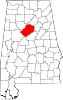
Chalkville, Alabama — CDP — Location in Jefferson County and the state of Alabama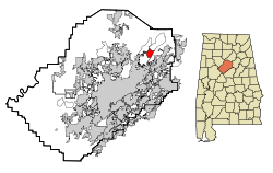
Coordinates: 33°40′4″N 86°38′58″W / 33.66778°N 86.64944°W Country United States State Alabama County Jefferson Area – Total 2.9 sq mi (7.6 km2) – Land 2.9 sq mi (7.5 km2) – Water 0 sq mi (0.1 km2) Elevation 873 ft (266 m) Population (2000) – Total 3,829 – Density 1,320.3/sq mi (503.8/km2) Time zone Central (CST) (UTC-6) – Summer (DST) CDT (UTC-5) FIPS code 01-13720 GNIS feature ID 0115909 Chalkville is a former census-designated place in Jefferson County, Alabama, United States.[1] At the 2000 census the population was 3,829. The area is now part of the city of Clay.
Geography
Chalkville is located at 33°40′4″N 86°38′59″W / 33.66778°N 86.64972°W (33.667902, -86.649643)[2].
According to the U.S. Census Bureau, the community has a total area of 2.9 square miles (7.5 km2), of which, 2.9 square miles (7.5 km2) of it is land and 0.04 square miles (0.10 km2) of it (1.03%) is water.
Demographics
As of the census[3] of 2000, there were 3,829 people, 1,275 households, and 1,105 families residing in the community. The population density was 1,330.0 people per square mile (513.3/km2). There were 1,313 housing units at an average density of 456.1 per square mile (176.0/km2). The racial makeup of the community was 96.32% White, 2.32% Black or African American, 0.24% Native American, 0.47% Asian, 0.05% Pacific Islander, 0.08% from other races, and 0.52% from two or more races. 0.57% of the population were Hispanic or Latino of any race.
There were 1,275 households out of which 49.5% had children under the age of 18 living with them, 74.1% were married couples living together, 9.9% had a female householder with no husband present, and 13.3% were non-families. 10.9% of all households were made up of individuals and 2.7% had someone living alone who was 65 years of age or older. The average household size was 2.97 and the average family size was 3.21.
In the community the population was spread out with 29.8% under the age of 18, 7.7% from 18 to 24, 32.9% from 25 to 44, 22.4% from 45 to 64, and 7.2% who were 65 years of age or older. The median age was 35 years. For every 100 females there were 95.9 males. For every 100 females age 18 and over, there were 93.9 males.
The median income for a household in the community was $55,114, and the median income for a family was $56,518. Males had a median income of $34,977 versus $29,266 for females. The per capita income for the community was $19,929. About 2.8% of families and 2.3% of the population were below the poverty line, including none of those under age 18 and 12.9% of those age 65 or over.
References
- ^ U.S. Geological Survey Geographic Names Information System: Chalkville, Alabama
- ^ "US Gazetteer files: 2010, 2000, and 1990". United States Census Bureau. 2011-02-12. http://www.census.gov/geo/www/gazetteer/gazette.html. Retrieved 2011-04-23.
- ^ "American FactFinder". United States Census Bureau. http://factfinder.census.gov. Retrieved 2008-01-31.
Coordinates: 33°40′04″N 86°38′59″W / 33.667902°N 86.649643°W
Municipalities and communities of Jefferson County, Alabama Cities Adamsville | Bessemer | Birmingham‡ | Brighton | Center Point | Clay | Fairfield | Fultondale | Gardendale | Graysville | Helena‡ | Homewood | Hoover‡ | Hueytown | Irondale | Leeds‡ | Lipscomb | Midfield | Mountain Brook | Pinson | Pleasant Grove | Sumiton‡ | Tarrant | Trussville‡ | Vestavia Hills‡ | Warrior‡
Towns Argo‡ | Brookside | Cardiff | County Line‡ | Kimberly | Maytown | Morris | Mulga | North Johns | Sylvan Springs | Trafford | West Jefferson
CDPs Concord | Edgewater | Forestdale | Grayson Valley | McDonald Chapel | Minor | Mount Olive | Rock Creek
Unincorporated
communitiesFootnotes ‡This populated place also has portions in an adjacent county or counties
Categories:- Unincorporated communities in Alabama
- Geography of Jefferson County, Alabama
- Former census-designated places in Alabama
- Birmingham–Hoover metropolitan area


Wikimedia Foundation. 2010.