- Center Point, Alabama
Infobox Settlement
official_name = Center Point, Alabama
settlement_type =City
imagesize =
image_caption =
image_
imagesize =
image_caption =
image_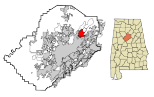
mapsize = 250px
map_caption = Location in Jefferson County and the state ofAlabama before incorporation.
mapsize1 =
map_caption1 =
subdivision_type = Country
subdivision_type1 = State
subdivision_type2 = County
subdivision_name =United States
subdivision_name1 =Alabama
subdivision_name2 = Jefferson
government_type =
leader_title =
leader_name =
established_date =
area_magnitude =
area_total_km2 = 20.9
area_total_sq_mi = 8
area_land_km2 = 20.8
area_land_sq_mi = 8
area_water_km2 = 0.1
area_water_sq_mi = 0
elevation_ft = 830
elevation_m = 253
population_as_of = 2000
population_footnotes =
population_total = 22784
population_metro =
population_density_km2 = 1090.1
population_density_sq_mi = 2848
timezone = Central (CST)
utc_offset = -6
latd = 33 |latm = 38 |lats = 21 |latNS = N
longd = 86 |longm = 40 |longs = 49 |longEW = W
timezone_DST = CDT
utc_offset_DST = -5
postal_code_type =ZIP code
postal_code = 35215
area_code = 205
blank_name = FIPS code
blank_info = 01-13264
blank1_name = GNIS feature ID
blank1_info = 0115852
footnotes =
website =Center Point is a newly incorporated
city and a formercensus-designated place (CDP) in Jefferson County,Alabama ,United States . At the 2000 census the population was 22,784. However, after its incorporation in 2002, the city's boundaries are much smaller than those of the CDP. As of the 2004 estimates, the population of the newly-created city was 15,130.fact|date=December 2007Geography
Center Point is located at coor dms|33|38|21|N|86|40|50|W|city (33.639302, -86.680437)GR|1. or about 12 miles NE of Birmingham.
According to the
U.S. Census Bureau , the CDP had a total area of 8.1square mile s (20.9km² ), of which 8.1 square miles (20.8 km²) of it was land and 0.04 square miles (0.1 km²) of it (0.25%) was water.Nearest Places to Center Point
*
Chalkville, Alabama (2.9 miles/4.7 Kilometers),Grayson Valley, Alabama (3.1 miles/5.0 kilometers),Pinson, Alabama (3.3 miles/5.3 kilometers),Clay, Alabama (5.8 miles/9.3 kilometers),Trussville, Alabama (5.9 miles/9.5 kilometers),Tarrant, Alabama (6.9 miles/11.1 kilometers),Irondale, Alabama (7.4 miles/11.9 kilometers),Fultondale, Alabama (8.5 miles/13.7 kilometers),Birmingham, AL (11.7 miles/18.8 kilometers),Leeds, AL (15.5 miles/24.9 kilometers).Demographics
As of the
census GR|2 of 2000, there were 22,784 people, 8,826 households, and 6,434 families residing in the CDP. Thepopulation density was 2,830.4 people per square mile (1,092.8/km²). There were 9,292 housing units at an average density of 1,154.3/sq mi (445.7/km²). The racial makeup of the CDP was 72.90% White, 24.23% Black or African American, 0.28% Native American, 0.55% Asian, 0.03% Pacific Islander, 1.02% from other races, and 0.98% from two or more races. 2.23% of the population were Hispanic or Latino of any race.There were 8,826 households out of which 35.3% had children under the age of 18 living with them, 53.7% were married couples living together, 15.4% had a female householder with no husband present, and 27.1% were non-families. 23.7% of all households were made up of individuals and 8.6% had someone living alone who was 65 years of age or older. The average household size was 2.56 and the average family size was 3.02.
In the CDP the population was spread out with 26.6% under the age of 18, 8.8% from 18 to 24, 30.2% from 25 to 44, 21.3% from 45 to 64, and 13.1% who were 65 years of age or older. The median age was 35 years. For every 100 females there were 89.6 males. For every 100 females age 18 and over, there were 84.8 males.
The median income for a household in the CDP was $40,929, and the median income for a family was $46,427. Males had a median income of $35,500 versus $25,544 for females. The
per capita income for the CDP was $18,160. About 7.7% of families and 9.5% of the population were below thepoverty line , including 12.2% of those under age 18 and 9.6% of those age 65 or over.References
External links
* [http://www.thecityofcenterpoint.org/ City of Center Point, AL-City Government Website]
Wikimedia Foundation. 2010.