- Gardendale, Alabama
Infobox Settlement
official_name = Gardendale, Alabama
settlement_type =City
imagesize =
image_caption =
image_
imagesize =
image_caption =
image_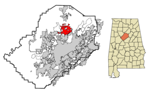
mapsize = 250px
map_caption = Location in Jefferson County and the state ofAlabama
mapsize1 =
map_caption1 =
subdivision_type = Country
subdivision_type1 = State
subdivision_type2 = County
subdivision_name =United States
subdivision_name1 =Alabama
subdivision_name2 = Jefferson
government_type =
leader_title =
leader_name =
established_date =
area_magnitude =
area_total_km2 = 46.5
area_total_sq_mi = 17.9
area_land_km2 = 46.5
area_land_sq_mi = 17.9
area_water_km2 = 0
area_water_sq_mi = 0
elevation_ft = 679
elevation_m = 207
population_as_of = 2000
population_footnotes =
population_total = 11626
population_metro =
population_density_km2 = 250
population_density_sq_mi = 649.5
timezone = Central (CST)
utc_offset = -6
latd = 33 |latm = 39 |lats = 38 |latNS = N
longd = 86 |longm = 48 |longs = 42 |longEW = W
timezone_DST = CDT
utc_offset_DST = -5
postal_code_type =ZIP code
postal_code = 35071
area_code = 205
blank_name = FIPS code
blank_info = 01-29056
blank1_name = GNIS feature ID
blank1_info = 0118823
footnotes =
website =Gardendale is a city in Jefferson County,
Alabama ,United States , and a northern suburb of Birmingham. The population was 11,626 at the 2000 census. 2006 Census estimates propose a population of 13,042.fact|date=December 2007History
A large farm settlement near the area today known as Gardendale was settled around 1825. Some years later, other settlers began to move into the community commonly known as Jugtown, a name given to the area based on the presence of a large jug and churn factory that operated in the area. Some years later, a school teacher would lead a campaign to change the name of the community. In 1906, the name Gardendale was selected and by 1955, the city of Gardendale was officially
incorporated . Today, with more than 13,000 residents, the city of Gardendale has grown to include more than 400 businesses, 4 schools, and 24 churches. In 1996, theOlympic torch run passed thru the city during the weeks leading up to the1996 Summer Olympic Games in Atlanta. Before Interstate 65 was constructed, the main route between Nashville, Tennessee and Birmingham, Alabama wasU.S. Route 31 . Prior to being built as a four-lane road, U.S. 31 was a twisting two-lane road that is still largely visible today. From the north end of Gardendale it is now Snow Rogers Road, then North Road, then Moncrief Road, and then Main Street southward thru the city to the Fultondale city limits where it becomes Stouts Road. In the fall of 2008 new signs were placed along the original route of Stouts Road thru Gardendale denoting its historical significance as a stagecoach route between Tennessee and Birmingham during the 1800's. The first traffic signals in the city were located along U.S. 31 at Tarrant Road, Fieldstown Road, and Moncrief Road. A new signal at the intersection of Fieldstown Road and Main Street near city hall replaced a blinking signal shortly thereafter. Fieldstown Road was a narrow two lane road from U.S. 31 westward untilInterstate 65 was built and then Fieldstown Road was re-routed onto the new road in the mid 1980's. An abundance of traffic signals have been erected in the city since those early days. In approximately 1970, the city installed street lights along U.S. 31 from the Fultondale city limits northward to the Moncrief Road intersection. The technology at that time was for blue vapor lights. Today, nearly 40 years later those same blue vapor lights still exist with some being replaced with the more modern bulbs near major intersections.Geography
Gardendale is located at coor dms|33|39|38|N|86|48|42|W|city (33.660492, -86.811648)GR|1.
According to the
U.S. Census Bureau , the city has a total area of 18.0square mile s (46.5km² ), all of it land. However, with the recent annexation of several thousand acres from the community of Mt. Olive and other unincorporated areas, the city now has an estimated total area of around 25.0 square miles (64.8 km²). Gardendale is situated along one of the three major transportation corridors from the Midwest to the Gulf Coast (I-75, I-65, I-55). A tremendous volume of freight (via rail and truck) passes thru or near Gardendale.Gardendale is serviced by two major north-south highways..Interstate 65 (I-65) and US 31. A new interstate highway, Interstate 22 will run northwestward from I-65 near Gardendale towards Memphis, Tennessee. This freeway is open from Cherry Avenue near the Brookside community just west of Gardendale to Memphis. Another future road project is the Northern Beltline which will run from I-59 near Argo westward across northern Jefferson county, crossing I-65 on the northern edge of Gardendale. This highway is currently designed by ALDOT as Alabama 959, but could be a future Interstate (259?). This route is some 15-20 years away from completion. Major east/west roads in Gardendale include Fieldstown Road ( there has been some discussion of requesting a state highway designation for this road between US 31 and I-65 and perhaps westward towards I-22) which runs from US31 in Gardendale westward, Tarrant Road which runs from the city eastward, and Mt. Olive Road which runs northwestward from the city. Another future road project may be an extension of Fieldstown Road east of US 31 to connect to the Castle Pines development (which is in the city but only accessible via a roundabout route nearly 10 miles long)and then across New Castle Road, and then further east to connect to Carson Road. Gardendale is located in an area that once yielded large amounts of coal. Gardendale is located at the southwestern end of one of the Appalachian ridgelines running from eastern Tennessee into northeast Alabama. Several old and closed coal mines exist in the area as well as lands that were once stripped mined and then replanted for forests. No major waterways are located in Gardendale but several streams feed into the Locust Fork of the Black Warrior River that passes north and west of the city. Much of the land inside the city limits on the east and northeast sides of Gardendale is rocky and hilly with deep ravines. This portion of the city is sparsely populated and has limited access by road. The only major rail line passing near Gardendale is a north/south track passing on the eastern edge of the city from Boyles Yard near Tarrant paralleling New Castle Road northward towards Blount County. This rail line carries freight and is not a passenger line. The nearest passenger train service is by Amtrak at the Birmingham station 10 miles south of Gardendale. Commercial air travel is located at the nearby Birmingham International Airport.Demographics
As of the
census GR|2 of 2000, there were 11,626 people, 4,733 households, and 3,474 families residing in the city. Thepopulation density was 647.9 people per square mile (250.1/km²). There were 4,959 housing units at an average density of 276.3/sq mi (106.7/km²). The racial makeup of the city was 97.19% White, 1.48% Black or African American, 0.17% Native American, 0.53% Asian, 0.02% Pacific Islander, 0.14% from other races, and 0.47% from two or more races. 0.65% of the population were Hispanic or Latino of any race.There were 4,733 households out of which 28.8% had children under the age of 18 living with them, 61.3% were married couples living together, 9.6% had a female householder with no husband present, and 26.6% were non-families. 24.6% of all households were made up of individuals and 11.7% had someone living alone who was 65 years of age or older. The average household size was 2.42 and the average family size was 2.88.
The median income for a household in the city was $45,786, and the median income for a family was $56,929. Males had a median income of $36,714 versus $29,039 for females. The
per capita income for the city was $22,673. About 3.5% of families and 5.1% of the population were below thepoverty line , including 7.0% of those under age 18 and 7.3% of those age 65 or over.Economic Development
Most new business development in the past ten years has been along Fieldstown Road (and Odum Road) on the west side of the city between I-65 and US 31. Additional development, but to a lesser extent, has occurred along Mt. Olive Road between US 31 and I-65. Several older more mature shopping and dining areas exist along US 31. Jefferson County has a satellite courthouse at the intersection of Tarrant Road and Main Street. This facility serves much of northern Jefferson County.
Media
Gardendale is located within the Birmingham television and radio market, the 39th largest market in the United States.
Print media available in Gardendale includes "
The Birmingham News " and "The North Jefferson News", a publication distributed twice a week throughout much of North Jefferson County.Churches & Hospitals
The Gardendale community is served by some 20-25 houses of worship. Denominations include but are not limited to, Southern Baptist, Methodist, Church of Jesus Christ of Latter Day Saints, Church of God, and many others. Gardendale is served by several small health centers/clinics. Large hospitals offering secondary and tertiary care, including a trauma center, are located nearby in
Birmingham , the home of theUniversity of Alabama School of Medicine , the University Hospital, and a dozen other hospitals offering all kinds of care, including major cardiac and brain surgery.City Government
Gardendale uses the mayor/council form of government. The council consists of five councilors. The city is divided into five geographic wards with each electing a councilor to represent it on the city council. The election cycle for the mayor and council members is every four years. The mayoral position will become a fulltime paid position following the 2008 elections. Once the 2010 US Census is conducted and if the city is then determined to have a population at or exceeding 12,000 residents, the city council will then choose a member to become council president.
Past and Present Mayors
These includeJ.I. Pesnell,Horace Parker,G.William Noble,Kenny Clemons
Civic Organizations
Included among several organizations are the Gardendale Chamber of Commerce which was established in 1987 and the Gardendale Arts Council.
Annual Events
Included is the Magnolia Festival which occurs each spring and is held around and near the Civic Center complex on Main Street.
City Services
Gardendale has a fulltime police force, fire/rescue department, public works, and parks & recreation department.
Municipal Facilities
Gardendale has a city hall located centrally inside the city at the corner of Main Street and Fieldstown Road. The Gardendale Civic Center is located on Main Street across from Gardendale High School. The Gardendale Public Library is located on Mt. Olive Road just south of the intersection of Mt. Olive Road and Fieldstown Road. Gardendale has several parks and athletic facilities. G. William Noble Park (formerly known as Moncrief Park) contains 6 baseball fields, 8 tennis courts, a football field, and 3 playgrounds as well as picnic and party facilities. This park is located just off Moncrief Road on the northside of the city. Luman Harris Park is a girls softball facility located just off Pineywood Road in the southeast part of the city. Mini Park, consisting of a playground for smaller children is located on Keith Circle, just of Tarrant Road, four tenths of a mile east of US 31. Celebration Park is located on Fieldstown Road on the western edge of the city and contains two soccer fields and a walking track, a splash pad for children and future plans for more expansion. Memorial Park is located between Main Street and US 31 in the north central part of the city and honors those who have served in the US Armed Forces. Past park facilities included two tennis courts and the old civic center which were located adjacent to city hall in the center of the city, two tennis courts located on Tarrant Road in the eastern edge of the city, a mini park located at the corner of Peterson Drive and Tarrant Road which contained a asphalt basketball court, and a softball field that was located behind the south end of Bragg Middle School.
Education
Gardendale is served by several schools. Gardendale Elementary School which opened in 1969 and replaced the older elementary school located about 300 yards east of the current school. Bragg Middle School was built later to handle the growing student population. Until Bragg was opened, Gardendale High School handled grades 7-12. Both Gardendale High School and Bragg Middle School use the nickname "Rockets" and share the same colors of maroon, gray, and white. Gardendale High School is rated as a 6A school for athletic competition for the two year period beginning in the fall of 2008. Tabernacle Christian school is located on the northern side of the city as a school run by the Gardendale Church of the Nazarene. Their athletic teams carry the nickname "Torches." Also located on the north side of Gardendale is Snow Rogers Elementary School. Snow Rogers school is unique in that although it is inside Gardendale city limits, it is a feeder school for both Bragg Middle School in Gardendale as well as North Jefferson Middle School located in nearby Kimberly, Alabama. These schools in turn feed into Gardendale High School and Mortimer Jordan High School located in nearby Morris, Alabama. Residential addresses of Snow Rogers students determine which school they go to once leaving Snow Rogers Elementary. Mt. Olive Elementary is located in the nearby unincorporated Mt.Olive community. Gardendale was once home to the Rogers Area Vocational School which has now become part of Gardendale High School. Gardendale High School currently uses the Rogers campus as well as temporary classroom buildings while a new high school is being constructed on the site of the former high school (which was built in the mid 1960's). The new high school hopes to be open by the beginning of the 2009-2010 school year. Gardendale High School graduated its first student class in 1968.
References
External links
* [http://www.cityofgardendale.com City of Gardendale]
* [http://www.gardendalechamberofcommerce.com Gardendale Chamber of Commerce]
* [http://gardendale.lib.al.us Gardendale-Martha Moore Public Library]
Wikimedia Foundation. 2010.