- Collinsville, Alabama
-
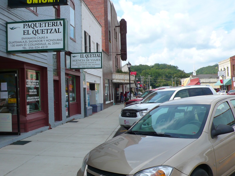
Collinsville, Alabama — Town — Downtown Collinsville, Alabama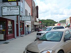 Location in DeKalb County and the state of Alabama
Coordinates: 34°15′55″N 85°51′41″W / 34.26528°N 85.86139°W Country United States State Alabama Counties DeKalb, Cherokee Area – Total 3.5 sq mi (9.1 km2) – Land 3.5 sq mi (9.1 km2) – Water 0 sq mi (0 km2) Elevation 702 ft (214 m) Population (2010) – Total 1,983 Time zone Central (CST) (UTC-6) – Summer (DST) CDT (UTC-5) ZIP code 35961 Area code(s) 256 FIPS code 01-16600 GNIS feature ID 0150164 Website http://www.collinsvillealabama.net/ Collinsville is a town in Cherokee and DeKalb Counties in the U.S. state of Alabama. As of the 2010 census, the population is 1,983. The town is a part of the 'Gadsden, Alabama Metropolitan Statistical Area'
Contents
Geography
Collinsville is located at 34°15'55.555" North, 85°51'41.483" West (34.265432, -85.861523)[1].
According to the U.S. Census Bureau, the town has a total area of 3.5 square miles (9.1 km2), all land.
Demographics
As of the 2010 census Collinsville had a population of 1,983. The racial and ethnic composition of the population was 44.9% non-Hispanic white, 9.0% black or African American, 1.1% Native American, 0.1% Asian, 2.1% Pacific Islander (all of whom where Guamanian or Chamorro), 36.8% reporting some other race and 3.0% from two or more races. 43.1% of the population was Hispanic or Latino of any race.[2]
As of the census[3] of 2000, there were 1,644 people, 565 households, and 367 families residing in the town. The population density was 465.8 people per square mile (179.8/km2). There were 629 housing units at an average density of 178.2 per square mile (68.8/km2). The racial makeup of the town was 63.32% White, 16.18% Black or African American, 1.52% Native American, 0.85% Asian, 13.99% from other races, and 4.14% from two or more races. 23.48% of the population were Hispanic or Latino of any race.
There were 565 households out of which 29.9% had children under the age of 18 living with them, 40.4% were married couples living together, 18.2% had a female householder with no husband present, and 35.0% were non-families. 29.4% of all households were made up of individuals and 15.2% had someone living alone who was 65 years of age or older. The average household size was 2.62 and the average family size was 3.20.
In the town the population was spread out with 24.1% under the age of 18, 10.3% from 18 to 24, 24.4% from 25 to 44, 19.2% from 45 to 64, and 22.0% who were 65 years of age or older. The median age was 36 years. For every 100 females there were 90.9 males. For every 100 females age 18 and over, there were 85.4 males.
The median income for a household in the town was $21,964, and the median income for a family was $27,500. Males had a median income of $20,114 versus $16,635 for females. The per capita income for the town was $13,042. About 22.2% of families and 25.7% of the population were below the poverty line, including 33.3% of those under age 18 and 27.0% of those age 65 or over.
Education
Collinsville Elementary (K-6) and Collinsville High (7-12), home of the Panthers which play football, serve Collinsville. The schools are members of the DeKalb County School System.
References
- ^ "US Gazetteer files: 2010, 2000, and 1990". United States Census Bureau. 2011-02-12. http://www.census.gov/geo/www/gazetteer/gazette.html. Retrieved 2011-04-23.
- ^ 2010 profile of population and housing characteristics for Collinsville from the US Census
- ^ "American FactFinder". United States Census Bureau. http://factfinder.census.gov. Retrieved 2008-01-31.
External links
Coordinates: 34°15′56″N 85°51′41″W / 34.265432°N 85.861523°W
Municipalities and communities of Cherokee County, Alabama City 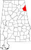
Towns Cedar Bluff | Collinsville‡ | Gaylesville | Leesburg | Piedmont‡ | Sand Rock‡
CDP Footnotes ‡This populated place also has portions in an adjacent county or counties
Municipalities and communities of DeKalb County, Alabama Cities 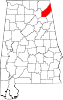
Towns Collinsville‡ | Crossville | Fyffe | Geraldine | Hammondville | Henagar | Ider | Lakeview | Mentone | Pine Ridge | Powell | Sand Rock‡ | Shiloh | Sylvania | Valley Head
Unincorporated
communitiesGhost towns Battelle | Bootsville | Rawlingsville
Footnotes ‡This populated place also has portions in an adjacent county or counties
Categories:- Towns in Alabama
- Populated places in Cherokee County, Alabama
- Populated places in DeKalb County, Alabama
- U.S. Route 11


Wikimedia Foundation. 2010.