- Cedar Bluff, Alabama
Infobox Settlement
official_name = Cedar Bluff, Alabama
settlement_type =Town
imagesize =
image_caption =
image_
imagesize =
image_caption =
image_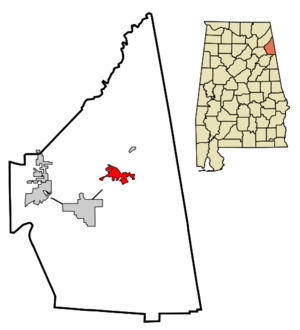
mapsize = 250px
map_caption = Location in Cherokee County and the state ofAlabama
mapsize1 =
map_caption1 =
subdivision_type = Country
subdivision_type1 = State
subdivision_type2 = County
subdivision_name =United States
subdivision_name1 =Alabama
subdivision_name2 = Cherokee
government_type =
leader_title =
leader_name =
established_date =
area_magnitude =
area_total_km2 = 10.7
area_total_sq_mi = 4.1
area_land_km2 = 10.3
area_land_sq_mi = 4
area_water_km2 = 0.4
area_water_sq_mi = 0.1
elevation_ft = 591
elevation_m = 180
population_as_of = 2000
population_footnotes =
population_total = 1467
population_metro =
population_density_km2 = 137.1
population_density_sq_mi = 357.8
timezone = Central (CST)
utc_offset = -6
latd = 34 |latm = 13 |lats = 14 |latNS = N
longd = 85 |longm = 35 |longs = 45 |longEW = W
timezone_DST = CDT
utc_offset_DST = -5
postal_code_type =ZIP code
postal_code = 35959
area_code = 256
blank_name = FIPS code
blank_info = 01-12760
blank1_name = GNIS feature ID
blank1_info = 0155014
footnotes =
website =Cedar Bluff is a town in Cherokee County,
Alabama ,United States . At the 2000 census the population was 1,467.NASCAR driverTina Gordon is from the town. Unlike the rest of the county, Cedar Bluff is a wet city, and calls itseld the "Crappie Capital of the World". [http://www.epodunk.com/slogans/fish.html Claims to Fame - Fish] ,Epodunk , accessedApril 16 ,2007 .]Geography
Cedar Bluff is located at 34°13'14.182" North, 85°35'45.596" West (34.220606, -85.595999)GR|1.
According to the
U.S. Census Bureau , the town has a total area of 4.1square mile s (10.7km² ), of which, 4.0 square miles (10.3 km²) of it is land and 0.1 square miles (0.4 km²) of it (3.40%) is water. The city sits on Lake Weiss.History
The city began as a meeting of the roads to
Livingston, Georgia ,Lyerly, Georgia , andCentre, Alabama . To the east of the city, there is a Civil War site where Confederate GeneralNathan Bedford Forrest defeatedAbel Streight and his band of raiders.Demographics
As of the
census GR|2 of 2000, there were 1,467 people, 630 households, and 444 families residing in the town. Thepopulation density was 369.3 people per square mile (142.7/km²). There were 975 housing units at an average density of 245.5/sq mi (94.8/km²). The racial makeup of the town was 87.18% White, 11.38% Black or African American, 0.27% Native American, 0.20% Asian, 0.07% from other races, and 0.89% from two or more races. 0.89% of the population were Hispanic or Latino of any race.There were 630 households out of which 29.7% had children under the age of 18 living with them, 49.4% were married couples living together, 16.5% had a female householder with no husband present, and 29.4% were non-families. 27.5% of all households were made up of individuals and 12.5% had someone living alone who was 65 years of age or older. The average household size was 2.33 and the average family size was 2.80.
In the town the population was spread out with 24.3% under the age of 18, 8.7% from 18 to 24, 25.2% from 25 to 44, 25.1% from 45 to 64, and 16.8% who were 65 years of age or older. The median age was 40 years. For every 100 females there were 94.0 males. For every 100 females age 18 and over, there were 89.6 males.
The median income for a household in the town was $29,211, and the median income for a family was $33,984. Males had a median income of $29,750 versus $20,231 for females. The
per capita income for the town was $16,864. About 19.5% of families and 21.1% of the population were below thepoverty line , including 28.8% of those under age 18 and 17.2% of those age 65 or over.References
External links
* [http://www.cedarbluff-al.org/ Welcome to Cedar Bluff, Alabama: Official Town Website]
Wikimedia Foundation. 2010.