- Henagar, Alabama
Infobox Settlement
official_name = Henagar, Alabama
settlement_type =Town
imagesize =
image_caption =
image_
imagesize =
image_caption =
image_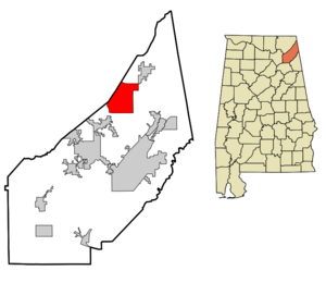
mapsize = 250px
map_caption = Location in DeKalb County and the state ofAlabama
mapsize1 =
map_caption1 =
subdivision_type = Country
subdivision_type1 = State
subdivision_type2 = County
subdivision_name =United States
subdivision_name1 =Alabama
subdivision_name2 = DeKalb
government_type =
leader_title =
leader_name =
established_date =
area_magnitude =
area_total_km2 = 56.7
area_total_sq_mi = 21.9
area_land_km2 = 56.6
area_land_sq_mi = 21.9
area_water_km2 = 0.1
area_water_sq_mi = 0
elevation_ft = 1447
elevation_m = 441
population_as_of = 2000
population_footnotes =
population_total = 2400
population_metro =
population_density_km2 = 42.3
population_density_sq_mi = 109.6
timezone = Central (CST)
utc_offset = -6
latd = 34 |latm = 38 |lats = 1 |latNS = N
longd = 85 |longm = 44 |longs = 35 |longEW = W
timezone_DST = CDT
utc_offset_DST = -5
postal_code_type =ZIP code
postal_code = 35978
area_code = 256
blank_name = FIPS code
blank_info = 01-34096
blank1_name = GNIS feature ID
blank1_info = 0150286
footnotes =
website =Henagar is a town in DeKalb County,
Alabama ,United States . At the 2000 census the population was 2,400. Henagar Junior High School is Home of the Wildcats.Celebrity
The town is also known for being the home of 2005 State High School Javelin Champion, Bradley Wayne Schultz
Geography
Henagar is located at coor dms|34|38|1|N|85|44|35|W|city (34.633700, -85.742921)GR|1.
According to the
U.S. Census Bureau , the town has a total area of 21.9square mile s (56.7km² ), of which, 21.9 square miles (56.6 km²) of it is land and 0.04 square miles (0.1 km²) of it (0.14%) is water.Demographics
As of the
census GR|2 of 2000, there were 2,400 people, 937 households, and 715 families residing in the town. Thepopulation density was 109.8 people per square mile (42.4/km²). There were 1,056 housing units at an average density of 48.3/sq mi (18.7/km²). The racial makeup of the town was 96.46% White, 1.67% Native American, 0.04% Asian, 0.04% Pacific Islander, 0.21% from other races, and 1.58% from two or more races. 0.71% of the population were Hispanic or Latino of any race.There were 937 households out of which 34.9% had children under the age of 18 living with them, 64.8% were married couples living together, 8.2% had a female householder with no husband present, and 23.6% were non-families. 21.7% of all households were made up of individuals and 10.0% had someone living alone who was 65 years of age or older. The average household size was 2.56 and the average family size was 2.96.
In the town the population was spread out with 24.8% under the age of 18, 9.3% from 18 to 24, 28.2% from 25 to 44, 25.0% from 45 to 64, and 12.8% who were 65 years of age or older. The median age was 37 years. For every 100 females there were 93.9 males. For every 100 females age 18 and over, there were 92.1 males.
The median income for a household in the town was $29,777, and the median income for a family was $34,469. Males had a median income of $29,309 versus $19,401 for females. The
per capita income for the town was $14,836. About 10.3% of families and 16.9% of the population were below thepoverty line , including 23.0% of those under age 18 and 25.5% of those age 65 or over.References
External links
Wikimedia Foundation. 2010.