Cotswold (neighborhood)

Cotswold (neighborhood)
Cotswold
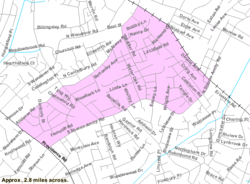
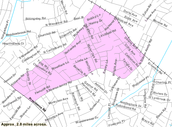
Country United States
State North Carolina
County Mecklenburg
City Charlotte
Population (March 16, 2008)
 – Total 1,582
  according to Zillow.com
ZIP code 28211

The Cotswold neighborhood of Charlotte, North Carolina most likely takes its name from a large shopping center, Cotswold Village Shops, located at the intersection of Randolph and Sharon Amity Roads. Originally known as Cotswold Mall, it was Charlotte's first suburban mall. Cotswold is emerging as one of the more desirable areas for living and shopping with close proximity to Uptown. Many 50's and 60's homes are being remodeled and sold. The area is neighbored by Randolph Park, Echo Hills, Grier Heights, Myers Park, Oakhurst, Providence Park, Sherwood Forest, and Wendover/Sedgewood. The neighborhood has many shopping and dining options[1]

References

  1. ^ Charlotte Magazine - Myers Park/ Cotswold

External links

Randolph Park Website


Coordinates: 35°10′31″N 80°48′01″W / 35.175370°N 80.800405°W / 35.175370; -80.800405


Wikimedia Foundation. 2010.

Игры ⚽ Поможем решить контрольную работу

Look at other dictionaries:

  • Cotswold — The Cotswolds are a range of hills in central England that give their name (usually as a singular) to:*Cotswold (district) *Cotswold (UK Parliament constituency) *Cotswold Chase, a horse race *Cotswold Games, annual games in Chipping Campden,… …   Wikipedia

  • Cotswold (disambiguation) — The Cotswolds are a range of hills in central England that give their name (usually as a singular) to: Cotswold (district) Cotswold (UK Parliament constituency) Cotswold Chase, a horse race Cotswold Games, annual games in Chipping Campden,… …   Wikipedia

  • NoDa (neighborhood) — The center of NoDa: N. Davidson St. @ E. 36th St. NoDa (short for North Davidson ) is a popular arts district in Charlotte, North Carolina, USA. It is located in the North Charlotte neighborhood on and around North Davidson Street and 36th Street …   Wikipedia

  • Myers Park (Charlotte neighborhood) — Myers Park is an affluent neighborhood in Charlotte, North Carolina. Though its boundaries originally coincided with the boundaries of the 1,220 acre (4.9 km2) John Spring Myers farm, by 2008 the neighborhood comprised 2,200 acres… …   Wikipedia

  • Dilworth (neighborhood) — Dilworth Historic District U.S. National Register of Historic Places U.S. Historic district …   Wikipedia

  • Chantilly Neighborhood — The Chantilly Neighborhood is located between the Elizabeth and Plaza Midwood neighborhoods, in Charlotte, North Carolina. Originally developed in the mid 1940s, additional streets were added in the 1950s. Neighborhood boundaries consist of… …   Wikipedia

  • Sherwood Forest (neighborhood) — Infobox Settlement official name = Sherwood Forest settlement type = motto = imagesize = image caption = mapsize = map caption = mapsize1 = map caption1 = image dot dot mapsize = dot map caption = dot x = dot y = pushpin pushpin label position =… …   Wikipedia

  • List of Charlotte neighborhoods — Main article: Charlotte, North Carolina The city of Charlotte, North Carolina, has 199 Neighborhood Statistical Areas, as determined by the city s planning division.[1]. Below is a partial listing of neighborhoods in the city. Contents 1 South… …   Wikipedia

  • Severn Valley (Cthulhu Mythos) — The Severn Valley is the setting of several fictional towns and other locations created by horror writer Ramsey Campbell. Part of the Cthulhu Mythos started by H. P. Lovecraft, the fictional milieu is arguably the most detailed mythos setting… …   Wikipedia

  • Mount Airy, Philadelphia, Pennsylvania — Stone cottage in Mount Airy, Philadelphia. The community is known for its elegant examples of 18th and 19th century residential architecture. For other uses, see Mount Airy. Mount Airy is a neighborhood of Northwest Philadelphia in the state of… …   Wikipedia

Share the article and excerpts

Direct link
Do a right-click on the link above
and select “Copy Link”