- Dilworth (neighborhood)
-
Dilworth Historic District
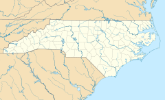
Location: Roughly bounded by Myrtle, Morehead, Berkeley, Dilworth Rd. W, Charlotte, Park, Tremont, Cleveland and Renssalaer, Charlotte, North Carolina Coordinates: 35°12′28″N 80°51′0″W / 35.20778°N 80.85°WCoordinates: 35°12′28″N 80°51′0″W / 35.20778°N 80.85°W Area: 395 acres (160 ha) Architect: Olmsted Bros. et al. Architectural style: Late 19th and 20th Century Revivals, Bungalow/Craftsman, Late Victorian Governing body: Local NRHP Reference#: 87000610[1] Added to NRHP: April 09, 1987 Dilworth is a neighborhood of Charlotte, North Carolina, USA found south of Uptown. The neighborhood was Charlotte's first streetcar suburb and was established by Edward Dilworth Latta in the 1890s on 250 acres (1 km²) southwest of the original city limits. It included the Joseph Forsyth Johnson designed Latta Park. Planned largely with a grid pattern similar to the city's original four wards, Dilworth was initially designated the Eighth Ward.
The streets of Dilworth feature stately, mature oak trees, sidewalks, and houses with front porches. The homes are primarily bungalows — with the occasional Queen Anne — and some larger, two-story Colonial Revivals lining Dilworth Road East and West. East Boulevard serves as the main thoroughfare through the neighborhood. East Boulevard is lined with restaurants, offices and shops, many located in renovated homes. Charlotte’s largest hospital, Carolinas Medical Center, is in Dilworth. This 861-bed teaching hospital is the region’s only Level 1 trauma center.
Much of the neighborhood is listed on the National Register of Historic Places as the Dilworth Historic District.[1]
References
- ^ a b "National Register Information System". National Register of Historic Places. National Park Service. 2009-03-13. http://nrhp.focus.nps.gov/natreg/docs/All_Data.html.
External links
City of Charlotte, North Carolina Main Government Mayor Anthony Foxx · Mayors of Charlotte · Charlotte-Mecklenburg Schools · Public Library System ·Charlotte Fire · CMPDHistory Neighborhoods Ballantyne · Chantilly · Cotswold · Derita · Dilworth · Eastland · Elizabeth · Myers Park · NoDa · North Charlotte · Plaza-Midwood · Quail Hollow · Sedgefield · Sherwood Forest · SouthPark · Starmount · Steele Creek
Municipal Service Districts: South End · University City · Uptown (Charlotte center city)Sports teams Newspapers Charlotte Observer · Charlotte Post · Creative Loafing · Mecklenburg Times · Q-Notes · Charlotte WeeklyTelevision stations Online News Transportation Categories:- Historic districts in North Carolina
- Streetcar suburbs
- Neighborhoods in Charlotte, North Carolina
- National Register of Historic Places in North Carolina
Wikimedia Foundation. 2010.

