- 2004–05 South-West Indian Ocean cyclone season
-
2004–05 South-West Indian Ocean cyclone season 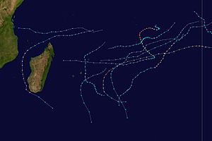
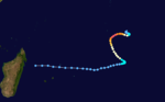
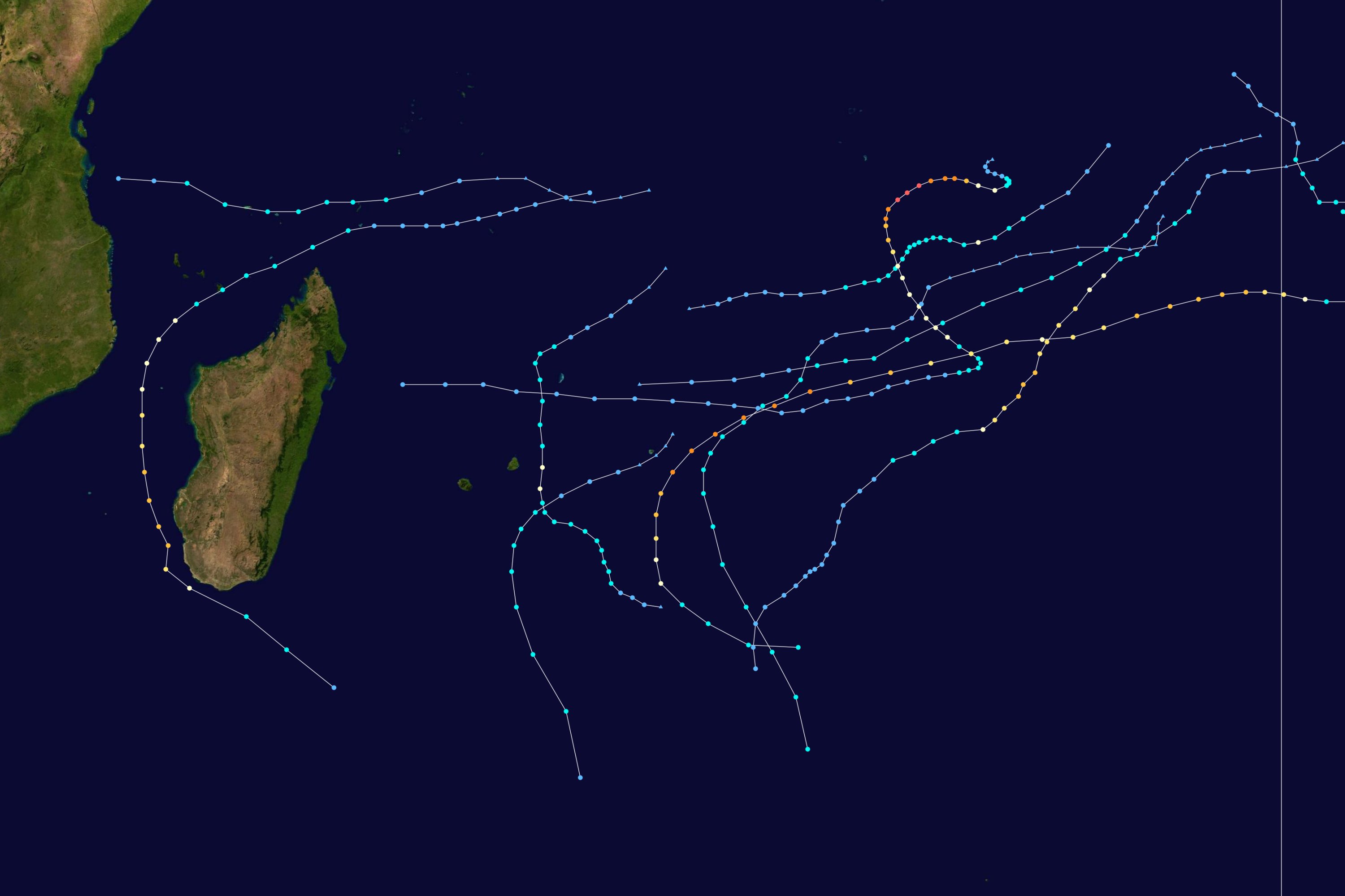
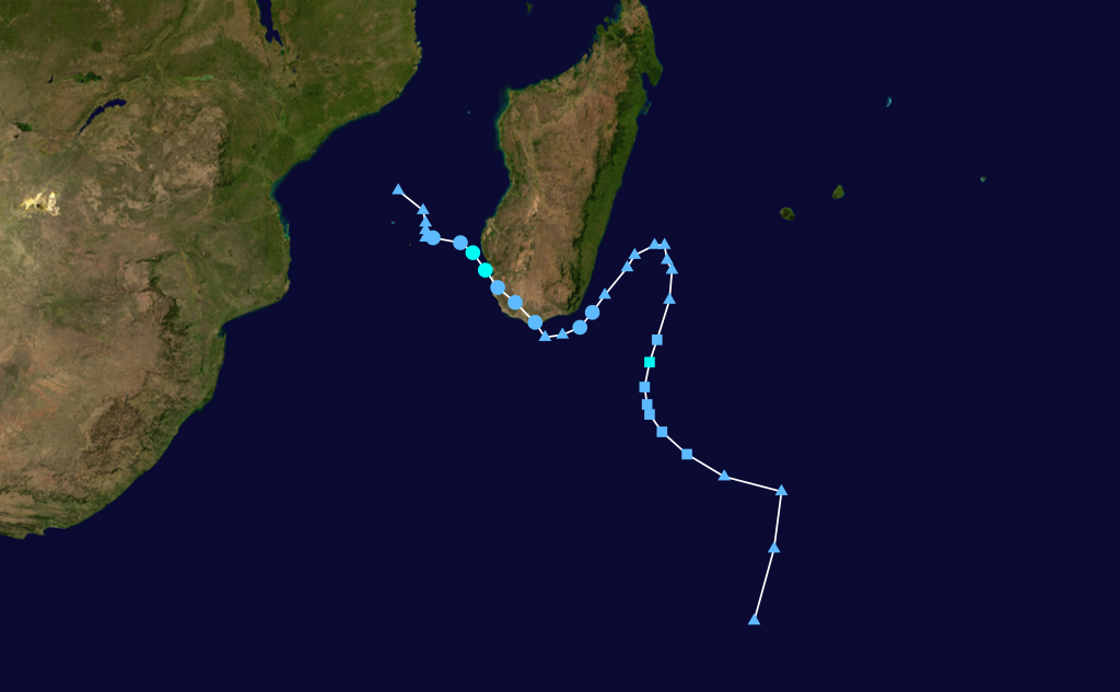
Season summary mapFirst storm formed: November 6, 2004 Last storm dissipated: April 16, 2005 Strongest storm: Juliet – 905 hPa (mbar), 220 km/h (140 mph) (10-minute sustained) Tropical depressions: 15 Total storms: 10 official, 1 unofficial Tropical cyclones: 4 Total fatalities: 19-233 Total damage: Unknown South-West Indian Ocean cyclone seasons
2002–03, 2003–04, 2004–05, 2005–06, 2006–07Related articles: The 2004-05 South-West Indian Ocean cyclone season was an annual event of tropical cyclone formation. It started on November 15, 2004 and ended on April 30, 2005. For Mauritius and the Seychelles, the season continued until May 15. These dates conventionally delimit the period of each year when most tropical cyclones form in the basin, which is west of 90°E and south of the Equator. Tropical cyclones in this basin are monitored by the Regional Specialised Meteorological Centre in Réunion.
Storms
Tropical Depression 01 (Phoebe)
Tropical depression (MFR) 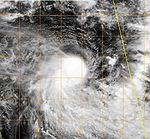
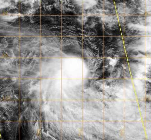
Duration August 30 – September 1 Intensity 55 km/h (35 mph) (10-min), 999 mbar (hPa) On August 30, an area of low pressure developed near the edge of Météo-France's area of responsibility within an unseasonably active monsoonal band which coincided with the Madden-Julian oscillation. Tracking towards the southeast, the low experience strong deep-level wind shear which kept most of the convection displaced from the center of circulation. On August 31, convection managed to develop around the west and southwestern portions of the low before[1] and was designated as Tropical Depression 01.[2] The depression reached its peak intensity at this time with winds of 55 km/h (35 mph 10-minute winds) and a minimum pressure of 999 hPa (mbar).[3] Shortly after, the depression entered Australian Bureau of Meteorology in Perth's area of responsibility. The depression later intensified into a tropical cyclone and was named Phoebe.[1]
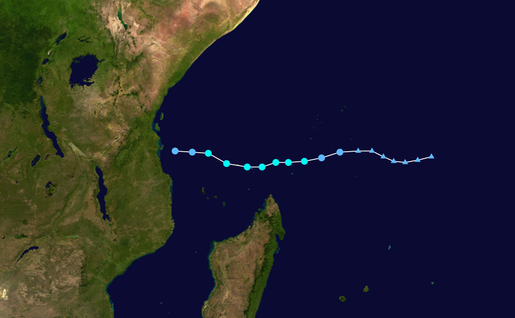
Tropical Depression 02
Tropical depression (MFR) Tropical storm (SSHS) 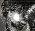

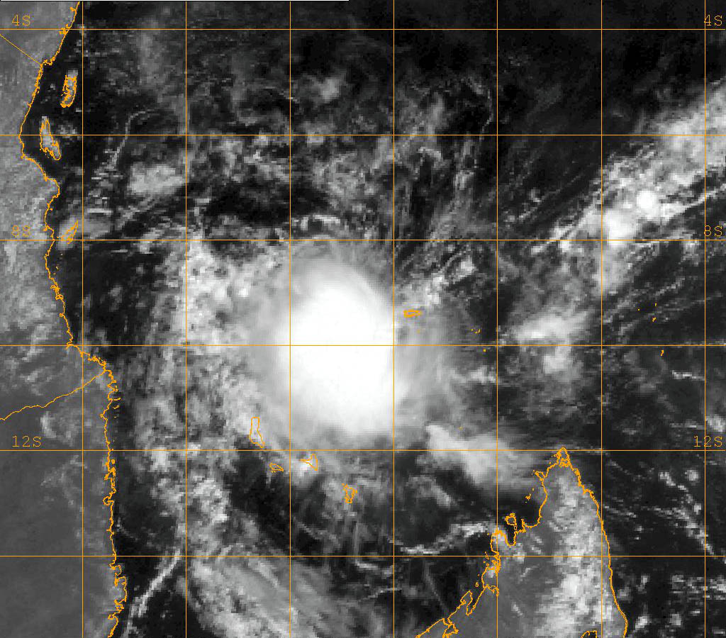
Duration October 25 – October 29 Intensity 55 km/h (35 mph) (10-min), 996 mbar (hPa) Tropical Depression 02R developed 675 nautical miles (1,250 km) west of Diego Garcia with winds of 25 knots (46 km/h) on October 25, while JTWC designated the storm as 02S. The storm moved westward, strengthening to 30 knots (60 km/h) sustained winds. The JTWC classified the storm as 35-knot (65 km/h) tropical storm. The storm weakened to a 25-knot (46 km/h) disturbance before making landfall near Dar es Salaam, Tanzania, on October 29.[4]
Severe Tropical Storm Arola
Severe tropical storm (MFR) Category 1 tropical cyclone (SSHS) 

Duration November 6 – November 18 Intensity 110 km/h (70 mph) (10-min), 978 mbar (hPa) Tropical Cyclone Arola developed from Tropical Depression 03R on November 8 approximately 400 nautical miles (700 km) east-southeast of Diego Garcia with 45-knot (83 km/h) winds. The storm moved west-southwest as it continued to intensify, reaching its peak intensity of 60 knots (110 km/h). The storm drifted westward as it weakened over the open waters never affecting land.
Intense Tropical Cyclone Bento
Intense tropical cyclone (MFR) Category 5 tropical cyclone (SSHS) 
Duration November 19 – December 4 Intensity 215 km/h (130 mph) (10-min), 915 mbar (hPa) Tropical Cyclone Bento developed from Tropical Depression 04S on November 21 approximately 375 nautical miles (695 km) east-southeast of Diego Garcia with 40-knot (70 km/h) winds. The storm continued to intensify, reaching cyclone status on November 22. Bento reached its peak intensity of 120 knots (220 km/h) on the 22nd, 175 nautical miles (324 km) east-southeast of Diego Garcia. Bento is the first South Indian tropical cyclone of this intensity located this close to the equator. Bento tracked to the west-southwest as it slowly began to weaken from its peak intensity. On November 25 the winds had dropped to 70 knots (130 km/h), and the storm was downgraded to a tropical storm. The storm weakened to a tropical depression on November 30, 615 nautical miles (1,139 km) south of Diego Garcia.
Tropical Disturbance 05
Tropical disturbance (MFR) 
Duration December 11 – December 11 Intensity 20 km/h (10 mph) (10-min), Unknown Formed and dissipated on December 11, 2004.[5]
Tropical Cyclone Chambo
Tropical cyclone (MFR) Category 3 tropical cyclone (SSHS) 

Duration December 22 – January 3 Intensity 155 km/h (100 mph) (10-min), 950 mbar (hPa) Tropical Cyclone Chambo developed from Tropical Depression 06S on December 24, 750 nautical miles (1,390 km) west of the Cocos Islands and moving southwestward with 40-knot (70 km/h) winds. The system reached cyclone intensity the following day. The storm reached a peak intensity of 85 knots (157 km/h) on December 27. The storm continued on a southwestern track over the open waters, becoming extratropical on December 30.
Tropical Depression 07
Tropical depression (MFR) Duration January 4 – January 4 Intensity 55 km/h (35 mph) (10-min), Unknown Tropical Depression 07 formed in the Mozambique Channel on January 4. The depression moved southeastward, making landfall in western Madagascar between Morombe and Toliara. It dissipated that same day.
Severe Tropical Storm Daren
Severe tropical storm (MFR) Tropical storm (SSHS) 

Duration January 17 – January 23 Intensity 95 km/h (60 mph) (10-min), 985 mbar (hPa) Tropical Storm Daren developed from Tropical Depression 11S (09M) on January 19, 450 nautical miles (830 km) south-southeast of Diego Garcia with winds of 40 knots (70 km/h). This would be the storm's peak intensity as it moved to the west-southwest. Increasing vertical wind shear would eventually cause the storm to weaken. The storm dissipated on January 22 150 nautical miles (280 km) north of Mauritius.
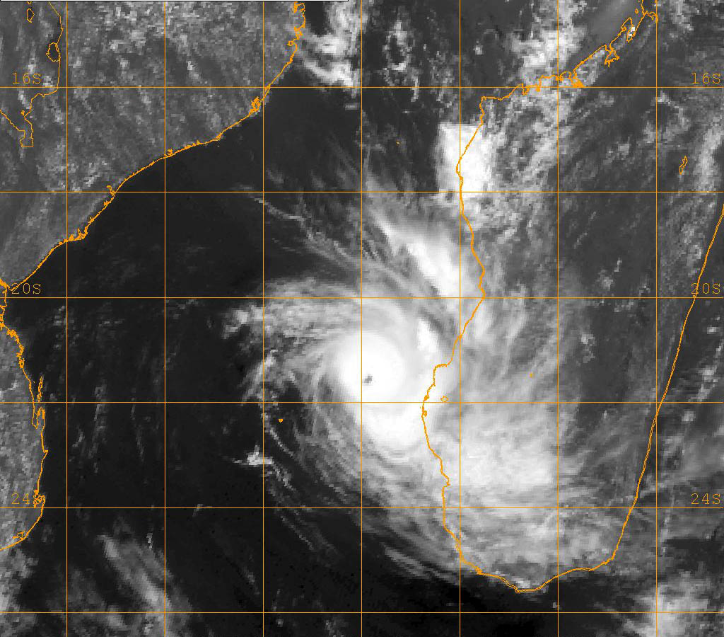
Intense Tropical Cyclone Ernest
Intense tropical cyclone (MFR) Category 3 tropical cyclone (SSHS) 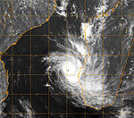

Duration January 16 – January 25 Intensity 165 km/h (105 mph) (10-min), 950 mbar (hPa) Tropical Cyclone Ernest developed from Tropical Depression 12S (08M) on January 20, 400 nautical miles (700 km) north-northwest of Antananarivo, Madagascar, with 40-knot (70 km/h) winds. As the storm moved into the Mozambique Channel, it intensified rapidly reaching 65-knot (120 km/h) winds in 12 hours. After the intensity leveled off, the storm went through a rapid intensification a second time, reaching 90-knot (170 km/h) winds as it moved southward through the channel. Ernest turned to the southeast and began to slowly weaken as it neared the southern end of the channel. Ernest moved along the coastline of Madagascar on January 22 with 70 knots (130 km/h) sustained winds. After passing the island, Ernest accelerated out to sea and became extratropical on January 24. Tropical Cyclone Ernest brought significant rainfall to southern Madagascar. Just five days later, Tropical Storm Felapi affected the same area. 19 people died, 214 were missing, and 32,000 were homeless following the two storms.
Tropical Disturbance 10
Only one bulletin was issued for this system, on January 23, 2005.[6]
Moderate Tropical Storm Felapi
Moderate tropical storm (MFR) 
Duration January 26 – February 3 Intensity 65 km/h (40 mph) (10-min), 995 mbar (hPa) Tropical Storm Felapi developed from Tropical Depression 11M on January 27, 115 nautical miles (213 km) northwest of Tulear. The storm moved southeastward where it made landfall in southwestern Madagascar on January 28. The storm was downgraded to a tropical depression as it moved over the southern portion of the island. The storm emerged in the South Indian Ocean on January 29, making a turn to the east, then northeast over the open waters. Felapi turned back to the southeast as a subtropical depression. See the Tropical Cyclone Ernest section above for fatalities associated with Tropical Storm Felapi.
Severe Tropical Storm Gerard
Severe tropical storm (MFR) Tropical storm (SSHS) 

Duration January 29 – February 5 Intensity 110 km/h (70 mph) (10-min), 973 mbar (hPa) Formed on January 28, became extratropical on February 5, 2005. Reached peak intensity of 60 knots (110 km/h).[7]
Tropical Depression 13
Tropical depression (MFR) Duration February 4 – February 8 Intensity 55 km/h (35 mph) (10-min), Unknown Formed on February 4, became extratropical on February 8, 2005.[7]
Tropical Disturbance 14
Tropical disturbance (MFR) Duration February 8 – February 17 Intensity 20 km/h (10 mph) (10-min), Unknown Formed on February 8, dissipated on February 17, 2005.[7]
Tropical Depression 15
Tropical depression (MFR) Duration February 24 – February 28 Intensity 55 km/h (35 mph) (10-min), Unknown Formed on February 24, dissipated on February 28, 2005.[7]
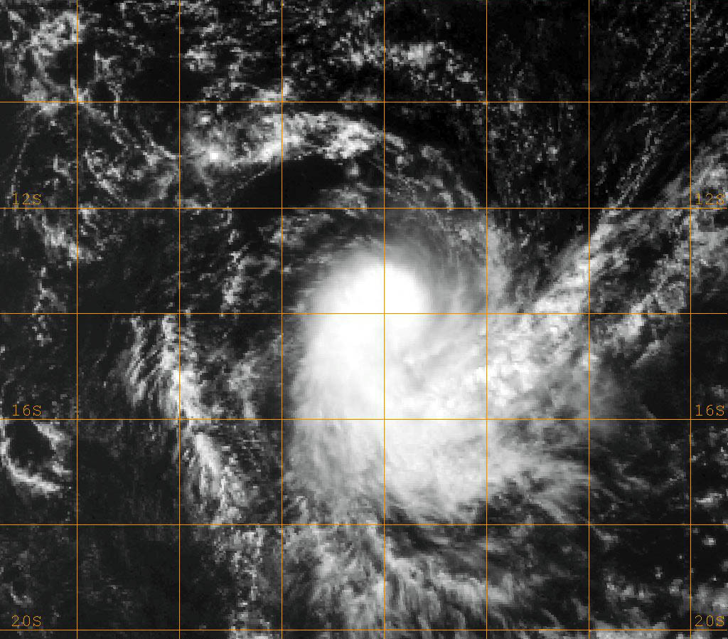
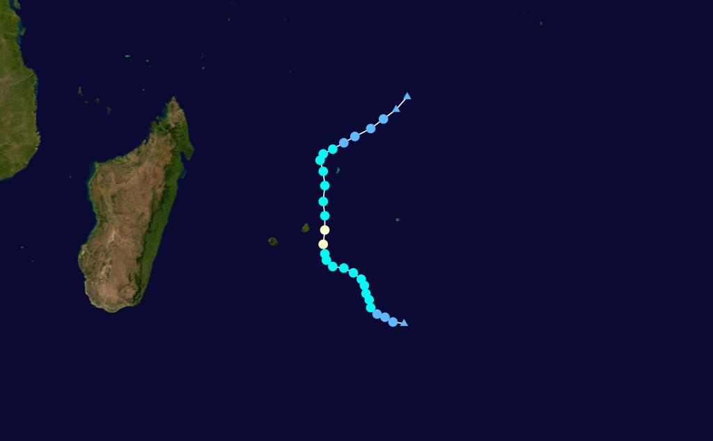
Severe Tropical Storm Hennie
Severe tropical storm (MFR) Category 1 tropical cyclone (SSHS) 

Duration March 19 – April 1 Intensity 100 km/h (65 mph) (10-min), 978 mbar (hPa) Formed on March 21, became extratropical on March 27 and Reunion centre stopped issuing advisories on March 29, 2005. Reached peak intensity of 55 knots (102 km/h).[8]
- Tropical Cyclone 2005's tracking chart of Tropical Cyclone Hennie.
Severe Tropical Storm Isang
Severe tropical storm (MFR) Tropical storm (SSHS) 

Duration March 29 – April 8 Intensity 110 km/h (70 mph) (10-min), 970 mbar (hPa) Formed on March 29, became extratropical on April 7, 2005. Reached peak intensity of 60 knots (110 km/h).[9]
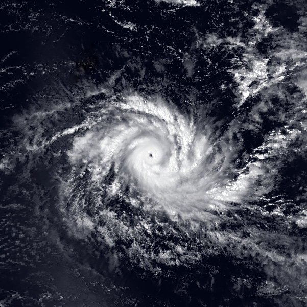
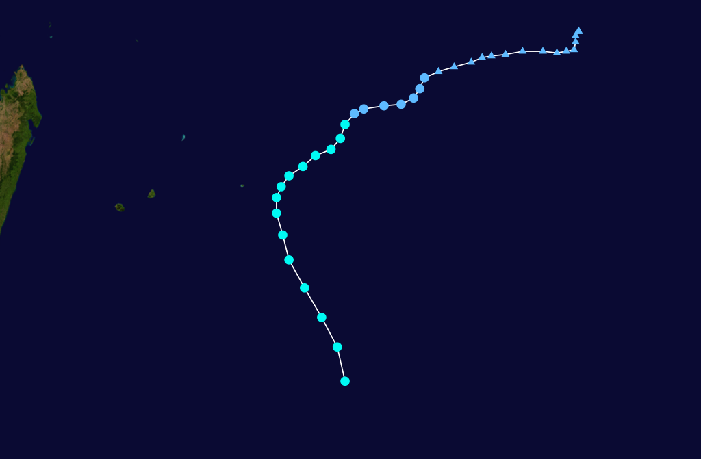
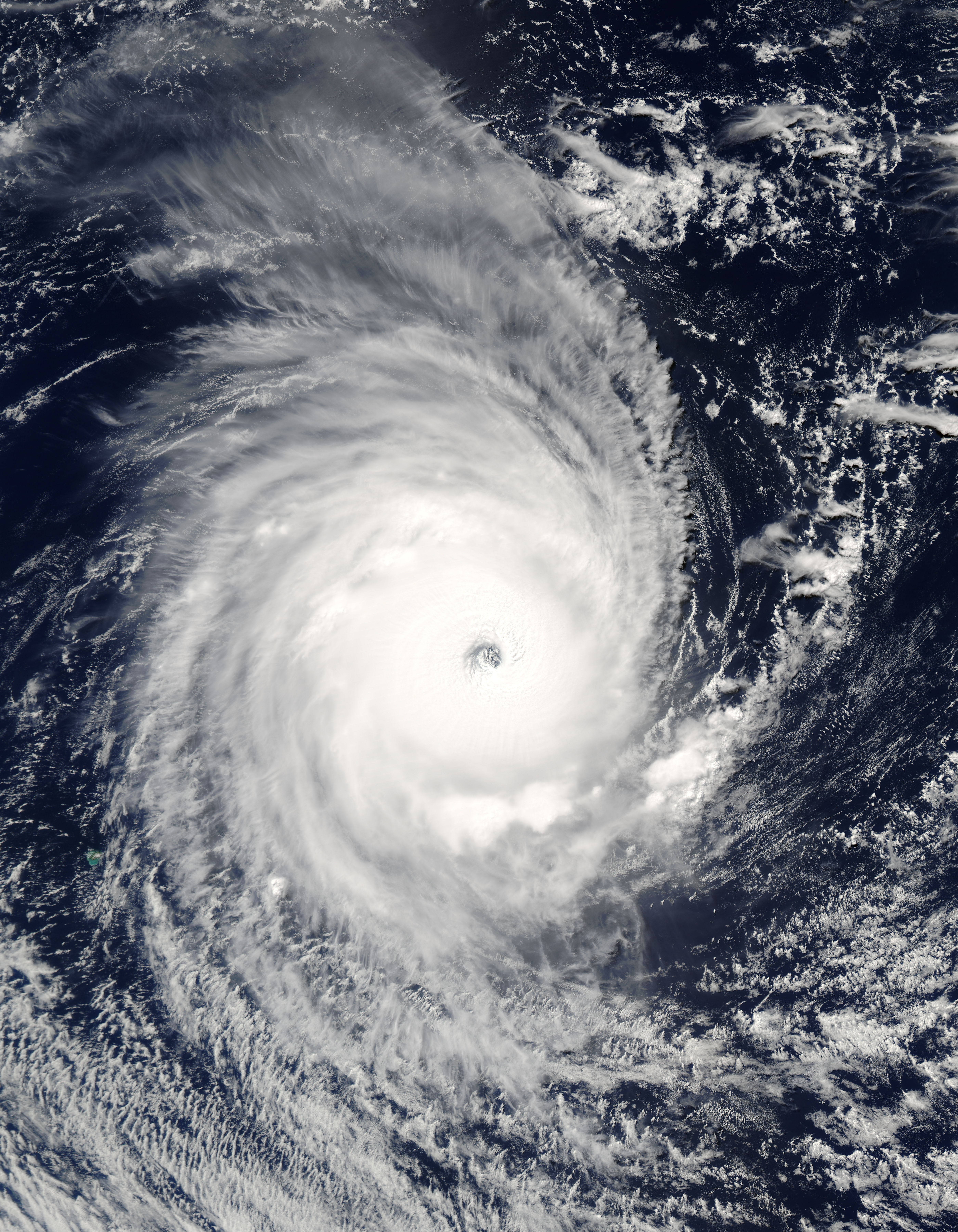
Very Intense Tropical Cyclone Adeline-Juliet
Very intense tropical cyclone (MFR) Category 4 tropical cyclone (SSHS) 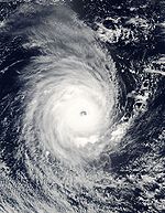

Duration April 2 – April 16 Intensity 220 km/h (140 mph) (10-min), 905 mbar (hPa) The cyclone formed in Perth's area of responsibility (AOR) on April 1 and entered Reunion's AOR on April 5. It became extratropical on April 12.[9] This would be the last very intense tropical cyclone until Edzani in 2010.
Storm names
A tropical disturbance is named when it reaches moderate tropical storm strength. If a tropical disturbance reaches moderate tropical storm status west of 55°E, then the Sub-regional Tropical Cyclone Advisory Centre in Madagascar assigns the appropriate name to the storm. If a tropical disturbance reaches moderate tropical storm status between 55°E and 90°E, then the Sub-regional Tropical Cyclone Advisory Centre in Mauritius assigns the appropriate name to the storm. A new annual list is used every year so no names are retired.[10]
- Arola
- Bento
- Chambo
- Daren
- Ernest
- Felapi
- Gerard
- Hennie
- Isang
- Juliet
- Kalo (unused)
- Lilian (unused)
- Madi (unused)
- Neddy (unused)
- Ouledi (unused)
- Patricia (unused)
- Qiqida (unused)
- Ramon (unused)
- Sopani (unused)
- Tina (unused)
- Ula (unused)
- Vera (unused)
- Willem (unused)
- Xaoka (unused)
- Yelda (unused)
- Zuze (unused)
See also
- Tropical cyclone scales
- List of Southern Hemisphere tropical cyclone seasons
- Atlantic hurricane seasons: 2004, 2005
- Pacific hurricane seasons: 2004, 2005
- Pacific typhoon seasons: 2004, 2005
- North Indian Ocean cyclone seasons: 2004, 2005
References
- ^ a b Gary Padgett (January 27, 2005). "Monthly Tropical Cyclone Summary for September 2004". Typhoon 2000. http://www.typhoon2000.ph/garyp_mgtcs/sep04sum.txt. Retrieved February 12, 2009.
- ^ Gary Padgett (December 7, 2004). "Monthly Tropical Cyclone Summary for August 2004". Typhoon 2000. http://www.typhoon2000.ph/garyp_mgtcs/aug04sum.txt. Retrieved February 12, 2009.
- ^ Gary Padgett (October 24, 2004). "Monthly Tropical Cyclone Tracks for September 2004". Typhoon 2000. http://www.typhoon2000.ph/garyp_mgtcs/sep04tks.txt. Retrieved February 12, 2009.
- ^ Monthly Global Tropical Cyclone Tracks October 2004
- ^ Monthly Global Tropical Cyclone Tracks December 2004
- ^ Monthly Global Tropical Cyclone Summary January 2005
- ^ a b c d Monthly Global Tropical Cyclone Tracks February 2005
- ^ Monthly Global Tropical Cyclone Tracks March 2005
- ^ a b Monthly Global Tropical Cyclone Tracks April 2005
- ^ "Tropical Cyclone Operational Plan for the South Pacific and South-East Indian Ocean". World Meteorological Organization. 2003. http://ftp.wmo.int/pages/prog/www/TCP_vO/OperationPlans/TCP12-English2003.pdf. Retrieved 2008-08-15.
External links
- Joint Typhoon Warning Center (JTWC).
- Météo France (RSMC La Réunion).
- World Meteorological Organization
- 2004-05 season from Météo France
- RA I Tropical Cyclone Committee for the South-West Indian Ocean - Seventeenth session
2000–09 South-West Indian Ocean cyclone seasons Categories:


Wikimedia Foundation. 2010.