- 2004 Pacific hurricane season
Infobox hurricane season
Basin=EPac
Year=2004
Track=2004 Pacific hurricane season map.pngMay 22 ,2004
Last storm dissipated=October 13 ,2004
Strongest storm name=Javier
Strongest storm winds=130
Strongest storm pressure=930
Average wind speed=1
Total depressions=17
Total storms=12
Total hurricanes=6
Total intense=3
Fatalities=0
Da
Inflated=
five seasons=2002, 2003, 2004, 2005, 2006May 15 2004 in the eastern Pacific, and onJune 1 2004 in the central Pacific, and lasted untilNovember 30 2004 . These dates conventionally delimit the period of each year when mosttropical cyclones form in the northeastern Pacific Ocean.This season was the first since 1990 to result in no deaths.
__TOC__
Pre-season forecasts
The U.S.
National Hurricane Center predicted a slow year, with only a 10% chance of above-average storm activity in the eastern North Pacific. The pre-season forecast predicted 13 to 15 tropical storms, 6 to 8 hurricanes, and 2 to 4 becoming major hurricanes (Category 3 or higher on theSaffir-Simpson Hurricane Scale ).Fact|date=February 2007torms
"See Also:
Timeline of the 2004 Pacific hurricane season "Tropical Storm Agatha
Infobox Hurricane Small
Basin=EPac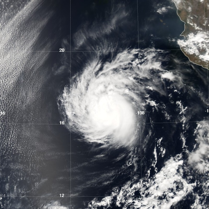
Track=Agatha 2004 track.pngMay 22
Dissipated=May 24
1-min winds=50
Pressure=997May 22 while located 575 miles south-southeast ofCabo San Lucas in theMexican state ofBaja California Sur . The depression moved to the northwest into an area of light vertical shear, and intensified into Tropical Storm Agatha shortly after forming. Agatha reached a peak of 60 mph on the 23rd, though the development of an eye feature suggests it could have been stronger. Cool waters and dry air was entrained into the system, causing Agatha to weaken and degenerate into a remnant low onMay 24 . The remnant low drifted erratically for two days until dissipating on the 26th. Agatha never affected land. [http://www.nhc.noaa.gov/2004agatha.shtml?]Tropical Depression Two-E
Infobox Hurricane Small
Basin=EPac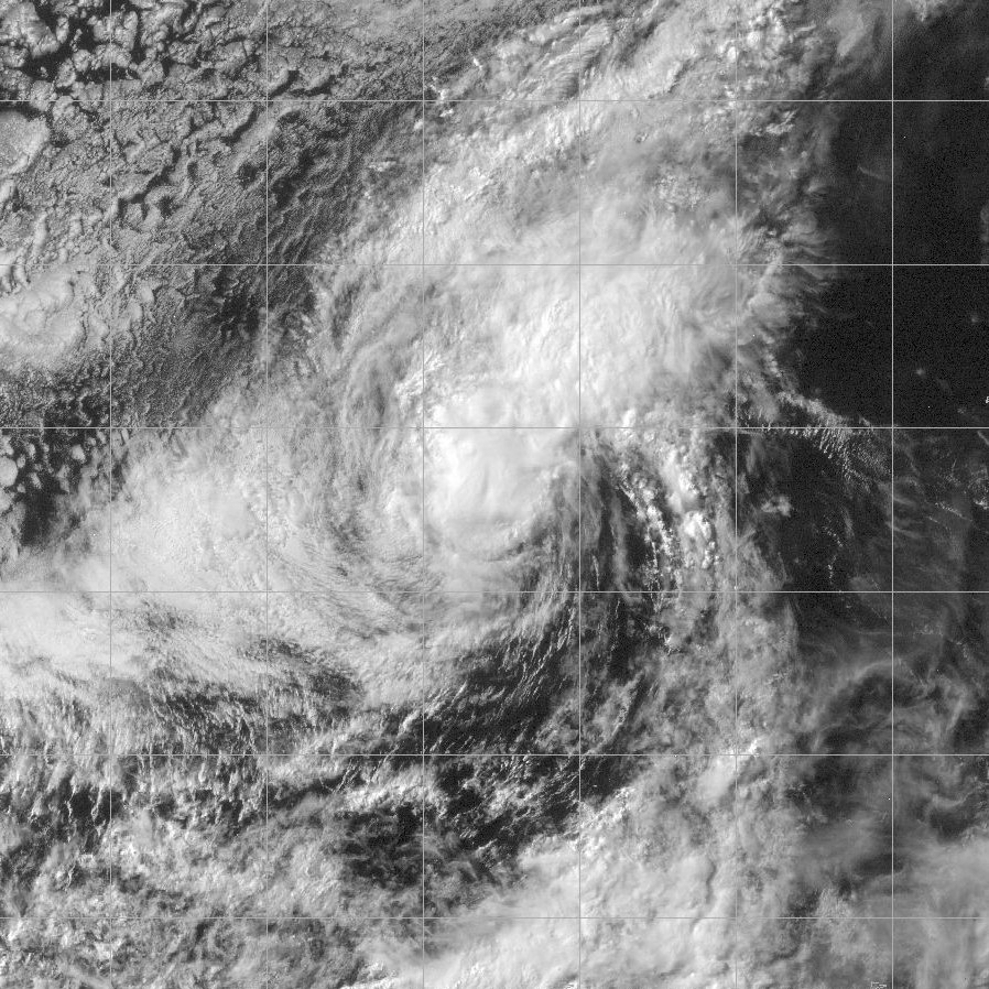
Track=2-E 2004 track.pngJuly 2
Dissipated=July 3
1-min winds=30
Pressure=1007June 17 a tropical wave moved off the coast ofAfrica , and entered the easternPacific Ocean onJune 25 . A circulation developed, and the system organized into Tropical Depression Two-E onJuly 2 while located 750 miles southwest of the southern tip of theBaja California Peninsula . [ [http://www.nhc.noaa.gov/2004two-e.shtml NHC Tropical Cyclone Report ] ] Due to cooler waters, the depression failed to develop further [ [http://www.nhc.noaa.gov/archive/2004/dis/ep022004.discus.003.shtml Tropical Depression TWO-E ] ] , and the system degenerated into a remnant area of low pressure onJuly 4 . The low dissipated a day later without effecting land. [ [http://www.nhc.noaa.gov/2004two-e.shtml NHC Tropical Cyclone Report ] ]Tropical Depression One-C
Infobox Hurricane Small
Basin=EPac
Track=1-C 2004 track.pngJuly 5
Dissipated=July 6
1-min winds=25
Pressure=1007
* CPHC [http://www.prh.noaa.gov/cphc/summaries/2004.php#td01c archive] for 1C.Tropical Storm Blas
Infobox Hurricane Small
Basin=EPac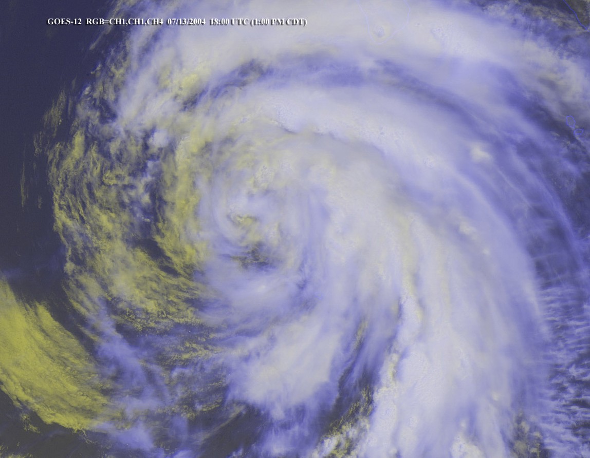
Track=Blas 2004 track.pngJuly 11
Dissipated=July 15
1-min winds=55
Pressure=991July 11 , a tropical wave organized into Tropical Depression Three to the southwest ofMexico , and strengthened into Tropical Storm Blas later that day. It moved to the northwest around a mid-level anticyclone, and intensified to reach a peak of 65 mph on the 12th. Cooler water temperatures weakened the storm to a remnant low on the 14th, though it remained large and well-defined. The remnant low continued to the west-northwest until dissipating onJuly 19 to the west ofBaja California . Blas never affected land. [http://www.nhc.noaa.gov/2004blas.shtml]Hurricane Celia
Infobox Hurricane Small
Basin=EPac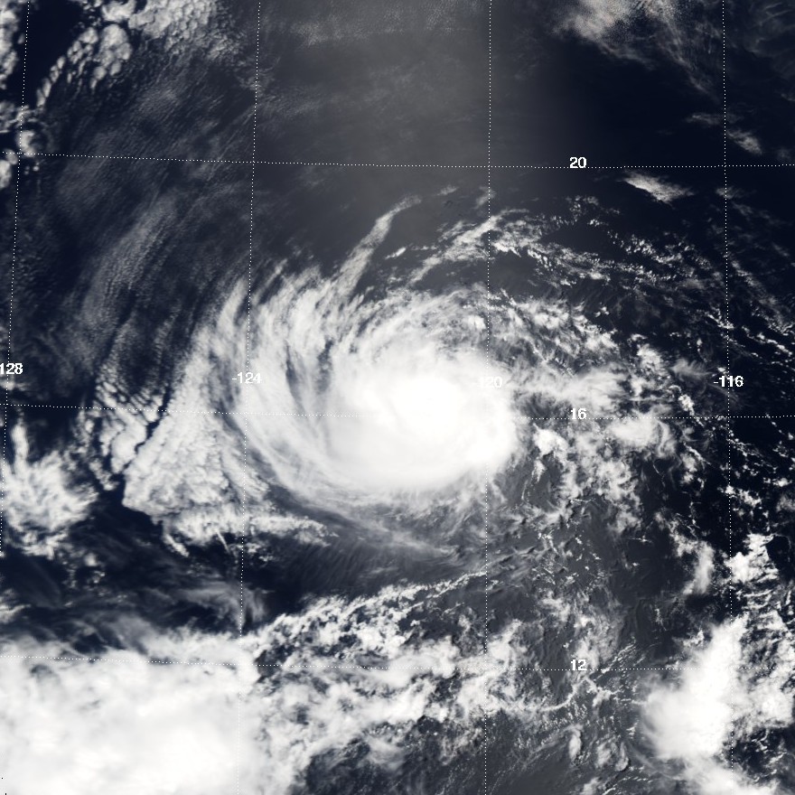
Track=Celia 2004 track.pngJuly 19
Dissipated=July 25
1-min winds=75
Pressure=981Africa entered the easternPacific Ocean . It entered an area of favorable upper level winds and water temperatures, and formed into Tropical Depression Four-E onJuly 19 . The depression quickly strengthened to tropical storm status, and slowly intensified to attain hurricane strength onJuly 22 . Celia reached a peak of 85 mph before moving into an area of cool waters and dry air, thus weakening it. The storm weakened into a tropical depression on the 24th, and dissipated two days later. [http://www.nhc.noaa.gov/2004celia.shtml]Hurricane Darby
Infobox Hurricane Small
Basin=EPac.jpg)
Track=Darby 2004 track.pngJuly 26
Dissipated=August 1
1-min winds=105
Pressure=957Mexico onJuly 26 . Later that day, it was upgraded to Tropical Storm Darby, and only four hours later, at 2 a.m. (0900 UTC) onJuly 27 , was upgraded to Hurricane Darby. It moved due west at this point, aiming directly for the big island ofHawaii . It reached Category 3 strength onJuly 29 , the first major hurricane in the northeastern Pacific basin since2002 . However, long before it reached Hawaii, it lost strength and dissipated on the evening ofJuly 31 . [http://www.nhc.noaa.gov/2004darby.shtml]The remnants of the storm caused heavy rainfall over
Hawaii , though caused no damage or deaths. [http://www4.ncdc.noaa.gov/cgi-win/wwcgi.dll?wwevent~ShowEvent~535835] As a hurricane, Darby also produced strong waves of 4 to 8 feet on easternHawaii . [http://www4.ncdc.noaa.gov/cgi-win/wwcgi.dll?wwevent~ShowEvent~535830]Tropical Depression Six-E
Infobox Hurricane Small
Basin=EPac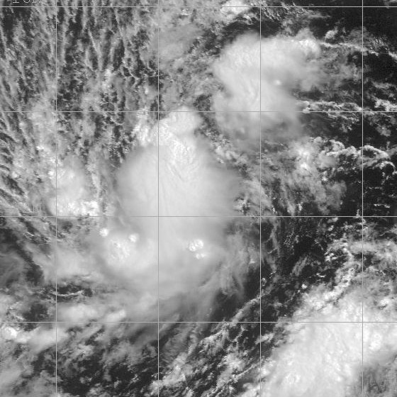
Track=6-E 2004 track.pngAugust 1
Dissipated=August 2
1-min winds=25
Pressure=1008August 1 while located 1,265 miles southwest of the Mexican port ofCabo San Lucas ,Baja California Sur . It moved westward without organizing, and quickly dissipated.cite web|author=National Hurricane Center|year=2004|title=Summary of the 2004 Eastern Pacific Hurricane Season|accessdate=2006-07-15|url=http://www.nhc.noaa.gov/archive/2004/tws/MIATWSEP_nov.shtml?] Operationally, the depression developed early onJuly 29 cite web|author=Stacy Stewart|year=2004|title=Tropical Depression Six-E Discussion One|publisher=National Hurricane Center|accessdate=2006-07-15|url=http://www.nhc.noaa.gov/archive/2004/dis/ep062004.discus.001.shtml?] , though further analysis indicated a circulation did not exist.cite web|author=James L. Franklin|year=2004|title=Tropical Depression Six-E Discussion Four|publisher=National Hurricane Center|accessdate=2006-07-15|url=http://www.nhc.noaa.gov/archive/2004/dis/ep062004.discus.004.shtml?] Also operationally, forecasters issued tropical cyclone advisories untilAugust 3 .cite web|author=Knabb/Avila|year=2004|title=Tropical Depression Six-E Discussion Twelve|publisher=National Hurricane Center|accessdate=2006-07-15|url=http://www.nhc.noaa.gov/archive/2004/dis/ep062004.discus.012.shtml?]Tropical Storm Estelle
Infobox Hurricane Small
Basin=EPac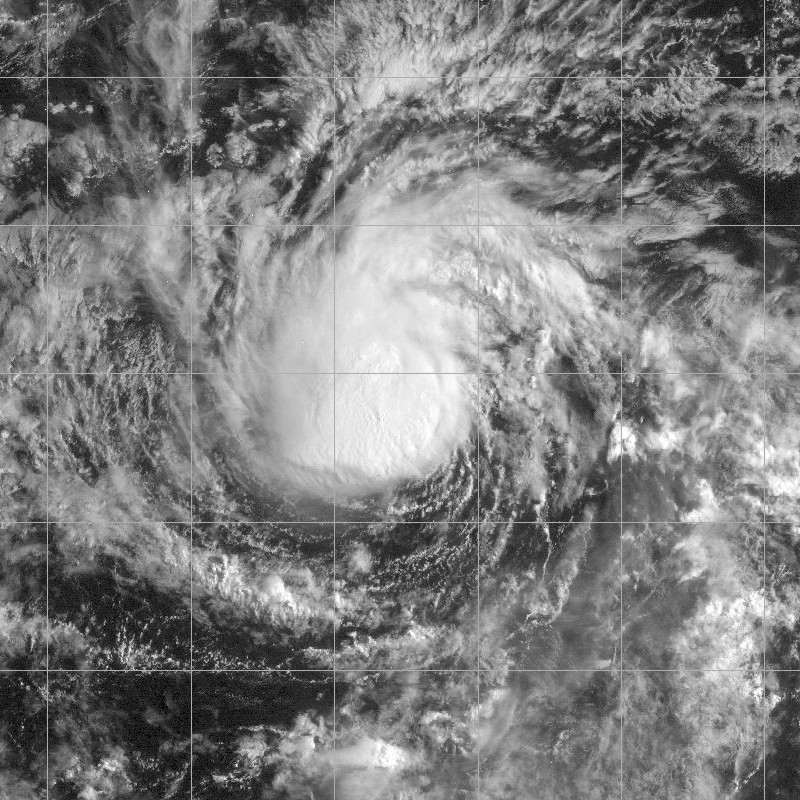
Track=Estelle 2004 track.pngAugust 19
Dissipated=August 24
1-min winds=60
Pressure=989August 19 while located 1,440 miles east-southeast ofHilo, Hawaii . The next day it strengthened into a tropical storm, and Estelle gradually strengthened to reach a peak of 70 mph on the 21st. Strong shear weakened the storm, and it weakened to a tropical depression on the 23rd. It turned to the west-southwest, degenerated into a remnant low on the 24th, and dissipated on the 25th. Estelle never effected land. [http://www.nhc.noaa.gov/2004estelle.shtml]Hurricane Frank
Infobox Hurricane Small
Basin=EPac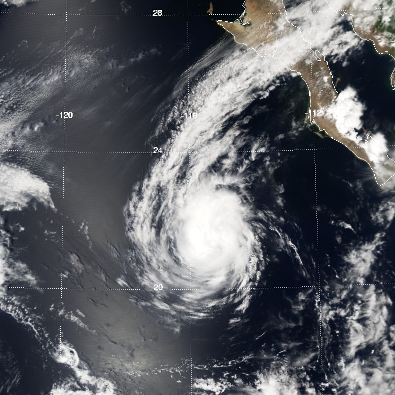
Track=Frank 2004 track.pngAugust 23
Dissipated=August 26
1-min winds=75
Pressure=979Atlantic Ocean Tropical Storm Earl entered the easternPacific Ocean onAugust 18 . Deep convection steadily organized, and the system developed into a tropical depression onAugust 23 while 415 miles south of the Mexican port ofCabo San Lucas ,Baja California Sur . The depression rapidly organized, and strengthened into a hurricane just 12 hours after forming, an unusual occurrence. Frank continued to strengthen as it moved to the northwest, and reached a peak intensity of 85 mph on the 24th. Shortly after peaking, the hurricane passed over cooler water temperatures, and Frank quickly weakened, degenerating into a remnant low byAugust 26 . The low drifted to the southwest, and dissipated on the 27th while 750 miles west of the southern tip of theBaja California Peninsula . The storm never affected land. [http://www.nhc.noaa.gov/2004frank.shtml?]Tropical Depression Nine-E
Infobox Hurricane Small
Basin=EPac
Track=9-E 2004 track.pngAugust 23
Dissipated=August 26
1-min winds=30
Pressure=1005August 8 a tropical wave moved off the coast ofAfrica . It entered the eastern Pacific Ocean onAugust 15 , and after slowly organizing the wave developed into a tropical depression on the 23rd while located 920 miles west-southwest of the Mexican port ofCabo San Lucas ,Baja California Sur . [http://www.nhc.noaa.gov/2004nine-e.shtml?] Despite initial predictions of the depression intensifying to a 45 mph tropical storm, [http://www.nhc.noaa.gov/archive/2004/dis/ep092004.discus.001.shtml?] cool water temperatures and south-southwesterlywind shear prevented strengthening, and the depression degenerated into a remnant area of low pressure on the 26th. The low dissipated on the 28th. [http://www.nhc.noaa.gov/2004nine-e.shtml?]Tropical Storm Georgette
Infobox Hurricane Small
Basin=EPac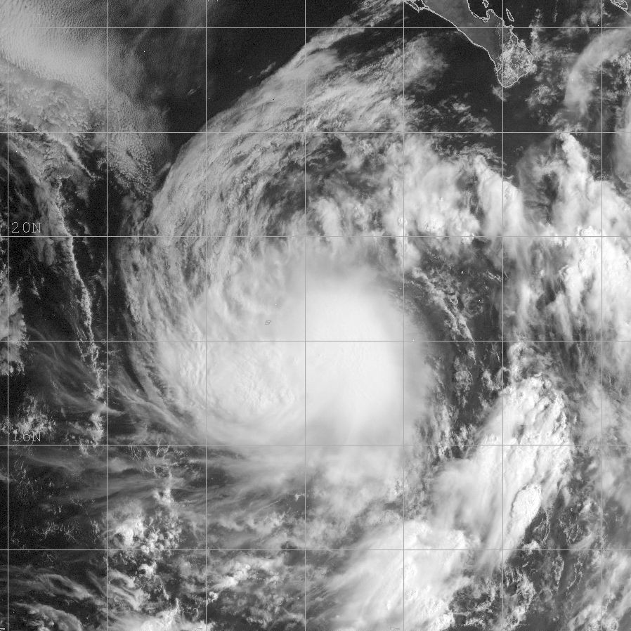
Track=Georgette 2004 track.pngAugust 26
Dissipated=August 30
1-min winds=55
Pressure=995August 24 developed into a tropical depression onAugust 26 while located 600 miles south-southeast of the southern tip of theBaja California Peninsula . Deep convection quickly organized, and the depression intensified into Tropical Storm Georgette shortly after forming. Georgette reached a peak of 65 mph on the 27th, but weakened due to upper level shear. The storm briefly restrengthened on the 28th, but again weakened until degenerating into a remnant low onAugust 30 . The low continued to the west-northwest until dissipating onSeptember 3 to the east ofHawaii . Georgette never affected land. [http://www.nhc.noaa.gov/2004georgette.shtml]Hurricane Howard
Infobox Hurricane Small
Basin=EPac
Track=Howard 2004 track.pngAugust 30
Dissipated=September 5
1-min winds=120
Pressure=943August 30 from atropical wave about 400 miles southwest of the Mexican port ofAcapulco ,Guerrero . It strengthened as it moved to the northwest, becoming a tropical storm on the 31st. OnSeptember 1 , Howard intensified into a hurricane, and with favorable conditions the hurricane rapidly intensified to attain peak winds of 140 mph, a Category 4 hurricane on the Saffir-Simpson Scale. Cool waters caused the hurricane to weaken to a tropical storm onSeptember 4 , and Howard degenerated into a remnant low on the 5th. A ridge of high pressure turned the low to the southwest, a motion it would keep until dissipating on the 10th. [http://www.nhc.noaa.gov/2004howard.shtml]As a Category 4 hurricane, Howard produced 6 to 12 foot waves on the
California coastline. Because it wasLabor Day weekend, 575,000 people went to Orange County beaches, resulting in over 1,000 lifeguard rescues. The hurricane did not cause any casualties or damages.Hurricane Isis
Infobox Hurricane Small
Basin=EPac.jpg)
Track=Isis 2004 track.pngSeptember 8
Dissipated=September 16
1-min winds=65
Pressure=987Hurricane Frances , developed into Tropical Depression Twelve-E onSeptember 8 while located 530 miles south of the Mexican port ofCabo San Lucas ,Baja California Sur . It moved westward and strengthened into Tropical Storm Isis later on the 8th, though vertical shear weakened the storm to a tropical depression on the 10th. Wind shear decreased, and Isis re-attained tropical storm status on the 12th. It remained a minimal tropical storm until the 15th, when Isis rapidly intensified to hurricane strength. Shortly after reaching hurricane status, Isis moved over cooler water temperatures, causing it to quickly weaken to a remnant low onSeptember 16 . The remnant low drifted to the west until dissipating on the 21st. Isis never affected land. [http://www.nhc.noaa.gov/2004isis.shtml]Hurricane Javier
Infobox Hurricane Small
Basin=EPac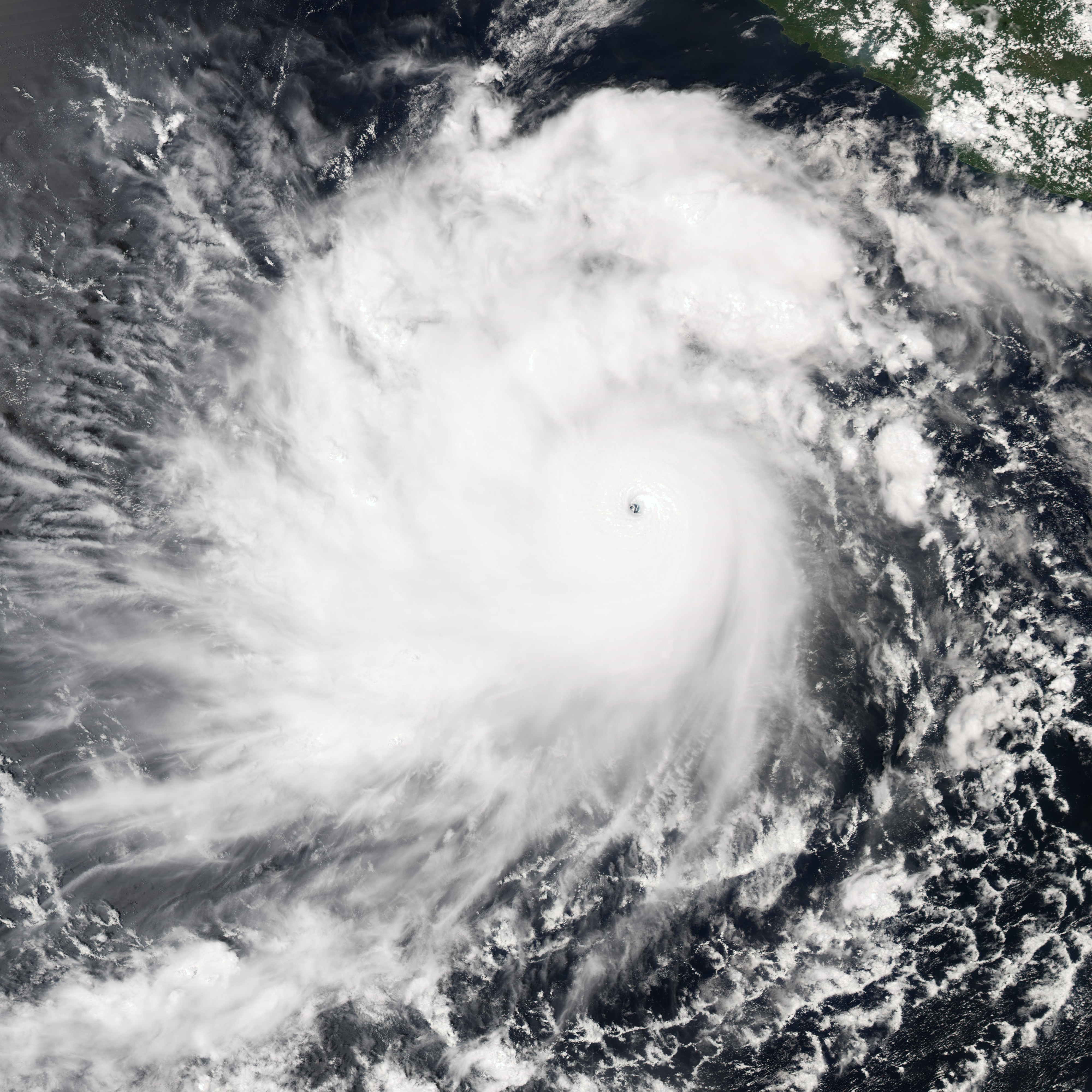
Track=Javier 2004 track.pngSeptember 10
Dissipated=September 19
1-min winds=130
Pressure=930Gulf of Tehuantepec onSeptember 10 . It slowly moved northwest, being designated Tropical Storm Javier on the morning ofSeptember 11 . It was upgraded to a hurricane on the afternoon ofSeptember 12 , and peaked at Category 4 strength on theSaffir-Simpson Hurricane Scale after rapidly strengthening onSeptember 13 . Warnings began to be issued onSeptember 15 forBaja California . While Javier peaked at Category 4, with windspeeds of 150 mph (240 km/h), it weakened dramatically before striking land south ofSan Ignacio, Baja California Sur , as only a tropical depression. Its remnants continued over Baja and inland.Javier produced moderate damage across northwestern Mexico. In the United States, the storm's rainfall brought relief to a severe drought.
Tropical Storm Kay
Infobox Hurricane Small
Basin=EPac.jpg)
Track=Kay 2004 track.pngOctober 4
Dissipated=October 6
1-min winds=40
Pressure=1004October 3 while several hundred miles to the southwest ofMexico . A low-level circulation gradually became more defined, and the system organized into a tropical depression onOctober 4 . The next day, it strengthened into Tropical Storm Kay, though strong wind shear weakened the storm to a depression 12 hours after becoming named. The depression degenerated into a remnant low onOctober 6 , turned to the southwest, and dissipated on the 7th. Kay never affected land. [http://www.nhc.noaa.gov/2004kay.shtml]Tropical Storm Lester
Infobox Hurricane Small
Basin=EPac.jpg)
Track=Lester 2004 track.pngOctober 11
Dissipated=October 13
1-min winds=45
Pressure=1000October 11 while located 90 miles off the coast ofMexico . With a weak anticyclone near the system, the depression slowly strengthened, and intensified into a tropical storm on the 12th. Lester neared the coast of Mexico, and weakened due to land interaction and interaction with a system to its southwest. The storm weakened to a tropical depression onOctober 13 , and dissipated shortly thereafter. [http://www.nhc.noaa.gov/2004lester.shtml]The Mexican government issued a Tropical Storm Warning along the
Guerrero coast fromPunta Maldonado toZihuatanejo . The storm produced 3 to 5 inches of rainfall across Mexico [http://www.nhc.noaa.gov/2004lester.shtml] , causing moderate damage in theAcapulco area. The rainfall caused at least one mudslide and downed 14 trees. [http://www.esmas.com/noticierostelevisa/mexico/398233.html]Tropical Depression Sixteen-E
Infobox Hurricane Small
Basin=EPac.jpg)
Track=16-E 2004 track.pngOctober 25
Dissipated=October 26
1-min winds=30
Pressure=1004Africa onOctober 8 , and moved westward across the unfavorableAtlantic Ocean . The wave entered the easternPacific Ocean onOctober 18 , and developed an area of low pressure the next day while south ofGuatemala . It continued slowly westward, and moved to into an area 520 miles south of Baja California. There, it combined with an area of disturbed weather due to two previous tropical waves. The system organized as deep convection concentrated into curved bands, and a tropical depression formed onOctober 25 while 315 miles south-southeast of theBaja California Peninsula . The depression moved northward around the western periphery of a high pressure system. Due to anticipated strengthening, the Government of Mexico issued a tropical storm warning for portions of the country's western coast. However, vertical shear prevented further strengthening. The depression continued northward, and made landfall inSinaloa , midway betweenGuasave andTopolobampo , onOctober 26 . It quickly dissipated. [ [http://www.nhc.noaa.gov/2004sixteen-e.shtml NHC Tropical Cyclone Report ] ]The depression dropped heavy rainfall in western Mexico, including a peak 24 hour total of 7.1 inches in
Sinaloa . [ [http://smn.cna.gob.mx/ciclones/tempo2004/pacifico/dt16p/dt16p.html CNA.SMN. Depresión Tropical N° 16 del Océano Pacífico. Temporada 2004 ] ] The media reported a possible tornado inCuliacán when the storm was making landfall. The depression's mid-level circulation produced strong thunderstorms and locally heavy rainfall across theU.S. states ofNew Mexico ,Texas , andOklahoma . [ [http://www.nhc.noaa.gov/2004sixteen-e.shtml NHC Tropical Cyclone Report ] ]torm names
The following names were used for named storms that formed in the north Pacific in 2004. Names that were not assigned are marked in gray. No names were retired by the
WMO ; therefore, this list will be used again in the 2010 season.No central Pacific names were used in 2004; the first name used would have been Ioke.
ee also
*
List of Pacific hurricanes
*List of Pacific hurricane seasons
*2004 Atlantic hurricane season
*2004 Pacific typhoon season
*2004 North Indian Ocean cyclone season
*South-West Indian Ocean cyclone seasons: 2003–04, 2004–05
*Australian region cyclone seasons: 2003–04, 2004–05
*South Pacific cyclone seasons: 2003–04, 2004–05References
External links
* [http://www.nhc.noaa.gov/2004epac.shtml National Hurricane Center's 2004 Pacific hurricane season archive]
* [http://www.prh.noaa.gov/hnl/cphc/ Central Pacific Hurricane Center]
Wikimedia Foundation. 2010.