- 2003–04 South-West Indian Ocean cyclone season
-
2003–04 South-West Indian Ocean cyclone season 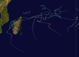
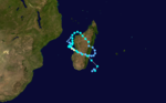
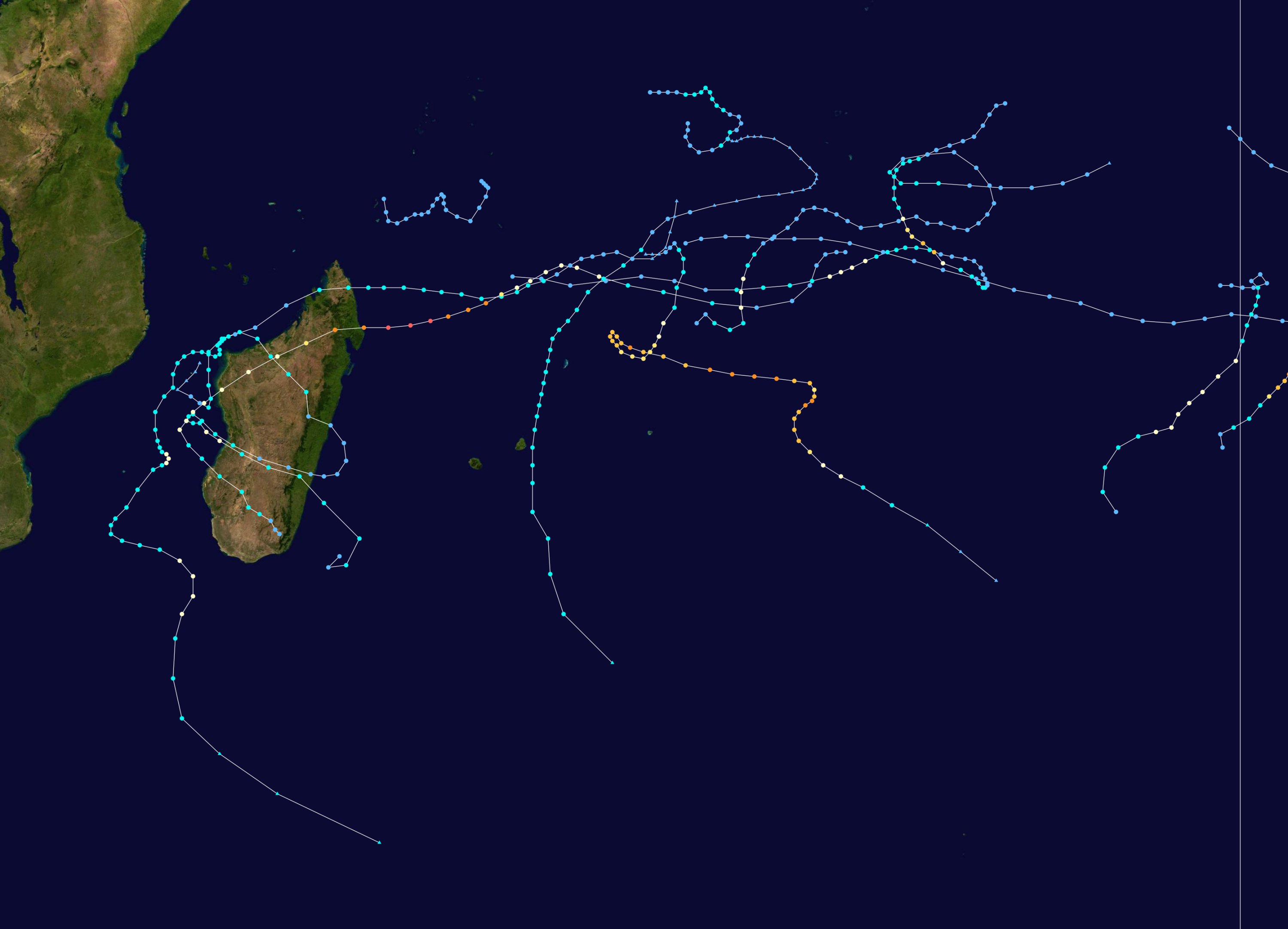
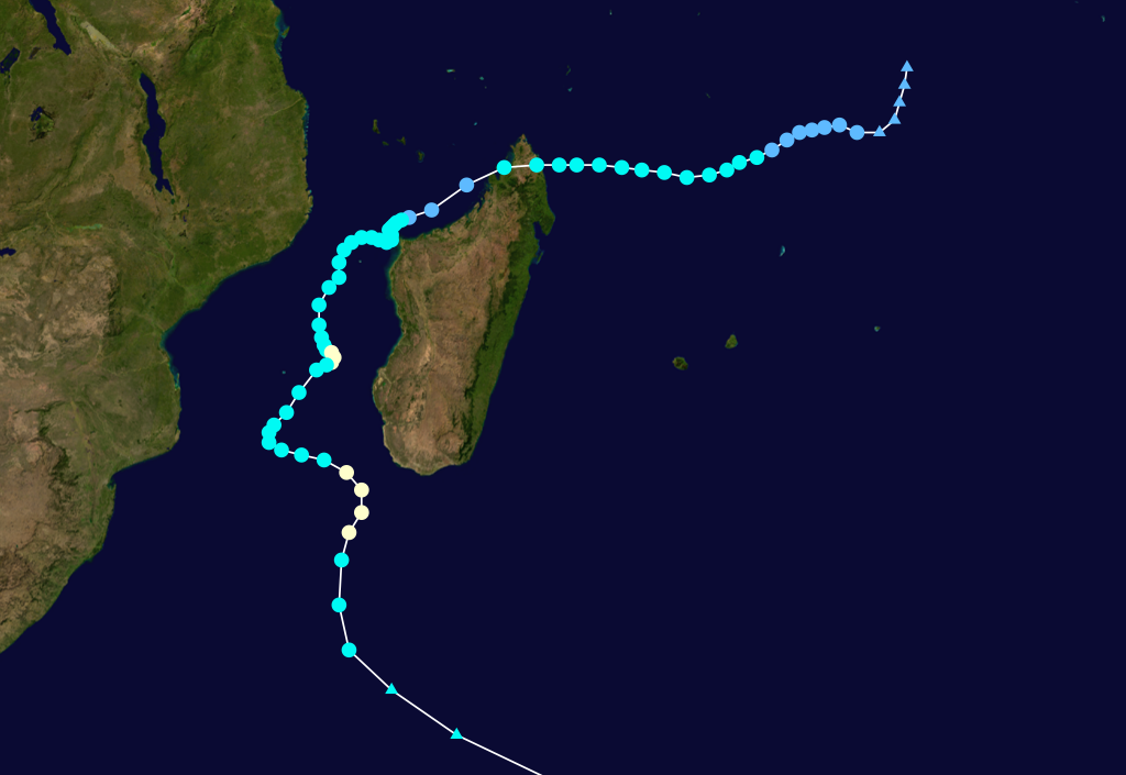
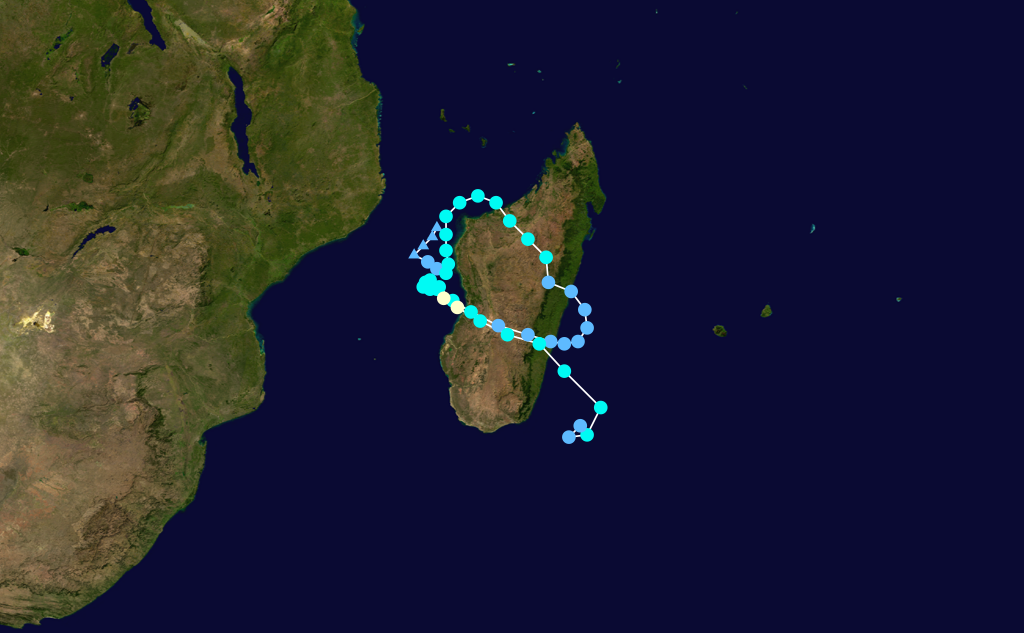
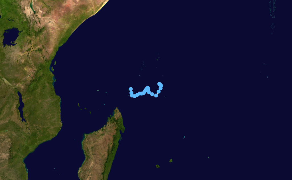
Season summary mapFirst storm formed: September 28, 2003 Last storm dissipated: May 15, 2004 Strongest storm: Gafilo – 895 hPa (mbar), 260 km/h (160 mph) (10-minute sustained) Tropical depressions: 10 Total storms: 10 Tropical cyclones: 5 Total fatalities: 396 Total damage: $250 million (2004 USD) South-West Indian Ocean cyclone seasons
2001–02, 2002–03, 2003–04, 2004–05, 2005–06Related articles: The 2003-04 South-West Indian Ocean cyclone season was an annual event of tropical cyclone formation. It started on November 15, 2003 and ended on April 30, 2004. For Mauritius and the Seychelles, the season continued until May 15. These dates conventionally delimit the period of each year when most tropical cyclones form in the basin, which is west of 90°E and south of the Equator. Tropical cyclones in this basin are monitored by the Regional Specialised Meteorological Centre in Réunion.
Storms
Moderate Tropical Storm Abaimba
Moderate tropical storm (MFR) Tropical storm (SSHS) 
Duration September 28 – October 4 Intensity 80 km/h (50 mph) (10-min), 995 mbar (hPa) This early out-of-season storm formed on September 29 and dissipated on October 4. It formed at a very low latitude but threatened no land. The name was contributed by Tanzania.[1]
Intense Tropical Cyclone Beni
Intense tropical cyclone (MFR) Category 3 tropical cyclone (SSHS) 

Duration November 9 – November 25 Intensity 175 km/h (110 mph) (10-min), 935 mbar (hPa) It first formed on November 9 and intensified to an intense cyclone, winds reaching 100 kts. It weakened below tropical disturbance status on November 15. It intensified again on November 18 and reached a secondary peak of 70 kts, before dissipating on November 22.[2]
Tropical Cyclone Cela
Tropical cyclone (MFR) Category 1 tropical cyclone (SSHS) 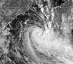

Duration December 4 – December 22 Intensity 120 km/h (75 mph) (10-min), 975 mbar (hPa) Formed on December 5 and became extratropical on December 21. It crossed Madagascar, but caused little if any damage.[3] Throughout Madagascar at least 150 mm (5.9 in) of rain fell, with northern areas receiving totals in excess of 300 mm (12 in). Parts of Mozambique also recorded heavy rainfall in relation to Cela, with between 75 and 150 mm (3.0 and 5.9 in) falling in northern regions of the country.[4]
Severe Tropical Storm Darius
Severe tropical storm (MFR) Tropical storm (SSHS) 

Duration December 27 – January 4 Intensity 100 km/h (65 mph) (10-min), 980 mbar (hPa) Formed on December 29, 2003, and moved poleward while remaining east of La Reunion. The system was absorbed by a larger extratropical system on January 4, 2004. It passed close to Mauritius.[3]
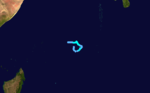
Tropical Disturbance 05R
Existed between January 22 and January 24.[5]
Tropical Cyclone Elita
Tropical cyclone (MFR) Category 1 tropical cyclone (SSHS) 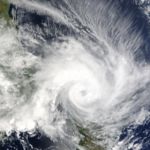
Duration January 24 – February 13 Intensity 120 km/h (75 mph) (10-min), 970 mbar (hPa) Elita developed on January 24 in the Mozambique Channel. It strengthened to become a strong tropical storm before striking northwestern Madagascar on January 28. Elita weakened to tropical depression status while crossing the island, and after turning to the west it restrengthened to a tropical storm before moving ashore on January 31. The cyclone intensified again after reaching waters, and Elita turned to the southeast to make its final landfall on February 3 near peak intensity. By February 5 it underwent extratropical transition, and the remnants of Elita drifted erratically before weakening further on February 12.
Elita dropped heavy rainfall of over 200 mm (8 inches), which damaged or destroyed thousands of houses in Madagascar. Over 50,000 people were left homeless, primarily in Mahajanga and Toliara provinces. Flooding from the storm damaged or destroyed more than 450 km² (170 sq mi) of agricultural land, including the staple foods of much of the population. Across the island, the cyclone caused at least 33 deaths, with its impact further compounded by Cyclone Gafilo about two months later. Elsewhere, the cyclone brought rainfall and damage to Mozambique and Malawi, while its outer circulation produced rough seas and strong winds in Seychelles, Mauritius, and Réunion.[6][7]
Intense Tropical Cyclone Frank
Intense tropical cyclone (MFR) Category 4 tropical cyclone (SSHS) 

Duration January 26 – February 9 Intensity 185 km/h (115 mph) (10-min), 930 mbar (hPa) On 25 January three areas of convection were being monitored in the south Indian Ocean. This system formed from the farthest eastward disturbance, about 700 nm off the northeast coast of Madagascar. At 1200 UTC on the 27th, bulletins were started on Tropical Disturbance 07 with the 10-min avg MSW estimated at 25 kts, while located approximately 520 nm west-southwest of Diego Garcia and drifting slowly to the south-southeastward. At 0600 UTC on 28 January it strengthened to a tropical storm. Steered by a low to mid-level ridge to the south and east, Tropical Storm Frank began to trot towards the south at 8 kts. It attained hurricane strength by 1800 UTC as Frank began the first leg of a cyclonic loop that it would transcribe over the following two to three days. Further strengthening occurred with Frank becoming a 90-kt storm, but there was no further intensification during the 29th as the system slowly moved southwestward, curving onto a west-northwesterly track by the end of the day. The next day, strengthening had resumed and winds increased to a 115 kts, an intensity that was maintained through 31 January and the 1st day of February. Enhanced infrared satellite imagery at 31/1800 UTC showed a distinct 15-nm irregular eye.
Frank slowed and turned toward the south-southeast. A second intensification period began, culminating in a second peak of 115 kts (1-min avg) at 04/0600 UTC as it completed a hairpin turn, now moving slowly to the southwest. A gradual weakening set in, which would continue as the system tracked towards cooler SSTs and heavy shearing conditions. At 0600 UTC on 6 February Frank was barely at hurricane/cyclone strength. Frank began to accelerate toward the east-southeast as winds fell to tropical storm intensity. Deep convection surrounding the LLCC had all but dissipated and the remnant extratropical system joined up with a weak baroclinic boundary by 1200 UTC on 7 February.[8]
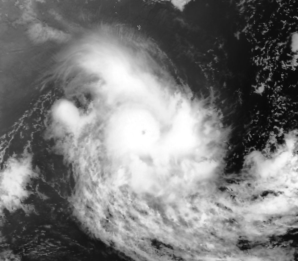
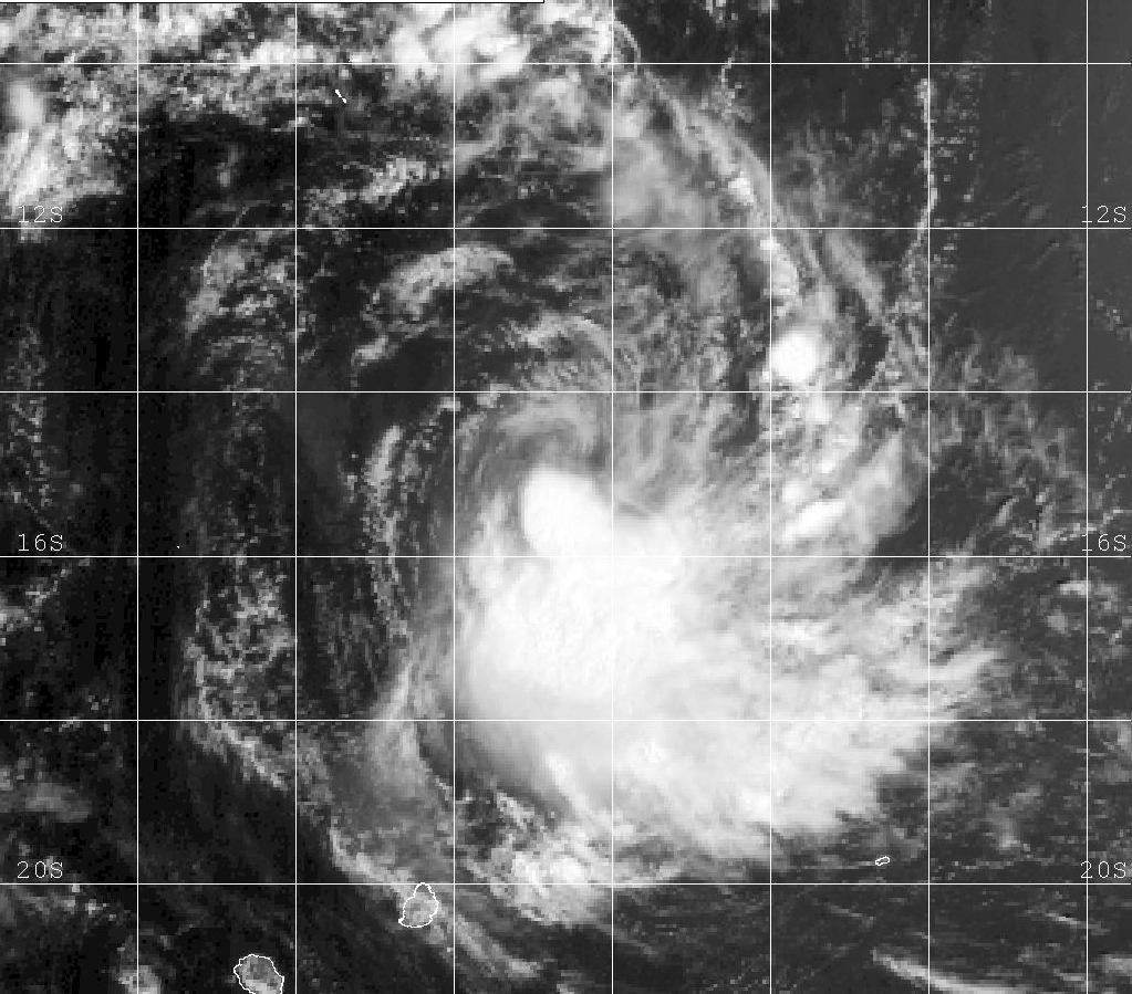
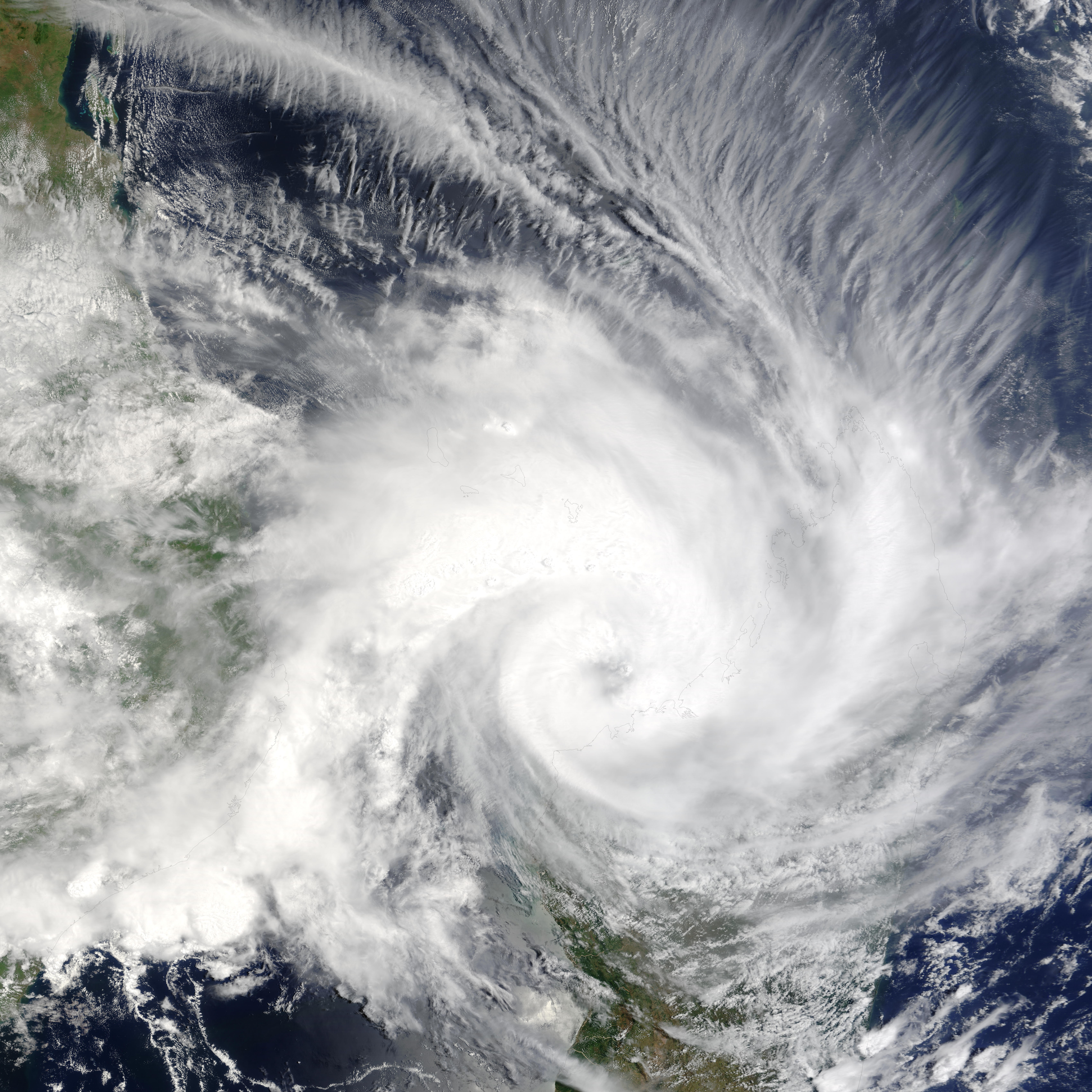
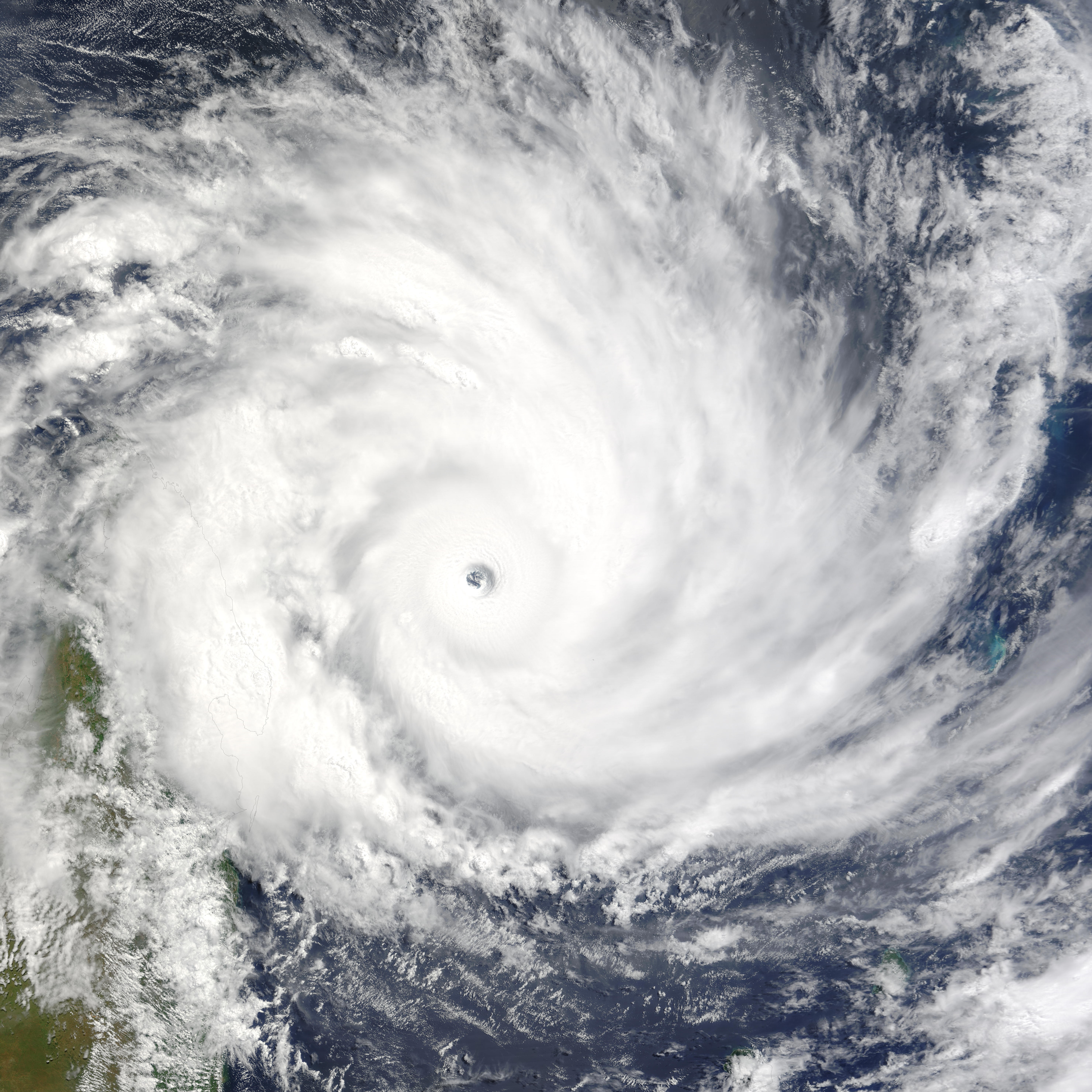
Very Intense Tropical Cyclone Gafilo
Very intense tropical cyclone (MFR) Category 5 tropical cyclone (SSHS) 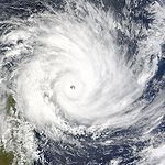

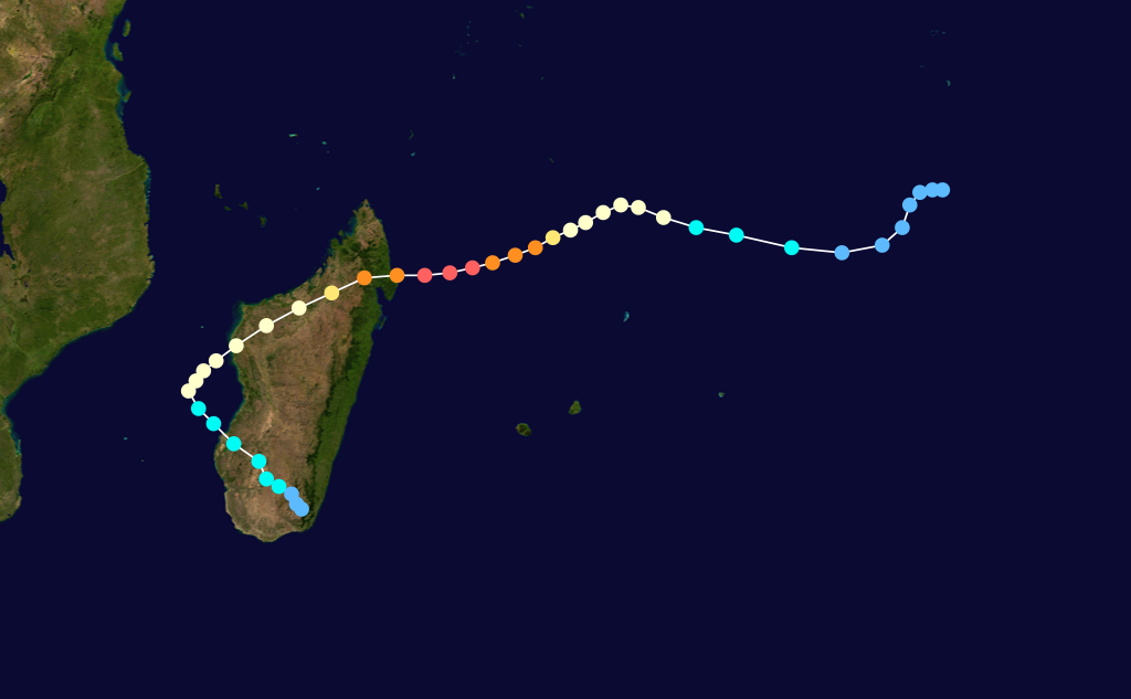
Duration March 1 – March 18 Intensity 230 km/h (145 mph) (10-min), 895 mbar (hPa) Cyclone Gafilo began as a tropical disturbance on the February 29, 2004 in the central Indian Ocean, south of Diego Garcia. First advisories for Tropical Disturbance 09 were issued on March 2 by the Tropical Cyclone Warning Center on La Réunion and Joint Typhoon Warning Center. At this point, it was moving to west-northwest at fairly rapid pace. Development became quicker, and next day it was named Tropical Storm Gafilo. Its forward motion also slowed, and it began to turn southwards. On March 4, Gafilo was upgraded to tropical cyclone. Next day, March 5, Gafilo began a cycle of rapid deepening with winds increasing to 145 mph (230 km/h) making it a Category 4 cyclone. It was now moving west-southwest heading straight for Madagascar. The next day, March 6, 2004 saw it reach its estimated peak intensity of 895 mbar (hPa) and sustained windspeed of 160 mph (260 km/h). After midnight, Gafilo struck the northeast coast of Madagascar near to the town of Antalaha as a Category 5 cyclone, the highest possible rating.
After landfall, Gafilo continued its track to southwest, crossing the island and emerging at the Mozambique Channel as a tropical storm. Over water it briefly re-intensified back to hurricane strength, then turned southeast and made a second landfall at southwest Madagascar as a strong tropical storm. Gafilo dissipated on March 11 over southern Madagascar, with remnant low emerging over the ocean, but conditions were unfavourable for regeneration.
Severe Tropical Storm Nicky-Helma
Severe tropical storm (MFR) Category 1 tropical cyclone (SSHS) 
Duration March 7 – March 16 Intensity 110 km/h (70 mph) (10-min), 975 mbar (hPa) Originally called Nicky by Perth's TCWC, it entered the region on March 10. It dissipated on March 13.[9]
Tropical Disturbance 11R
Tropical disturbance (MFR) Tropical depression (SSHS) 

Duration March 15 – March 28 Intensity 45 km/h (30 mph) (10-min), 1002 mbar (hPa) A continuation of Tropical Cyclone Evan from the Australian region. Persisted until March 28.[9]
Intense Tropical Cyclone Oscar-Itseng
Intense tropical cyclone (MFR) Category 4 tropical cyclone (SSHS) 

Duration March 23 – March 29 Intensity 165 km/h (105 mph) (10-min), 940 mbar (hPa) Originally called Oscar by Perth's TCWC, it entered the region on March 27, but dissipated by the next day.[9]
Tropical Disturbance 13R
Existed on March 31.[9]
Tropical Disturbance 14R
Existed on April 26.[10]
Severe Tropical Storm Juba
Severe tropical storm (MFR) Category 1 tropical cyclone (SSHS) 

Duration May 5 – May 17 Intensity 110 km/h (70 mph) (10-min), 975 mbar (hPa) Formed on May 5 and dissipated on May 15. Name was contributed by Swaziland.[11]
Tropical Disturbance 16R
Existed between May 19 and May 24.[11]
Storm names
A tropical disturbance is named when it reaches moderate tropical storm strength. If a tropical disturbance reaches moderate tropical storm status west of 55°E, then the Sub-regional Tropical Cyclone Advisory Centre in Madagascar assigns the appropriate name to the storm. If a tropical disturbance reaches moderate tropical storm status between 55°E and 90°E, then the Sub-regional Tropical Cyclone Advisory Centre in Mauritius assigns the appropriate name to the storm. A new annual list is used every year so no names are retired.[12]
- Juba
- Katiba (unused)
- Lenny (unused)
- Moingaza (unused)
- Naledi (unused)
- Olie (unused)
- Patou (unused)
- Quilmane (unused)
- Ralph (unused)
- Sefate (unused)
- Tom (unused)
- Umuri (unused)
- Valetta (unused)
- Wells (unused)
- Xavier (unused)
- Yvonne (unused)
- Zuri (unused)
See also
- Tropical cyclone scales
- List of Southern Hemisphere tropical cyclone seasons
- Atlantic hurricane seasons: 2003, 2004
- Pacific hurricane seasons: 2003, 2004
- Pacific typhoon seasons: 2003, 2004
- North Indian Ocean cyclone seasons: 2003, 2004
References
- ^ Monthly Global Tropical Cyclone Summary September 2003
- ^ Monthly Global Tropical Cyclone Summary November 2003
- ^ a b Monthly Global Tropical Cyclone Summary December 2003
- ^ United States Agency for International Development (December 23, 2003). "Africa: Drought and floods hazards assessment 23 Dec 2003". ReliefWeb. http://www.reliefweb.int/rw/rwb.nsf/db900sid/OCHA-64BGYN?OpenDocument&query=Cyclone%20Cela. Retrieved July 6, 2009.
- ^ Monthly Global Tropical Cyclone Summary January 2004
- ^ Gary Padgett (2004). "January 2004 Worldwide Tropical Cyclone Summary". http://www.australiasevereweather.com/cyclones/2004/summ0401.htm. Retrieved 2008-01-18.
- ^ RA I Tropical Cyclone Committee for the Southwest Indian Ocean (2005). "Seventeenth Session for the Tropical Cyclone Committee". World Meteorological Organization. http://www.wmo.ch/pages/prog/www/TCP_vO/RA%20I%20TCC-17%20En.pdf. Retrieved 2008-01-18.
- ^ TROPICAL-SUMM: SUMMARY: January Tropical Cyclone Summary
- ^ a b c d Monthly Global Tropical Cyclone Summary March 2004
- ^ Monthly Global Tropical Cyclone Summary April 2004
- ^ a b Monthly Global Tropical Cyclone Summary May 2004
- ^ "Tropical Cyclone Operational Plan for the South Pacific and South-East Indian Ocean". World Meteorological Organization. 2003. http://ftp.wmo.int/pages/prog/www/TCP_vO/OperationPlans/TCP12-English2003.pdf. Retrieved 2008-08-15.
External links
- Joint Typhoon Warning Center (JTWC).
- Météo France (RSMC La Réunion).
- World Meteorological Organization
2000–09 South-West Indian Ocean cyclone seasons Categories:


Wikimedia Foundation. 2010.