- 2001–02 South-West Indian Ocean cyclone season
-
2001–02 South-West Indian Ocean cyclone season 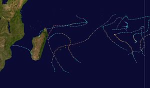
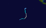
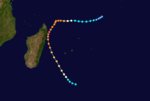
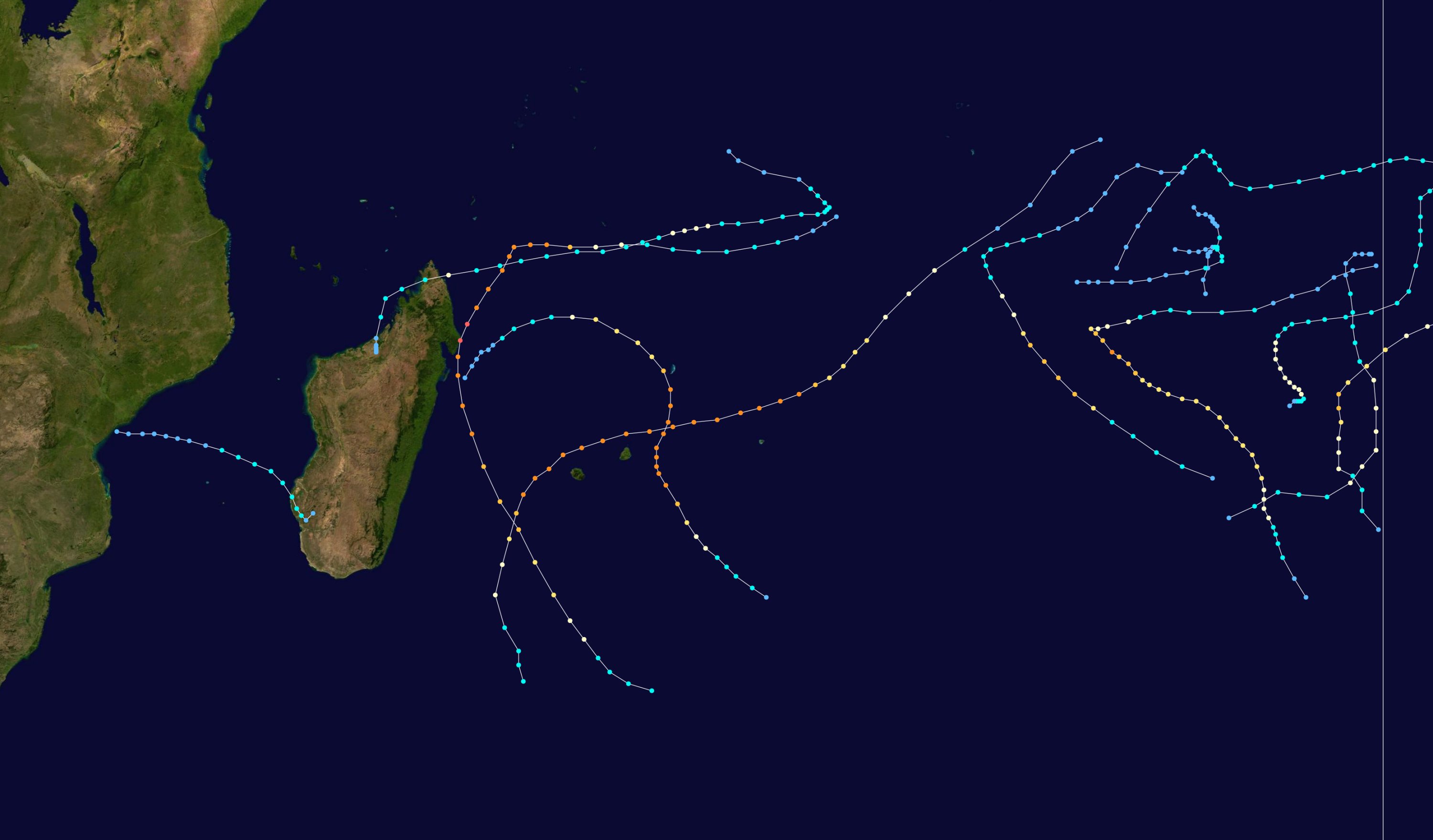
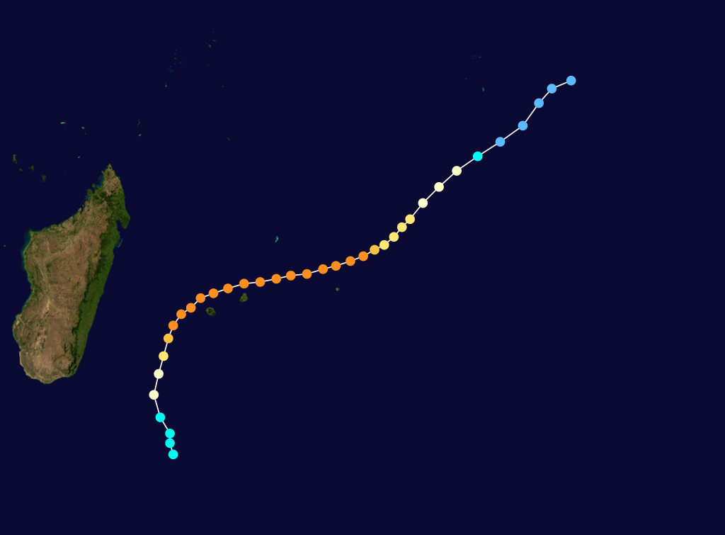
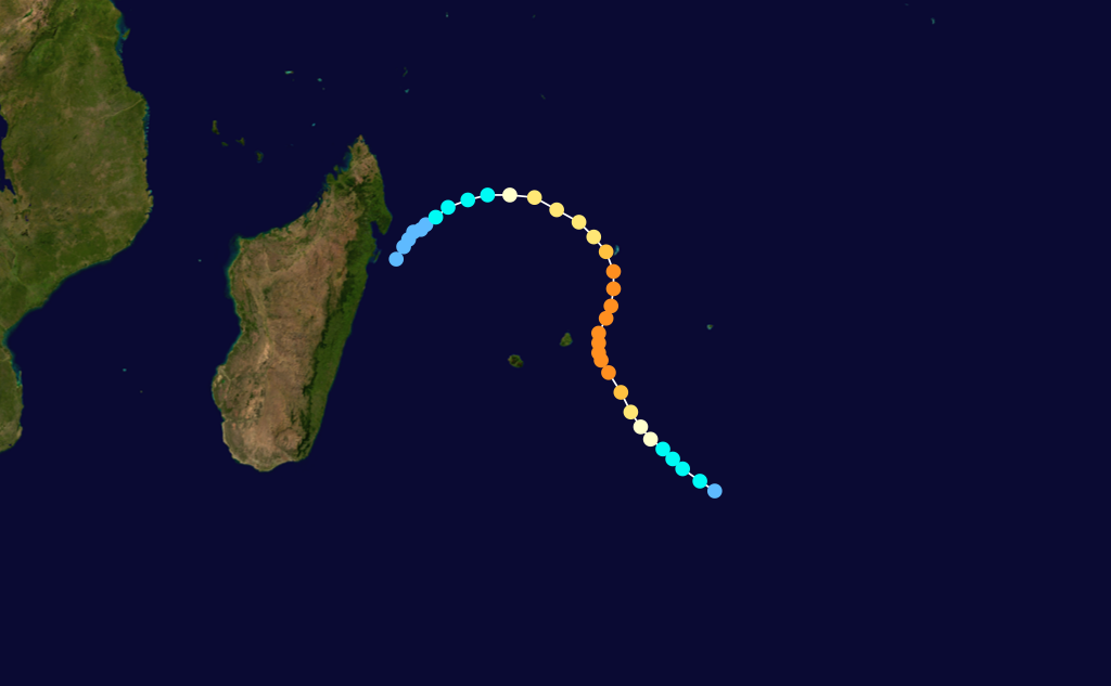
Season summary mapFirst storm formed: October 5, 2001 Last storm dissipated: June 15, 2002 Strongest storm: Hary – 905 hPa (mbar), 220 km/h (140 mph) (10-minute sustained) Total disturbances: 15 Total storms: 11 Tropical cyclones: 9 Intense cyclones: 5 Total fatalities: Unknown Total damage: $250 million (2002 USD) South-West Indian Ocean cyclone seasons
1999–00, 2000–01, 2001–02, 2002–03, 2003–04Related articles: The 2001-02 South-West Indian Ocean cyclone season was an annual event of tropical cyclone formation. It started on November 15, 2001 and ended on April 30, 2002. For Mauritius and the Seychelles, the season continued until May 15. These dates conventionally delimit the period of each year when most tropical cyclones form in the basin, which is west of 90°E and south of the Equator. Tropical cyclones in this basin are monitored by the Regional Specialised Meteorological Centre in Réunion.
Storms
Tropical Depression 01
Tropical depression (MFR) Tropical storm (SSHS) 

Duration October 5 – October 7 Intensity 55 km/h (35 mph) (10-min), 998 mbar (hPa) This system was also known as Tropical Cyclone 01S by the Joint Typhoon Warning Center.
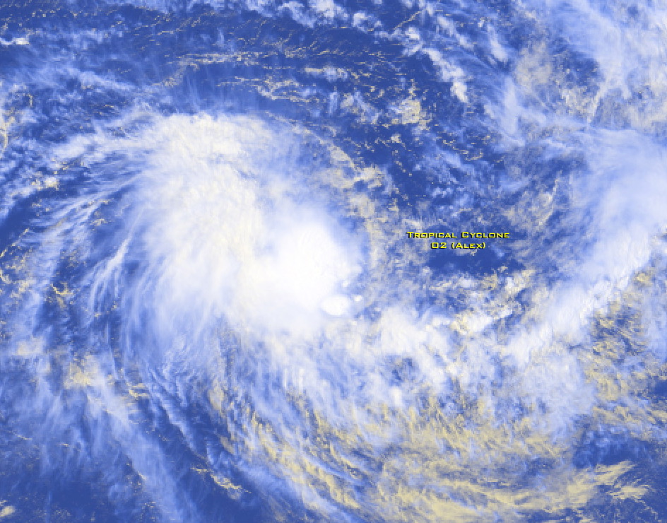
Severe Tropical Storm Alex-Andre
Severe tropical storm (MFR) Tropical storm (SSHS) 

Duration October 27 – October 31 Intensity 100 km/h (65 mph) (10-min), 980 mbar (hPa) Tropical Depression 03
Tropical depression (MFR) Tropical storm (SSHS) 
Duration November 17 – November 21 Intensity 55 km/h (35 mph) (10-min), 998 mbar (hPa) This system was also known as Tropical Cyclone 04S by the Joint Typhoon Warning Center.
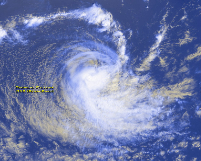
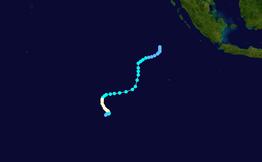
Tropical Cyclone Bessi-Bako
Tropical cyclone (MFR) Category 1 tropical cyclone (SSHS) 

Duration November 28 – December 6 Intensity 125 km/h (80 mph) (10-min), 966 mbar (hPa) Severe Tropical Storm Cyprien
Severe tropical storm (MFR) Tropical storm (SSHS) 

Duration December 30 – January 3 Intensity 100 km/h (65 mph) (10-min), 980 mbar (hPa) Main article: Tropical Storm CyprienTropical Storm Cyprien formed near the Mozambique coast on December 30. It moved east peaking with 95 km/h (60 mph) winds before dissipating over southern Madagascar on January 3. Cyprien caused moderate damage in Morombe.
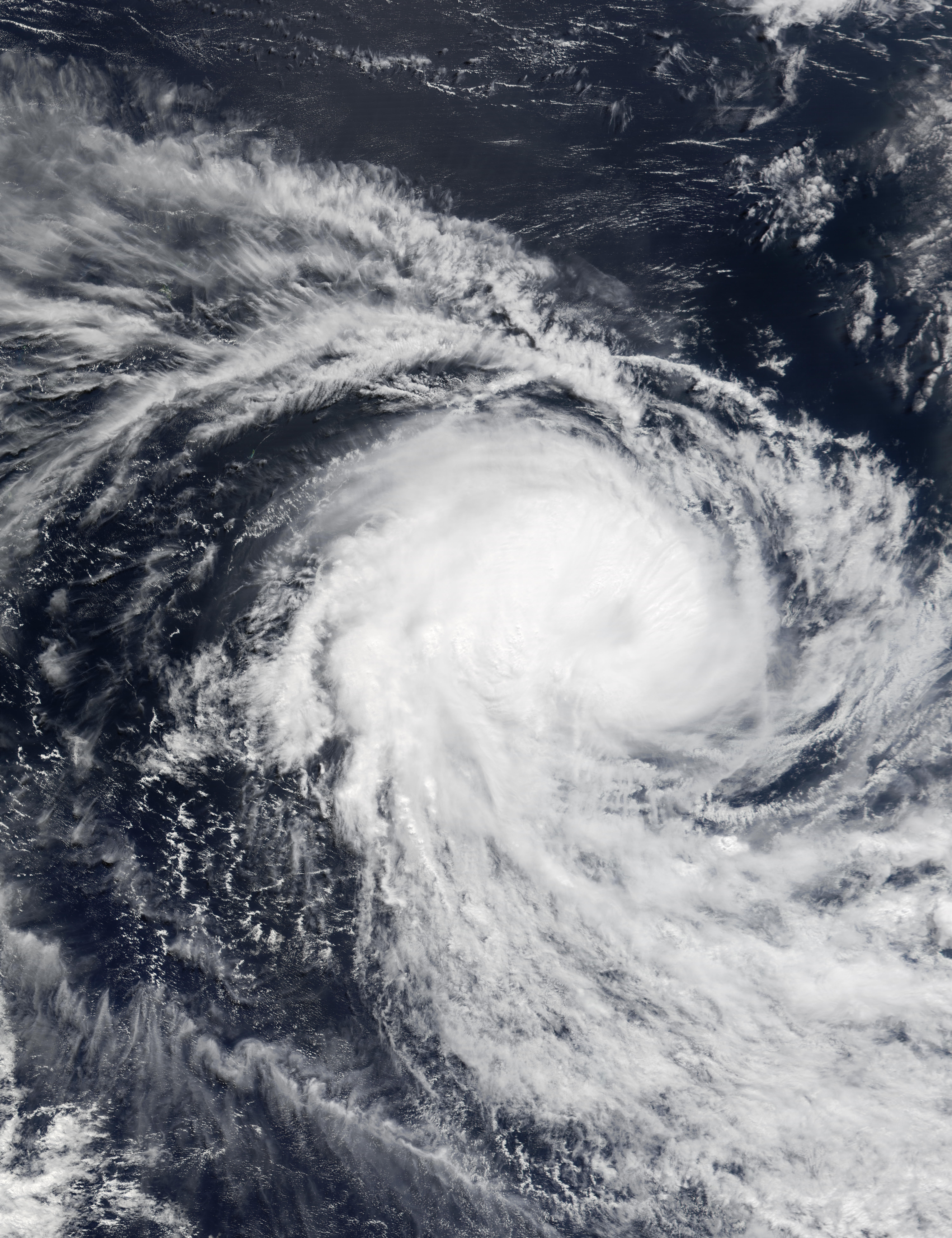
Intense Tropical Cyclone Dina
Intense tropical cyclone (MFR) Category 4 tropical cyclone (SSHS) 

Duration January 17 – January 26 Intensity 215 km/h (130 mph) (10-min), 910 mbar (hPa) Cyclone Dina formed to the south of Diego Garcia on January 16 and moved west. It peaked with 215 km/h (130 mph) winds near Rodrigues before dissipating to the south of Réunion on January 25.[1] Dina caused approximately $250 million of damage on Mauritius and Réunion.
Tropical Cyclone Eddy
Tropical cyclone (MFR) Category 1 tropical cyclone (SSHS) 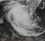
Duration January 22 – January 28 Intensity 130 km/h (80 mph) (10-min), 965 mbar (hPa) Cyclone Eddy formed to the west of the Cocos Islands on January 23. The storm peaked with 140 km/h (85 mph) winds before dissipating on January 28.
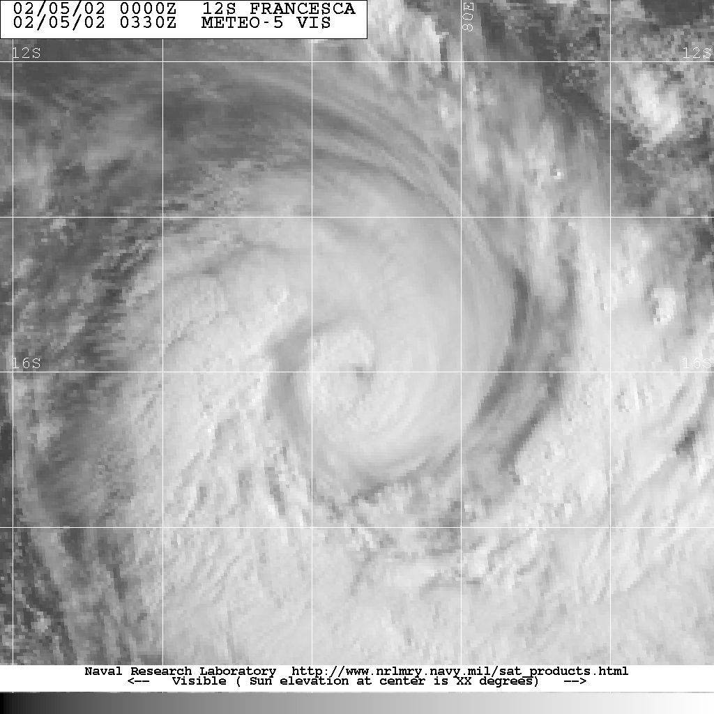
Intense Tropical Cyclone Francesca
Intense tropical cyclone (MFR) Category 4 tropical cyclone (SSHS) 

Duration January 30 – February 12 Intensity 185 km/h (115 mph) (10-min), 925 mbar (hPa) Cyclone Francesca formed in the central Indian Ocean on January 31. It peaked with 215 km/h (130 mph) winds before it dissipatd on February 11.
Tropical Disturbance 09
Tropical disturbance (MFR) Duration February 6 – February 12 Intensity 45 km/h (30 mph) (10-min), 1005 mbar (hPa) This was a weak system in the Mozambique Channel that La Reunion issued two bulletins on.
Intense Tropical Cyclone Guillaume
Intense tropical cyclone (MFR) Category 4 tropical cyclone (SSHS) 

Duration February 15 – February 22 Intensity 195 km/h (120 mph) (10-min), 920 mbar (hPa) Cyclone Guillaume formed off the east coast of Madagascar on February 14 and peaked with winds of 220 km/h (140 mph). It moved east and dissipated on February 22.
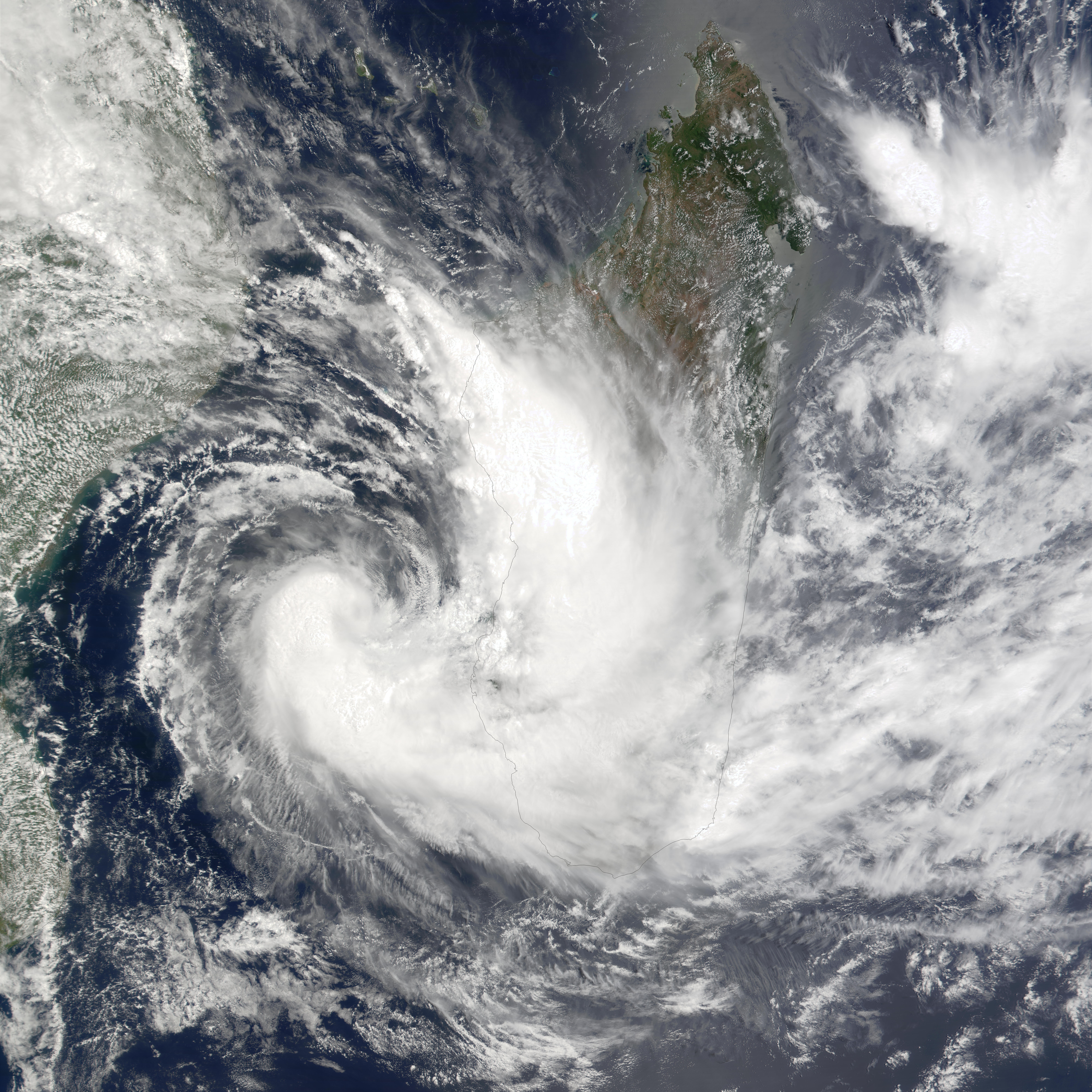
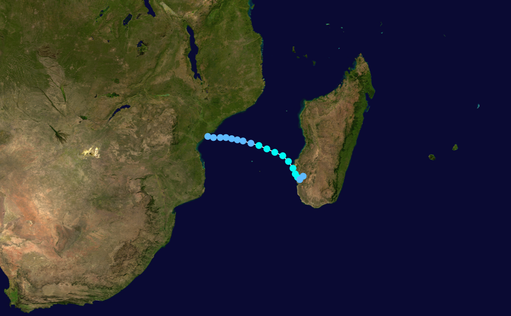
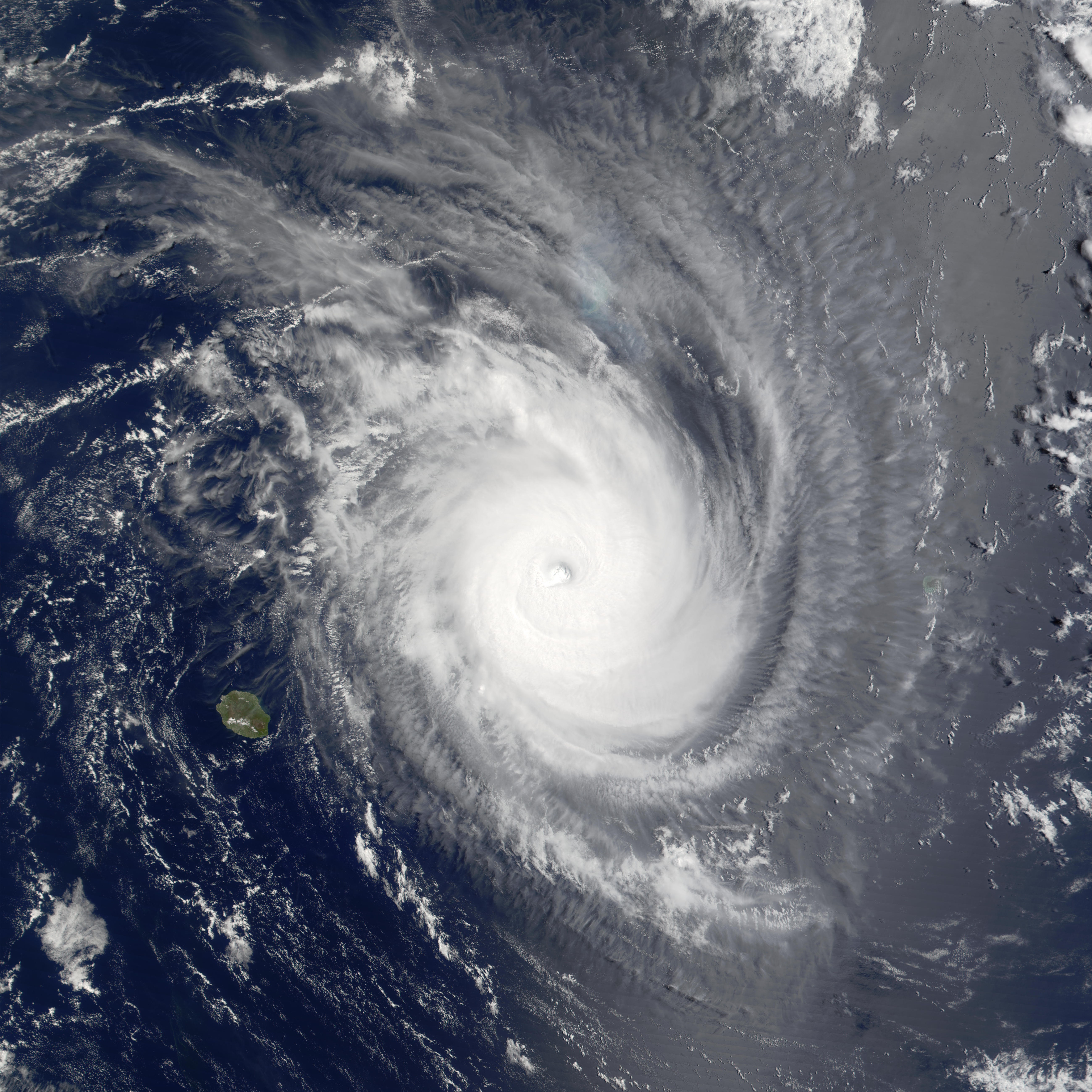
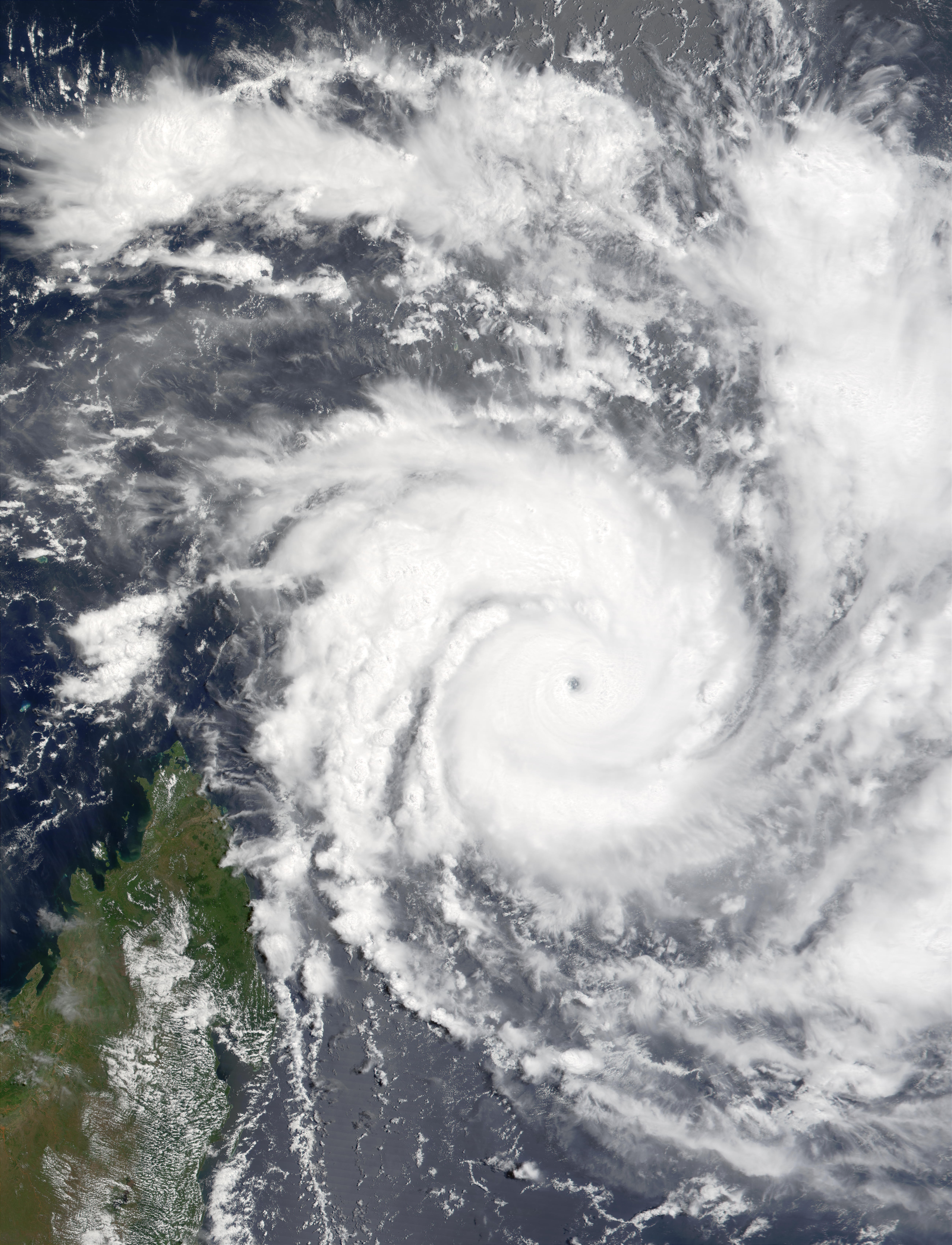
Very Intense Tropical Cyclone Hary
Very intense tropical cyclone (MFR) Category 5 tropical cyclone (SSHS) 
Duration March 5 – March 15 Intensity 220 km/h (140 mph) (10-min), 905 mbar (hPa) Cyclone Harry developed on March 5 to the southwest of Diego Garcia. Hary peaked with 260 km/h (160 mph) winds, the strongest of the season, as it brushed the northeastern coast of Madagascar. Hary then turned southeast and dissipated on March 14. There were only minor effects on land.[citation needed] One person was killed in relation to the storm after being electrocuted by a downed power line. At least four bridges were also destroyed by the storm.[2]
Intense Tropical Cyclone Ikala
Intense tropical cyclone (MFR) Category 3 tropical cyclone (SSHS) 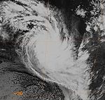

Duration March 22 – March 31 Intensity 165 km/h (105 mph) (10-min), 940 mbar (hPa) Cyclone Ikala formed east of Diego Garcia on March 22 and headed west. It turned to the southeast before peaking with 205 km/h (125 mph) winds and dissipated on March 29.
Tropical Cyclone Dianne-Jery
Tropical cyclone (MFR) Category 3 tropical cyclone (SSHS) 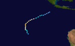
Duration April 8 – April 12 Intensity 150 km/h (90 mph) (10-min), 954 mbar (hPa) Tropical Cyclone Kesiny
Tropical cyclone (MFR) Category 1 tropical cyclone (SSHS) 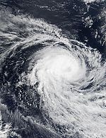

Duration May 2 – May 11 Intensity 130 km/h (80 mph) (10-min), 965 mbar (hPa) At least nine people were killed by Kesiny, mainly due flooding. Numerous bridges were destroyed, isolating several areas for over a week.[3]
Tropical Disturbance 15
Tropical disturbance (MFR) Duration June 13 – June 15 Intensity 45 km/h (30 mph) (10-min), 1000 mbar (hPa) This system was a weak disturbance which elicited the issuance of several bulletins from the La Reunion TCWC.
Storm names
A tropical disturbance is named when it reaches moderate tropical storm strength. If a tropical disturbance reaches moderate tropical storm status west of 55°E, then the Sub-regional Tropical Cyclone Advisory Centre in Madagascar assigns the appropriate name to the storm. If a tropical disturbance reaches moderate tropical storm status between 55°E and 90°E, then the Sub-regional Tropical Cyclone Advisory Centre in Mauritius assigns the appropriate name to the storm. A new annual list is used every year so no names are retired.[4]
- Andre
- Bako
- Cyprien
- Dina
- Eddy
- Francesca
- Guillaume
- Hary
- Ikala
- Jery
- Kesiny
- Lalita (unused)
- Mirana (unused)
- Naly (unused)
- Orelie (unused)
- Parina (unused)
- Quincy (unused)
- Roger (unused)
- Solo (unused)
- Teddy (unused)
- Usha (unused)
- Vero (unused)
- Wendy (unused)
- Xora (unused)
- Yolande (unused)
- Zaza (unused)
See also
- List of Southern Hemisphere tropical cyclone seasons
- Atlantic hurricane seasons: 2001, 2002
- Pacific hurricane seasons: 2001, 2002
- Pacific typhoon seasons: 2001, 2002
- North Indian Ocean cyclone seasons: 2001, 2002
References
- ^ "MFR Data for Dina" (in French). Météo-France. Archived from the original on 2009-05-14. http://www.meteo.fr/temps/domtom/La_Reunion/trajGP20012002/data/06_table.html. Retrieved 2009-04-07.
- ^ United Nations Office for the Coordination of Humanitarian Affairs (March 12, 2002). "Madagascar - Tropical Cyclone Hary OCHA Situation Report No. 1". ReliefWeb. http://www.reliefweb.int/rw/rwb.nsf/db900sid/OCHA-64C4FM?OpenDocument. Retrieved June 6, 2009.
- ^ United Nations Office for the Coordination of Humanitarian Affairs (May 21, 2002). "Madagascar - Tropical Cyclone Kesiny OCHA Situation Report No. 2". ReliefWeb. http://www.reliefweb.int/rw/rwb.nsf/db900sid/ACOS-64D3B4?OpenDocument&query=Cyclone%20Kesiny. Retrieved June 6, 2009.
- ^ "Tropical Cyclone Operational Plan for the South Pacific and South-East Indian Ocean". World Meteorological Organization. 2003. http://ftp.wmo.int/pages/prog/www/TCP_vO/OperationPlans/TCP12-English2003.pdf. Retrieved 2008-08-15.
External links
- Joint Typhoon Warning Center (JTWC).
- Météo France (RSMC La Réunion).
- World Meteorological Organization
- 2001-02 Cyclone Season from Météo France
2000–09 South-West Indian Ocean cyclone seasons


Wikimedia Foundation. 2010.