- 2002–03 South-West Indian Ocean cyclone season
-
2002–03 South-West Indian Ocean cyclone season 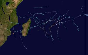
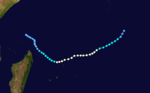
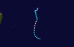
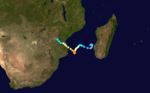
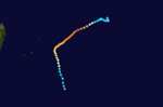
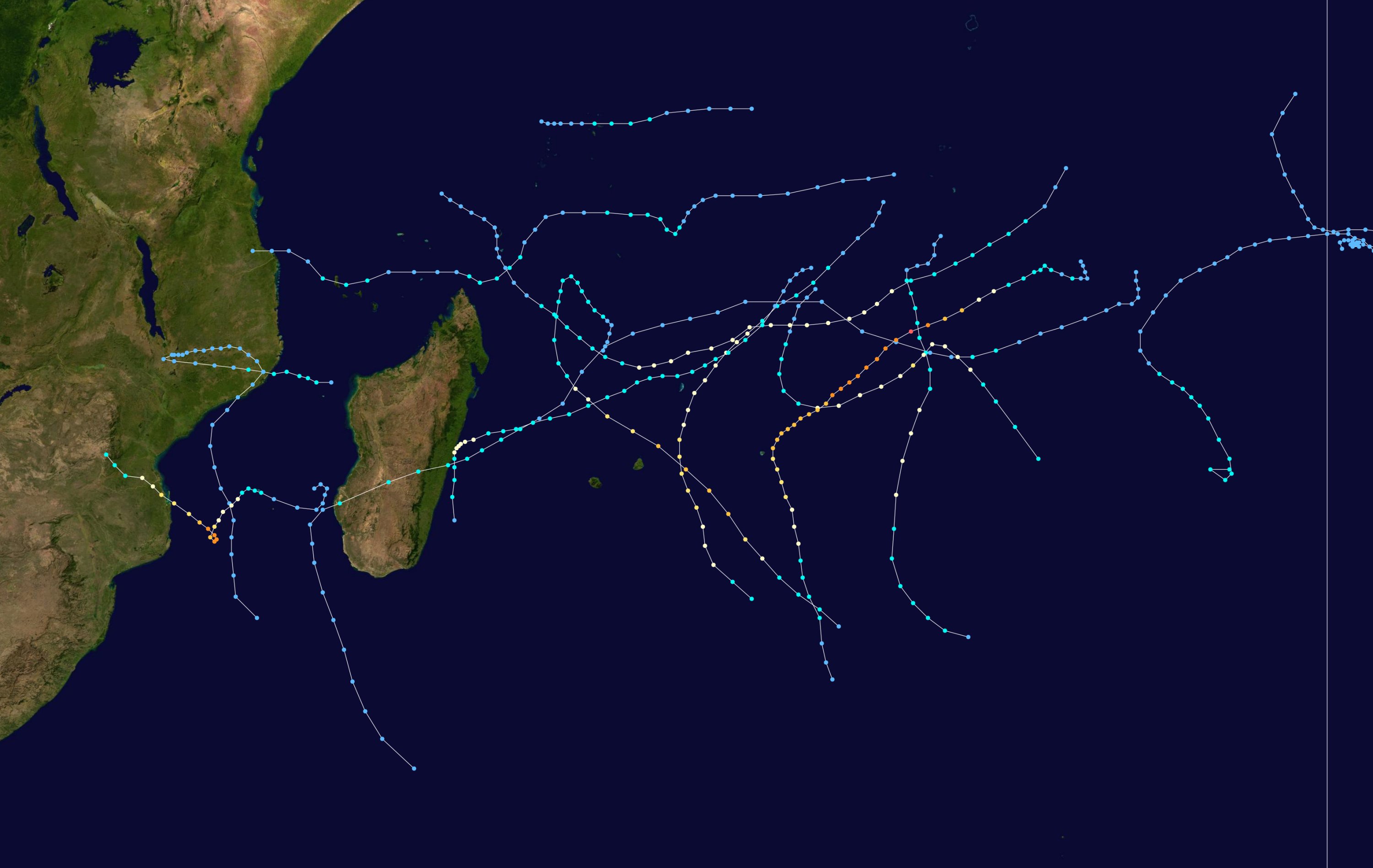
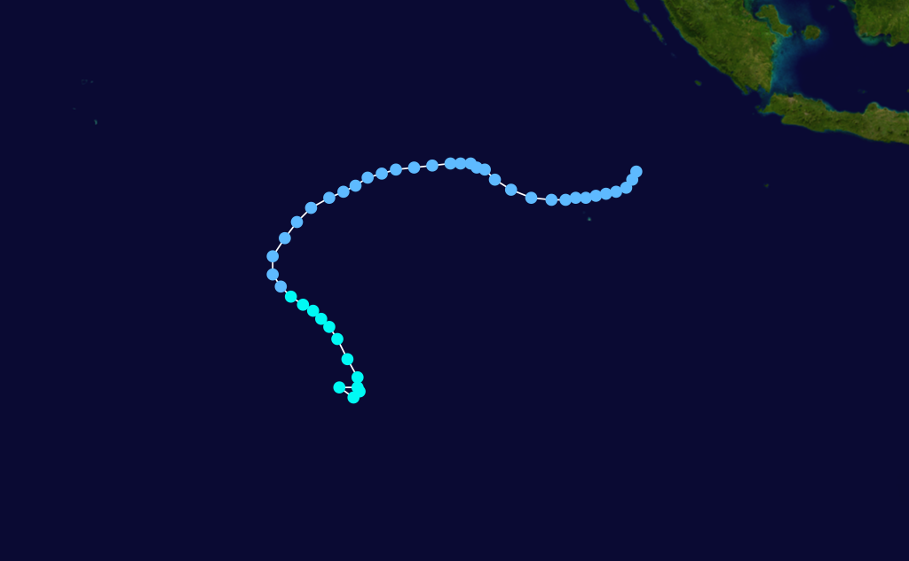
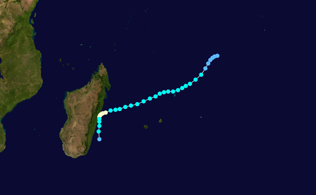
Season summary mapFirst storm formed: September 5, 2002 Last storm dissipated: May 10, 2003 Strongest storm: Kalunde – 905 hPa (mbar), 215 km/h (130 mph) (10-minute sustained) Total disturbances: 16 Total storms: 11 Tropical cyclones: 7 Intense cyclones: 3 Total fatalities: 143-162 Total damage: Unknown South-West Indian Ocean cyclone seasons
2000–01, 2001–02, 2002–03, 2003–04, 2004–05Related articles: The 2002-03 South-West Indian Ocean cyclone season was an annual event of tropical cyclone formation. It started on November 15, 2002 and ended on April 30, 2003. For Mauritius and the Seychelles, the season continued until May 15. These dates conventionally delimit the period of each year when most tropical cyclones form in the basin, which is west of 90°E and south of the Equator. Tropical cyclones in this basin are monitored by the Regional Specialised Meteorological Centre in Réunion.
Storms
Tropical Depression 01
Tropical depression (MFR) Tropical storm (SSHS) 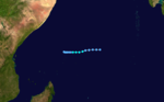
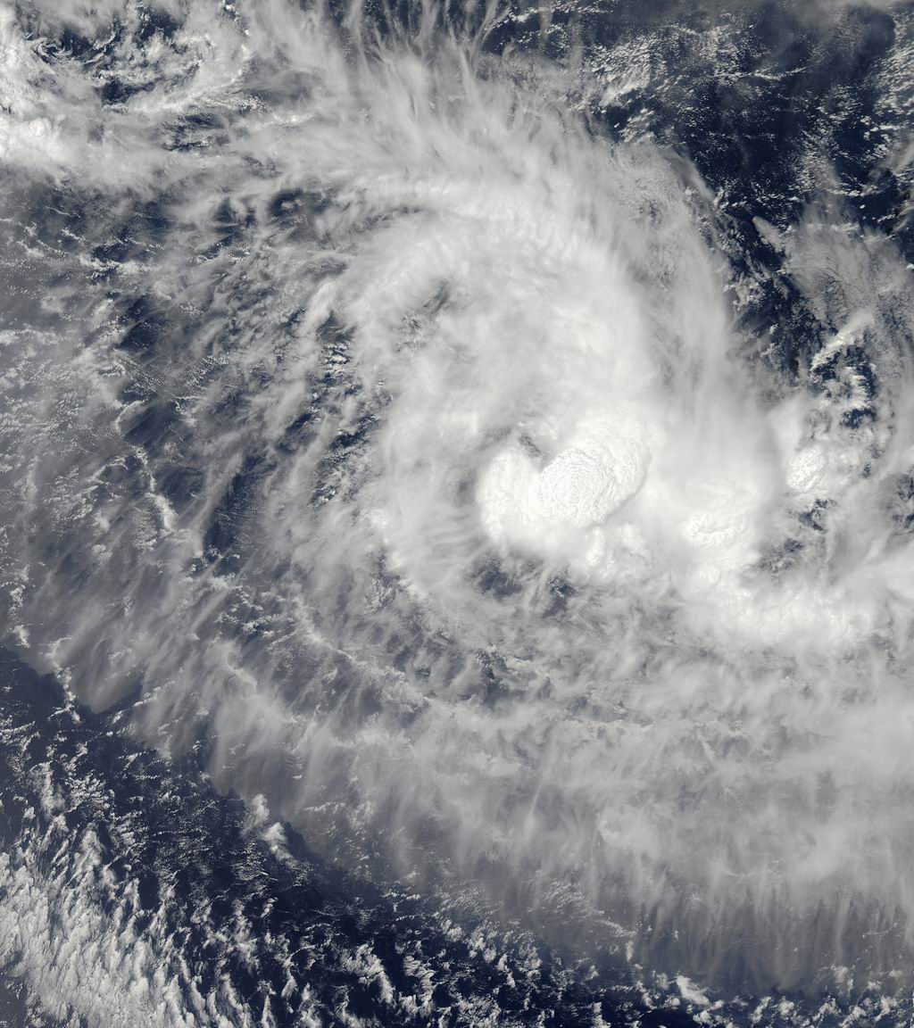
Duration September 5 – September 7 Intensity 55 km/h (35 mph) (10-min), 1000 mbar (hPa) The first report of a tropical disturbance was released on August 27 in a Tropical Weather Outlook by the Joint Typhoon Warning Center.[1] The disturbance was located about 80 nmi (150 km) ENE of Diego Garcia and was accompanied by an LLCC and deep convection. Development was poor by the next Tropical Weather Outlook. The disturbance remained disorganized and was considered no longer a threat or further development by September 4.[1] However, on that day, at 1241 UTC, a QuickScat showed a weak circulation near Diego Garcia and on September 5, the JTWC released an interim Tropical Weather Outlook to upgrade its potential to fair. Infrared imagery and a mid-level analysis showed a well-organized mid-level circulation. However, no evidence of an LLCC was found. The MeteoFrance RSMC in La Reunion also began issuing warnings on the disturbance with 30 mph winds.[1] La Reunion upgraded the disturbance into Tropical Depression 1S on September 6. 1S peaked at 35 mph (55 km/h) winds on September 6. La Reunion and the Joint Typhoon Warning Center released their final warnings on September 8, 100 WNW of the Seychelles.[1]
Winds up to 78 mph (126 km/h) were recorded in Praslin, which suggested that 1S may have been stronger than forecast.[1] Almost 10% of the 75,000 people in the Seychelles were directly affected. 375 families were also forced to seek refuge. Flooding was major in Grand Anse, Anse Kerlan, Baie St Anne, Cote D'or and Mont Plaisir, which had many villages and settlements underwater. Many hectares of cultivated land were destroyed.[1]
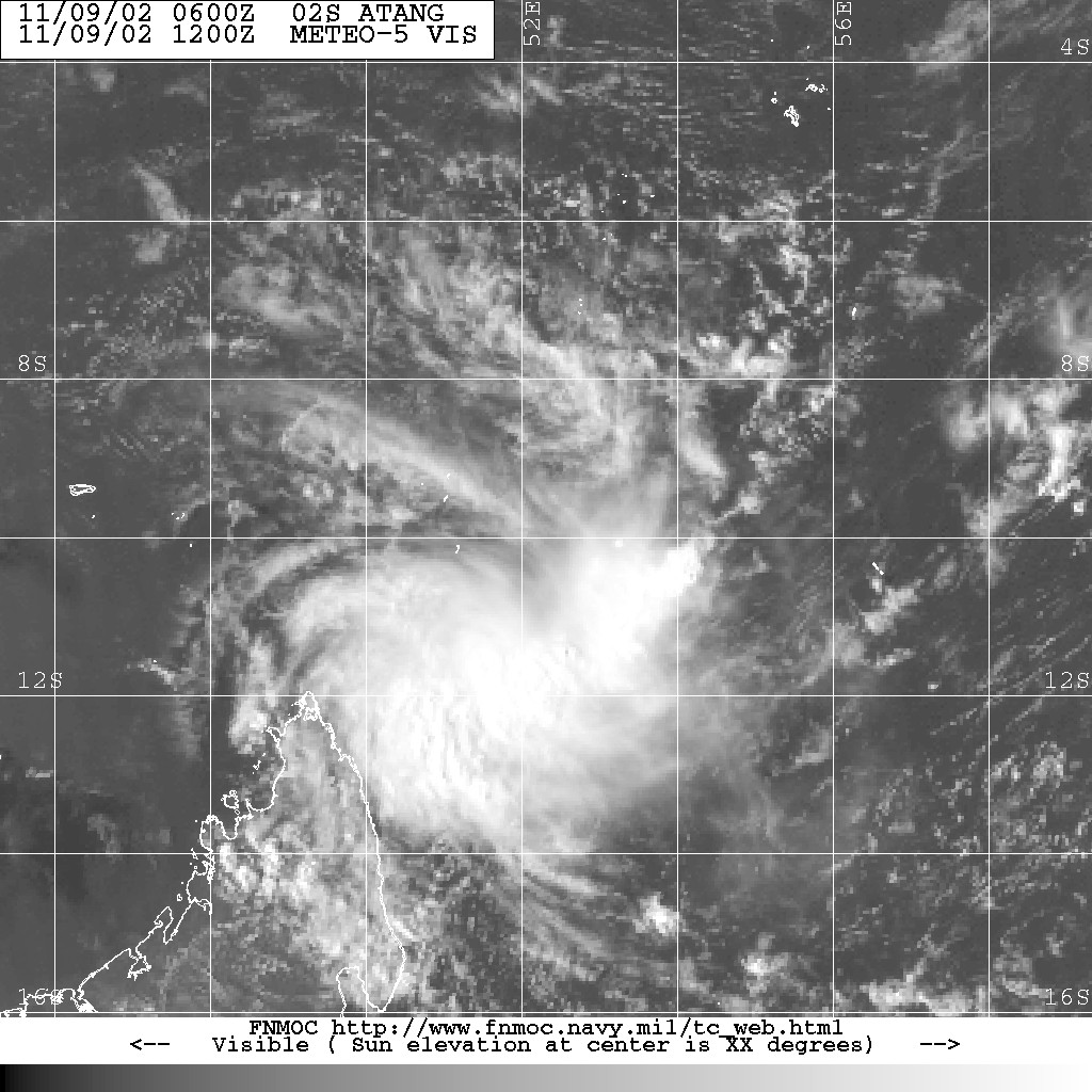
Tropical Depression Atang
Tropical depression (MFR) Tropical storm (SSHS) 
Duration November 4 – November 12 Intensity 55 km/h (35 mph) (10-min), 998 mbar (hPa) Formed on November 4 and dissipated on November 13. Atang was never classified as a tropical storm by Meteo France or Mauritius, but was named because it posed a threat to the island of Agalega. The name Atang was contributed by Botswana.[2]
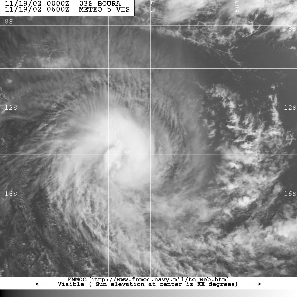
Tropical Cyclone Boura
Tropical cyclone (MFR) Category 1 tropical cyclone (SSHS) 
Duration November 15 – November 23 Intensity 120 km/h (75 mph) (10-min), 968 mbar (hPa) Formed on November 15 and dissipated on November 23. The name Boura was contributed by Comoros Islands.[2]
Tropical Cyclone Crystal
Tropical cyclone (MFR) Category 2 tropical cyclone (SSHS) 
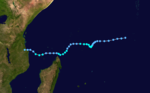
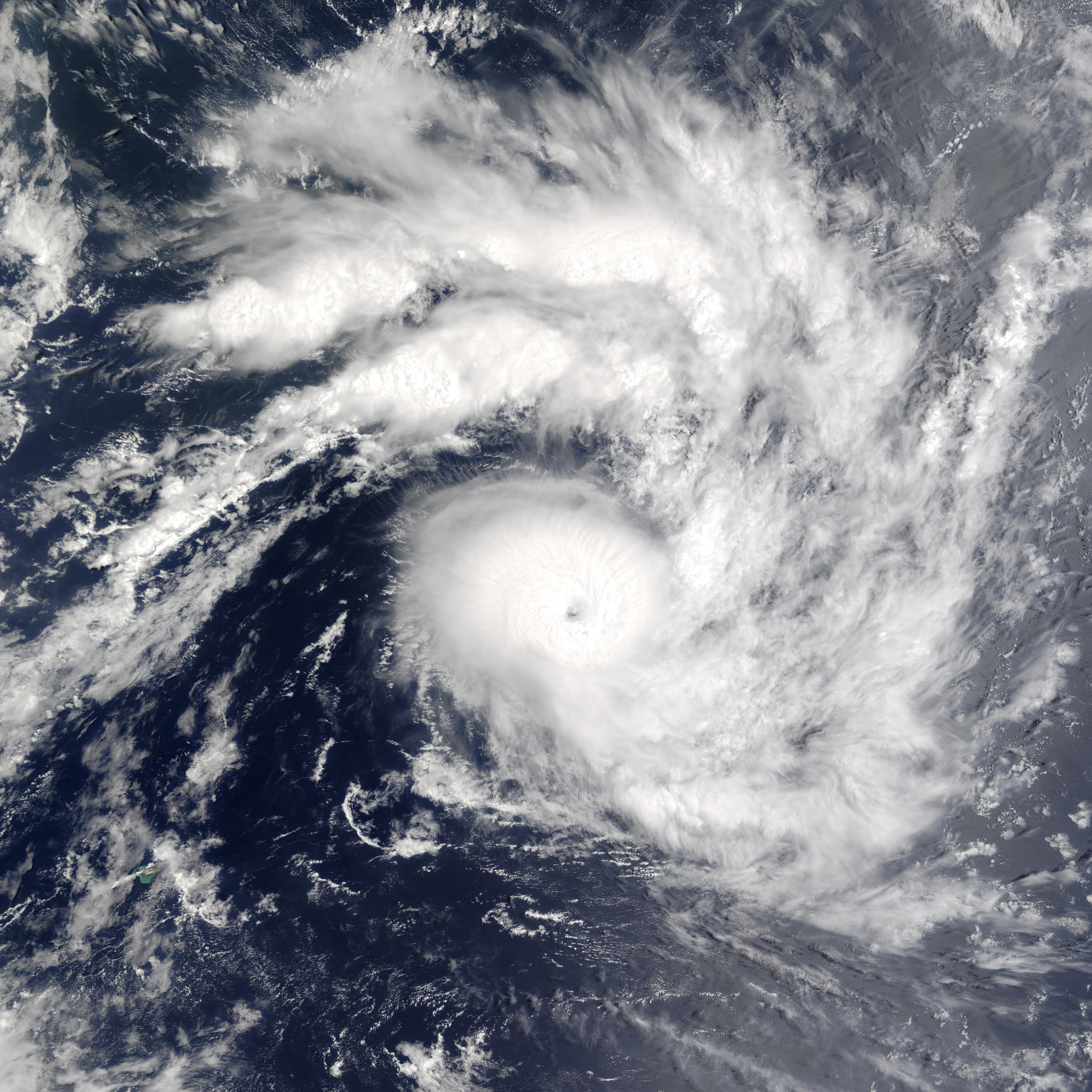
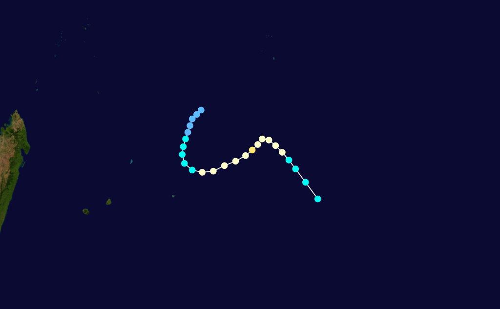
Duration December 22 – December 30 Intensity 140 km/h (85 mph) (10-min), 956 mbar (hPa) Formed on December 22 and dissipated on December 30. The name Crystal was contributed by Mauritius.[3]
Between December 26 and 27, Mauritius was under cyclone alert two, on a scale ranging from one to four with four being the highest.[4] Heavy rains, thunderstorms, and high winds were anticipated across the island.[5] Due to the change in Cyclone Crystal's track, the impact from the storm was significantly less than anticipated.[6] The highest rainfall was recorded in the southern portion of the island at 58.8 mm (2.31 in). Despite the proximity of the storm, no rainfall was recorded in northern areas of Mauritius. The highest winds were recorded at the Bain Boeuf station located in the northern portion of the island at 90 km/h (55 mph). Southern areas recorded gusts up to 80 km/h (40 mph). Authorities in Mauritius reported no damage; however, minor damage to poorly constructed buildings was likely.[4]
Tropical Depression 05
Tropical depression (MFR) Tropical depression (SSHS) 
Duration December 25 – December 27 Intensity 55 km/h (35 mph) (10-min), 998 mbar (hPa) Formed on December 25 and then moved east into Perth's area of responsibility on December 27. Dissipated on January 4.[3]
Severe Tropical Storm Delfina
Severe tropical storm (MFR) Tropical storm (SSHS) 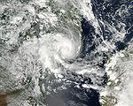
Duration December 30 – January 1 Intensity 90 km/h (55 mph) (10-min), 984 mbar (hPa) Cyclone Delfina made landfall in southern Nampula Province in Mozambique on December 31, 2002. Delfina then moved west-northwestward towards Malawi and became stationary over the country.[3] Heavy flooding from the resulting rains killed 47 people in Mozambique and 7 in Malawi.[7]
Tropical Disturbance 07
Tropical disturbance (MFR) Duration January 6 – January 12 Intensity 50 km/h (30 mph) (10-min), 1000 mbar (hPa) Developed concurrently with Tropical Storm Ebula.[8]
Severe Tropical Storm Ebula
Severe tropical storm (MFR) Category 1 tropical cyclone (SSHS) 
Duration January 7 – January 13 Intensity 110 km/h (70 mph) (10-min), 975 mbar (hPa) Formed on January 7 and dissipated on January 13. Name was contributed by Swaziland.[8]
Moderate Tropical Storm Fari
Moderate tropical storm (MFR) Tropical storm (SSHS) 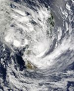
Duration January 23 – February 1 Intensity 75 km/h (45 mph) (10-min), 990 mbar (hPa) Formed on January 23 and dissipated on February 1. Name was contributed by Zimbabwe.[8]
Intense Tropical Cyclone Gerry
Intense tropical cyclone (MFR) Category 3 tropical cyclone (SSHS) 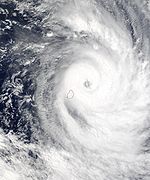

Duration February 8 – February 17 Intensity 165 km/h (105 mph) (10-min), 940 mbar (hPa) Formed on February 8 and dissipated on February 17. Name was contributed by Kenya.[9]
Tropical Cyclone Hape
Tropical cyclone (MFR) Category 2 tropical cyclone (SSHS) 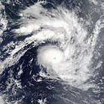

Duration February 9 – February 16 Intensity 130 km/h (80 mph) (10-min), 965 mbar (hPa) Formed on February 9 and dissipated on February 16. Name was contributed by Lesotho.[9]
Moderate Tropical Storm Isha
Moderate tropical storm (MFR) Tropical storm (SSHS) 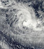

Duration February 11 – February 13 Intensity 65 km/h (40 mph) (10-min), 995 mbar (hPa) Formed on February 11 and dissipated on February 14. Name was contributed by the Seychelles.[9]
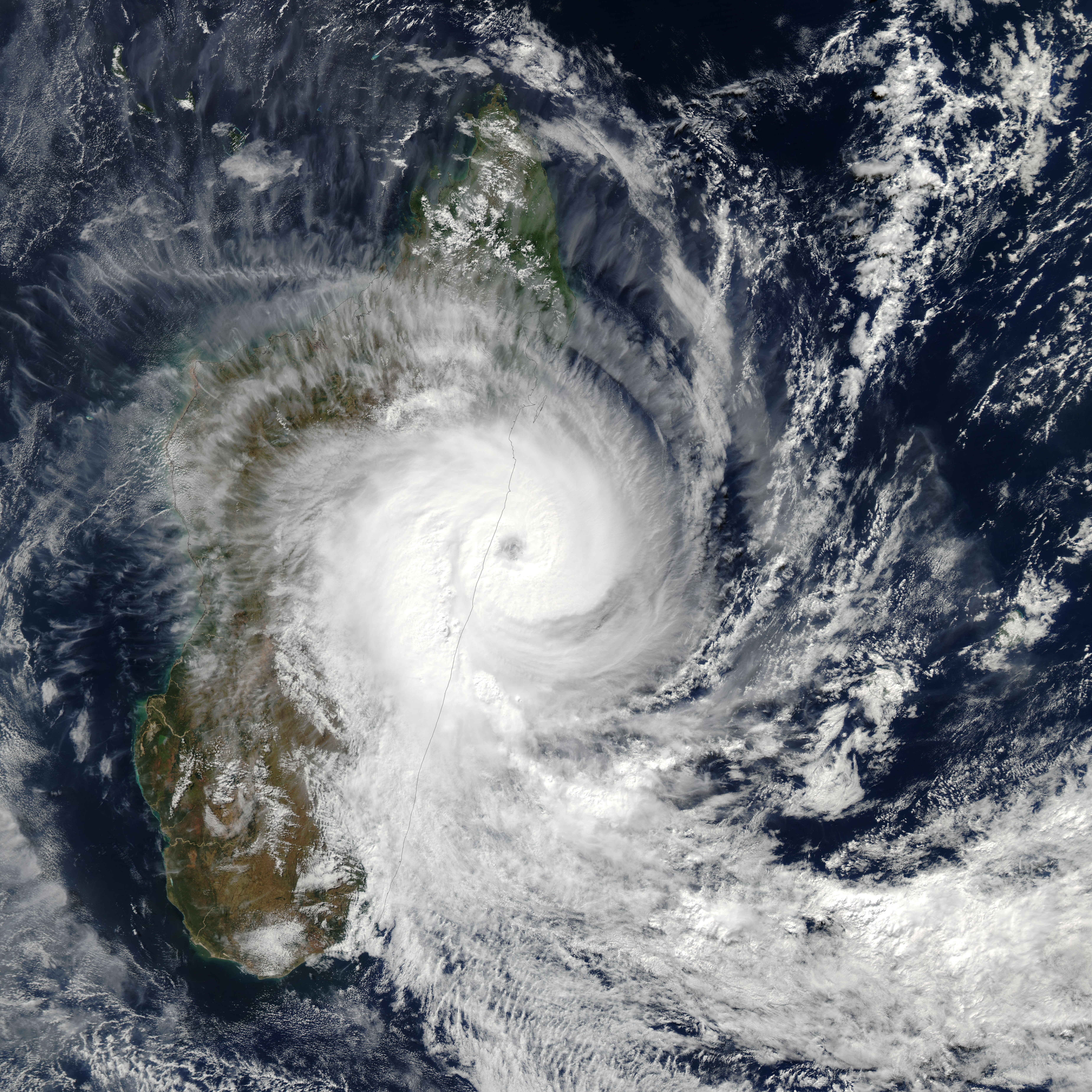
Intense Tropical Cyclone Japhet
Intense tropical cyclone (MFR) Category 4 tropical cyclone (SSHS) 
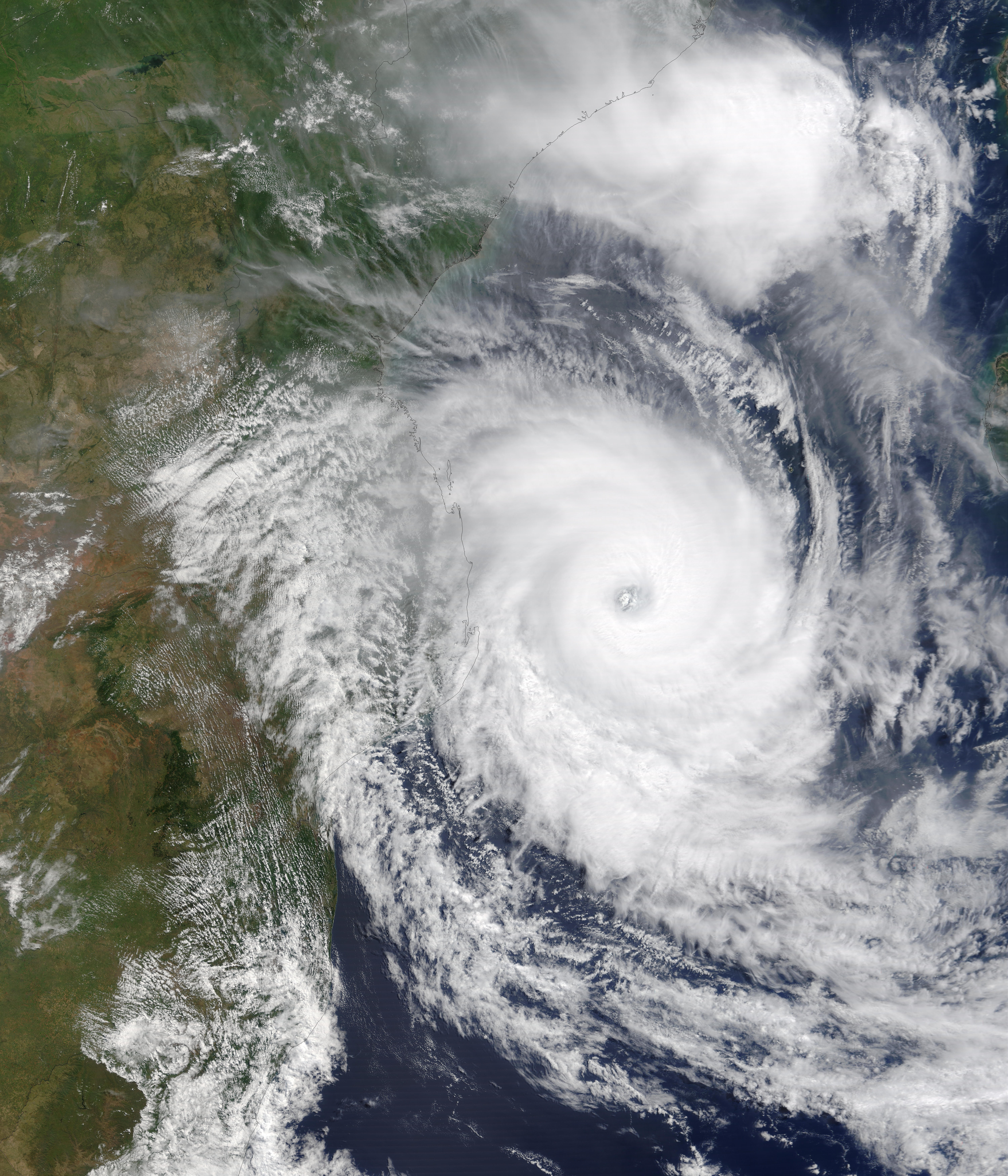
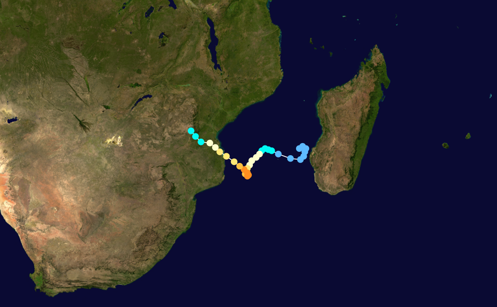
Duration February 25 – March 6 Intensity 185 km/h (115 mph) (10-min), 935 mbar (hPa) Cyclone Japhet formed on February 25 west of Madagascar. It headed west, and then south, and strengthened rapidly into a category 4 storm with 135 mph (217 km/h) winds and 927 milibars of pressure. It weakened as it headed northwest, and made landfall on March 3 in the country of Mozambique with winds of 110 miles per hour (180 km/h) The name Japhet was contributed by Malawi. A total of nineteen people were killed. In the city of Vilanculos, over 90% of houses were unroofed. Many roads in the region were washed out by Japhet's rains. Japhet was the strongest cyclone ever to form in the Mozambique Channel on record.
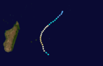
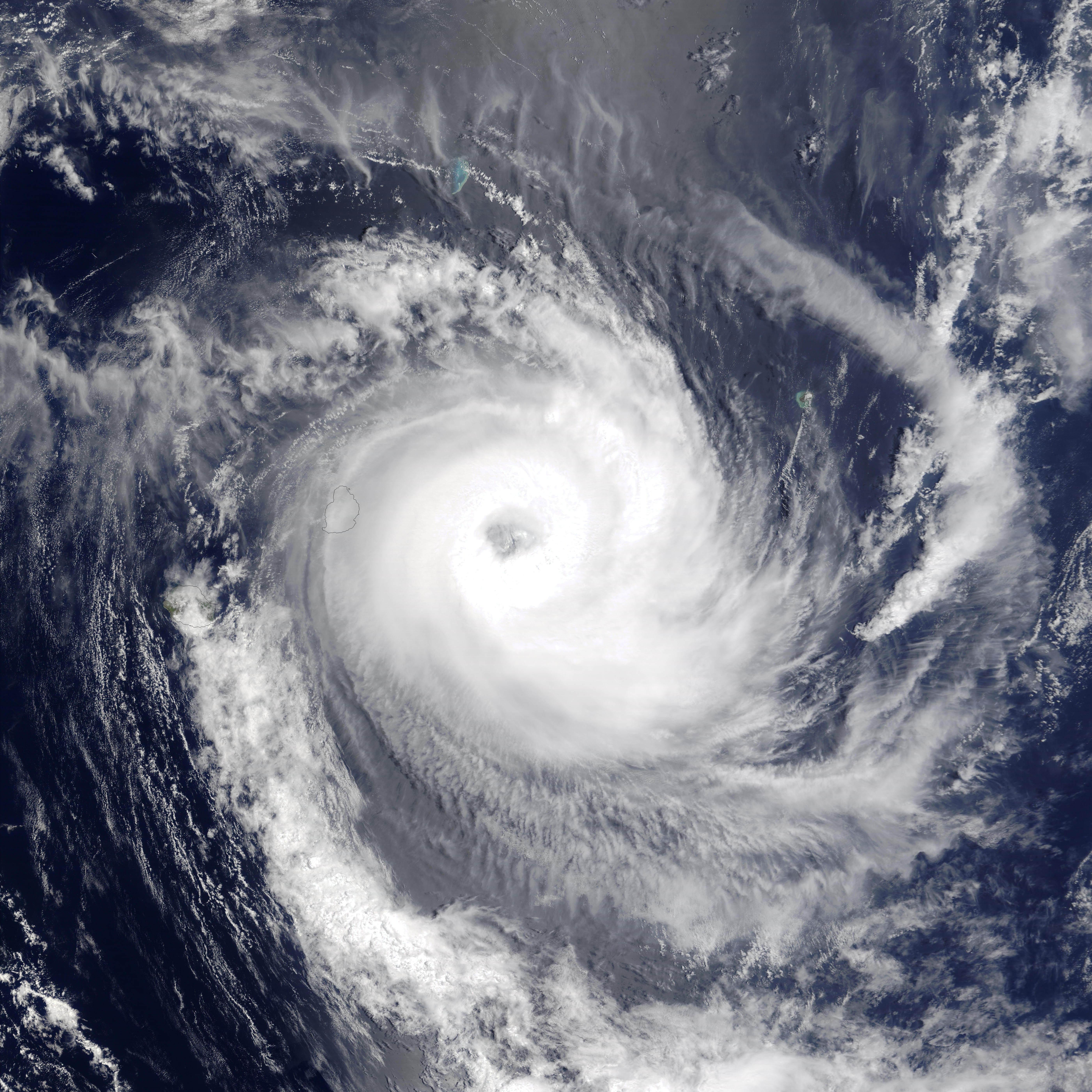
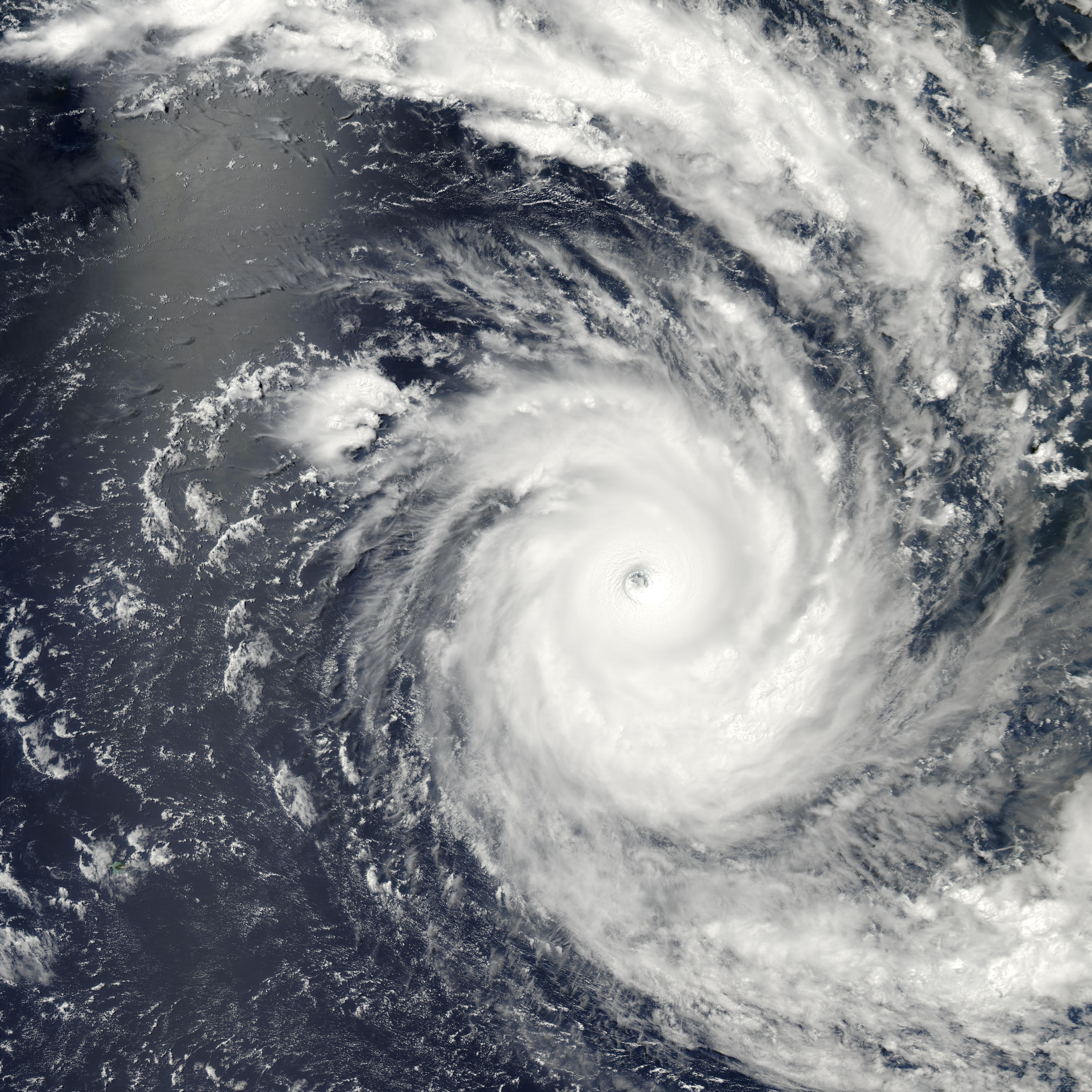
Intense Tropical Cyclone Kalunde
Intense tropical cyclone (MFR) Category 5 tropical cyclone (SSHS) 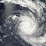
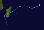
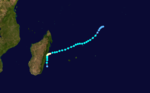
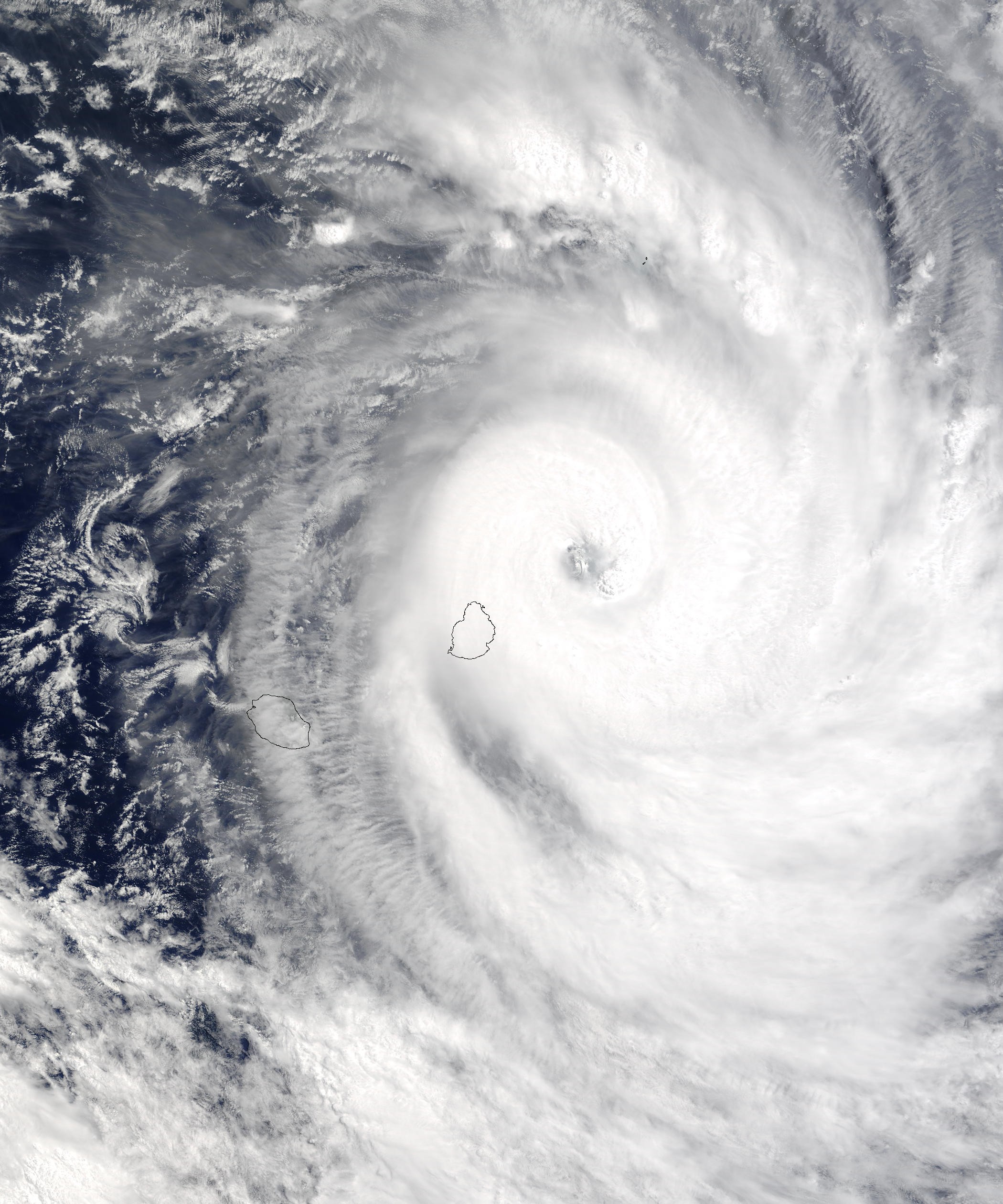
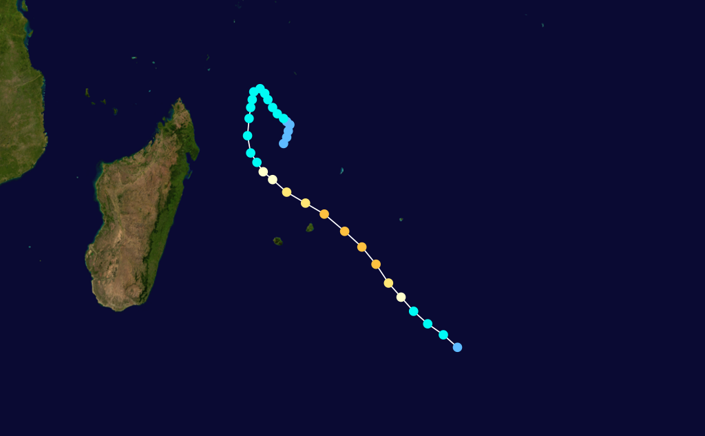
Duration March 4 – March 16 Intensity 215 km/h (130 mph) (10-min), 910 mbar (hPa) One of the most severe cyclones for the S. Indian basin, Cyclone Kalunde side-swiped Rodrigues Island, on March 12 causing significant damage but no deaths.
Sub-tropical Disturbance Luma
Sub-Tropical Disturbance (MFR) Duration April 10 – April 12 Intensity 120 km/h (75 mph) (10-min), 985 mbar (hPa) Formed on April 6 and dissipated on April 12. Name was contributed by Swaziland.[10]
Tropical Cyclone Manou
Tropical cyclone (MFR) Category 1 tropical cyclone (SSHS) 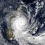
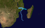
Duration May 3 – May 10 Intensity 150 km/h (90 mph) (10-min), 952 mbar (hPa) Late in the season, an area of disturbed weather formed Tropical Disturbance 16 on May 2. Météo-France upgraded it to a depression 2 days later. The cyclone strengthened into Tropical Storm Manou. The name Manou was contributed by Madagascar. After weakening, it restrengthened as it approached Madagascar. It strengthened into a cyclone as it neared the island. It turned and paralleled the course while drifting south. Land interaction and cooler waters weakened the cyclone, and Manou had dissipated by May 10.
Cyclone Manou caused death and destruction on Madagascar. Almost 90% of buildings in Vatomandry were destroyed and over 20000 people left homeless. Infrastructure was ruined, with power poles being knocked down and rice crops being flooded out. In Brickaville and Andevorento, almost all houses were destroyed. A total of 70 people, with 19 missing, were killed by Manou.
Storm names
A tropical disturbance is named when it reaches moderate tropical storm strength. If a tropical disturbance reaches moderate tropical storm status west of 55°E, then the Sub-regional Tropical Cyclone Advisory Centre in Madagascar assigns the appropriate name to the storm. If a tropical disturbance reaches moderate tropical storm status between 55°E and 90°E, then the Sub-regional Tropical Cyclone Advisory Centre in Mauritius assigns the appropriate name to the storm. A new annual list is used every year so no names are retired.[11]
- Atang
- Boura
- Crystal
- Delfina
- Ebula
- Fari
- Gerry
- Hape
- Isha
- Japhet
- Kalunde
- Luma
- Manou
- Noe (unused)
- Opanga (unused)
- Pale (unused)
- Qacha (unused)
- Rita (unused)
- Serame (unused)
- Tina (unused)
- Ulysse (unused)
- Vicente (unused)
- Winston (unused)
- Xena (unused)
- Yve (unused)
- Zaitoune (unused)
See also
- List of Southern Hemisphere tropical cyclone seasons
- Atlantic hurricane seasons: 2002, 2003
- Pacific hurricane seasons: 2002, 2003
- Pacific typhoon seasons: 2002, 2003
- North Indian Ocean cyclone seasons: 2002, 2003
References
- ^ a b c d e f MONTHLY GLOBAL TROPICAL CYCLONE SUMMARY
- ^ a b Monthly Global Tropical Cyclone Summary November 2002
- ^ a b c Monthly Global Tropical Cyclone Summary December 2002
- ^ a b Gary Padgett (March 10, 2003). "Monthly Tropical Weather Summary for December 2002". Typhoon 2000. http://www.typhoon2000.ph/garyp_mgtcs/dec02.txt. Retrieved June 10, 2009.
- ^ Associated Press (December 24, 2002). "Tropical cyclone approaches Mauritius". Highbeam Research. http://www.highbeam.com/doc/1P1-70583449.html. Retrieved June 10, 2009.
- ^ Staff Writer (December 28, 2002). "Earthweek: A Diary of the Planet". Pittsburgh Post-Gazette. http://news.google.com/newspapers?id=OvANAAAAIBAJ&sjid=1HADAAAAIBAJ&pg=6741,4133737&dq=cyclone+crystal. Retrieved June 10, 2009.
- ^ http://iri.columbia.edu/climate/cid/Feb2003/impacts.html
- ^ a b c Monthly Global Tropical Cyclone Summary January 2003
- ^ a b c Monthly Global Tropical Cyclone Summary February 2003
- ^ Monthly Global Tropical Cyclone Summary April 2003
- ^ "Tropical Cyclone Operational Plan for the South Pacific and South-East Indian Ocean". World Meteorological Organization. 2003. http://ftp.wmo.int/pages/prog/www/TCP_vO/OperationPlans/TCP12-English2003.pdf. Retrieved 2008-08-15.
External links
- Joint Typhoon Warning Center (JTWC).
- Météo France (RSMC La Réunion).
- World Meteorological Organization
- 2002-03 Cyclone Season from Météo France
2000–09 South-West Indian Ocean cyclone seasons


Wikimedia Foundation. 2010.