- 1994 Pacific hurricane season
Infobox hurricane season
Basin=EPac
Year=1994
Track=1994 Pacific hurricane season map.png
Last storm dissipated=October 26, 1994
Strongest storm name=Gilma
Strongest storm winds=140
Strongest storm pressure=920
Average wind speed=1
Total depressions=22
Total storms=20
Total hurricanes=10
Total intense=5
Fatalities=4 direct, 8 missing, 22 related
Da
Inflated=1
five seasons=1992, 1993, 1994, 1995, 1996Pacific Ocean .Of note in this season is an unusual spree of very intense storms. Hurricanes Emilia, Gilma, John, and Olivia all reached a pressure below 930
millibars . Elsewhere, Hurricane Rosa caused several casualties inMexico .eason summary
The 1994 Pacific hurricane season officially started May 15, 1994 in the eastern Pacific, and June 1, 1994 in the central Pacific, and lasted until November 30, 1994. These dates conventionally delimit the period of each year when most tropical cyclones form in the northeastern
Pacific Ocean .cite web|work=FAQ: Hurricanes, Typhoons, and Tropical Cyclones|title=Subject: G1) When is hurricane season?|url=http://www.aoml.noaa.gov/hrd/tcfaq/G1.html|publisher=Atlantic Oceanographic and Meteorological Laboratory Hurricane Research Division|accessdate=2008-09-23|author=Neal Dorst] In actuality, the season lasted from June 18, the formation date of its first system, to October 26, the dissipation date of the last.cite web|title=Eastern North Pacific Tracks File 1949-2007|url=http://www.nhc.noaa.gov/tracks1949to2007_epa.txt|format=Plaintext|date=2008-03-21|accessdate=2008-09-23|publisher=National Hurricane Center ]This season, twenty-two
tropical cyclones formed in the northPacific Ocean east of the dateline. All but two of them became tropical storms or hurricanes. In the eastern Pacific (140°W to North America), nineteen tropical depressions formed, of which seventeen became tropical storms, nine became hurricanes, and five became major hurricanes of Category 3 intensity or higher on the Saffir Simpson Scale. These numbers are the long-term averages of fifteen tropical storms, nine hurricanes, and four major hurricanes.cite web|url= http://www.cpc.ncep.noaa.gov/products/Epac_hurr/background_information.html|title=Background Information: East Pacific Hurricane Season|date=2008-05-22|publisher=Climate Prediction Center |accessdate=2008-09-23]In the
Central Pacific Hurricane Center 'sarea of responsibility (140°W to the dateline), three depressions, two tropical storms, and one hurricane formed. Over all, there were eleven tropical cyclones, eight tropical storms, five hurricanes, and three major hurricanes that formed or entered the central Pacific.cite web|url= http://www.prh.noaa.gov/cphc/summaries/|title=Previous Tropical Systems in the Central Pacific|publisher=Central Pacific Hurricane Center |accessdate=2008-09-23] These numbers are well above the long-term average of four tropical cyclones, two hurricanes, one tropical storm, and two depressions. cite web|url= http://www.prh.noaa.gov/cphc/summaries/2006.php|title=2006 Tropical Cyclones Central North Pacific|month=July|year=2007|author=Andy Nash, Tim Craig, Sam Houston, Roy Matsuda, Jeff Powell, Ray Tanabe, & Jim Weyman|accessdate=2008-09-23|publisher=Central Pacific Hurricane Center ] The extremely high activity was contributed to by anEl Niño ongoing at the time.cite web|url= http://www.prh.noaa.gov/cphc/summaries/1997.php|title=The 1997 Central Pacific Tropical Cyclone Season|author=Benjamin Hablutzel, Hans Rosendal, James Weyman, & Jonathan Hoag|publisher=Central Pacific Hurricane Center |accessdate=2008-09-23]The only named storm to make landfall this year was Hurricane Rosa, which killed several people in Mexico.cite web|url= http://www.nhc.noaa.gov/archive/storm_wallets/epacific/ep1994-prelim/rosa/prelim02.gif|title=Preliminary Report Hurricane Rosa|pages=2|date=1994-11-22|format=GIF|author=
Lixion Avila |publisher=National Hurricane Center |accessdate=2008-09-23] Other notable storms include Hurricane Olivia, which is one of the most intense Pacific hurricanes on record, the three Category 5 hurricanes Emilia, Gilma, and John, and Hurricane Li, which existed in all three basins (East, Central, and West) of thePacific Ocean .cite web|url=http://www.prh.noaa.gov/cphc/summaries/1994.php|title=The 1994 Central Pacific Tropical Cyclone Season|accessdate=2008-09-23|publisher=Central Pacific Hurricane Center ]This season is the swan song of the eastern north Pacific's most recent active period. That period, which began in 1982,cite web|url=http://www.australiansevereweather.com/cyclones/2004/summ0404.htm|title=Monthly Global Tropical Cyclone Summary April 2004|author=Gary Padgett|accessdate=2008-09-23] and includes the five most active Pacific hurricane seasons, ended with this season. Starting in 1995, multi-decadal factors switched to a phase that suppresses Pacific hurricane activity.cite web|url=http://www.cpc.ncep.noaa.gov/products/Epac_hurr/Epac_hurricane.html|title=NOAA: 2008 Eastern Pacific Hurricane Season Outlook|date=2008-05-22|publisher=
Climate Prediction Center |accessdate=2008-09-23] Since then, Pacific hurricane activity has been largely inactive.cite web|url=http://www.cpc.ncep.noaa.gov/products/Epac_hurr/figure2.gif|title=Historical East Pacific Seasonal Activity|format=GIF|publisher=Climate Prediction Center |accessdate=2008-09-23]Records
The 1994 Pacific hurricane season set several records. First, three hurricanes reached Category 5 intensity on the
Saffir-Simpson Hurricane Scale . The only other time that happened was in 2002. (TheNational Hurricane Center does not consider Emilia to have reached Category 5 intensity.) Two systems, Hurricanes Li and John, crossed through all three Pacific Ocean basins; this season is the only one to have more than one tropical cyclone do that. Eleven tropical cyclones entered or formed in the central Pacific, a record shared with the 1992 season. Finally, although not really a record, of the four most intense hurricanes in the central Pacific, three of them occurred this season.torms
Tropical Storm Aletta
Infobox Hurricane Small
Basin=EPac.jpg)
Track=Aletta 1994 track.png
Dissipated=June 23
1-min winds=45
Pressure=999National Hurricane Center ] Aletta never affected land, and no damage or casualties were reported.cite web|url=http://www.nhc.noaa.gov/archive/storm_wallets/epacific/ep1994-prelim/aletta/prelim02.gif|title=Preliminary Report Tropical Storm Aletta|author=Richard Pasch|date=1994-10-25|accessdate=2008-09-23|pages=2|format=GIF|publisher=National Hurricane Center ]Tropical Depression One-E strengthened into Tropical Storm Aletta on June 19. That date is the fourth latest date for a season's first tropical storm since 1966. It was the latest date since the 1968 season.
Tropical Storm Bud
Infobox Hurricane Small
Basin=EPac
Track=Bud 1994 track.png
Dissipated=June 29
1-min winds=40
Pressure=1003Baja California Peninsula . The depression headed west-northwest, gradually turned to the northwest, and strengthened into Tropical Storm Bud on June 27. Early the next day, Bud peaked in intensity. Shear caused by a nearby upper level low slowly weakened Bud. Later on June 28, a second center of circulation developed. The two centers started aFujiwhara interaction . The second center then became dominant and the first one vanished. This confused structure is similar to what happened to 1993's Tropical Storm Arlene. This confused structure also weakened Bud to a tropical depression on the afternoon of the same day the second center formed. Bud then headed westward over cool waters and dissipated on June 29.cite web|url=http://www.nhc.noaa.gov/archive/storm_wallets/epacific/ep1994-prelim/bud/prelim01.gif|title=Preliminary Report Tropical Storm Bud|author=Edward Rappaport |date=1994-07-22|format=GIF|pages=1|publisher=National Hurricane Center |accessdate=2008-09-24] Tropical Storm Bud spent its entire life over the open ocean far from land areas. No casualties or damage was reported.cite web|url=http://www.nhc.noaa.gov/archive/storm_wallets/epacific/ep1994-prelim/bud/prelim02.gif|title=Preliminary Report Tropical Storm Bud|author=Edward Rappaport |date=1994-07-22|format=GIF|pages=2|publisher=National Hurricane Center |accessdate=2008-09-24]Hurricane Carlotta
Infobox Hurricane Small
Basin=EPac
Track=Carlotta 1994 track.png
Dissipated=July 5
1-min winds=90
Pressure=967July 5 . Carlotta did not threaten land.cite web|url=http://www.nhc.noaa.gov/archive/storm_wallets/epacific/ep1994-prelim/carlotta/prelim01.gif|date=1994-07-21|author=Lixion Avila |title=Preliminary Report Hurricane Carlotta|pages=1|format=GIF|publisher=National Hurricane Center |accessdate=2008-09-24]Carlotta buffeted
Socorro Island with sustained winds of convert|39|mph|km/h on June 30.cite web|url=http://www.nhc.noaa.gov/archive/storm_wallets/epacific/ep1994-prelim/carlotta/prelim02.gif|date=1994-07-21|author=Lixion Avila |title=Preliminary Report Hurricane Carlotta|pages=2|format=GIF|publisher=National Hurricane Center |accessdate=2008-09-24] Other than there, Carlotta caused no damage or deaths.Tropical Storm Daniel
Infobox Hurricane Small
Basin=EPac.jpg)
Track=Daniel 1994 track.png
Dissipated=July 14
1-min winds=55
Pressure=993Baja California Peninsula developed a circulation and became Tropical Depression Four-E. Convection increased, and the depression strengthened into Tropical Storm Daniel. Upper-level outflow improved, and Daniel peaked in intensity on July 9. Daniel slowly declined as it continued westward. It entered the central Pacific on July 11.Wind shear weakened Daniel as it approached the Big Island, and by July 15 had degenerated into an open wave.cite web|url=http://www.nhc.noaa.gov/archive/storm_wallets/epacific/ep1994-prelim/daniel/prelim01.gif|date=1994-10-14|title=Preliminary Report Tropical Storm Daniel|author=Max Mayfield |format=GIF|pages=1|publisher=National Hurricane Center ]When Daniel was approaching Hawaii, moderate surf of convert|4|to|6|ft|m impacted the south and southeast shores of the Big Island on July 13 and 14. Daniel's remnants also passed about convert|100|mi|km south of
South Point, Hawaii on July 15. That day, they caused rainfall on windward slopes of the Big Island locally reaching convert|5|in|mm. No reports of damage or casualties were received.cite web|url=http://www.nhc.noaa.gov/archive/storm_wallets/epacific/ep1994-prelim/daniel/prelim02.gif|date=1994-10-14|title=Preliminary Report Tropical Storm Daniel|author=Max Mayfield |format=GIF|pages=2|publisher=National Hurricane Center ]Hurricane Emilia
Infobox Hurricane Small
Basin=EPac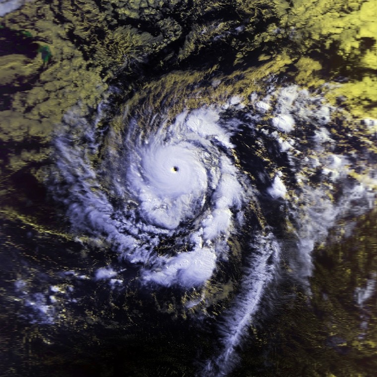
Track=Emilia 1994 track.png
Dissipated=July 25
1-min winds=140
Pressure=926National Hurricane Center |pages=1] It entered the central Pacific on July 17. It continued intensifying, reaching Category 5 intensity on July 19, the first Category 5 Pacific hurricane since Ava. (TheNational Hurricane Center does not consider Emilia to have reached Category 5 intensity, but theCentral Pacific Hurricane Center does.) Emilia started weakening quickly on July 21. It weakened to a tropical storm on July 23 and dissipated two days later.Emilia passed south of the Hawai’ian Islands, producing swells of convert|6|to|10|ft|m in height near the Puna and Ka‘ū coasts. Winds caused minor damage, and rain was moderate. No one was killed.cite web|url=http://www.nhc.noaa.gov/archive/storm_wallets/epacific/ep1994-prelim/emilia/prelim02.gif|title=Preliminary Report Hurricane Emilia|date=1994-08-13|author=Miles Lawrence|accessdate=2008-09-24|format=GIF|publisher=
National Hurricane Center |pages=2]Tropical Storm Fabio
Infobox Hurricane Small
Basin=EPac
Track=Fabio 1994 track.png
Dissipated=July 24
1-min winds=40
Pressure=1002Max Mayfield |date=1994-10-15|format=GIF|publisher=National Hurricane Center |accessdate=2008-09-24] It entered the central Pacific as a tropical depression, and dissipated on July 24.Fabio's remnants brought locally heavy rainfall to Hawaii, reaching convert|3|to|4|in|mm. No one was killed and there was no damage.cite web|url=http://www.nhc.noaa.gov/archive/storm_wallets/epacific/ep1994-prelim/fabio/prelim02.gif|pages=2|title=Preliminary Report Tropical Storm Fabio|author=
Max Mayfield |date=1994-10-15|format=GIF|publisher=National Hurricane Center |accessdate=2008-09-24]Hurricane Gilma
Infobox Hurricane Small
Basin=EPac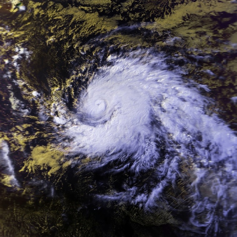
Track=Gilma 1994 track.png
Dissipated=July 31
1-min winds=140
Pressure=920tropical wave organized into a tropical depression on July 21. It headed westward and out to sea, strengthening into a tropical storm the next day. Gilma rapidly strengthened and became a hurricane exactly one day after it was named. It continued to intensify as it entered the central Pacific. Shortly after entering the central Pacific, Gilma reached Category 5 intensity on theSaffir-Simpson Hurricane Scale , the second of the season.cite web|url=http://www.nhc.noaa.gov/archive/storm_wallets/epacific/ep1994-prelim/gilma/prelim01.gif|title=Preliminary Report Hurricane Gilma|publisher=National Hurricane Center |author=Richard J. Pasch|date=1995-01-20|format=GIF|pages=1|accessdate=2008-09-24] It then suddenly weakened for unexplained reasons, and weakened into a tropical storm on July 27. It became a depression three days dat and dissipated on July 31. Hurricane Gilma had minor impact onJohnston Atoll . That atoll received lightrain , wind gusts to neargale force ,cite web|url=http://www.nhc.noaa.gov/archive/storm_wallets/epacific/ep1994-prelim/gilma/prelim02.gif|title=Preliminary Report Hurricane Gilma|publisher=National Hurricane Center |author=Richard J. Pasch|date=1995-01-20|format=GIF|pages=2|accessdate=2008-08-18] and surf. No casualties or damage were reported.Hurricane Gilma was the second most-intense Pacific at the time. As of 2008, it remains the sixth-most intense. Gilma is also the strongest July storm in the eastern or central Pacific.
Hurricane Li
Infobox Hurricane Small
Basin=EPac
Track=Li 1994 track.png
Dissipated=August 18
1-min winds=65
Prepressure=≤
Pressure=1007Cabo San Lucas organized into Tropical Depression Eight-E on July 31.cite web|url=http://www.nhc.noaa.gov/archive/storm_wallets/epacific/ep1994/td8e/tropdisc/nep0894.001|title=Tropical Depression Eight-E Discussion 1|date=1994-07-31|accessdate=2008-09-24|author=Pasch|publisher=National Hurricane Center ] It headed west-northwest without strengthening much, and crossed into the central Pacific on August 2.cite web|url=http://www.nhc.noaa.gov/archive/storm_wallets/epacific/ep1994/td8e/tropdisc/nep0894.010|author=Rappaport|date=1994-08-02|title=Tropical Depression Eight-E Discussion Number 10|accessdate-2008-09-24|publisher=National Hurricane Center ] Eight-E developed a second center of circulation, which became dominant,cite web|url=http://www.nhc.noaa.gov/archive/storm_wallets/epacific/ep1994/td8e/tropdisc/tcd0321z.gif|format=GIF|title=Tropical Depression Eight Special Discussion Number 13|author=Hablutzul|publisher=National Hurricane Center |date=1994-08-03|accessdate=2008-09-24] and then became bound up in theintertropical convergence zone .cite web|url=http://www.nhc.noaa.gov/archive/storm_wallets/epacific/ep1994/td8e/tropdisc/tcd0321z.gif|author=Farrell|date=1994-08-04|title=Tropical Depression Eight E Discussion 16|publisher=National Hurricane Center |accessdate=2008-09-24|format=GIF] Eight-E then became disorganized, with multiple centers of circulation,cite web|url=http://www.nhc.noaa.gov/archive/storm_wallets/epacific/ep1994/td8e/tropdisc/tcd0503z.gif|title=Tropical Depression Eight-E Discussion 18|date=1994-08-04|author=Rosendal|publisher=National Hurricane Center |accessdate=2008-09-24|format=GIF] and advisories were discontinued on August 5. The depression's remains continued their westward path well south of theHawaiian Islands . The depression regenerated on August 8. It soon strengthened into a tropical storm and was named Li, which is Hawaiian for "".cite web|url=http://www.nhc.noaa.gov/archive/storm_wallets/epacific/ep1994/td8e/tropdisc/tcd0821z.gif|title=Tropical Storm Li Special Discussion Number 22|date=1994-08-08|publisher=National Hurricane Center |format=GIF|author=Hablutzel|accessdate=2008-09-14] Li approached the dateline on its generally westward heading. Just before crossing, it intensified into a minimal Category 1 hurricane. It crossed the dateline on August 12 and became a typhoon in the1994 Pacific typhoon season . Wind shear from atropical upper-tropospheric trough weakened back into a tropical storm as it crossed the dateline, and theJoint Typhoon Warning Center downgraded Li with its first advisory.cite web|url=http://metocph.nmci.navy.mil/jtwc/atcr/1994atcr/pdf/cep/08e.pdf|title=Typhoon Li (08E)|pages=106|accessdate=2008-09-24|publisher=Joint Typhoon Warning Center |format=PDF|work=1994 Annual Tropical Cyclone Report] Li stayed a tropical storm until August 16, where it weakened into a tropical depression. The system then began recurving, and dissipated on August 18.cite web|url=http://metocph.nmci.navy.mil/jtwc/atcr/1994atcr/pdf/cep/08e.pdf|title=Typhoon Li (08E)|pages=105|accessdate=2008-09-24|publisher=Joint Typhoon Warning Center |format=PDF|work=1994 Annual Tropical Cyclone Report] A weakening Tropical Depression Li caused showers onWake Island . Other than there, Li had no impact on any land, and no casualties or damage were reported.Hurricane Li is one of only six tropical cyclones to exist on all three
tropical cyclone basin s in the Pacific Ocean. It is also one of only three systems to form as a depression in the east Pacific but be named in the central; the other two are Lala and Iniki. However, the question of whether Li actually actually did those two things is somewhat complicated. Although theNational Hurricane Center issued advisories on Tropical Depression Eight-E, Li's first data point in the official database has a longitude of 140°W, "exactly" on the boundary between the east and central Pacific. However, in its preliminary report, the NHC includes a preliminary set of track data including several positions east of 140°W.cite web|url=http://www.nhc.noaa.gov/archive/storm_wallets/epacific/ep1994/td8e/prenhc/prelim01.gif|title=Preliminary Report Tropical Depression Eight-E (Hurricane Li)|date=1994-10-20|author=Edward Rappaport |publisher=National Hurricane Center |format=GIF|accessdate=2008-09-24] Hence, Li's status as an east Pacific tropical cyclone is debatable.Tropical Storm Hector
Infobox Hurricane Small
Basin=EPac
Track=Hector 1994 track.png
Dissipated=August 10
1-min winds=55
Pressure=993tropical wave a few hundred miles south of Baja California. It became Tropical Storm Hector quickly, and as it paralleled the coast of Mexico, it began to weaken, dissiating on August 10. No damage was reported anywhere.cite web|url=http://www.nhc.noaa.gov/archive/storm_wallets/epacific/ep1994-prelim/hector/prelim01.gif|title=Preliminary Report Tropical Storm Hector|date=1994-09-20|author=Lixion Avila |format=GIF|pages=2|accessdate=2008-09-24|publisher=National Hurricane Center |pages=1]Tropical Storm Hector was forecast to approach the
Baja California Peninsula . A tropical storm watch was issued for part of the peninsula on August 8. It was lifted later the same day.cite web|url=http://www.nhc.noaa.gov/archive/storm_wallets/epacific/ep1994-prelim/hector/prelim02.gif|title=Preliminary Report Tropical Storm Hector|date=1994-09-20|author=Lixion Avila |format=GIF|pages=2|accessdate=2008-09-24|publisher=National Hurricane Center |pages=2] Hector's most significant impact was rain. The tropical storm dumped rain along a discontinuous zone of coastal and inland Mexico. The highest point maxima were convert|7.87|in|mm at Cerro de Ortega/Ixtlahua and convert|7.60|in|mm at Caduano/Santiago.cite web|url=http://www.hpc.ncep.noaa.gov/tropical/rain/hector1994filledrainblk.gif|author=David M. Roth |publisher=Hydrometeorological Prediction Center |accessdate=2008-09-24|title=Tropical Storm Hector] No damage or casualties were reported.Tropical Depression One-C
Infobox Hurricane Small
Basin=EPac
Formed=August 9
Dissipated=August 14
1-min winds=30An area of disturbed weather organized into a tropical depression on August 9 while located convert|740|mi|km southeast ofHilo, Hawaii . The depression moved westward without organizing, and dissipated on August 14.Moisture from the system produced heavy rainfall over the island of Hawaii, totaling to over convert|15|in|mm. The flooding closed all major roads in Hilo, and was considered the worst flooding in 40 years. The rainfall destroyed 2 homes and damaged 214, 14 severely. It also damaged roads and businesses. Damage throughout the island totaled to $5 million (1993 USD).cite web|publisher=
National Climatic Data Center |url=http://www4.ncdc.noaa.gov/cgi-win/wwcgi.dll?wwevent~ShowEvent~203410|title=Flood Report: Kauai Mountains|accessdate=2007-03-08] Flooding occurred inMaui as well, where landslides blocked portions of the Hana Highway.cite web|publisher=National Climatic Data Center |url=http://www4.ncdc.noaa.gov/cgi-win/wwcgi.dll?wwevent~ShowEvent~203402|title=Flood Report: Kauai Leeward|accessdate=2007-03-08] One-C's point maximum of convert|15|in|mm|abbr=on makes itHawaii 's seventh wettest known tropical cyclone.Hurricane Ileana
Infobox Hurricane Small
Basin=EPac
Track=Ileana 1994 track.png
Dissipated=August 14
1-min winds=65
Pressure=986intertropical convergence zone developed several centers of circulation. After it organized, it seperated from the ITCZ and became Tropical Depression Eleven-E on August 10 while the system was about convert|690|mi|km south-southeast of the southern tip of theBaja California Peninsula .cite web|url=http://www.nhc.noaa.gov/archive/storm_wallets/epacific/ep1994-prelim/ileana/prelim01.gif|title=Preliminary Report Hurricane Ileana|author=Max Mayfield |date=1994-10-17|accessdate=2008-09-24|format=GIF|publisher=National Hurricane Center |pages=1] It was upgraded to Tropical Storm Ileana at the second advisory,cite web|url=http://www.nhc.noaa.gov/archive/storm_wallets/epacific/ep1994/ileana/tropdisc/nep1194.002|author=Rappaport|date=1994-08-11|title=Tropical Storm Ileana Discussion Number 2|accessdate=2008-09-24|publisher=National Hurricane Center ] at the same time as John, the next storm.cite web|url=http://www.nhc.noaa.gov/archive/storm_wallets/epacific/ep1994/john/tropdisc/nep1094.003|title=Tropical Storm John Discussion Number 3|date=1994-08-11|publisher=National Hurricane Center |accessdate=2008-09-24|author=Rappaport] An eye appeared, and Ileana became a hurricane on August 12. It began weakening almost immediately thereafter, as it passed over cooler waters and encountered increasing wind shear. Ileana was a tropical storm on August 13, and the next day it was a dissipating swirl low-level clouds located about convert|520|mi|km|-1 west ofPunta Eugenia . Although Ileana paralleled the coast of Mexico, watches and warnings were not issued because winds of tropical storm-force were not expected to affect land. No one was killed and there was no damage reported in association with this cyclone.cite web|url=http://www.nhc.noaa.gov/archive/storm_wallets/epacific/ep1994-prelim/ileana/prelim02.gif|title=Preliminary Report Hurricane Ileana|author=Max Mayfield |date=1994-10-17|accessdate=2008-09-24|format=GIF|publisher=National Hurricane Center |pages=2]Hurricane John
Infobox Hurricane Small
Basin=EPac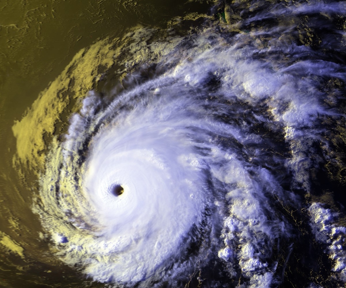
Track=John 1994 track.png
Dissipated=September 10
1-min winds=150
Pressure=929Hawaii , and passed just north of Johnston Atoll on August 26.cite web|url=http://www.nhc.noaa.gov/archive/storm_wallets/epacific/ep1994-prelim/john/prelim01.gif|author=Miles Lawrence|date=1995-01-03|title=Preliminary Report Hurricane John|publisher=National Hurricane Center |format=GIF|accessdate=2008-09-24] John stayed at hurricane intensity until it crossed the dateline on August 28, becoming a typhoon of the1994 Pacific typhoon season . After weakening into a tropical storm, John recurved, looped, and recurved again.cite web|url=http://metocph.nmci.navy.mil/jtwc/atcr/1994atcr/pdf/cep/10e.pdf|format=PDF|title=Typhoon John (10-E)|publisher=Joint Typhoon Warning Center |pages=128|accessdate=2008-08-24] It reintensified, and was a hurricane when it recrossed thedateline to reenter the central Pacific. John headed north-northeast until it went extratropical on September 10, thirty one days after it formed.Ahead of the hurricane, the 1100 people at
Johnston Atoll evacuated . On the atoll, John caused $15 million (1994 USD) in damage. No deaths were reported. Other than on Johnston, Hurricane John had no impact on land.Hurricane John was the longest lasting and most continuous tropical cyclone on Earth in recorded history.cite web|url=http://www.aoml.noaa.gov/hrd/tcfaq/E6.html|author=Neal Dorst|title=Subject: E6) Which tropical cyclone lasted the longest?|work=FAQ: Hurricanes, Typhoons, and Tropical Cyclones|publisher=
Atlantic Oceanographic and Meteorological Laboratory |accessdate=2008-09-24] It is also one of six tropical cyclones to exist in all three basins of thePacific Ocean , an uncommon west-to-east dateline crosser, and one of the few tropical cyclone to cross the dateline more than once.Tropical Depression Twelve-E
Infobox Hurricane Small
Basin=EPac
Formed=August 12
Dissipated=August 15
1-min winds=30
Pressure=1006On August 14, an area of convection organized enough to be considered a tropical depression. It was steered by John's circulation, and it was never expected to strengthen much because it was close to cool waters.cite web|url=http://www.nhc.noaa.gov/archive/storm_wallets/epacific/ep1994/td12e/tropdisc/nep1294.001|date=1994-08-14|author=Mayfield|publisher=National Hurricane Center |accessdate=2008-09-24|title=Tropical Depression Twelve-E Discussion Number 1] The cyclone drifted north, then northeast, north again, northwest, and then west.cite web|url=http://www.nhc.noaa.gov/archive/storm_wallets/epacific/ep1994/td12e/prenhc/prelim01.gif|format=GIF|author=Richard Pasch|title=Preliminary Report Tropical Depression Twelve-E|date=1995-01-13|accessdate=2008-09-25|publisher=National Hurricane Center ] TheNational Hurricane Center declared the depression dissipated on August 15.cite web|url=http://www.nhc.noaa.gov/archive/storm_wallets/epacific/ep1994/td12e/tropdisc/nep1294.005|title=Tropical Depression Twelve-E Discussion Number 5|author=Mayfield|date=1994-08-15|publisher=National Hurricane Center |accessdate=2008-09-24] The depression had no effects anywhere.Hurricane Kristy
Infobox Hurricane Small
Basin=EPac
Track=Kristy 1994 track.png
Dissipated=September 5
1-min winds=90
Prepressure=≤
Pressure=992Cabo San Lucas, Mexico . It was named Tropical Storm Kristy on August 30. As it crossed into the central Pacific, a banding-type eye formed and it became a hurricane.cite web|url=http://www.nhc.noaa.gov/archive/storm_wallets/epacific/ep1994-prelim/kristy/prelim01.gif|date=1994-10-17|author=Edward Rappaport |accessdate=2008-09-25|format=GIG|title=Preliminary Report Hurricane Kristy|pages=1] Twelve hours later, it Category 2 intensity. Kristy weakened steadily from that point due towind shear . It passed about convert|300|mi|km|abbr=on south of Hawaii, and dissipated on September 5. The lowest central pressure of Kristy is unknown. The last estimate was made when Kirsty was still a tropical storm.As it approached the Hawaiian Islands, a high surf advisory and a high wind warnings were issued for the
Big Island of Hawaii . No damage or deaths were reported in association with this system.cite web|url=http://www.nhc.noaa.gov/archive/storm_wallets/epacific/ep1994-prelim/kristy/prelim02.gif|date=1994-10-17|author=Edward Rappaport |accessdate=2008-09-25|format=GIG|title=Preliminary Report Hurricane Kristy|pages=2]Hurricane Lane
Infobox Hurricane Small
Basin=EPac
Track=Lane 1994 track.png
Dissipated=September 10
1-min winds=115
Pressure=948Atlantic became Tropical Depression Fourteen-E on September 3. It quickly became Tropical Storm Lane. A high pressure ridge centered itself north of Lane, keeping the storm on a westward track. This brought Lane into very favorable conditions, and Lane intensified. When the tropical storm reached hurricane strength, it entered a phase of rapid intensification, reaching winds of about convert|135|mi/h|km/h|abbr=on, making it a category four hurricane. The high pressure ridge shifted eastward, and allowed Lane to enter unfavorable conditions. Lane dissipated on September 10. [National Hurricane Center. [http://www.nhc.noaa.gov/archive/storm_wallets/epacific/ep1994-prelim/lane/ Hurricane Lane.] Retrieved on2007-03-08 .]Tropical Storm Mele
Infobox Hurricane Small
Basin=EPac
Track=Mele 1994 track.png
Dissipated=September 9
1-min winds=35Hawaiian language and is also the Hawaiian form of "".cite web|url=http://www.behindthename.com/name/mele|title=Behind the Name: Meaning, Origin and History of the name Mele|publisher=Behind the Name: The Etymology and History of First Names|accessdate=2008-09-24] Mele headed west-northwest and weakened back into a tropical depression on September. It dissipated later that day without incident.Tropical Storm Miriam
Infobox Hurricane Small
Basin=EPac
Track=Miriam 1994 track.png
Dissipated=September 21
1-min winds=40
Pressure=1002National Hurricane Center |url=http://www.nhc.noaa.gov/archive/storm_wallets/epacific/ep1994-prelim/miriam/prelim01.gif|author=Miles Lawrence|accessdate-2008-09-26|title=Preliminary Report Tropical Storm Miriam|date=1994-10-30|format=GIF|pages=1]Tropical Storm Norman
Infobox Hurricane Small
Basin=EPac
Track=Norman 1994 track.png
Dissipated=September 22
1-min winds=35
Pressure=1004National Hurricane Center |url=http://www.nhc.noaa.gov/archive/storm_wallets/epacific/ep1994-prelim/norman/prelim01.gif|accessdate=2008-09-26|author=Max Mayfield |date=1997-10-17|format=GIF|title=Preliminary Report Tropical Storm Norman|pages=1]Hurricane Olivia
Infobox Hurricane Small
Basin=EPac
Track=Olivia 1994 track.png
Dissipated=September 29
1-min winds=130
Pressure=923intertropical convergence zone and become distinct by September 19. The disturbance slowly headed westward and it organized into a tropical deprssion on September 22 while located about convert|720|mi|km south of the southern tip of theBaja California Peninsula . The depression headed west-northwestwards and strengthened into Tropical Storm Olivia on September 22. It steadily intensified and was a hurricane on September 24. It then rapidly strengthened into a powerful major hurricane. It slowly curled to the northwest as it was observed by NOAA research aircraft.cite web|url=http://www.nhc.noaa.gov/archive/storm_wallets/epacific/ep1994-prelim/olivia/prelim01.gif|accessdate=2008-09-26|author=Richard Pasch|publisher=National Hurricane Center |pages=1|title=Preliminary Report Hurricane Olivia|format=GIF] Olivia peaked in intensity on September 25. Meanwhile, a largecyclone off the extreme southern part ofCalifornia induced a northward path. As Olivia started a small anticyclonic loop,wind shear began to weaken the hurricane. When Olivia was finished the loop, it had weakened to a tropical storm. It then headed westward. It weakened into a tropical depression on September 28 and dissipated the next day. No impact was reported.cite web|url=http://www.nhc.noaa.gov/archive/storm_wallets/epacific/ep1994-prelim/olivia/prelim02.gif|accessdate=2008-09-26|author=Richard Pasch|publisher=National Hurricane Center |pages=2|title=Preliminary Report Hurricane Olivia|format=GIF]When it formed, Hurricane Olivia was the third most-intense Pacific hurricane ever recorded, and second most-intense in the east Pacific proper. Since then, several other hurricanes have reached a lower pressure, but Olivia remains the ninth most-intense Pacific hurricane, seventh-most in the east Pacific proper. Olivia was also the strongest September hurricane at the time. It held that record until Hurricane Linda broke it. Olivia is still the third strongest September hurricane. Olivia is also the most intense
Pacific hurricane "not" to reach Category 5 intensity. Hurricane Olivia shares its intensity records and and rankings with 2001's Juliette.Tropical Storm Paul
Infobox Hurricane Small
Basin=EPac
Track=Paul 1994 track.png
Dissipated=September 30
1-min winds=40
Pressure=1003Edward Rappaport |date=1994-10-18|publisher=National Hurricane Center |pages=1|title=Preliminary Report Tropical Storm Paul|format=GIF|accessdate=2008-09-24] The tropical cyclone never threatened land, and consequently, no damage or deaths were reported.cite web|url=http://www.nhc.noaa.gov/archive/storm_wallets/epacific/ep1994-prelim/paul/prelim02.gif|author=Edward Rappaport |date=1994-10-18|publisher=National Hurricane Center |pages=2|title=Preliminary Report Tropical Storm Paul|format=GIF|accessdate=2008-09-24]Hurricane Rosa
Infobox Hurricane Small
Basin=EPac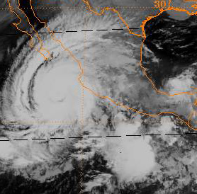
Track=Rosa 1994 track.png
Dissipated=October 15
1-min winds=90
Pressure=974La Concepcion on the morning of October 14. Rosa quickly decayed over the mountains of Mexico, and its cloud shield rapidly accelerated northward through the United States, spreading moisture.cite web|url=http://www.nhc.noaa.gov/archive/storm_wallets/epacific/ep1994-prelim/rosa/prelim01.gif|title=Preliminary Report Hurricane Rosa|date=1994-11-22|author=Lixion Avila |format=GIF|publisher=National Hurricane Center |accessdate=2008-09-24|pages=1]On October 12, a hurricane watch was issued for the coast from
Culiacan toManzanillo and theBaja California Peninsula south of latitude 24°N. At the same time, a tropical storm warning was issued from Manzanillo toTepic . On October 14, a hurricane warning was issued for the coast between Culiacan andCabo Corrientes , and a tropical storm warning south of Cabo Corrientes to Manzanillo. All watches and warnings were lifted later that day.cite web|url=http://www.nhc.noaa.gov/archive/storm_wallets/epacific/ep1994-prelim/rosa/prelim05.gif|title=Preliminary Report Hurricane Rosa|date=1994-11-22|author=Lixion Avila |format=GIF|publisher=National Hurricane Center |accessdate=2008-09-24|pages=5]Four deaths, two in each of
Nayarit andDurango , were reported. Four people were missing inSinaloa . All of the deaths were due todrowning . More than 100,000 people had their homes damaged in Nayarit.Telephone pole s and power lines were downed in Sinaloa. Rain causedlandslide s and flash-flooding in mountainous areas. InJalisco , mudslides forced the evacuation of 400 people from two coastal villages.cite news|page=3|url=http://www.thehurricanearchive.com/Viewer.aspx?|date=1994-10-15|publisher=
Chicago Daily Herald |title=Mexican West Coast Survives Hurricane|accessdate=2008-09-26] The highest rainfall total in Mexico was convert|14.09|in|mm at Mesa de Pedro Pablo.cite web|publisher=Hydrometeorological Prediction Center |author=David M. Roth |url=http://www.hpc.ncep.noaa.gov/tropical/rain/rosa1994filledrainblk.gif|accessdate=2008-09-24|title=Hurricane Rosa|format=GIF] The moisture Rosa sent into the United States was a contributing factor in record rains in parts of southeasternTexas from October 15 to 19. Those rains caused flooding that killed 22 people, destroyed over 3000 homes, and caused 700 million USD (year unknown) in damage.cite web|url=http://pubs.usgs.gov/fs/fs-073-94/pdf/FS-94-073.pdf|title=Floods in Southeast Texas, October 1994|publisher=United States Geological Survey |format=PDF|accessdate=2008-09-24|year=January|year=1995]Tropical Storm Nona
Infobox Hurricane Small
Basin=EPac
Track=Nona 1994 track.png
Dissipated=October 26
1-min winds=35Atlantic Oceanographic and Meteorological Laboratory Hurricane Research Division|accessdate=2008-10-02]eason statistics
Impact
TC stats cyclone|cat=storm|name=Aletta|dates=June 18 – June 23
max-winds=50 |min-press=999|ace= .42TC stats cyclone|cat=storm|name=Bud|dates=June 27 – June 29
max-winds=45|min-press=1003|ace= 0.565TC stats cyclone|cat=cat2|name=Carlotta|dates=June 28 – July 5
max-winds=100|min-press=967|ace= 10.5TC stats table end|num-cyclones-text="'17 cyclones|dates=June 18 – October 26|max-winds=175|min-press=920
num-cyclones-text=22 cyclones|tot-ace=185|num-landfalls=1|tot-da
tot-deaths=4–30Timeline
ImageSize = width:799 height:201PlotArea = top:10 bottom:80 right:20 left:20 Backgroundcolors = canvas:canvas
BarData = barset:Hurricane bar:Month
PlotData=
barset:Hurricane width:10 align:left fontsize:S shift:(4,-4) anchor:till from:18/06/1994 till:23/06/1994 color:TS text:"Aletta" from:27/06/1994 till:29/06/1994 color:TS text:"Bud" from:28/06/1994 till:05/07/1994 color:C2 text:"Carlotta" from:08/07/1994 till:14/07/1994 color:TS text:"Daniel" from:16/07/1994 till:25/07/1994 color:C5 text:"Emilia" from:19/07/1994 till:24/07/1994 color:TS text:"Fabio" from:21/07/1994 till:31/07/1994 color:C5 text:"Gilma" from:31/07/1994 till:12/08/1994 color:C1 text:"Li" barset:break from:07/08/1994 till:10/08/1994 color:TS text:"Hector" from:09/08/1994 till:14/08/1994 color:TD text:"One-C" from:10/08/1994 till:14/08/1994 color:C1 text:"Ileana" from:11/08/1994 till:10/09/1994 color:C5 text:"John" from:12/08/1994 till:15/08/1994 color:TD text:"Twelve-E" from:28/08/1994 till:05/09/1994 color:C2 text:"Kristy" from:03/09/1994 till:10/09/1994 color:C4 text:"Lane" from:06/09/1994 till:09/09/1994 color:TS text:"Mele" barset:break from:15/09/1994 till:21/09/1994 color:TS text:"Miriam" from:22/09/1994 till:29/09/1994 color:TS text:"Norman" from:24/09/1994 till:30/09/1994 color:C4 text:"Olivia" barset:skip from:13/09/1994 till:14/09/1994 color:TS text:"Paul" barset:break from:08/10/1994 till:15/10/1994 color:C2 text:"Rosa" from:21/10/1994 till:26/10/1994 color:TS text:"Nona" barset:skip
bar:Month width:7 align:center fontsize:S shift:(0,-20) anchor:middle color:canvas from:15/05/1994 till:01/06/1994 text:May from:01/06/1994 till:01/07/1994 text:June from:01/07/1994 till:01/08/1994 text:July from:01/08/1994 till:01/09/1994 text:August from:01/09/1994 till:01/10/1994 text:September from:01/10/1994 till:01/11/1994 text:October from:01/11/1994 till:01/12/1994 text:November
TextData = pos:(570,30) text:"(From the" pos:(617,30) text:"
Saffir-Simpson Hurricane Scale )"The season began with the formation of Tropical Depression One-E on June 18 and ended with the dissipation of Tropical Depression Nona on October 26. No named systems formed in May, three in June, four in July, five in August, six in September, two in October, and none in November. The total length of the season, from the formation of the first depression to the dissipation of the last, was 130 days.
Accumulated Cyclone Energy (ACE)
Accumulated Cyclone Energy (ACE) is a measure of how active a hurricane season is. It is calculated by squaring the windspeed of a cyclone with at least tropical storm-force winds every six hours, summing the results, and dividing that total by 104. As a tropical cyclone does not have gale-force winds until it becomes a tropical storm, tropical depressions are not included in these tables. For all storms, ACE is given to threesignificant figures . The ACE in the east Pacific proper (140°W to North America) is given; the ACE in the central Pacific (the international dateline to 140°W) is given in brackets. The table includes the ACE for Li and John only during those storm's time east of the dateline. Their ACE west of the dateline is part of the totals of the 1994 typhoon season.The
National Hurricane Center uses ACE to rank hurricane seasons as above-normal, near-normal, and below-normal. It defines below-normal as having an ACE less than 95*104 kt2 kt2; It defines above normal as having an ACE above 150*104 kt2 along with the numbers of any two of the following above average: tropical storms (15), hurricanes (9), or major hurricanes (4); It defines near-normal as having an ACE between 100*104 kt2 and 150*104 kt2, or an ACE above 150*104 kt2 with fewer than two of the numbers of the following above average: tropical storms (15), hurricanes (9), or major hurricanes (4).This season has a total of seventeen tropical storms, nine hurricanes, and five major hurricanes. The total ACE of this season is 185*104 kt2. This qualifies this season as above-normal.
torm names
The following names were used for named storms that formed in the eastern Pacific in 1994; names that were not assigned are marked in gray. No names were retired, so it was used again in the 2000 season. This is the same list used for the 1988 season except for Ileana, which replaced Iva. A storm was named Ileana for the first time in 1994.
Three names were used from the Central Pacific list - Li, Mele and Nona. This was the first usage for all of these names.
ee also
*
List of Pacific hurricanes
*List of Pacific hurricane seasons
*1994 Atlantic hurricane season
*1994 Pacific typhoon season
*1994 North Indian Ocean cyclone season
*Southern Hemisphere tropical cyclone seasons: 1993–94, 1994–95References
External links
* [http://www.nhc.noaa.gov/archive/storm_wallets/epacific/ep1994/ NHC 1994 Pacific hurricane season archive]
* [http://www.prh.noaa.gov/cphc/summaries/#1994 Central Pacific Hurricane Center archive]


_id:GP_value:red_id:TD_value:rgb(0.38,0.73,1)_legend:Tropical_Depression_=_<39_mph_(0-62_km/h)_id:TS_value:rgb(0,0.98,0.96)_legend:Tropical_Storm_=_39-73_mph_(63-117_km/h)_id:C1_value:rgb(1,1,0.80)_legend:Category_1_=_74-95_mph_(119-153_km/h)_id:C2_value:rgb(1,0.91,0.46)_legend:Category_2_=_96-110_mph_(154-177_km/h)_id:C3_value:rgb(1,0.76,0.25)_legend:Category_3_=_111-130_mph_(178-209-km/h)_id:C4_value:rgb(1,0.56,0.13)_legend:Category_4_=_131-155_mph_(210-249_km/h)_id:C5_value:rgb(1,0.38,0.38)_legend:Category_5_=_>=156_mph_(>=250_km/h))
Wikimedia Foundation. 2010.