- 2000 Pacific hurricane season
Infobox hurricane season
Basin=EPac
Year=2000
Track=2000 Pacific hurricane season map.pngMay 22 ,2000
Last storm dissipated=November 8 ,2000
Strongest storm name=Carlotta
Strongest storm winds=135
Strongest storm pressure=932
Average wind speed=1
Total depressions=21
Total storms=19
Total hurricanes=6
Total intense=2
Fatalities=18
Da
Inflated=1
five seasons=1998, 1999, 2000, 2001, 2002tropical cyclone meteorology . There were few notable storms this year. Tropical Storms Miriam, Norman, and Rosa all made landfall inMexico with minimal impact. Hurricane Daniel briefly threatened theU.S. state ofHawaii while weakening. Hurricane Carlotta was the strongest storm of the year and the second strongest June hurricane in recorded history. It killed 18 people when it sank a freighter.__TOC__
eason Summary
The 2000 Pacific hurricane season officially started on
May 15 ,2000 in the eastern Pacific, and onJune 1 ,2000 in the central Pacific, and lasted untilNovember 30 ,2000 . These dates conventionally delimit the period of each year when most tropical cyclones form in the northeasternPacific Ocean .This season had an above average number of storms. However, it had a below average number of hurricanes and major hurricanes. There were also two tropical depressions that did not reach storm strength. In the central Pacific, two tropical storms formed. The first storm formed on
May 22 and the last storm dissipated onNovember 8 .Hurricane Aletta
Infobox Hurricane Small
Basin=EPac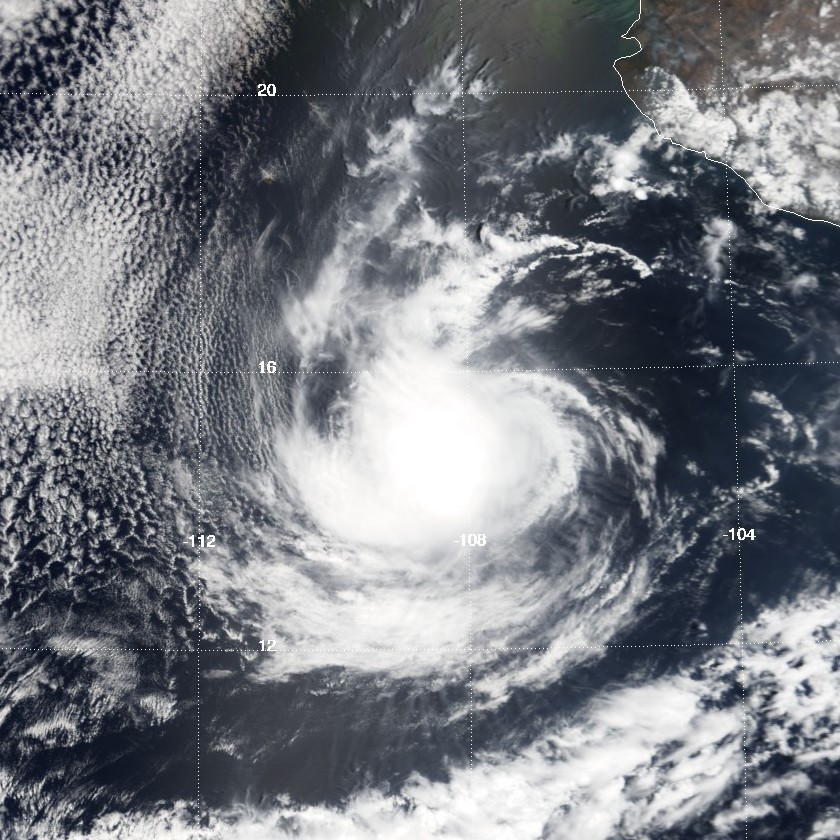
Track=Aletta 2000 track.pngMay 22
Dissipated=May 28
1-min winds=90
Pressure=970Central America onMay 18 and 19 and moved south of theGulf of Tehuantepec onMay 20 . The wave did not increase in organization for the next couple of days, but onMay 22 , deepconvection developed near its center, and became the first tropical depression of the season, while located south ofAcapulco ,Mexico .cite web|url=http://www.nhc.noaa.gov/2000aletta.html|title=TPC PACIFIC ALETTA 2000 TROPICAL CYCLONE REPORT|author=Richard J. Pasch|year=2000|work=National Hurricane Center |accessdate=2007-04-28] A mid-levelridge kept the depression moving west northwestwards, preventing it from moving towards the Mexican coast.cite web|url=http://www.nhc.noaa.gov/archive/2000/dis/NEP0100.001.html|title=NHC Advisory Archive - Tropical Depression One-E Discussion #1|author=Franklin|year=2000|work=National Hurricane Center |accessdate=2007-04-28] It slowly intensified, reaching tropical storm intensity early onMay 23 , while located 220 mi (350 km) south ofZihuatanejo , Mexico. Aletta was the first tropical storm in May since the 1996 season, and the first named storm in May since the 1991 season, as the storm in 1996 was not given a name. When, Aletta was named, its motion changed from west northwestward to westward, as well as decreasing its speed. Aletta continued to intensify slowly, but it began to deepen more rapidly onMay 24 , as thewind shear that inhibited Aletta from intensifying eased off. The storm was upgraded to a hurricane on the same day and peaked as a Category 2 hurricane six hours later, with a 1-min sustained wind speed of 105 mph (165 km/h). Its Category 2 intensity was unexpected, as it was forecast earlier that day only suggested Aletta to reach Category 1 intensity.cite web|url=http://www.nhc.noaa.gov/archive/2000/dis/NEP0100.009.html|title=NHC Advisory Archive - Hurricane Aletta Discussion #9|author=Avila|year=2000|work=National Hurricane Center |accessdate=2007-04-28] The hurricane was forecast to intensify further to 110 mph (175 km/h),cite web|url=http://www.nhc.noaa.gov/archive/2000/dis/NEP0100.013.html|title=NHC Advisory Archive - Hurricane Aletta Discussion #13|author=Avila|year=2000|work=National Hurricane Center |accessdate=2007-04-28] but this did not materialize. OnMay 25 , Aletta begin to weaken due to increasing easterly shear. Also at this time, a trough eroded a ridge that was steering the movement of Aletta, causing the hurricane to remain almost stationary for the next two days. Directional wind shear, as well as the upwelling of cool ocean waters caused Aletta to weaken further. OnMay 27 , the cyclone was expected to maintain its intensity and possibly restrengthen,cite web|url=http://www.nhc.noaa.gov/archive/2000/dis/NEP0100.020.html|title=NHC Advisory Archive - Tropical Storm Aletta Discussion #20|author=Franklin|year=2000|work=National Hurricane Center |accessdate=2007-04-28] but the storm continued to weaken rapidly and was downgraded to a tropical depression later that day dissipated onMay 28 due to cool ocean waters, while located well south ofCabo San Lucas , slowly drifting northwards. Its remnants lingered in the same area for the next several days.Aletta caused no known damages or casualties. However, the
National Hurricane Center advised parts of Mexico of possible heavy rainfall from the storm's outer bands when the storm was developing on May 23.cite web|url=http://www.nhc.noaa.gov/archive/2000/dis/NEP0100.003.html|title=NHC Advisory Archive - Tropical Depression One-E Discussion #3|author=Lawrence|year=2000|work=National Hurricane Center |accessdate=2007-04-28] Hurricane Aletta was the second-strongest May hurricane. As of the start of the 2006 season, it is the fourth-most intense.
* NHC [http://www.nhc.noaa.gov/2000aletta.html archive] for Aletta.Tropical Storm Bud
Infobox Hurricane Small
Basin=EPac
Track=Bud 2000 track.pngJune 13
Dissipated=June 17
1-min winds=45
Pressure=994Africa onMay 22 . It moved across theAtlantic Ocean andCaribbean Sea , then into the easternPacific Ocean onJune 6 with little development. The tropical wave remained disorganized untilJune 11 when a broadlow pressure area developed southwest ofAcapulco ,Mexico . The wave was only intensifying slowly, and onJune 13 , it became strong enough to be designated as a tropical depression. It quickly strengthened to tropical storm intensity six hours later, and moved to the northwest.cite web|url=http://www.nhc.noaa.gov/2000bud.html|title=TPC PACIFIC BUD 2000 TROPICAL CYCLONE REPORT|author=Jack Beven|year=2000|work=National Hurricane Center |accessdate=2007-04-29] It was forecast to strengthen to a strong tropical storm with winds reaching 70 mph (110 km/h),cite web|url=http://www.nhc.noaa.gov/archive/2000/dis/NEP0200.003.html|title=NHC Advisory Archive - Tropical Storm Bud Discussion #3|author=Lawrence|year=2000|work=National Hurricane Center |accessdate=2007-04-29] but the storm only reached a peak intensity of 50 mph (85 km/h) early onJune 14 . Bud turned to the north-northwest, and slowly weakened fromJune 15 onwards, due to increasing verticalwind shear and cooler ocean water temperatures. The storm's forward speed decreased and began to meander, as the ridge to the north of Bud weakens and a trough develops over the westernUnited States .cite web|url=http://www.nhc.noaa.gov/archive/2000/dis/NEP0200.008.html|title=NHC Advisory Archive - Tropical Storm Bud Discussion #8|author=Avila|year=2000|work=National Hurricane Center |accessdate=2007-04-29] It drifted erratically while located just north ofSocorro Island , and was downgraded to a tropical depression onJune 16 . By the next day, it dissipated into an area of low pressure, however, it continued to exist untilJune 19 .Bud passed near Socorro Island on June 15, with estimated 1-min winds of 45 mph (75 km/h), and caused large waves along the western coast of Mexico. However, no reports of damage or casualties were received.
* NHC [http://www.nhc.noaa.gov/2000bud.html archive] for Bud.Hurricane Carlotta
Infobox Hurricane Small
Basin=EPac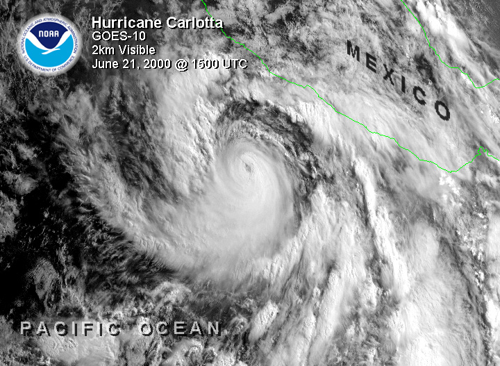
Track=Carlotta 2000 track.pngJune 18
Dissipated=June 25
1-min winds=135
Pressure=932June 18 . It strengthened into a stormJune 19 and a hurricane the next day. Carlotta then began explosively deepening, and it strengthened into a Category 4 hurricane onJune 21 . It then began to reduce its forward speed and slowly weaken as its path paralleled the Pacific coast of Mexico. Carlotta weakened to a storm onJune 24 and a depressionJune 25 . The cyclone dissipated shortly thereafter.Though it never made landfall, Carlotta killed 18 people when it sunk the Lithuanian
freighter "M/V Linkuva". Carlotta is also the second most intense June tropical cyclone in the east Pacific; only Ava of 1973 was stronger.
* NHC [http://www.nhc.noaa.gov/2000carlotta.html archive] for Carlotta.Tropical Depression Four-E
Infobox Hurricane Small
Basin=EPac
Track=4-E 2000 track.pngJuly 6
Dissipated=July 7
1-min winds=25
Pressure=1007tropical wave that spawned Tropical Depression Two in theAtlantic Ocean . The tropical wave crossedCentral America betweenJune 30 andJuly 1 , continuing to move westward into thePacific Ocean . The wave became more organized onJuly 6 and theNational Hurricane Center started issuing advisories on the newly developed tropical depression later that day.cite web|url=http://www.nhc.noaa.gov/2000four-e.html|title=TPC PACIFIC FOUR-E 2000 TROPICAL CYCLONE REPORT|author=Lixion A. Avila|year=2000|work=National Hurricane Center |accessdate=2007-05-11] The hurricane center predicted that the depression will reach tropical storm intensity, as there was a lack of vertical wind shear around the system andsea surface temperature s were warm enough for intensification to occur.cite web|url=http://www.nhc.noaa.gov/archive/2000/dis/NEP0400.001.html|title=NHC Advisory Archive - Tropical Depression Four-E Discussion #1|author=Stewart / Pasch|year=2000|work=National Hurricane Center |accessdate=2007-05-11] The depression lacked any deepconvection , however, and it began weakening on the next day.cite web|url=http://www.nhc.noaa.gov/archive/2000/dis/NEP0400.003.html|title=NHC Advisory Archive - Tropical Depression Four-E Discussion #3|author=Stewart|year=2000|work=National Hurricane Center |accessdate=2007-05-11] It was dissipating late in the day as the storm moved into an area of stronger wind shear.cite web|url=http://www.nhc.noaa.gov/archive/2000/dis/NEP0400.004.html|title=NHC Advisory Archive - Tropical Depression Four-E Discussion #4|author=Pasch|year=2000|work=National Hurricane Center |accessdate=2007-05-11]
* NHC [http://www.nhc.noaa.gov/2000four-e.html archive] for 4E.Tropical Depression Five-E
Infobox Hurricane Small
Basin=EPac
Track=5-E 2000 track.pngJuly 22
Dissipated=July 23
1-min winds=30
Pressure=1005July 8 when atropical wave moved off the westAfrica n coast. It entered the easternPacific Ocean onJuly 16 after tracking over theCaribbean Sea . The wave developed to a tropical depression onJuly 22 .cite web|url= http://www.nhc.noaa.gov/2000five-e.html|title=TPC PACIFIC FIVE-E 2000 TROPICAL CYCLONE REPORT|author=Stacy R. Stewart|year=2000|work=National Hurricane Center |accessdate=2007-05-11] It lacked any deepconvection and it was moving over cold waters, so it never intensified further to a tropical storm.cite web|url=http://www.nhc.noaa.gov/archive/2000/dis/NEP0500.003.html|title=NHC Advisory Archive - Tropical Depression Five-E Discussion #3|author=Pasch|year=2000|work=National Hurricane Center |accessdate=2007-05-11] The depression dissipated late onJuly 23 , one day after it formed to a depression.cite web|url=http://www.nhc.noaa.gov/archive/2000/dis/NEP0500.004.html|title=NHC Advisory Archive - Tropical Depression Five-E Discussion #4|author=Beven|year=2000|work=National Hurricane Center |accessdate=2007-05-11]
* NHC [http://www.nhc.noaa.gov/2000five-e.html archive] for 5E.Tropical Storm Upana
Infobox Hurricane Small
Basin=EPac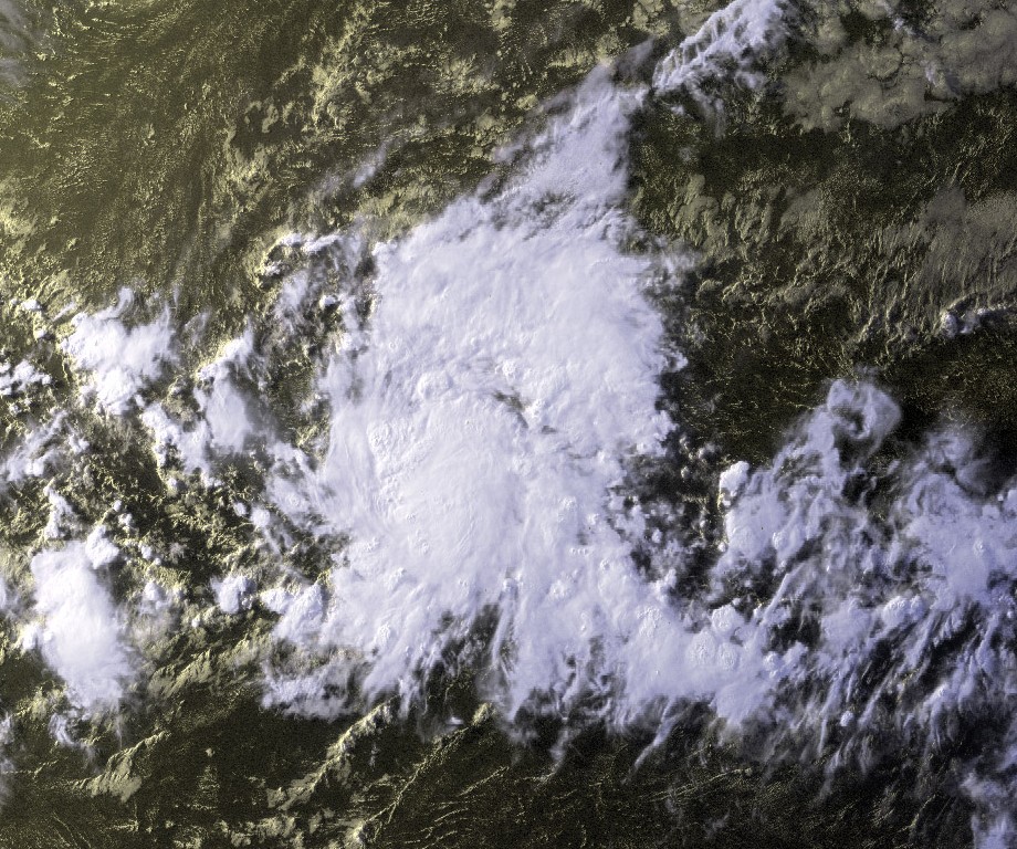
Track=Upana 2000 track.pngJuly 20
Dissipated=July 23
1-min winds=40
Pressure=1006July 20 while located southeast of theHawaiian Islands . It strengthened slowly and moved nearly due west, before reaching storm strength later on July 20. The storm was named Upana, which is Hawaiian for "Urban". Despite a favourable environment, Upana strengthened little, reaching a peak intensity onJuly 21 with winds of 50 mph (85 km/h). The storm had no deepconvection in its circulation onJuly 22 , and was downgraded to a tropical depression in the afternoon. Late onJuly 23 , deep convection flared up, briefly strengthening the storm, but failed to become a tropical storm again, as it remained poorly organized. It dissipated onJuly 24 , despite a low shear environment favorable for development.cite web|url= http://www.prh.noaa.gov/cphc/summaries/2000.php#upana|title=The 2000 Central Pacific Tropical Cyclone Season - Tropical Storm Upana|author=Kodama, K. et al.
year=2000|work=National Hurricane Center |accessdate=2007-05-11]Upana is the first storm in the
Central Pacific Hurricane Center 's area of responsibility to be named in July, and the first tropical storm to develop in the region since Tropical Storm Paka in the 1997 season. Upana's remnants continued moving to the west, and it crossed theInternational Date Line onJuly 26 . The remnants encountered a favorable environment just west of the dateline, and they formed into Tropical Depression 12W. The depression strengthened into Tropical Storm Chanchu. The name Chanchu, submitted byMacau , is a Chinese word forpearl . Chanchu moved north, and had dissipated byJuly 30 .cite web|url=http://www.australiansevereweather.com/cyclones/2001/summ0007.htm|title=Monthly Global Tropical Cyclone Summary July 2000|author=Gary Padgett and John Wallace|year=2000|accessdate=2007-05-11]Gary Padgett suggested that there was good evidence Chanchu was actually a regeneration of Upana. The official policy is that dateline crossers keep their name. However, there was supposedly some doubt at the time so Chanchu and Upana were officially treated as distinct tropical cyclones. Also, since Upana had dissipated several days earlier, and the
Joint Typhoon Warning Center had already assigned a new number for the system, Gary Padgett deemed it likely that theJapan Meteorological Agency 's decision to rename the cyclone was the best choice.
* CPHC [http://www.prh.noaa.gov/cphc/summaries/2000.php#upana archive] for Upana.
* Monthly global tropical cyclone summary for July found at Typhoon2000 [http://www.typhoon2000.ph/garyp_mgtcs/jul00.txt]Hurricane Daniel
Infobox Hurricane Small
Basin=EPac
Track=Daniel 2000 track.pngJuly 23
Dissipated=August 5
1-min winds=110
Pressure=954Hawaii as a tropical storm, but veered to the northwest as it approached the islands.No casualties or damaged was reported in association with Hurricane Daniel, despite the system's passing close enough to Hawaii to require tropical storm warnings. It still produced heavy surf conditions along the northern shores of the
Hawaiian Islands . Daniel was the first tropical cyclone to be a significant threat to Hawaii since 1994.
* NHC [http://www.nhc.noaa.gov/2000daniel.html archive] for Daniel.Tropical Storm Emilia
Infobox Hurricane Small
Basin=EPac
Track=Emilia 2000 track.pngJuly 26
Dissipated=July 30
1-min winds=55
Pressure=994July 11 , a tropical wave moved off theAfrica n coast, and moved to theLesser Antilles one week later. It passed overCentral America nearPanama onJuly 22 without any increase in organization. OnJuly 25 , the wave began to show curved banding, showing that it had become better organized. It intensified to a tropical depression onJuly 26 while located south southwest ofManzanillo ,Mexico , designated as Tropical Depression Seven-E. The depression was upgraded to Tropical Storm Emilia later that day while moving northwest, steered by a mid-level ridge to its north.cite web|url= http://www.nhc.noaa.gov/2000emilia.html|title=TPC PACIFIC EMILIA 2000 TROPICAL CYCLONE REPORT|author=Richard J. Pasch|year=2000|work=National Hurricane Center |accessdate=2007-05-11] During this time, Emilia was forecast to strengthen to a hurricane within two days, due to the system moving over warm waters.cite web|url=http://www.nhc.noaa.gov/archive/2000/dis/NEP0700.003.html|title=NHC Advisory Archive - Tropical Storm Emilia Discussion #3|author=Avila|year=2000|work=National Hurricane Center |accessdate=2007-05-11] However, late onJuly 27 , the storm began to accelerate, meaning that it will move into cooler waters sooner than firstly anticipated, therefore, only allowing the storm to intensify within a few hours before weakening.cite web|url=http://www.nhc.noaa.gov/archive/2000/dis/NEP0700.006.html|title=NHC Advisory Archive - Tropical Storm Emilia Discussion #6|author=Franklin|year=2000|work=National Hurricane Center |accessdate=2007-05-11] Emilia moved nearSocorro Island and it's intensity peaked with wind speeds of 65 mph (100 km/h), with an eyewall beginning to form. A few hours later, the storm moved into cooler waters and drier air, and Emilia's deepconvection dissipated, weakening the storm. Late onJuly 28 deep convection redeveloped near the storm's center, but wind shear prevented Emilia from strengthening.cite web|url=http://www.nhc.noaa.gov/archive/2000/dis/NEP0700.009.html|title=NHC Advisory Archive - Tropical Storm Emilia Discussion #9|author=Stewart / Lawrence|year=2000|work=National Hurricane Center |accessdate=2007-05-11] It turned to the west and weakened below tropical storm intensity onJuly 29 , as the deep convection in the storm diminished again.cite web|url=http://www.nhc.noaa.gov/archive/2000/dis/NEP0700.014.html|title=NHC Advisory Archive - Tropical Depression Emilia Discussion #14|author=Lawrence|year=2000|work=National Hurricane Center |accessdate=2007-05-11] It shortly dissipated while located several hundred miles west south-west ofCabo San Lucas ,Mexico .
* NHC [http://www.nhc.noaa.gov/2000emilia.html archive] for Emilia.Tropical Storm Fabio
Infobox Hurricane Small
Basin=EPac
Track=Fabio 2000 track.pngAugust 3
Dissipated=August 8
1-min winds=45
Pressure=1000
* NHC [http://www.nhc.noaa.gov/2000fabio.html archive] for Fabio.Hurricane Gilma
Infobox Hurricane Small
Basin=EPac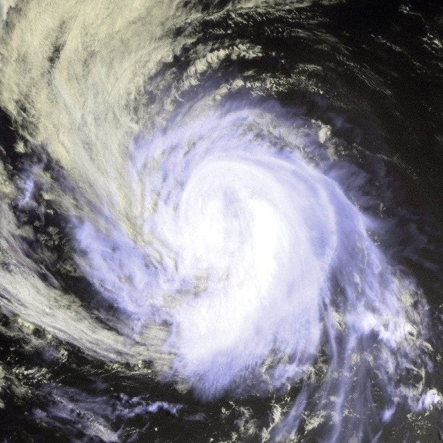
Track=Gilma 2000 track.pngAugust 5
Dissipated=August 11
1-min winds=70
Pressure=984
* NHC [http://www.nhc.noaa.gov/2000gilma.html archive] for Gilma.Hurricane Hector
Infobox Hurricane Small
Basin=EPac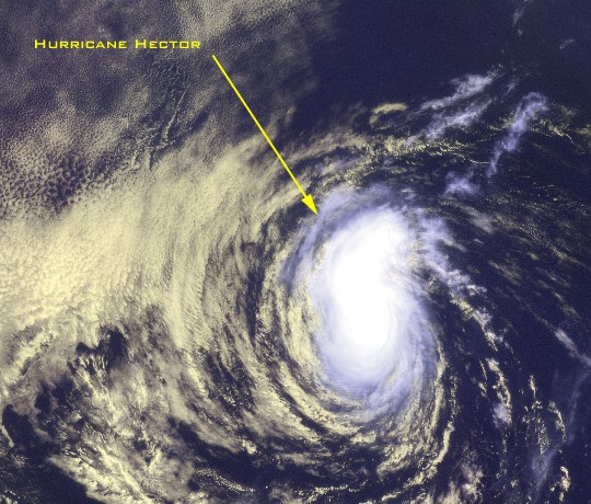
Track=Hector 2000 track.pngAugust 10
Dissipated=August 16
1-min winds=70
Pressure=983
* NHC [http://www.nhc.noaa.gov/2000hector.html archive] for Hector.Tropical Storm Ileana
Infobox Hurricane Small
Basin=EPac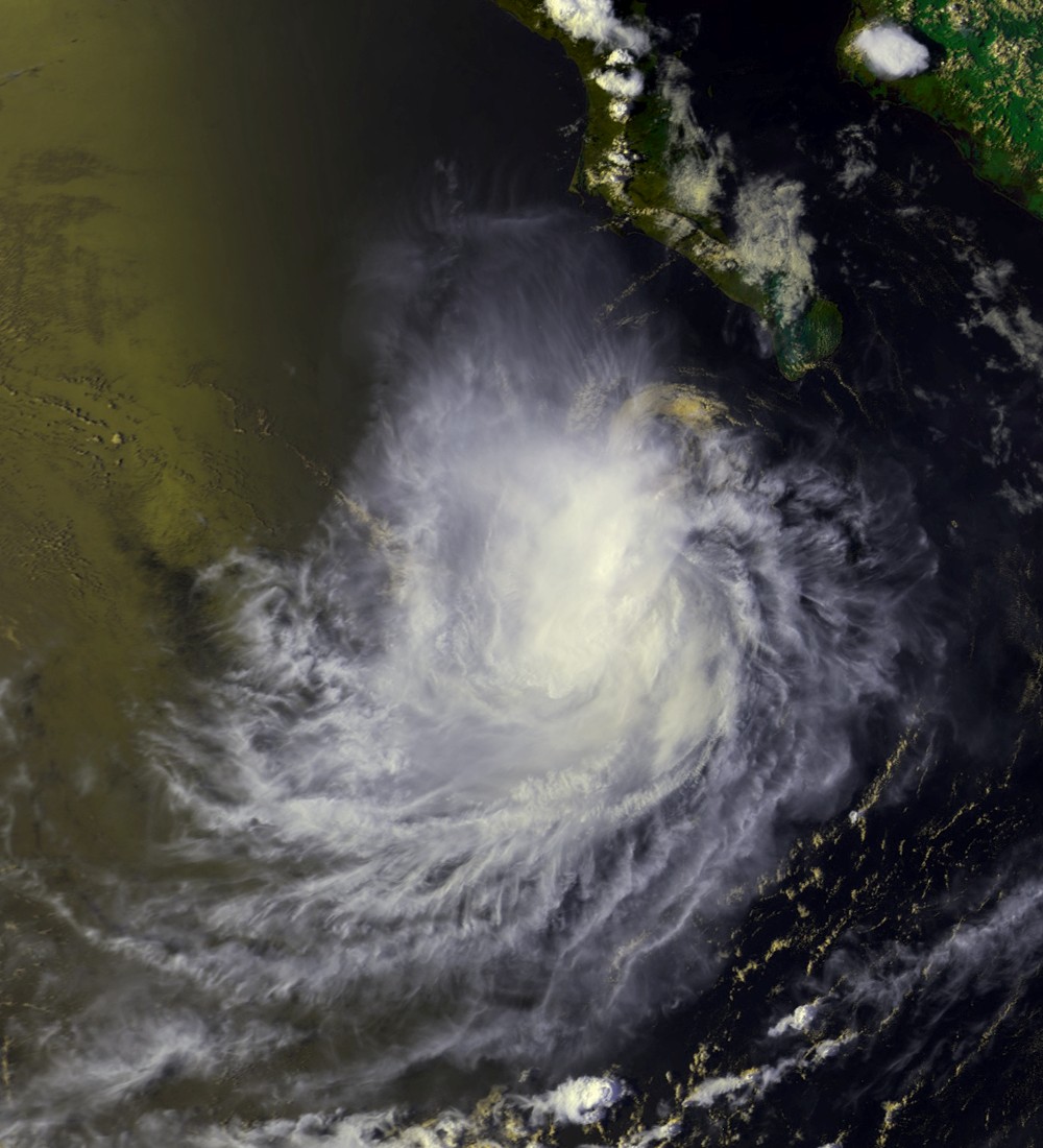
Track=Ileana 2000 track.pngAugust 13
Dissipated=August 17
1-min winds=60
Pressure=991
* NHC [http://www.nhc.noaa.gov/2000ileana.html archive] for Ileana.
* HPC [http://www.hpc.ncep.noaa.gov/tropical/rain/ileana2000.html rainfall page] for Ileana.Tropical Storm Wene
Infobox Hurricane Small
Basin=EPac
Track=Wene 2000 track.pngAugust 15
Dissipated=August 17
1-min winds=45
Pressure=1002August 15 while located 1700 miles to the northwest ofHonolulu, Hawaii . It moved eastward along the west- east oriented surface pressure trough, and crossed theInternational Date Line later on the 15th. Warmer than usual water temperatures allowed the system to intensify despite its unusually high latitude, and it became Tropical Storm Wene on the 16th. It quickly attained a peak intensity of 50 mph, but weakened due to cooler waters and wind shear. Wene continued to weaken, and dissipated when the storm merged with an extratropical cyclone.As a depression, Wene was the first, and currently is the most recent Western Pacific tropical cyclone to cross the dateline since the 1996 season. The name Wene is Hawaiian for "Wayne".
* CPHC [http://www.prh.noaa.gov/cphc/summaries/2000.php#wene archive] for Wene.
* Monthly global tropical cyclone tracks for August found at Typhoon2000 [http://www.typhoon2000.ph/garyp_mgtcs/aug00tks.txt]Tropical Storm John
Infobox Hurricane Small
Basin=EPac
Track=John 2000 track.pngAugust 28
Dissipated=September 1
1-min winds=60
Pressure=994
* NHC [http://www.nhc.noaa.gov/2000john.html archive] for John.Tropical Storm Kristy
Infobox Hurricane Small
Basin=EPac
Track=Kristy 2000 track.pngAugust 31
Dissipated=September 3
1-min winds=35
Pressure=1004August 31 . Despite significant shear, the depression strengthened into Tropical Storm Kristy as it meandered far from land over the open ocean. The shear then destroyed the system onSeptember 3 where it was at a place just 210 kilometers from where it first organized. There were no effects anywhere.
* NHC [http://www.nhc.noaa.gov/2000kristy.html archive] for Kristy.Hurricane Lane
Infobox Hurricane Small
Basin=EPac
Track=Lane 2000 track.pngSeptember 5
Dissipated=September 14
1-min winds=85
Pressure=967September 5 . It moved westward and strengthened into Tropical Storm Lane later that day. OnSeptember 6 , Lane then started increasing in size, perhaps due to a merger with a larger low-pressure area, and started doing a loop. Loops are rare in the eastern Pacific basin. During the loop, Lane passed over its own wake and weakened slightly.When the loop was finished on
September 8 , Lane resumed its previous course and strengthened into a hurricane. Lane peaked onSeptember 10 and then weakened steadily over cooler waters. Atrough recurved the tropical storm. Lane dissipated onSeptember 14 , while located at 32°N, an unusually northerly location. Itsremnant low made it toCalifornia .Lane's large eye passed directly over
Socorro Island , where a weather station recorded a pressure of 973 millibars. [http://nhc.boulder.noaa.gov/2000lane.html NHC Report on Lane] ] . The hurricane's large circulation caused rains and gusty winds over parts ofMexico , disrupting several ports. [Reuters (2000) [http://archives.cnn.com/2000/WORLD/americas/09/11/weather.mexico.lane.reut/ Hurricane Lane shuts Mexican ports, brings rain] "CNN ".] , and its remnant low hitCalifornia . At all locations, effects were minimal, with no reports of damage or casualties.
* NHC [http://www.nhc.noaa.gov/2000lane.html archive] for Lane.Tropical Storm Miriam
Infobox Hurricane Small
Basin=EPac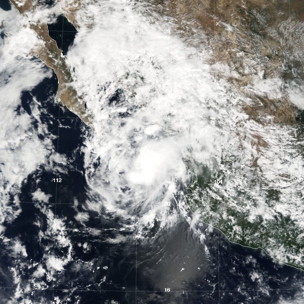
Track=Miriam 2000 track.pngSeptember 15
Dissipated=September 17
1-min winds=35
Pressure=1004Africa onAugust 29 . It remained weak as it moved westward across the Atlantic Ocean, and entered the Eastern Pacific Ocean onSeptember 9 . As it moved west-northwestward, it organized, and developed into Tropical Depression 15-E on the 15th while 290 miles east-southeast ofCabo San Lucas ,Baja California Sur . Banding features became more pronounced, though convection remained intermittent. OnSeptember 16 , the depression briefly became Tropical Storm Miriam, though quickly weakened back to a tropical depression as it continued north-northwestward. Miriam dissipated on the 17th while 70 miles northeast of Cabo San Lucas. Tropical storm force winds were never reported, and it is possible Miriam never attained tropical storm status. [http://www.nhc.noaa.gov/2000miriam.html]Miriam dropped lighter than average rainfall upon Mexico, peaking at 7.68 inches (195 mm) at La Cruz/Elota. [
David M. Roth . [http://www.hpc.ncep.noaa.gov/tropical/rain/tcmaxima.html Tropical Storm Miriam Rainfall Page.] Retrieved on2007-07-19 .] Damage was relatively minimal from the storm, amounting to $770,000 (2000 USD) [http://www.proteccioncivil.gob.mx/upLoad/Publicaciones/ised_2000.pdf]
* NHC [http://www.nhc.noaa.gov/2000miriam.html archive] for Miriam.
* HPC [http://www.hpc.ncep.noaa.gov/tropical/rain/miriam2000.html rainfall page] for Miriam.Tropical Storm Norman
Infobox Hurricane Small
Basin=EPac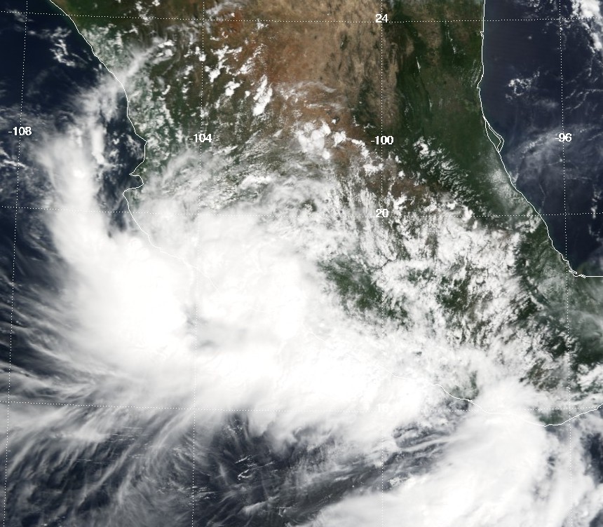
Track=Norman 2000 track.pngSeptember 20
Dissipated=September 22
1-min winds=45
Pressure=998September 18 . Its convection slowly organized while south ofMexico , and a tropical depression formed onSeptember 20 while 205 miles south-southeast ofManzanillo, Colima . Weak steering currents forced the depression to drift slowly northward, and later on the 20th it strengthened intoTropical Storm Norman . Norman quickly reached peak winds of 50 mph before making landfall in western Mexico. The storm rapidly weakened to a tropical depression over land, but Norman maintained its circulation and some deep convection as it turned to the northwest. It emerged over water on the 22nd, but turned to the northeast, made landfall again in Mexico, and dissipated late on the 22nd. [ [http://www.nhc.noaa.gov/2000norman.html TPC PACIFIC NORMAN 2000 TROPICAL CYCLONE REPORT ] ]Norman produced heavy rainfall across western Mexico, peaking at nearly 16 inches (405 mm) in the state of
Colima . [David M. Roth . [http://www.hpc.ncep.noaa.gov/tropical/rain/norman2000.html Tropical Storm Norman Rainfall Page.] Retrieved on2007-07-19 .] In all, Norman caused $13.3 million (2000 USD) in damage. [ [http://www.proteccioncivil.gob.mx/upLoad/Publicaciones/ised_2000.pdf Microsoft Word - TEXTO2000.doc ] ]
* NHC [http://www.nhc.noaa.gov/2000norman.html archive] for Norman.
* HPC [http://www.hpc.ncep.noaa.gov/tropical/rain/norman2000.html rainfall page] for Norman.Tropical Storm Olivia
Infobox Hurricane Small
Basin=EPac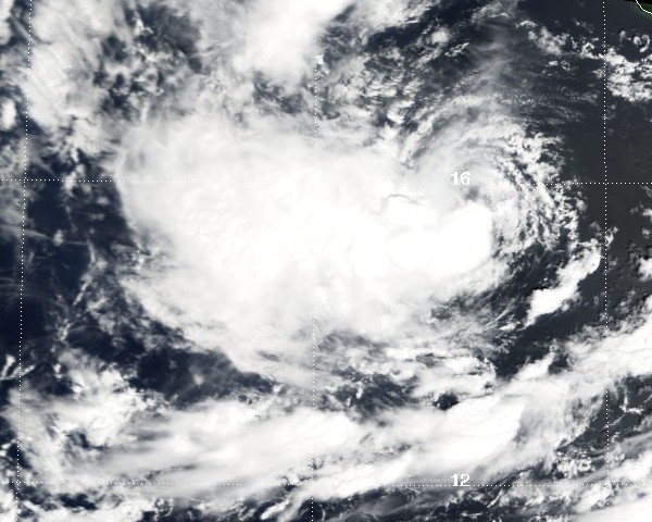
Track=Olivia 2000 track.pngOctober 2
Dissipated=October 10
1-min winds=55
Pressure=994
* NHC [http://www.nhc.noaa.gov/2000olivia.html archive] for Olivia.Tropical Storm Paul
Infobox Hurricane Small
Basin=EPac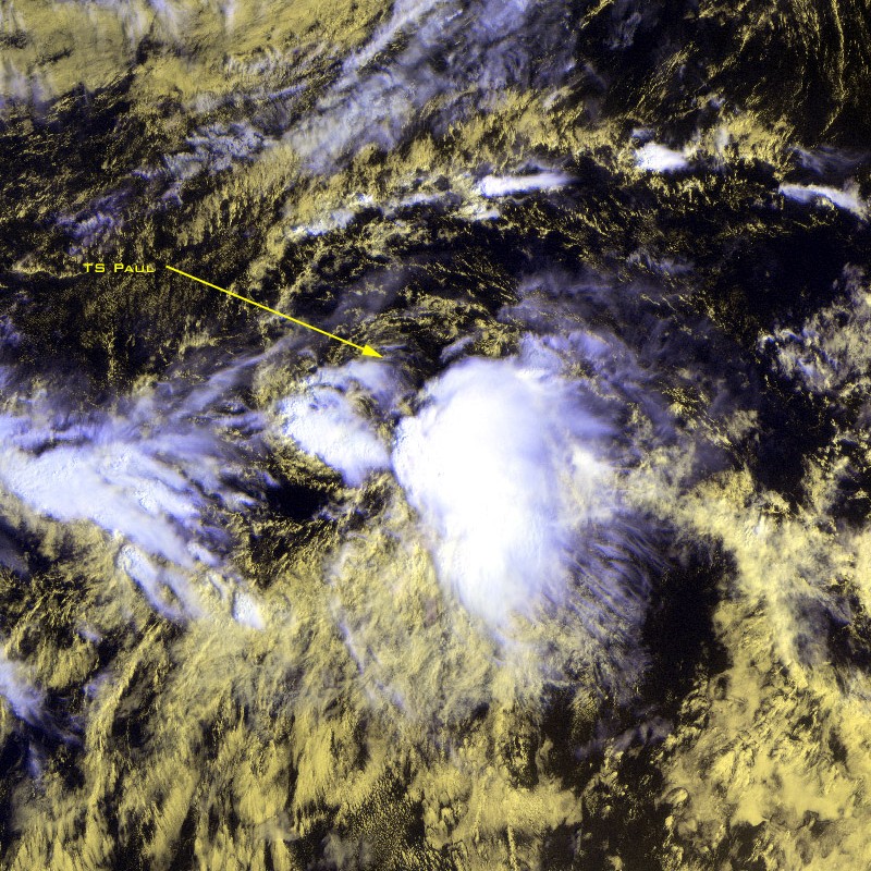
Track=Paul 2000 track.png
Dissipated=October 29
1-min winds=40
Pressure=1003intertropical convergence zone became was influenced by a tropical wave and started developing a circulation. It became Tropical Depression Eighteen-E on October 25. It headed generally westward at about convert|17|mph|km/h|abbr=on. It intensified into a tropical storm on October 26 and peaked right after that. It then slowly and was briefly pulled northwest by a trough. After resuming its westward path out to sea, Paul spun down. It dissipated on October 29.cite web|url=http://www.nhc.noaa.gov/2000paul.html|title=Tropical Cyclone Report Tropical Storm Paul|date=2000-11-18|author=Miles Lawrence|publisher=National Hurricane Center |accessdate=2008-09-25]Paul caused no impact while it was a tropical cyclone. However, its remnants eventually made it to the
Big Island of Hawaii . There, from November 1 to 3, they caused heavy one-day rainfall totals. The flooding caused 70 million (2000 USD) in damage. In the aftermath, the flooded areas were declared a disaster area. The highest total was convert|38.76|in|mm at Kapapala Ranch.cite web|url=David M. Roth |title=Remains of Paul|publisher=Hydrometeorological Prediction Center |accessdate=2008-09-25|url=http://www.hpc.ncep.noaa.gov/tropical/rain//paul2000.html] That rainfall total makes Paul Hawaii's second rainiest tropical cyclone, and the third rainiest overall.cite web|url=http://www.hpc.ncep.noaa.gov/tropical/rain/tcmaxima.html|title=Tropical Cyclone Point Maxima|author=David M. Roth |publisher=Hydrometeorological Prediction Center |accessdate=2008-09-25]Tropical Storm Rosa
Infobox Hurricane Small
Basin=EPac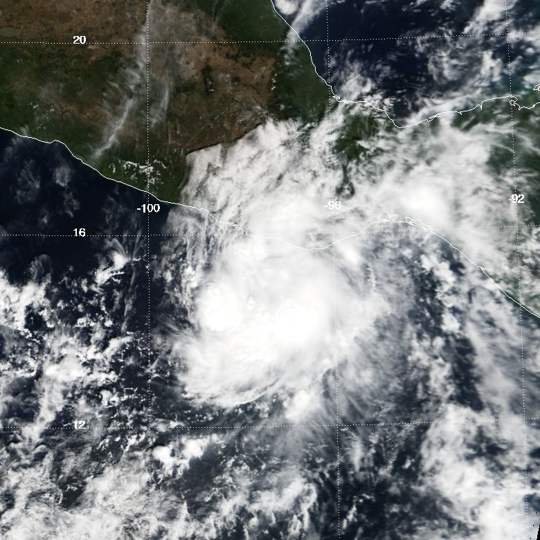
Track=Rosa 2000 track.pngNovember 3
Dissipated=November 8
1-min winds=55
Pressure=993Africa onOctober 18 . It showed signs of development in the southwesternCaribbean Sea , though moved into the East Pacific Ocean onNovember 1 before being able to develop further. Favorable conditions allowed the system to quickly organize, and the wave formed into Tropical Depression 19-E onNovember 3 while 230 miles south of theEl Salvador –Guatemala border. A ridge of high pressure to its north forced the depression westward, where it slowly organized into a tropical storm on the 5th. A mid-level trough eroded the high pressure system, allowing Rosa to turn more to the north. On the 6th, the storm reached a peak of 65 mph, though Rosa slowly weakened as it accelerated to the northeast. OnNovember 8 , the storm made landfall on the southern coast ofMexico with winds of 40 mph, and quickly dissipated. [http://www.nhc.noaa.gov/2000rosa.html]Rosa dropped moderate rainfall across Mexico, peaking at 15.32 inches (389 mm) near the Mexico/Guatemala border. [
David M. Roth . [http://www.hpc.ncep.noaa.gov/tropical/rain/rosa2000.html Tropical Storm Rosa Rainfall Page.] Retrieved on2007-07-19 .] Damage was minimal, totaling to only $15,000 (2000 USD). [ [http://www.proteccioncivil.gob.mx/upLoad/Publicaciones/ised_2000.pdf Microsoft Word - TEXTO2000.doc ] ]Rosa was the first November storm since Hurricane Rick in the 1997 season.
* NHC [http://www.nhc.noaa.gov/2000rosa.html archive] for Rosa.
* HPC [http://www.hpc.ncep.noaa.gov/tropical/rain/rosa2000.html rainfall page] for Rosa.torm names
The following names were used for named storms that formed in the eastern Pacific in 2000. Names that were not assigned are marked in gray. No names were retired, so it was used again in the
2006 Pacific hurricane season . This is the same list used for the 1994 season.Two names were used from the Central Pacific list - Upana and Wene. This was the first usage for both names.
ee also
*
List of Pacific hurricanes
*List of Pacific hurricane seasons
*2000 Atlantic hurricane season
*2000 Pacific typhoon season
*2000 North Indian Ocean cyclone season
*South-West Indian Ocean cyclone seasons: 1999–00, 2000–01
*Australian region cyclone seasons: 1999–00, 2000–01
*South Pacific cyclone seasons: 1999–00, 2000–01References
External links
* [http://www.nhc.noaa.gov/2000epac.html NHC 2000 Pacific hurricane season archive]
* [http://www.hpc.ncep.noaa.gov/tropical/rain/2000.html HPC 2000 Tropical Cyclone Rainfall Pages]
* [http://www.prh.noaa.gov/cphc/pages/hurrclimate.php#2000 Central Pacific Hurricane Center archive]

Wikimedia Foundation. 2010.