- 1996 Pacific hurricane season
Infobox hurricane season
Basin=EPac
Year=1996
Track=1996 Pacific hurricane season map.pngMay 13 ,1996
Last storm dissipated=November 11 ,1996
Strongest storm name=Douglas
Strongest storm pressure=946
Strongest storm winds=116
Average wind speed=1
Total depressions=14
Total storms=9
Total hurricanes=5
Total intense=2
Fatalities=10-51
Da
Inflated=
five seasons=1994, 1995, 1996, 1997, 1998May 15 ,1996 in the eastern north Pacific and onJune 1 ,1996 in the central north Pacific. It ended onNovember 30 ,1996 . These dates conventionally delimit the period of each year when most tropical cyclones form in the northeastern Pacific Ocean.Few notable storms formed this season, however it was very eventful. Twelve tropical cyclones formed during this season, of which five made landfall and two other impacted land areas. Two tropical cyclones that formed in other basins entered the eastern north
Pacific Ocean . Early in the season three tropical cyclones impactedMexico in a ten day span, while the first cyclone of the season formed before it officially began. Hurricane Douglas was the strongest storm, reaching Category 4 intensity on theSaffir-Simpson Hurricane Scale and had its beginnings in the Atlantic as Hurricane Cesar.eason summary
This hurricane season officially started on
May 15 ,1996 in the eastern Pacific, and onJune 1 ,1996 in the central Pacific, and lasted untilNovember 30 ,1996 . These dates limit the time period when most tropical cyclones form in the northeasternPacific Ocean . In actuality the season exceeded these limits slightly with the formation of Tropical Depression One-E onMay 13 and ended onNovember 11 with the dissipation of Tropical Depression Twelve-E.This season was below average in activity. In the eastern north Pacific, eleven tropical cyclones formed. Of these, four became hurricanes, one of which were major hurricanes because they reached Category 3 or higher on the
Saffir-Simpson Hurricane Scale . The remainder were tropical storms.cite web|title=The 1996 East Pacific Hurricane Season|url=http://www.nhc.noaa.gov/1996epac.html|author=National Hurricane Center |year=1996|accessdate=2007-02-23] In addition, oneAtlantic hurricane , Hurricane Cesar, crossed into this zone from the Atlantic Ocean and was renamed Douglas.cite web|title=Hurricane Douglas|author=Lixion Avila |date=1996-10-24|publisher=National Hurricane Center |url=http://www.nhc.noaa.gov/1996douglas.html|accessdate=2007-02-23] None of the systems in the eastern north Pacific crossed 140°W and entered the central Pacific. The last time that happened was in the 1979 season.cite web|title=Previous Tropical Systems of the Central Pacific|url=http://www.prh.noaa.gov/cphc/summaries/|author=Central Pacific Hurricane Center |accessdate=2007-02-23]In the central north Pacific, one tropical depression formed. In addition, a depression crossed the dateline from the western Pacific before dissipating in this basin. None of these two systems reached tropical storm strength.cite web|title=The 1996 Central Pacific Tropical Cyclone Season|url=http://www.prh.noaa.gov/cphc/summaries/1996.php|author=
Central Pacific Hurricane Center |accessdate=2007-02-23]In terms of the number of storms, the season was below average. Despite this, there were a large number of landfalls. Of note is the fact that three tropical cyclones approached close to Mexico during a ten-day span.cite web|title=Tropical Storm Cristina|url=http://www.nhc.noaa.gov/1996cristina.html|author=
Max Mayfield |date=1996-08-11|publisher=National Hurricane Center |accessdate=2007-02-08]torms
Tropical Storm One-E
Infobox Hurricane Small
Name=Tropical Storm One-E
Basin=EPac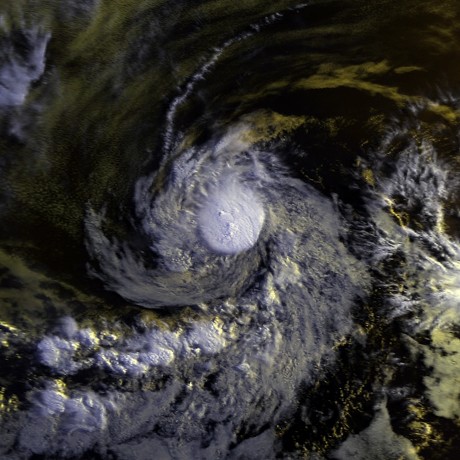
Track=1-E 1996 track.pngMay 13
Dissipated=May 16
1-min winds=45
Pressure=1000May 13 when a tropical wave in the open ocean organized into Tropical Depression One-E. The depression moved west-northwest and strengthened into a tropical storm onMay 14 . On that day, the tropical storm reached its peak intensity, with maximum sustained winds at convert|50|mi/h|km/h|abbr=on and a minimum central pressure of 1000 mb.cite web|author=Edward Rappaport|title=Unnamed tropical storm|url=http://www.nhc.noaa.gov/1996unnamed.html|date=1996-11-09|accessdate=2007-02-17|publisher=National Hurricane Center ]Wind shear steadily weakened the cyclone until it dissipated early onMay 17 . This system was the only tropical storm to form in May during the period from 1992-99.cite web|title=Monthly Global Tropical Cyclone Summary May 2006|url=http://australiasevereweather.com/cyclones/2006/summ0605.htm|author=Gary Padgett|accessdate=2007-02-17]One-E storm was not assigned a name because it was determined to be a tropical storm after the season was over. The storm was initially forecast to become a tropical storm, but information available at the time did not warrant the upgrade.cite web|url=http://www.nhc.noaa.gov/archive/storm_wallets/epacific/ep1996/unnamed/tropdisc/nep0196.001|author=Edward Rappaport|title=Tropical Depression One-E Discuission Number 1|publisher=
National Hurricane Center |date=1996-05-13|accessdate=2007-02-17] Subsequently, wind reports relayed from the US Coast Guard to theNational Hurricane Center suggested that this cyclone was a tropical storm.This tropical cyclone impacted two ships. The first - called the "True Blue" - was near the fringes of the storm and escaped. The other - the trimaran "Solar Wind" - provided wind observations until communications with the vessel were lost after 0600
UTC onMay 14 . Despite a search by the US Coast Guard, the ship and its two-person crew was never found.Tropical Depression Two-E
Infobox Hurricane Small
Basin=EPac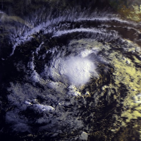
Track=2-E 1996 track.pngMay 15
Dissipated=May 19
1-min winds=30
Pressure=1006May 15 an area of disturbed weather in theIntertropical Convergence Zone developed into a tropical depression. The disturbance was not readily traceable back to a tropical wave from the Atlantic. On its first day of its existence, Tropical Depression Two-E was a well-organized system with maximum sustained winds of convert|35|mi/h|km/h|abbr=on and a minimum central pressure of 1006 mb.cite web|title=Brief Information about Tropical Depression Two-E|author=Richard Pasch|url=http://www.nhc.noaa.gov/1996td2e.html|date=1996-06-05|accessdate=2006-02-23] As it slowly moved west, Two-E experienced a few intermittent burts of convection. However, the depression gradually became less organized during the remainder of its life. OnMay 18 , the cyclone's organization deteriorated markedly until it dissipated the next morning.Tropical Depression Two-E never threatened land. Consequently, there were no reports of deaths or damage.
Hurricane Alma
Infobox Hurricane Small
Basin=EPac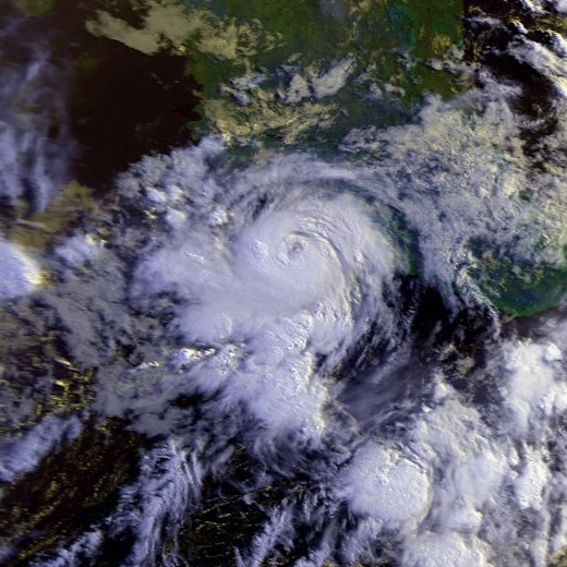
Track=Alma 1996 track.pngJune 20
Dissipated=June 27
1-min winds=90
Pressure=969June 20 , the southern part of the same tropical wave that spawned Tropical Storm Arthur in the Atlantic overcame shear to strengthen into Tropical Depression Three-E. It reached tropical storm intensity that same day. When the shear relaxed, Alma strengthened into a hurricane. Weak steering currents sent Alma towards the Mexican coast. It made landfall nearLázaro Cárdenas, Michoacán onJune 23 and almost immediately went back out to sea. Alma slowly paralleled the coast as the topography disrupted the cyclone's cirulation. Alma weakened to tropical storm intensity onJune 24 and to tropical depression intensity onJune 26 . It dissipated the next day. Alma's maximum winds were convert|90|kn|km/h and Alma's minimum pressure was 969 mb.cite web|title=Hurricane Alma|url=http://www.nhc.noaa.gov/1996alma.html|author=Lixion Avila |publisher=National Hurricane Center |date=1996-07-24|accessdate=2007-02-17]Hurricane Alma was the first of three consecutive storms to come close to, or make landfall on, the Pacific coast of
Mexico during a ten-day span. At least three, and possibly twenty, people were killed. Three were killed when a house near Lázaro Cárdenas collapsed. There were unconfirmed reports that 17 people were killed by floods in the state ofPuebla caused by Alma's rains. Trees were downed and power was knocked out to many places. Roads were flooded and covered with debris throughout the affected area.Hurricane Boris
Infobox Hurricane Small
Basin=EPac
Track=Boris 1996 track.pngJune 27
Dissipated=July 1
1-min winds=80
Pressure=979June 27 , a tropical wave developed convection and became Tropical Depression Four. It moved north and slowly intensified. The rate of intensification increased and the depression became a tropical storm onJune 28 . Boris reached hurricane intensity onJune 28 and peaked with winds of convert|80|kn|km/h and a central pressure of 979 mb.cite web|title=Hurricane Boris|url=http://www.nhc.noaa.gov/1996boris.html|author=Miles Lawrence|date=1996-08-15|publisher=National Hurricane Center|accessdate=2007-08-18] Boris then made landfall onJune 29 about midway between Lázaro Cárdenas andAcapulco . Boris then moved offshore after turning to the southwest and dissipated onJuly 1 while south ofPuerto Vallarta .Hurricane Boris was, in general, a well-forecast storm. Due to the short time when the system was at or above tropical storm intensity, long-range forecasts were not verified. The average errors were convert|101|nmi|km|abbr=on at one and a half days in the future. As Hurricane Boris was approaching Mexico, a tropical storm watch was issued for the coast between
Manzanillo and Puerto Escondido onJune 28 . From Manzanillo toPuerto Maldonado , the tropical storm replaced with a hurricane warning the same day.Boris caused at least five deaths. One person was killed in Tecpan. Nearby, three other people drowned and five fishers were missing. In Acapulco, a child was killed when a roof collapsed. Rain was heavy throughout the impacted region, with the highest totals in
Guerrero . A total of 12.16 in was recorded inCoyuca de Benítez . The highest total was 14.98 in at Paso de San Antonio, to the east of the point of landfall.cite web|title=Hurricane Boris|url=http://www.hpc.ncep.noaa.gov/tropical/rain/boris1996.html|publisher=Hydrometeorological Prediction Cente|accessdate=2007-02-15|year=2007] Those rains caused a flood on theSan Jeronimo River , which left at least 5000 homeless. In Tecpan, a countless number of homes were washed away.Tropical Storm Cristina
Infobox Hurricane Small
Basin=EPac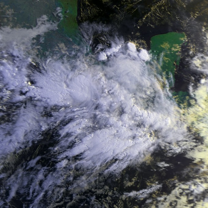
Track=Cristina 1996 track.pngJuly 1
Dissipated=July 3
1-min winds=60
Pressure=991July 1 , a tropical wave organized into Tropical Depression Five-E. The location of the depression was the easternmost since the depression that eventually became Hurricane Paul in the 1982 season.cite web|url=http://www.nhc.noaa.gov/tracks1949to2006_epa.txt|title=Eastern North Pacific Tracks File 1949-2006|publisher=National Hurricane Center |year=2007|accessdate=2007-02-18] Five-E strengthened into Tropical Storm Cristina onJuly 2 as it continued its west-northwest track. Cristina was almost a hurricane at the time of its landfall nearPuerto Angel onJuly 3 . It peak strength, which occurred at landfall, was convert|60|kn|km/h and 991 mb. Cristina dissipated over the mountains of Mexico onJuly 3 .As a whole, both Cristina's intensity and track were well-forecast. However, the tropical cyclone's short life made verification of a small number of forecasts limited. When Cristina was approaching, the Mexican government issued a tropical storm warning for the coast between
Tapachula andPunta Maldonado onJuly 2 .Tropical Storm Cristina killed one person, a fisherman, who was aboard a boat caught at sea. Another person from that boat was missing, and a third individual was rescued. Eleven other fishing boats, with a total of twenty-two people aboard, were missing. Their fate is unknown. The National Hurricane Center received no reports of damage due to Tropical Storm Cristina; however flooding due to
storm surge and damage from wind and rain was likely to have occurred.Tropical Depression Six-E
Infobox Hurricane Small
Basin=EPac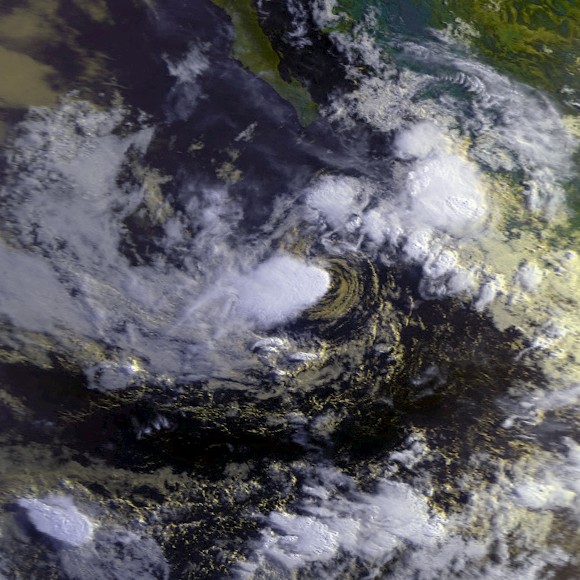
Track=6-E 1996 track.pngJuly 4
Dissipated=July 6
1-min winds=30
Pressure=1003July 4 , a persistent area of thunderstorms organized into a tropical depression. Weak steering currents slowly moved it northwest.cite web|title=Tropical Depression Six-e Discussion Number 1|author=Max Mayfield |date=1996-07-04|publisher=National Hurricane Center |url=http://www.nhc.noaa.gov/archive/storm_wallets/epacific/ep1996/td6/tropdisc/nep0696.001|accessdate=2007-03-02] Easterly wind shear inhibited the development of the system.cite web|title=Tropical Depression Six-e Discussion Number 2|author=Max Mayfield |publisher=National Hurricane Center |url=http://www.nhc.noaa.gov/archive/storm_wallets/epacific/ep1996/td6/tropdisc/nep0696.002|date=1996-07-05|accessdate=2007-03-02] Despite the wind shear, Six-E was forecast to strengthen into a tropical storm,cite web|title=Tropical Depression Six-E Discussion Number 3|url=http://www.nhc.noaa.gov/archive/storm_wallets/epacific/ep1996/td6/tropdisc/nep0696.003|author=Jerry Jarrell|date=1996-07-05|publisher=National Hurricane Center |accessdate=2007-03-02] but it instead weakened to a swirl of clouds and advisories were ended onJuly 5 .cite web|url=http://www.nhc.noaa.gov/archive/storm_wallets/epacific/ep1996/td6/tropdisc/nep0696.005|title=Tropical Depression Six-E Discussion Number 5|author=Lixion Avila |date=1996-07-05|publisher=National Hurricane Center |accessdate=2007-03-02] Tropical Depression Six-E dissipated onJuly 6 . At its peak strength, Six-E had winds of convert|30|kn|km/h and a central pressure of 1003 mb.cite web|title=Tropical Depression 6-E|author=Richard Pasch|url=http://www.nhc.noaa.gov/1996td6e.html|publisher=National Hurricane Center |accessdate=2007-03-02]This cyclone never came ashore. Consequently, no reports of damage or deaths were received by the National Hurricane Center.
Hurricane Douglas
Infobox Hurricane Small
Basin=EPac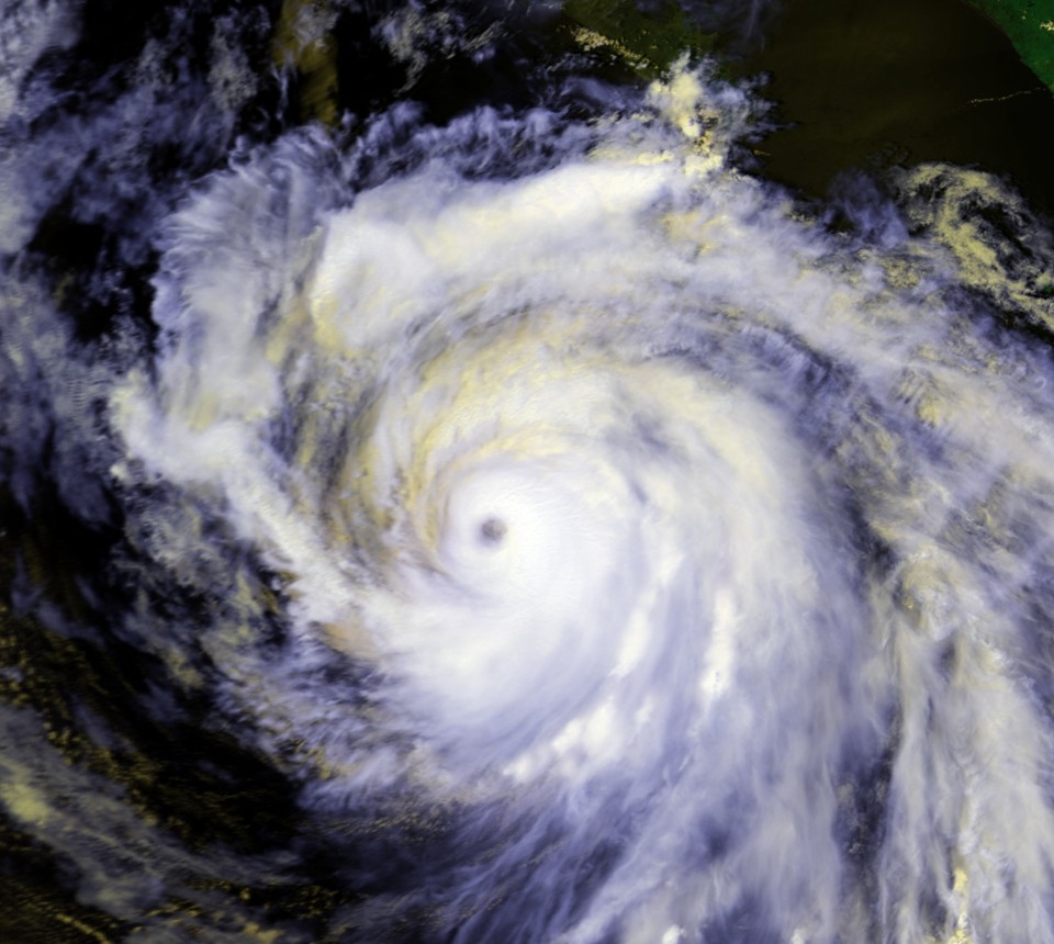
Track=Douglas 1996 track.pngJuly 24
Dissipated=August 6
1-min winds=115
Pressure=946Central America . Continuing Cesar's nearly due-west heading, it was still a tropical storm when it entered the Pacific onJuly 29 , and quickly regained hurricane status.Douglas's strengthened over the next two days as it turned west-northwest, paralleling the coast of Mexico. It reached its peak intensity on
August 1 ,with winds of 135 mph (215 km/h) and a central pressure of 946 millibars, making it the strongest hurricane of the season at a Category 4 strength. It slow weakening began onAugust 2 as it entered cooler waters, and it officially dissipated onAugust 6 , though like many Pacific hurricanes, a remnant circulation could be tracked westward for several days afterward. At its peak strength, Douglas had a central pressure of 946 mb and winds of convert|115|kn|km/h.Compared with the long-tern average, Hurricane Douglas was a well-forecast storm. The cyclone passed close enough to Mexico to necessitate a tropical storm warning starting on
July 29 for the coast fromSalina Cruz to Acapulco, with a watch along a further section of coast. The watches and warnings were discontinued onJuly 30 .Hurricane Douglas brought up to 6 inches (150 mm) of rain on the south coast of
Mexico and resulted in a 4-foot (1.2-m)storm surge .cite web|url=http://wwwnotes.reliefweb.int/w/RWB.NSF/480fa8736b88bbc3c12564f6004c8ad5/225921ce1d150f66c1256377003249a6?OpenDocument|title=Hurricane Douglas leaves at least 35 dead as it crosses from Caribbean to Pacific|publisher=ReliefWeb |author=Associated Press |date=1996-07-30|accessdate=2007-02-23] No deaths or damages were attributed to the Douglas portion of Hurricane Cesar-Douglas.Tropical Depression Seventeen-W
Infobox Hurricane Small
Basin=EPac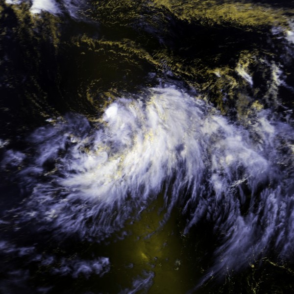
Track=17-W 1996 track.pngAugust 13
Dissipated=August 14
1-min winds=30
Pressure=1000August 13 from acutoff area oflow pressure area , crossed the dateline onAugust 14 . It continued to head east, passing close toMidway Island . It dissipated onAugust 14 , although the remnants of the system hung around the area for a few more days. At its strongest in the central north Pacific, Tropical Depression Seventeen-W had winds of convert|30|kn|km/h and a pressure of 1000 mbar.cite web|title=Tropical Depression Seventeen-W ATCR|url=https://metocph.nmci.navy.mil/jtwc/atcr/1996atcr/pdf/wnp/17w.pdf|author=Joint Typhoon Warning Center |accessdate=2007-10-05|format=PDF]Seventeen-W brought light winds, with gusts reaching
gale -force, to Midway Island. It also brought about 2.5 in (63.5 mm) of rain. After the cyclone dissipated, showers and gusty winds continued to occur on Midway and Kure for a few more days.Seventeen-W was the first tropical cyclone to cross the
international dateline in either direction since Typhoon John in the 1994 season.Tropical Storm Elida
Infobox Hurricane Small
Basin=EPac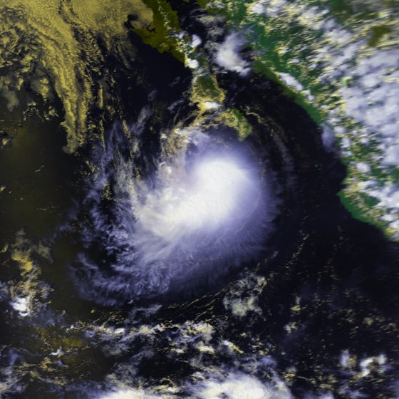
Track=Elida 1996 track.pngAugust 30
Dissipated=September 6
1-min winds=55
Pressure=994tropical wave organized into Tropical Depression Eight-E onAugust 30 . The cyclone paralleled the coast of Mexico and also gradually decelerated. Despite somewind shear , Eight-E strengthened into a tropical storm onSeptember 2 and was named Elida. OnSeptember 3 and 4, Elida came close to the southern tip of theBaja California Peninsula at its peak intensity of 994 mb and convert|55|kn|km/h. The cyclone then drifted into cooler waters, was devoid of deep convection onSeptember 5 , and dissipated the next day.cite web|title=Tropical Storm Elida|url=http://www.nhc.noaa.gov/1996elida.html|author=Edward Rappaport|date=1996-07-11|publisher=National Hurricane Center |accessdate=2007-02-23]The storm was forecast slightly better than the long term averages for the eastern North Pacific. Elida posed enough of a threat to the Baja California Peninsula to require a tropical storm warning for the Baja California Peninsula south of
Cabo San Lázaro onSeptember 3 . The warning was lifted onSeptember 5 after the threat ended. Tropical Storm Elida caused no known deaths or damage.Hurricane Fausto
Infobox Hurricane Small
Basin=EPac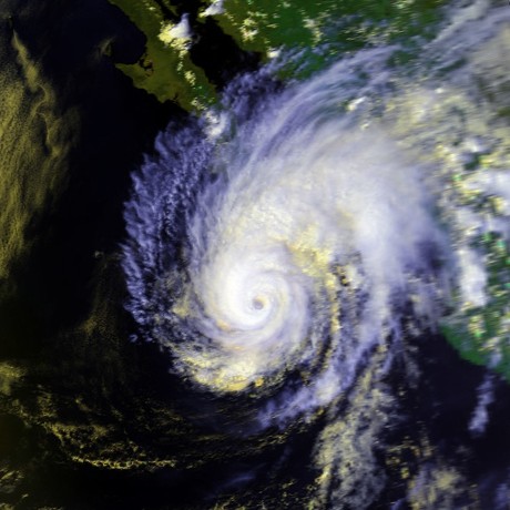
Track=Fausto 1996 track.pngSeptember 10
Dissipated=September 14
1-min winds=105
Pressure=955Venezuela as early asAugust 31 , and may have been related to thetropical wave that spawnedHurricane Fran .cite web|publisher=National Hurricane Center |url=http://www.nhc.noaa.gov/1996fausto.html|title=Hurricane Fausto|accessdate=2007-01-25|author=Miles Lawrence|date=1996-10-12] BySeptember 4 the wave had crossed Central America into the Pacific; it steadily organized until it was upgraded to Tropical Storm Fausto onSeptember 10 .Fausto intensified rapidly after it reached hurricane intensity on the
September 12 , peaking with sustained winds of convert|105|kn|km/h and a minimum central pressure of 955 mb. The hurricane weakened as an approachingtrough increased shear over the storm; this same trough also turned the storm north on theSeptember 13 , where it made landfall as a minimal hurricane on Baja California that day. OnSeptember 14 , the storm turned northeastward across theGulf of California , and dissipated inland over theSierra Madre range after its second landfall as a hurricane. Its extratropical remnants flared up briefly over northern Mexico and theU.S. state ofTexas , but otherwise soon lost their identity.Heavy rainfall was accompanied with the passage of this cyclone, with a storm total of 18.50 inches (470 mm) reported at San Vicente de la Sierra.cite web|publisher=
Hydrometeorological Prediction Center |url=http://www.hpc.ncep.noaa.gov/tropical/rain/fausto1996.html|title=Hurricane Fausto|accessdate=2007-01-26] Damage in Mexico was relatively minor, with only a single casualty caused by a downed power line. Damage totaled to around $800,000 (1996 USD).cite web|accessdate=2007-03-02|publisher=Departamento de Comunicación para el Centro de Investigación Científica y de Educación Superior de Ensenada|url=http://gaceta.cicese.mx/ver.php?topico=especial&ejemplar=102&id=76|title=CICESE - La Paz: de proyecto a realidad en expansión|accedssdate=2007-02-23]Tropical Depression One-C
Infobox Hurricane Small
Basin=EPac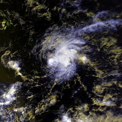
Track=1-C 1996 track.pngSeptember 15
Dissipated=September 20
1-min winds=30September 15 . It headed west untilSeptember 17 . That day, it turned to the west for two days before heading back west-northwest onSeptember 19 . It soon began to weaken and dissipated the next day. At its most intense, Tropical Depression One-C had winds of convert|30|kn|km/h and unknown pressure.The tropical cyclone caused no known impact and never came near land.
Tropical Storm Genevieve
Infobox Hurricane Small
Basin=EPac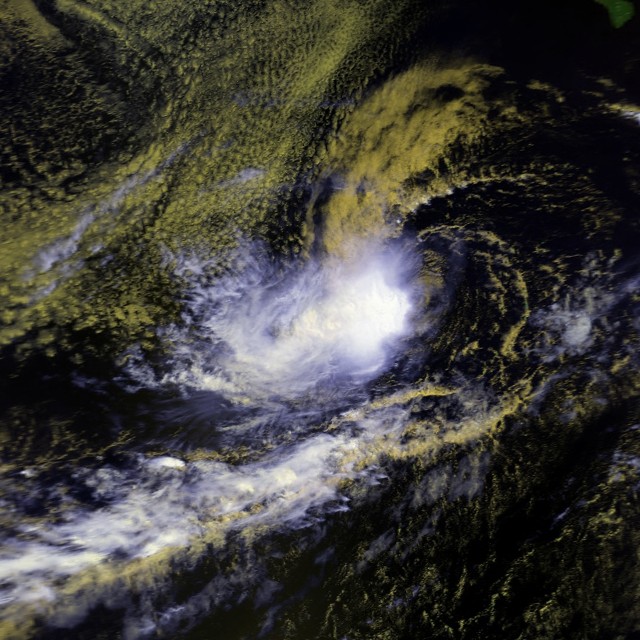
Track=Genevieve 1996 track.pngSeptember 27
Dissipated=October 9
1-min winds=45
Pressure=999Gulf of Tehuantepec , an area of disturbed weather containing convection formed onSeptember 23 . It moved westward without incident untilSeptember 27 , when it developed stronger convection and became Tropical Depression Ten-E. Immediately thereafter, it strengthened into a tropical storm and was named Genevieve while it continued its westward track.cite web|title=Tropical Storm Genevieve|author=Max Mayfield |url=http://www.nhc.noaa.gov/1996genev.html|publisher=National Hurricane Center |date=1996-11-14|accessdate=2007-02-25]Genevieve slowly got better organized, and reached its peak intensity of 999 mb and convert|45|kn|km/h on
September 29 . The tropical storm then turned to the west-southwest as steering currents collapsed. The cyclone began a time of erratic motion, which included two loops. The erratic motion also exposed Genevieve towind shear , and the tropical storm weakened to a tropical depression onOctober 1 . OnOctober 6 , the shear temporarily weakened, and Tropical Depression Genevieve restrengthened into a tropical storm. The cyclone's wandering continued, and it entrained dry air. This dry air weakened the system to a depression for a second time onOctober 8 , and Genevieve dissipated the next day. Brief flare-ups of convection could still be seen for a few days thereafter.Tropical Storm Genevieve was a rather poorly forecast storm. Most
tropical cyclone prediction model s indicated a northwesterly track that never happened, and also over-intensified the system. In addition, advisories on Tropical Depression Genevieve were discontinued onOctober 3 , and only resumed three days later. Later analysis determined that Genevieve had been a tropical depression for this whole time.Tropical Storm Genevieve never came near land, and consequently no watches or warnings were required for any location. The tropical cyclone had no impact on any land; indeed it is the only tropical storm or hurricane this season to directly impact no one.
Hurricane Hernan
Infobox Hurricane Small
Basin=EPac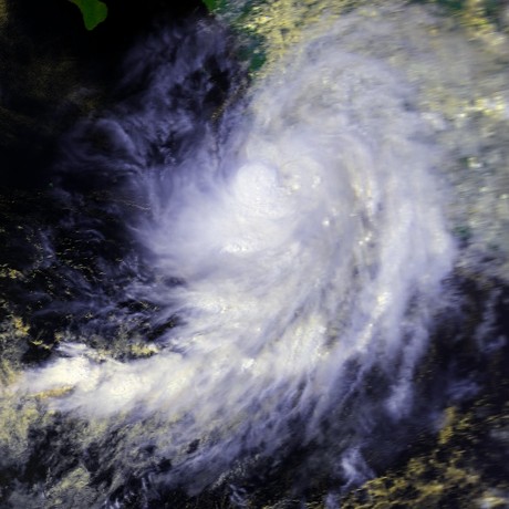
Track=Hernan 1996 track.pngSeptember 30
Dissipated=October 4
1-min winds=75
Pressure=980September 30 , a tropical wave organized into Tropical Depression Eleven-E. Gradual strengthening ensued, and the depression strengthened into a tropical storm twelve hours later and was named Hernan.cite web|title=Hurricane Hernan|author=Richard J. Pasch|url=http://www.nhc.noaa.gov/1996hernan.html|publisher=National Hurricane Center |date=1997-01-17|accessdate=2007-03-01] Hernan's initial track was to the west, but the system gradually started to recurve. Its center of circulation reformed, and Hernan briefly turned to the northwest again. ByOctober 2 , and Hernan was close to the coast. It strengthened into a hurricane that day. Late onOctober 2 and early onOctober 3 Hernan closely paralleled the coast. Interaction with land weakened the cyclone, and when Hernan made landfall onOctober 3 nearBarra de Navidad , it was only a minimal hurricane. Land weakened the cyclone, and by the time it emerged into the ocean north ofPuerto Vallarta , it was so disorganized that it dissipated onOctober 5 . At its strongest, Hurricane Hernan had winds of convert|75|kn|km/h and a central pressure of 980 mb.Because Hernan made landfall in a sparsely populated area, there where around not deaths. Around 1,000 homes were damaged or destroyed and 100 people were injured. Flooding occurred in
Melaque, Jalisco . Flooding also caused washed-out roads alongMexico Route 200 and 80. In many areas, telephone service was interrupted andpower outage s occurred. Along the coasts ofColima andJalisco , waves caused by Hernan reached 13 ft (3.9 m) in height.Tropical Depression Twelve-E
Infobox Hurricane Small
Basin=EPac
Track=12-E 1996 track.pngNovember 7
Dissipated=November 11
1-min winds=30
Pressure=1003November 7 .cite web|url=http://www.nhc.noaa.gov/archive/storm_wallets/epacific/ep1996/td12/tropdisc/nep1296.001|title=Tropical Depression Twelve-E Special Discussion Number 1|author=Richard Pasch|date=1996-11-07|publisher=National Hurricane Center |accessdate=2007-03-02] Although the environment was initially favourable and the system was almost upgraded into a tropical storm as was forecast,cite web|url=http://www.nhc.noaa.gov/archive/storm_wallets/epacific/ep1996/td12/tropdisc/nep1296.003|title=Tropical Depression Twelve-E Discussion Number 3|author=Max Mayfield |date=1996-11-07|publisher=National Hurricane Center |accessdate=2007-03-02] wind shear kept the cyclone weak. It's convection was eventually destroyed and advisories were ended onNovember 10 .cite web|author=Miles Lawrence|url=http://www.nhc.noaa.gov/archive/storm_wallets/epacific/ep1996/td12/tropdisc/nep1296.014|title=Tropical Depression Twelve-E Discussion Number 14|date=1996-11-10|publisher=National Hurricane Center |accessdate=2007-03-02] Twelve-E dissipated onNovember 11 and no deaths or damages were reported.cite web|title=Tropical Depression 12-E|date=1996-11-13|url=http://www.nhc.noaa.gov/1996td12e.html|author=Edward Rappaport|publisher=National Hurricane Center |accessdate=2007-03-02]Accumulated Cyclone Energy (ACE)
Accumulated Cyclone Energy (ACE) is a measure of how active a season is. It is found by taking a tropical storm or hurricane's windspeed in knots every six hours, squaring it, adding up the results, and dividing the total by 104. The ACE of this season makes it a below-normal season. It is one of the lowest totals ever recorded, indeed only the 1977 season has a lower total.torm names
The following names were used for named storms that formed in the eastern Pacific in 1996. Names that were not assigned are marked in gray. No names were retired, so it was used again in the 2002 season. This is the same list used for the 1990 season.
No central Pacific names were used; the first name used would have been Oliwa.
ee also
*
List of Pacific hurricanes
*List of Pacific hurricane seasons
*1996 Atlantic hurricane season
*1996 Pacific typhoon season
*1996 North Indian Ocean cyclone season
*South-West Indian Ocean cyclone seasons: 1995–96, 1996–97
*Australian region cyclone seasons: 1995–96, 1996–97
*South Pacific cyclone seasons: 1995–96, 1996–97References
External links
* [http://www.nhc.noaa.gov/1996epac.html NHC 1996 Pacific hurricane season archive]
* [http://www.hpc.ncep.noaa.gov/tropical/rain/1996.html HPC 1996 Tropical Cyclone Rainfall Pages]
* [http://www.prh.noaa.gov/cphc/summaries/1996.php Central Pacific Hurricane Center archive]
Wikimedia Foundation. 2010.