- 1999 Pacific typhoon season
Infobox hurricane season
Track=1999 Pacific typhoon season summary.jpg
Basin=WPac
Year=1999
First storm formed=January 3, 1999
Last storm dissipated=December 16, 1999
Strongest storm name=Bart
Strongest storm pressure=898
Strongest storm winds=140
Total storms=24
Total hurricanes=11
Total intense=1
Fatalities=At least 580
Damagespre=>
Da
Inflated=1
five seasons=1997, 1998, 1999, 2000, 2001The 1999 Pacific typhoon season has no official bounds; it ran year-round in 1999, but mosttropical cyclones tend to form in the northwesternPacific Ocean between May and November. These dates conventionally delimit the period of each year when most tropical cyclones form in the northwesternPacific Ocean .The scope of this article is limited to the Pacific Ocean, north of the equator and west of the
international date line . Storms that form east of the date line and north of the equator are called hurricanes; see1999 Pacific hurricane season . Tropical Storms formed in the entire west Pacific basin were assigned a name by theJoint Typhoon Warning Center . Tropical depressions in this basin have the "W" suffix added to their number. Tropical depressions that enter or form in the Philippine area of responsibility are assigned a name by thePhilippine Atmospheric, Geophysical and Astronomical Services Administration or PAGASA. This can often result in the same storm having two names.torms
Tropical Storm Hilda (Auring)
Infobox Hurricane Small
Basin=WPac
Track=Hilda 1999 track.png
Dissipated=January 7
1-min winds=35
Pressure=997Joint Typhoon Warning Center (JTWC) issued aTropical Cyclone Formation Alert for a developing broad circulation which stretched out from the northwestBorneo coast early on January 4. This developed into a tropical depression and moved slowly to the north away from the Borneo coast, becoming Tropical Storm Hilda early on January 6. Soon after reaching its peak strength of 65 km/h (40 mph) Hilda drifted further north into an area of increased wind shear, which caused the storm to dissipate the next day.cite web|url=http://metocph.nmci.navy.mil/jtwc/atcr/1999atcr/ch1/chap1_page6.html|author=Joint Typhoon Warning Center |title=Tropical Storm Hilda (01W)|accessdate=2007-02-17|work=1999 Annual Tropical Cyclone Report] BothJapan Meteorological Agency and PAGASA tracked this system, but considered it a tropical depression. PAGASA named the storm "Auring".cite web|url=http://www.australiasevereweather.com/cyclones/1999/summ9901.txt|author=Padgett, Gary|title=Monthly Global Tropical Cyclone Summary: January 1999|accessdate=2007-02-17]Malaysia reported to theTyphoon Committee that Tropical Storm Hilda brought heavy rain toSabah . This rain caused flooding and landslides, and was responsible for six deaths. The mudslides caused about $1.3 million in damage (1999 USD, 15 million 1999MYR ) to roads throughout the country.cite news|author=Borneo Bulletin|date=1999-01-11|title=Hilda causes RM15 mil in road damages in Sabah|accessdate=2007-02-19]Tropical Storm Iris (Bebeng)
Infobox Hurricane Small
Basin=WPac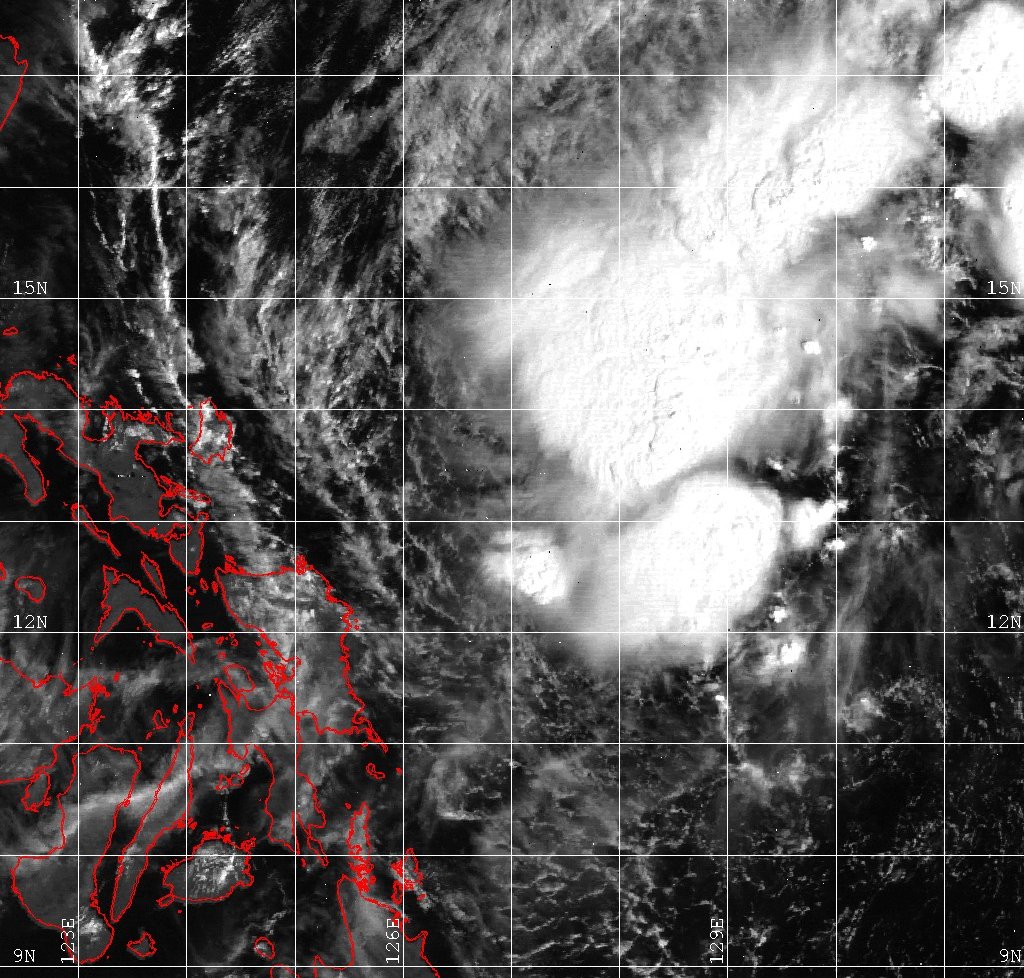
Track=Iris 1999 track.png
Dissipated=February 19
1-min winds=35
Pressure=997Pohnpei andChuuk on February 10 as it moved west.cite web|url=http://www.australiasevereweather.com/cyclones/1999/summ9902.txt|author=Padgett, Gary|title=Monthly Global Tropical Cyclone Summary: February 1999|accessdate=2007-02-17] The JTWC issued a TCFA as the depression passed nearPalau on February 13. The storm slowly consolidated as it moved towards the Philippines, becoming Tropical Storm Iris on February 17, but did not intensify any further. As the storm turned northwards under the influence of a subtropical ridge to the east it entered a high shear environment and rapidly degenerated, dissipating on February 19 220 km (140 miles) to the east of Luzon.cite web|url=http://metocph.nmci.navy.mil/jtwc/atcr/1999atcr/ch1/chap1_page7.html|author=Joint Typhoon Warning Center |title=Tropical Storm Iris (02W)|accessdate=2007-02-17|work=1999 Annual Tropical Cyclone Report]PAGASA considered this storm to have been a tropical depression and named it "Bebeng". Tropical Storm Iris had no effects on land.
Tropical Storm Jacob (Karing)
Infobox Hurricane Small
Basin=WPac
Track=Jacob 1999 track.png
Dissipated=April 10
1-min winds=35
Pressure=997Yap developed into a tropical depression on April 6. It gradually developed as it moved to the west, becoming a strong depression with 55 km/h (35 mph) winds. It then began to accelerate to the northwest, becoming a minimal tropical storm as it did so. However, this northwards motion brought it into a region of increased shear, which weakened it back into a tropical depression. The low level circulation became completely exposed and the weakening system made landfall on southernLuzon on April 10.cite web|url=http://metocph.nmci.navy.mil/jtwc/atcr/1999atcr/ch1/chap1_page8.html|author=Joint Typhoon Warning Center |title=Tropical Storm Jacob (03W)|accessdate=2007-02-17|work=1999 Annual Tropical Cyclone Report] PAGASA named the system "Karing" and considered it a tropical depression.cite web|url=http://www.australiasevereweather.com/cyclones/1999/summ9904.txt|author=Padgett, Gary|title=Monthly Global Tropical Cyclone Summary: April 1999|accessdate=2007-02-17]The rainfall from Jacob ranged from 80 mm (3 inches) up to 400 mm (16 inches) in some places, but only minor damage was recorded on land.cite web|url=http://www.cpc.ncep.noaa.gov/products/analysis_monitoring/GLOB_CLIM/archives/1999/04-10-1999.html|title=Weekly Global Climate Highlights|author=Climate Prediction Center|date=
1999-04-10 |accessdate=2007-02-18]Typhoon Kate (Diding)
Infobox Hurricane Small
Basin=WPac
Track=Kate 1999 track.png
Dissipated=April 28
1-min winds=75
Pressure=967Philippine Sea moved overMindanao and intensified into a tropical depression whilst it was still overland. The depression soon moved overwater again as it tracked north to the east of the Philippines, becoming Tropical Storm Kate the next day. The JTWC initially forecast that the storm would only intensify slightly, as they predicted it to move north-northeast into an unfavorable environment. However, Kate instead moved on a more northerly route and entered an area with minimal wind shear. On April 26 Kate became a typhoon, the first of the season, and reached its peak strength with 140 km/h (85 mph) soon after. Later that day, the typhoon's motion acclerated to the northeast and it passed 9 km (6 miles) to the north ofIwo Jima . Kate then began to lose its convection and became anextratropical on April 28 to the northeast of Iwo Jima.cite web|url=http://metocph.nmci.navy.mil/jtwc/atcr/1999atcr/ch1/chap1_page9.html|author=Joint Typhoon Warning Center |title=Typhoon Kate (04W)|accessdate=2007-02-17|work=1999 Annual Tropical Cyclone Report]Both JMA and PAGASA considered Kate to have been a tropical storm at its peak, in both cases considering this the first tropical storm of the season. PAGASA named the depression "Diding" soon after it formed and upgraded it to a tropical storm before the JTWC. Kate brought torrential rain to the north-east of the country, with amounts as high as 260 mm (14 inches) falling in places.cite web|url=http://www.cpc.ncep.noaa.gov/products/analysis_monitoring/GLOB_CLIM/archives/1999/04-24-1999.html|title=Weekly Global Climate Highlights|author=Climate Prediction Center|date=
1999-04-24 |accessdate=2007-02-18] The peak winds recorded on Iwo Jima were 95 km/h (60 mph), with gusts of up to 126 km/h (78 mph). There were no available damage reports following Kate for the Philippines or Iwo Jima.Typhoon Leo
Infobox Hurricane Small
Basin=WPac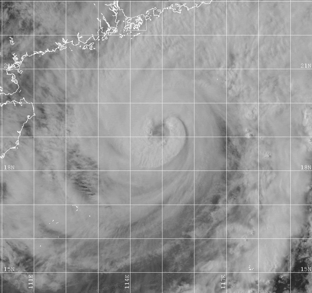
Track=Leo 1999 track.png
Dissipated=May 2
1-min winds=110
Pressure=933South China Sea , forming into a tropical depression on April 27 when it was 710 km (440 miles) to the west ofManila . It strengthened as it moved to the west and became Tropical Storm Leo the next day. The storm then performed a cyclonic loop off the Vietnamese coast and began to intensify, becoming a typhoon as it moved to the northeast. As it moved towards China under a high-level ridge Typhoon Leo rapidly intensified to its peak with 205 km/h (125 mph) winds. However, it did not sustain this for long as it then moved northeast into a high shear environment and it weakened as it moved to the north. Leo made landfall on May 2 as a tropical depression, after the convection had become separated from the circulation of the storm and soon dissipated overland.cite web|url=http://metocph.nmci.navy.mil/jtwc/atcr/1999atcr/ch1/chap1_page10.html|author=Joint Typhoon Warning Center |title=Typhoon Leo (05W)|accessdate=2007-02-17|work=1999 Annual Tropical Cyclone Report]As Typhoon Leo was developing, its outer rainbands brought up to 130 mm (5 inches) to regions of Vietnam.cite web|url=http://www.cpc.ncep.noaa.gov/products/analysis_monitoring/GLOB_CLIM/archives/1999/05-01-1999.html|title=Weekly Global Climate Highlights|author=Climate Prediction Center|date=
1999-05-01 |accessdate=2007-02-18] High waves caused by the typhoon sank a ship to the south of Hong Kong and only 7 of the 21 people on board were rescued. Peak sustained winds of 90 km/h (55 mph) were recorded onWaglan Island as Typhoon Leo passed to the south ofHong Kong and the storm dropped over 100 mm (4 inches) of rain on the territory. There was only light damage in Hong Kong as a result of Typhoon Leo, but the rainfall was responsible for 14 injuries, mostly in traffic accidents.cite web|url=http://www.weather.gov.hk/publica/tc/tc1999.pdf#page=36|format=PDF|pages=pp. 36-40|title=Typhoon Leo (9902)|work=Tropical cyclones in 1999|author=Hong Kong Observatory |year=2000|month=April|accessdate=2007-02-18]Typhoon Maggie (Etang)
Infobox Hurricane Small
Basin=WPac
Track=Maggie 1999 track.png
Dissipated=June 8
1-min winds=105
Pressure=938Luzon Strait and it reached its peak with 195 km/h (120 mph) winds on June 5. The typhoon turned further to the west as it began to interact withTaiwan and started to weaken slowly. Maggie made landfall as a 150 km/h (90 mph) typhoon in southeastern China, to the east of Hong Kong on June 6. The storm then moved along the Chinese coast weakening as it did so. Maggie passed just to the north of Hong Kong before it turned into the mouth of the Pearl River and dissipated inland on June 8.cite web|url=http://metocph.nmci.navy.mil/jtwc/atcr/1999atcr/ch1/chap1_page11.html|author=Joint Typhoon Warning Center |title=Typhoon Maggie (06W)|accessdate=2007-02-17|work=1999 Annual Tropical Cyclone Report] Both the JMA and PAGASA considered Maggie a typhoon, and PAGASA named this storm "Etang".cite web|url=http://www.australiasevereweather.com/cyclones/1999/summ9906.txt|author=Padgett, Gary|title=Monthly Global Tropical Cyclone Summary: June 1999|accessdate=2007-02-17]The rainfall from Typhoon Maggie caused landslides in the Philippines that killed three people. The storm killed at two with another 5 people reported missing on Taiwan. The electricity supply to over 100,000 homes was cut off and there was over $18 million of agricultural damage on the island. Maggie brought sustained winds of up to 80 km/h (50 mph) and 85 mm (3.3 inches) of rain to Hong Kong. Two oil barges docked in the territory sank, one fully laden with oil which polluted a nearby beach. There were 5 injuries resulting from Maggie in the territory and the total damages were approximately $100,000. The typhoon killed four people and damaged over 3000 homes in
Guangdong . At least 120 vessels were also damaged and there was more than $150 million of direct economic damage in the province.cite web|url=http://www.weather.gov.hk/publica/tc/tc1999.pdf#page=42|format=PDF|pages=pp. 42-49|title=Typhoon Maggie (9903)|work=Tropical cyclones in 1999|author=Hong Kong Observatory |year=2000|month=April|accessdate=2007-02-18] Maggie also brought rain of up to 100 mm (4 inches) to northern Vietnam, causing some localised flooding.cite web|url=http://usda.mannlib.cornell.edu/usda/waob/weather_weekly//1990s/1999/weather_weekly-06-15-1999.pdf#page=26|format=pdf|pages=p. 26|title=Weekly Weather and Crop Bulletin|author=USDA|coauthors=NOAA |date=1999-06-15 |accessdate=2007-02-17]Tropical Depression 07W
Infobox Hurricane Small
Basin=WPac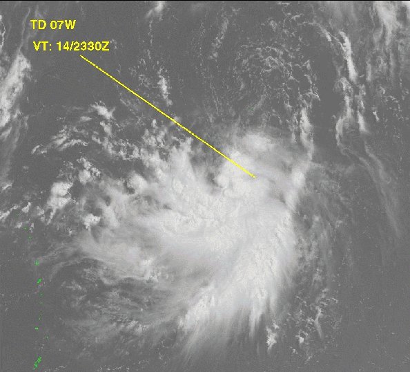
Track=7-W 1999 track.png
Dissipated=July 18
1-min winds=30
Pressure=1000Guam slowly developed as it moved to the west, becoming a tropical depression on July 15. Soon after it formed the depression reached its peak strength with 55 km/h (35 mph) winds which it maintained for two days as it moved towardsHonshū . Increased wind shear began to exposed the low level circulation and the depression began to weaken as it turned to the northeast. The depression dissipated on July 18 to the southeast of Honshū, having posed no threat to land.cite web|url=http://metocph.nmci.navy.mil/jtwc/atcr/1999atcr/ch1/chap1_page12.html|author=Joint Typhoon Warning Center |title=Tropical Depression 07W|accessdate=2007-02-17|work=1999 Annual Tropical Cyclone Report]Tropical Depression 08W
Infobox Hurricane Small
Basin=WPac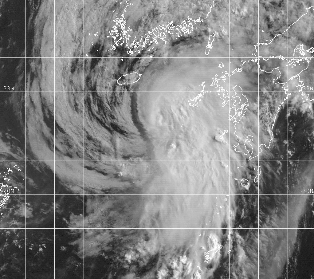
Track=8-W 1999 track.png
Dissipated=June 22
1-min winds=30
Pressure=1000Okinawa gradually developed as it moved to the north towards the Japanese mainland. On July 21 it began to intensify, becoming Tropical Depression 08W to the northeast of Okinawa. The depression strengthened slightly in theEast China Sea before it made landfall nearChanghung ,South Korea on July 22. The storm became extratropical as it moved over the Korean peninsula and it entered theSea of Japan , where it dissipated. The effects of Tropical Depression 08W are unknown.cite web|url=http://metocph.nmci.navy.mil/jtwc/atcr/1999atcr/ch1/chap1_page13.html|author=Joint Typhoon Warning Center |title=Tropical Depression 08W|accessdate=2007-02-17|work=1999 Annual Tropical Cyclone Report]Tropical Storm Neil (Helming)
Infobox Hurricane Small
Basin=WPac
Track=Neil 1999 track.png
Dissipated=July 28
1-min winds=40
Pressure=994Suncheon the next day as a minimal tropical storm and soon reemerged over theYellow Sea as a tropical depression. There it interacted with a mid-latitude trough, that redirected back towards South Korea and it made a second landfall 35 km (25 miles) southwest ofSeoul on July 28. Neil then quickly dissipated overland.cite web|url=http://metocph.nmci.navy.mil/jtwc/atcr/1999atcr/ch1/chap1_page14.html|author=Joint Typhoon Warning Center |title=Tropical Storm Neil (09W)|accessdate=2007-02-17|work=1999 Annual Tropical Cyclone Report]Both the JMA and PAGASA considered Neil a tropical storm, with PAGASA naming it "Helming". Unusually, PAGASA assessed the storm as having reached a peak on July 22, when the JTWC still considered it a developing disturbance. This difference was due to a difference in opinion between the two centers as to where the storm's center was.cite web|url=http://www.australiasevereweather.com/cyclones/2000/summ9907.htm|author=Padgett, Gary|title=Monthly Global Tropical Cyclone Summary: July 1999|accessdate=2007-02-17] There were reports of damage from flooding and winds gusts from Tropical Storm Neil in Japan, with a ferry running aground near
Kannoura . Neil caused a fishing boat off the Korean coast to capsize, killing its crew of eight. There were wind gusts of up to 95 km/h (60 mph) onCheju Island and the peak rainfall reported from the storm was over 200 mm (8 inches). As the storm dissipated over Korea, it caused flash floods that killed at least 7 and left 7,000 homeless.cite news|url=http://www.cnn.com/NATURE/9908/06/diary.planet/index.html#Storm|author=Newman, Steve|title=Earthweek - A Diary of the Planet|date=1999-08-06 |accessdate=2007-02-18|publisher=CNN ]Tropical Depression 10W
Infobox Hurricane Small
Basin=WPac
Track=10-W 1999 track.png
Dissipated=July 27
1-min winds=25
Pressure=1002Shanwei as a minimal tropical depression on July 27. The depression then moved inland and dissipated, with no known effects.cite web|url=http://metocph.nmci.navy.mil/jtwc/atcr/1999atcr/ch1/chap1_page15.html|author=Joint Typhoon Warning Center |title=Tropical Depression 10W|accessdate=2007-02-17|work=1999 Annual Tropical Cyclone Report] The JMA considered Tropical Depression 10W to be a tropical storm, with peak 10-minute winds of 75 km/h (45 km/h), making 10W the second storm in 1999 that the JMA considered a tropical storm but the JTWC considered a depression.As the depression passed near Hong Kong, it dropped 31 mm (1.2 inches) of rain on the territory and sustained winds of 72 km/h (45 mph) were recorded on
Waglan Island . There was no significant damage over land in the territory, though 18 swimmers were injured in the strong seas associated with the storm.cite web|url=http://www.weather.gov.hk/publica/tc/tc1999.pdf#page=50|format=PDF|pages=pp. 50-54|title=Tropical Storm (9906)|work=Tropical cyclones in 1999|author=Hong Kong Observatory |year=2000|month=April|accessdate=2007-02-18]Typhoon Olga (Ising)
Infobox Hurricane Small
Basin=WPac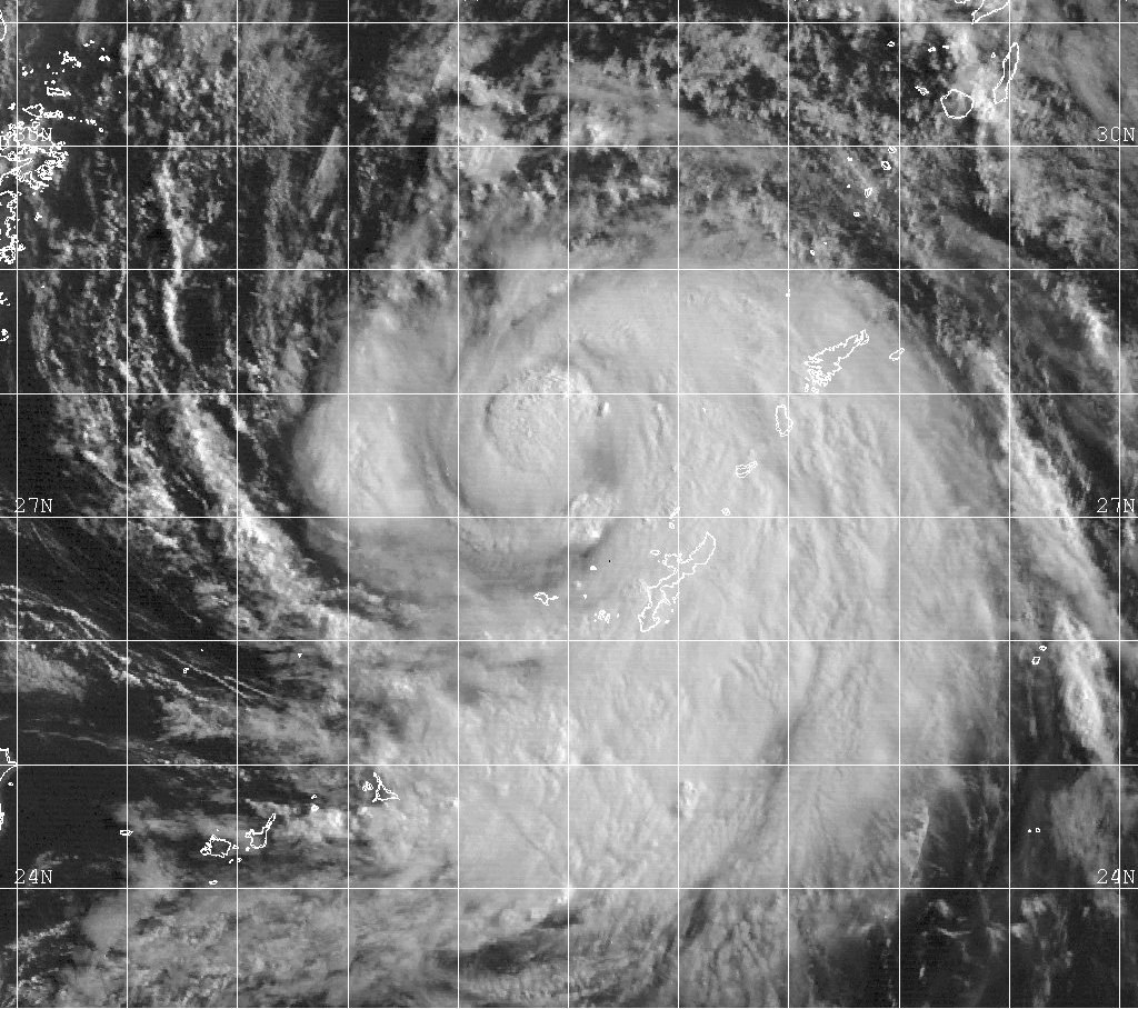
Track=Olga 1999 track.png
Dissipated=August 3
1-min winds=80
Pressure=963Cheju Island on August 3 and it made a second brief landfall on the T'aean Peninsula before moving north in theYellow Sea . The storm made its final landfall inNorth Korea as a strong tropical storm later that day with 100 km/h (65 mph) winds and became extratropical soon after.cite web|url=http://metocph.nmci.navy.mil/jtwc/atcr/1999atcr/ch1/chap1_page16.html|author=Joint Typhoon Warning Center |title=Typhoon Olga (11W)|accessdate=2007-02-17|work=1999 Annual Tropical Cyclone Report] Both the JMA and PAGASA considered Olga a typhoon, with PAGASA naming the storm "Ising" before the JTWC issued its first warning on the developing system.Although Typhoon Olga never approached the Philippines closely, it was responsible for heavy rains over much of
Luzon that killed 160 people and displaced 80,000.cite web|url=http://www.dartmouth.edu/~floods/Archives/1999sum.htm|title=1999 Flood Archive|author=Dartmouth Flood Observatory|accessdate=2007-02-18] Olga passed over Okinawa, with winds of 80 km/h (50 mph) recorded atKadena Air Base although damages on the island are unknown. Torrential rain of up to 600 mm (24 inches) fell on theKorean Peninsula , with the highest totals falling near the border between North and South Korea.cite web|url=http://usda.mannlib.cornell.edu/usda/waob/weather_weekly//1990s/1999/weather_weekly-08-10-1999.pdf#page=29|format=pdf|pages=p. 29|title=Weekly Weather and Crop Bulletin|author=USDA|coauthors=NOAA |date=1999-08-10 |accessdate=2007-02-17] The resulting floods and landslides caused 64 fatalities in South Korea and wind gusts of 96 km/h (60 mph) were reported nearSeoul . The flooding in South Korea destroyed about convert|400000|km2|sqmi ofrice paddies and 8,500 homes, leaving 25,000 people homeless. The Red Cross reported a further 42 deaths and 40,000 were made homeless from flooding inNorth Korea and that the flooding worsened the ongoing food shortages in the country.cite news|url=http://news.bbc.co.uk/1/hi/world/asia-pacific/413464.stm|title=High alert as typhoon threatens|author=Staff Writer|publisher=BBC |date=1999-08-06 |accessdate=2007-02-18] Typhoon Olga brought the heaviest rains recorded in Korea for 25 years and caused a total of $657 million of damage in South Korea.Tropical Storm Paul
Infobox Hurricane Small
Basin=WPac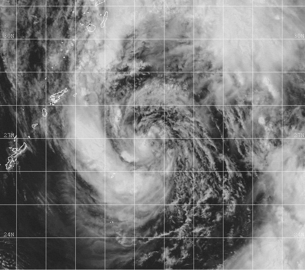
Track=Paul 1999 track.png
Dissipated=August 8
1-min winds=50
Pressure=987gyre to the southwest of Guam. On August 2 the JTWC issued a TCFA for the devleoping disturbance as it moved to the northwest, and it became Tropical Depression 12W the next day. On August 4 the depression became Tropical Storm Paul and began to merge with the gyre from which it had formed. As it merged with the gyre Paul strengthened to its peak with 95 km/h (60 mph) winds, to the east of Okinawa. After the two systems had merged, Paul turned briefly to the northeast and weakened to back into a tropical depression. The depression moved to the west brushing the south coast of Kyūshū on August 6 before dissipating in theYellow Sea .cite web|url=http://metocph.nmci.navy.mil/jtwc/atcr/1999atcr/ch1/chap1_page17.html|author=Joint Typhoon Warning Center |title=Tropical Storm Paul (12W)|accessdate=2007-02-17|work=1999 Annual Tropical Cyclone Report]Tropical Storm Paul was highly unusual in that it formed from a monsoon gyre and then merged with it. Mergers of such systems rarely occur, it is much more common for tropical cyclones which form in this manner to move independently of the non-tropical system. Paul was also considered a tropical storm by the JMA, who reported that the rainfall from the storm caused landslides and flooding in western Japan.
Tropical Storm Rachel
Infobox Hurricane Small
Basin=WPac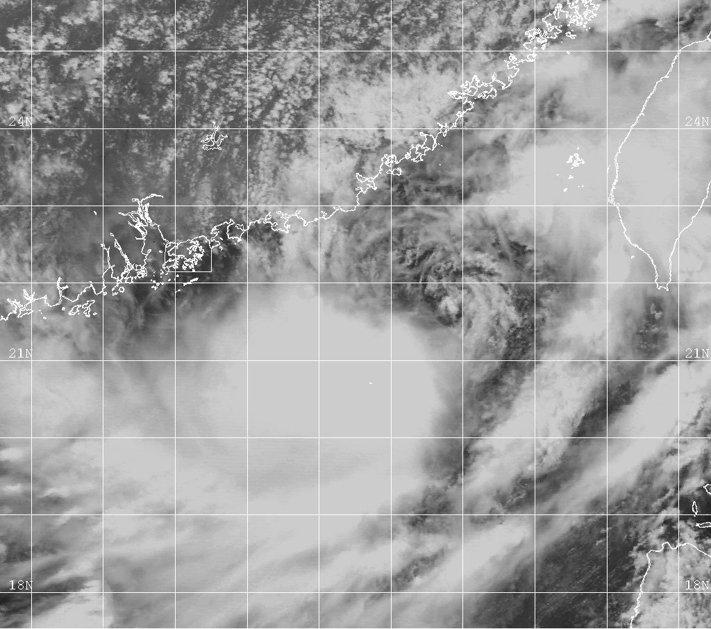
Track=Rachel 1999 track.png
Dissipated=August 9
1-min winds=35
Pressure=997Chungyang mountains on August 7. The remnants moved northeast into theEast China Sea and the system redeveloped into a tropical depression the next day as it approached Okinawa. Rachel briefly became a minimal tropical storm for a second time as it approached the Japanese island, before it turned to the northwest. The storm entered an increasingly unfavorable environment and rapidly weakened on August 9.cite web|url=http://metocph.nmci.navy.mil/jtwc/atcr/1999atcr/ch1/chap1_page18.html|author=Joint Typhoon Warning Center |title=Typhoon Rachel (13W)|accessdate=2007-02-17|work=1999 Annual Tropical Cyclone Report] Damage from Tropical Storm Rachel is unknown.Tropical Depression 14W
Infobox Hurricane Small
Basin=WPac
Track=14-W 1999 track.png
Dissipated=August 10
1-min winds=25
Pressure=1000Iwo Jima on August 8. The depression, which had an exposed circulation center, moved to the north under the influence of a subtropical ridge over northern Japan. On August 9 it turned to the northwest and accelerated before its landfall nearOwase the next day, with 45 km/h (30 mph) winds. The depression weakened as it passed north over Honshū and dissipated shortly after moving over the Sea of Japan.cite web|url=http://metocph.nmci.navy.mil/jtwc/atcr/1999atcr/ch1/chap1_page19.html|author=Joint Typhoon Warning Center |title=Tropical Depression 14W|accessdate=2007-02-17|work=1999 Annual Tropical Cyclone Report]Tropical Depression 15W
Infobox Hurricane Small
Basin=WPac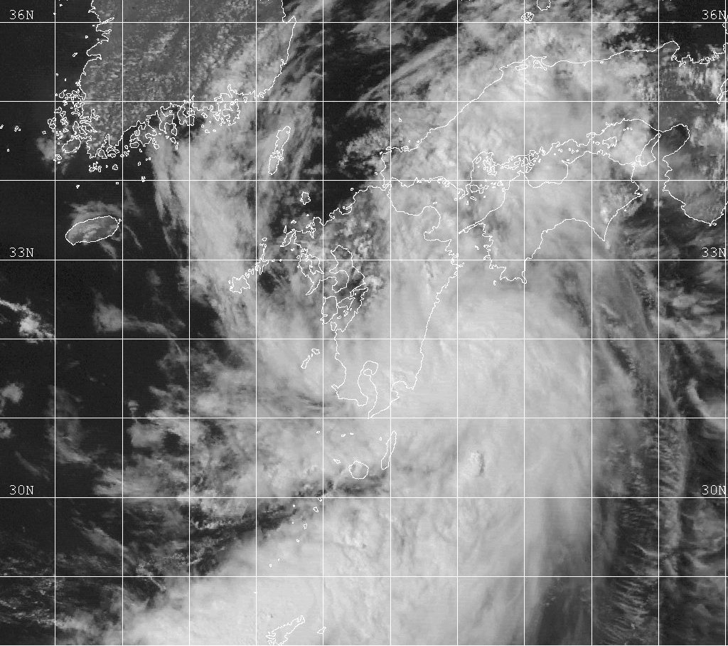
Track=15-W 1999 track.png
Dissipated=August 18
1-min winds=25
Pressure=1002East China Sea on August 15 and gradually drifted towards Kyūshū. It intensified as it did so, becoming Tropical Depression 15W the next day. The fourth warning from the JTWC repositioned the cyclone much closer to the Kyūshū coast, where it made landfall nearUshibuka on August 17. The depression then drifted over Kyūshū and entered the Sea of Japan later that day, where it weakened. The storm dissipated on August 18 but its remnants were recognisable for a further two days.cite web|url=http://metocph.nmci.navy.mil/jtwc/atcr/1999atcr/ch1/chap1_page20.html|author=Joint Typhoon Warning Center |title=Tropical Depression 15W|accessdate=2007-02-17|work=1999 Annual Tropical Cyclone Report] The depression's effects are unknown.Typhoon Sam (Luding)
Infobox Hurricane Small
Basin=WPac
Track=Sam 1999 track.png
Dissipated=August 23
1-min winds=75
Pressure=967Philippine Sea became more organized and the JTWC issued a TCFA. The developing cyclone slowly moved to the northwest, becoming Tropical Depression 16W nine hours after the TCFA was first issued. As the cyclone continued to intensify becoming Tropical Storm Sam on August 19, thesubtropical ridge to the north shifted its track in a westwards direction towards Luzon. The storm passed over the north of the island on August 20 and entered theSouth China Sea reaching typhoon strength the next day. Sam gradually intensified further as it approached the Chinese coast and it made landfall about 19 km (12 miles) to the northeast ofHong Kong at its peak with 140 km/h (85 mph) winds on August 22. Sam continued to move to the northwest over China dissipating about 24 hours later.cite web|url=http://metocph.nmci.navy.mil/jtwc/atcr/1999atcr/ch1/chap1_page21.html|author=Joint Typhoon Warning Center |title=Typhoon Sam (16W)|accessdate=2007-02-17|work=1999 Annual Tropical Cyclone Report] PAGASA named the developing storm "Luding" shortly before the JTWC began to issue advisories.cite web|url=http://www.australiasevereweather.com/cyclones/2000/summ9908.htm|author=Padgett, Gary|title=Monthly Global Tropical Cyclone Summary: August 1999|accessdate=2007-02-17]Typhoon Sam was responsible for 7 deaths in the Philippines and flooding from its rainfall displaced over 4000 people and landslides closed many major roads near
Baguio City . Sam became the wettest tropical cyclone to affect Hong Kong since records began in 1884, dropping over 616 mm (24.2 inches) of rain; exceeding the previous record set in 1926. Peak sustained winds of 96 km/h (60 mph) were recorded onWaglan Island as the typhoon passed over the territory. The heavy rain led to many instances of flooding and over 150 landslides throughout Hong Kong, killing 1 person and forcing the evacuation of about 1,000. A total of 328 people were injured in various incidents relating to the storm and total damage in Hong Kong totalled approximately $17 million.cite web|url=http://www.weather.gov.hk/publica/tc/tc1999.pdf#page=56|format=PDF|pages=pp. 56-66|title=Typhoon Sam (9910)|work=Tropical cyclones in 1999|author=Hong Kong Observatory |year=2000|month=April|accessdate=2007-02-17] In addition to the direct casualties from the storm, anChina Airlines Flight 642 , using anMD-11 aircraft, crashed while attempting to land atHong Kong International Airport , killing 3 on board and injuring 219. At the time of the crash wind gusts in excess of 65 km/h (40 mph) were recorded at the airport.cite web|url=http://www.cad.gov.hk/reports/main1.pdf|title=Aircraft Accident Report 1/2004|author=Civil Aviation Department, Hong Kong|year=2004|month=December|accessdate=2007-02-17|format=PDF] After moving into China, Sam killed at least 17 and injured 100 people inGuangdong . Direct economic losses in the province were about $18 million.Typhoon Tanya
Infobox Hurricane Small
Basin=WPac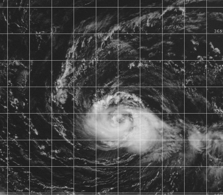
Track=Tanya 1999 track.png
Dissipated=August 24
1-min winds=70
Pressure=972extratropical storm and the JTWC issued the final warning on the cyclone on August 24.cite web|url=http://metocph.nmci.navy.mil/jtwc/atcr/1999atcr/ch1/chap1_page22.html|author=Joint Typhoon Warning Center |title=Typhoon Tanya (17W)|accessdate=2007-02-17|work=1999 Annual Tropical Cyclone Report]The JMA also monitored Tanya and made it a severe tropical storm at its peak. Post-season analysis increased the initial intensity of the system, making it a tropical storm before the JTWC began to issue full advisories on Tanya. Typhoon Tanya had no effects on land.
Typhoon Dora
Infobox Hurricane Small
Basin=WPac
Track=Dora 1999 track.png
Dissipated=August 23
1-min winds=65
Pressure=9961999 Pacific hurricane season , crossed theInternational Date Line and entered the western Pacific on August 20. The final advisory from theCentral Pacific Hurricane Center , while Dora was still in the eastern Pacific was for a minimal hurricane. As the storm crossed the Date Line, the JTWC assumed responsibility for the storm and downgraded it to a tropical storm on its first advisory. Once in the West Pacific, Tropical Storm Dora turned towards the northwest and weakened further as wind shear increased. Dora weakened to a tropical depression on August 22 well to the north ofWake Island and drifted to the north before dissipating the next day.cite web|url=http://metocph.nmci.navy.mil/jtwc/atcr/1999atcr/ch1/chap1_page39.html|author=Joint Typhoon Warning Center |title=Hurricane Dora (07E)|accessdate=2007-02-17|work=1999 Annual Tropical Cyclone Report]Dora became the first storm since 1994's John to have existed in all three Pacific basins and no significant damage was caused by the system anywhere along its path.cite web|url=http://www.nhc.noaa.gov/1999dora.html|author=Lawrence, Miles|coauthors=Kimberlain, Todd|title=Preliminary Report: Hurricane Dora|accessdate=2007-02-17|publisher=National Hurricane Center]
Tropical Depression 18W
Infobox Hurricane Small
Basin=WPac
Track=18-W 1999 track.png
Dissipated=August 24
1-min winds=30
Pressure=1000Joint Typhoon Warning Center |title=Tropical Depression 18W|accessdate=2007-02-17|work=1999 Annual Tropical Cyclone Report]Typhoon Virgil
Infobox Hurricane Small
Basin=WPac
Track=Virgil 1999 track.png
Dissipated=August 29
1-min winds=70
Pressure=972Iwo Jima on August 23. Vertical shear began to weaken and the JTWC began to issue advisories on Tropical Depression 19W the next day. The storm turned to the southwest and rapidly intensified on August 25, strengthening from a tropical depression to its peak as a 130 km/h (80 mph) typhoon in 12 hours. Virgil maintained typhoon strength for over a day before it entered a highly sheared environment in which it began to weaken again. Under the influence of a passing frontal system, the motion of the dissipating cyclone turned clockwise to the northeast. The storm dissipated on August 29 over water having never approached land.cite web|url=http://metocph.nmci.navy.mil/jtwc/atcr/1999atcr/ch1/chap1_page24.html|author=Joint Typhoon Warning Center |title=Typhoon Virgil (19W)|accessdate=2007-02-17|work=1999 Annual Tropical Cyclone Report] The JMA monitored Typhoon Virgil and made it a minimal severe tropical storm at its peak.Tropical Storm Wendy (Mameng)
Infobox Hurricane Small
Basin=WPac
Track=Wendy 1999 track.png
Dissipated=September 4
1-min winds=40
Pressure=994Joint Typhoon Warning Center |title=Tropical Storm Wendy (20W)|accessdate=2007-02-17|work=1999 Annual Tropical Cyclone Report] Both the JMA and PAGASA monitored Tropical Storm Wendy, with PAGASA naming this storm "Mameng". PAGASA considered Wendy to have stronger winds than the JTWC, despite the fact that PAGASA uses a 10 minute averaging period to measure sustained winds, which generally results in a lower speed.Tropical Storm Wendy fuelled severe rain over much of southern China in the week after it made landfall, with amounts as high as 500 mm (20 inches) recorded in northern
Jiangxi and southernZhejiang .cite web|url=http://www.cpc.ncep.noaa.gov/products/analysis_monitoring/GLOB_CLIM/archives/1999/09-14-1999.html|title=Weekly Global Climate Highlights|author=Climate Prediction Center|date=1999-09-14 |accessdate=2007-02-18] At least 133 people were killed and over 2,600 people were injured, withWenzhou being particularly badly hit. Over 500,000 people had to be evacuated, over 2.2 million people had been affected by the storm and a local government spokesman called it "the most serious storm in a century". The direct economic damage in the region exceeded $275 million.cite news|url=http://weather.ou.edu/~spark/AMON/v3_n3/News/China_Wendy.html|title=Wendy Death Toll Hits 133|author=Staff Writer|publisher=China Daily |date=1999-09-07 |accessdate=2007-02-18] Whilst mainland China was severely affected by Wendy, the storm only had a minimal impact in Hong Kong.Typhoon York (Neneng)
Infobox Hurricane Small
Basin=WPac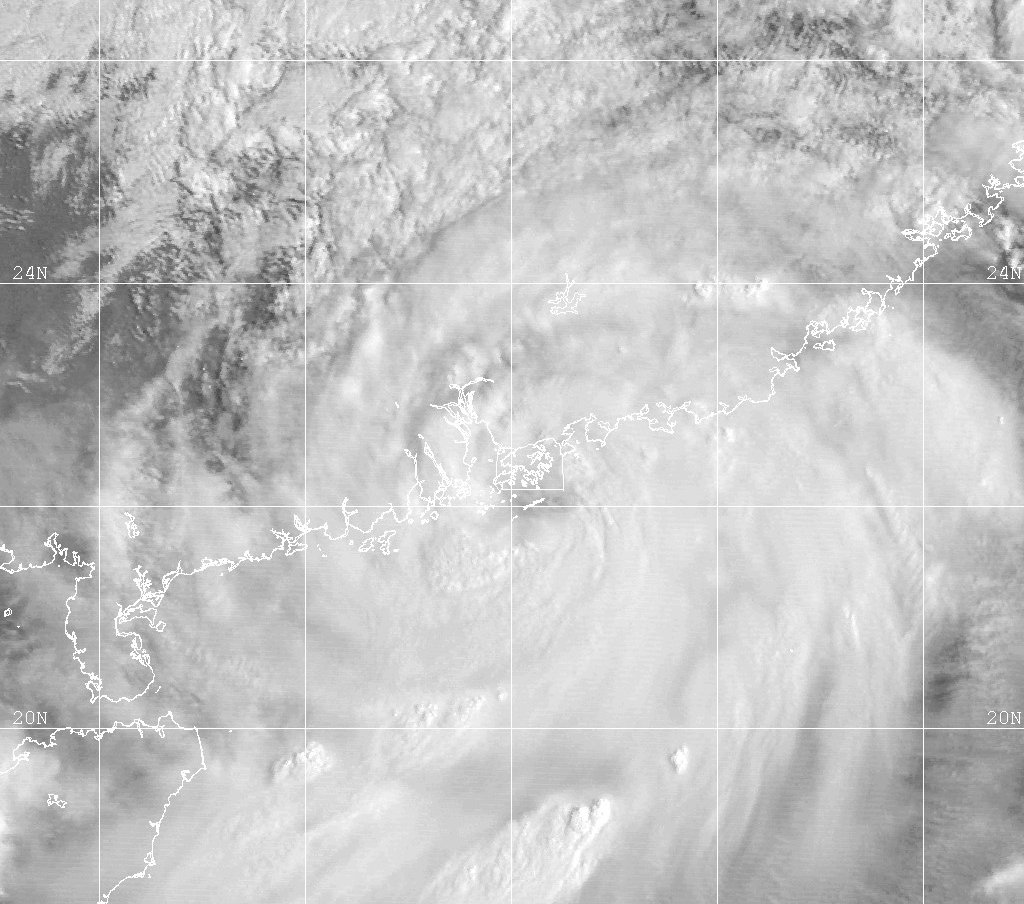
Track=York 1999 track.png
Dissipated=September 17
1-min winds=70
Pressure=972Philippine Sea but initially failed to develop as it interacted withLuzon . The disturbance passed over Luzon and entered theSouth China Sea , where it became more organized and developed into Tropical Depression 21W late on September 11. The system gradually strengthened as it moved northwest towards the Chinese coastline, reaching its peak as a 130km/h (80mph ) typhoon as it turned towardsHong Kong on September 16. York made landfall to the west of Hong Kong soon after and dissipated into a low pressure area over China the next day.cite web|url=http://metocph.nmci.navy.mil/jtwc/atcr/1999atcr/ch1/chap1_page26.html|author=Joint Typhoon Warning Center |title=Typhoon York (21W)|accessdate=2007-02-17|work=1999 Annual Tropical Cyclone Report] Both the JMA and PAGASA monitored York as a tropical storm, with PAGASA naming the system "Neneng".cite web|url=http://www.australiasevereweather.com/cyclones/2000/summ9909.htm|author=Padgett, Gary|title=Monthly Global Tropical Cyclone Summary: September 1999|accessdate=2007-02-17]As the developing depression was crossing the Philippines, it brought heavy showers of up to 400 mm (16 inches), which caused some flooding in the
Cagayan Valley cite web|url=http://usda.mannlib.cornell.edu/usda/waob/weather_weekly//1990s/1999/weather_weekly-09-14-1999.pdf#page=26|format=pdf|pages=p. 26|title=Weekly Weather and Crop Bulletin|author=USDA|coauthors=NOAA |date=1999-09-14 |accessdate=2007-02-17] 18 people were killed in landslides in northern Luzon. As Typhoon York approached Hong Kong, theHong Kong Observatory raised the No. 10 warning for the first time since 1983 and maintained it for 11 hours, the longest this level had ever been maintained. The peak sustained winds of 150 km/h (95 mph) were recorded onWaglan Island and the peak gusts of 234 km/h (146 mph) were the highest on record there. A total of 300 mm (12 inches) of rain fell on the territory as York passed directly over it and the resulting floods had a severe effect on agriculture throughout Hong Kong. Two people died in the storm and over 500 were injured, 11 seriously. Some 18,000 homes lost power in the wake of the storm and 4,000 trees were uprooted. Damage from the storm exceeded $10 million (USD) and direct economic losses were several billion Hong Kong Dollars. Transport in the territory was severely disrupted, with 470 flights cancelled and 80,000 passengers affected.cite web|url=http://www.weather.gov.hk/publica/tc/tc1999.pdf#page=73|format=PDF|pages=pp. 73-83|title=Typhoon York (9915)|work=Tropical cyclones in 1999|author=Hong Kong Observatory |year=2000|month=April|accessdate=2007-02-18]Two ships ran aground and a cargo ship sank, but all the crew were successfully rescued. One person was injured in
Macau and 120 incidents related to the storm were reported there. After passing over Hong Kong, York killed 15 and injured 700 inGuangdong , with economic losses there exceeding $24 million (USD). 10,000 people were left stranded by flooding in China after the storm and more than 10,000 trees were uprooted inShenzhen .cite news|url=http://news.bbc.co.uk/1/hi/world/asia-pacific/449023.stm|title=China typhoon strands thousands|date=1999-09-17 |author=Staff Writer|publisher=BBC |accessdate=2007-02-17]Tropical Storm Zia
Infobox Hurricane Small
Basin=WPac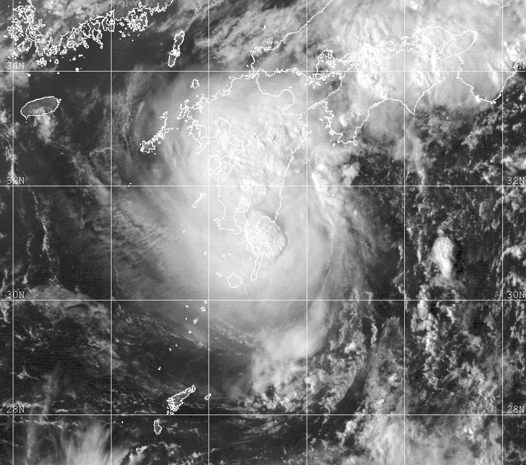
Track=Zia 1999 track.png
Dissipated=September 15
1-min winds=45
Pressure=997Marianas Islands on September 11. The disturbance moved to the north without any significant development until September 13, when the outflow of the system markedly improved and it soon developed into a tropical depression to the east of Okinawa. The depression strengthened further becoming Tropical Storm Zia later that day as approachedKyūshū . Zia peaked with 85 km/h (50 mph) winds as it made landfall on the island on September 14. The storm turned to the northeast and tracked overJapan and dissipated over centralHonshū the next day.cite web|url=http://metocph.nmci.navy.mil/jtwc/atcr/1999atcr/ch1/chap1_page27.html|author=Joint Typhoon Warning Center |title=Tropical Storm Zia (22W)|accessdate=2007-02-17|work=1999 Annual Tropical Cyclone Report]Tropical Storm Zia brought heavy rain to western Japan, which exceeded 500 mm (7.9 inches) in places. The resulting
flood ing and landslides prompted evacuations of over 14,000 people and stranded over 1,300 tourists in a Japanese mountain resort. Nine people died in Japan as a result of Tropical Storm Zia.Tropical Storm Ann
Infobox Hurricane Small
Basin=WPac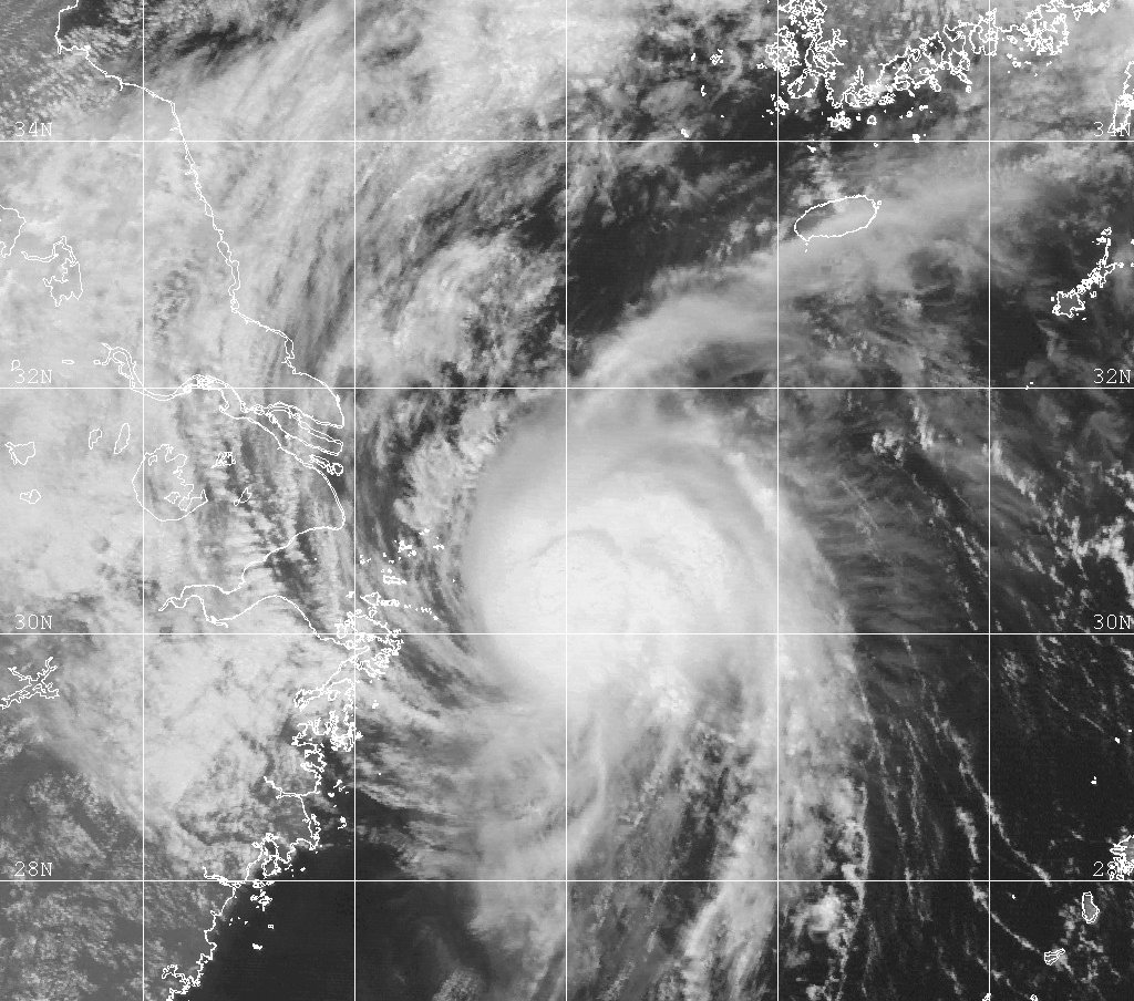
Track=Ann 1999 track.png
Dissipated=September 20
1-min winds=45
Pressure=991Shanghai on September 18, it reached its peak with 85km/h (50mph ) winds and began to recurve to the northwest. The storm started to weaken as it entered a higher shear environment. Ann captured by a mid-level trough moving through the region and turned to the east, rapidly weakening as it crossed theYellow Sea . The system dissipated just off theSouth Korea n coast nearMokpo early on September 20.cite web|url=http://metocph.nmci.navy.mil/jtwc/atcr/1999atcr/ch1/chap1_page28.html|author=Joint Typhoon Warning Center |title=Tropical Storm Ann (23W)|accessdate=2007-02-17|work=1999 Annual Tropical Cyclone Report]Tropical Storm Ann brought moderate rain of up to 100 mm (4 inches) to
Anhui ,Jiangsu andShandong on September 18.cite web|url=http://www.cpc.ncep.noaa.gov/products/analysis_monitoring/GLOB_CLIM/archives/1999/09-18-1999.html|title=Weekly Global Climate Highlights|author=Climate Prediction Center|date=1999-09-18 |accessdate=2007-02-18] Rains of up to 200 mm (8 inches) from Ann and Typhoon Bart saturated South Korea and southwestern Japan, causing flooding and damage to rice paddies.cite web|url=http://usda.mannlib.cornell.edu/usda/waob/weather_weekly//1990s/1999/weather_weekly-09-28-1999.pdf#page=21|format=pdf|pages=p. 21|title=Weekly Weather and Crop Bulletin|author=USDA|coauthors=NOAA |date=1999-09-28 |accessdate=2007-02-17]uper Typhoon Bart (Oniang)
Infobox Hurricane Small
Basin=WPac
Track=Bart 1999 track.png
Dissipated=September 24
1-min winds=140
Pressure=898Kyūshū ,Japan , which it struck on September 3 with 185 km/h (115 mph) winds. After crossing Kyūshū and westernmostHonshū the storm accelerated to the northeast in theSea of Japan , becomingextratropical shortly before it reached northernHokkaidō .cite web|url=http://metocph.nmci.navy.mil/jtwc/atcr/1999atcr/ch1/chap1_page29.html|author=Joint Typhoon Warning Center |title=Super Typhoon Bart (24W)|accessdate=2007-02-17|work=1999 Annual Tropical Cyclone Report] As Typhoon Bart formed in PAGASA's area of responsibility, it was named "Oniang" by PAGASA before moving to the north.Typhoon Bart claimed at least two lives on Okinawa and brought over 710 mm (28 inches) of rain to the island.
Kadena Air Base was badly damaged by the typhoon with over $5 million of damage on the base.cite news|url=http://www.afcesa.af.mil/userdocuments/periodicals/cemag/AFCE_Winter99.pdf#page=8|format=PDF|pages=p. 8|title=Super Typhoon Bart Blasts Kadena|author=Major D. Lehosit|publisher=The U.S. Air Force Civil Engineer|year=1999|accessdate=2007-02-19] Heavy flooding and landslides led to total of a 30 deaths and over 1,000 injuries in Japan. Over 800,000 homes lost power and 80,000 damaged in the aftermath of the storm. The worst damage was inKumamoto Prefecture onKyūshū , where 16 people died and over 45,000 homes were damaged. Bart affected the whole of Japan, with some minor damages occurring inHokkaidō shortly after the storm became extratropical.cite web|url=http://www.fdma.go.jp/html/infor/110921taifu18.htm|title=平成11年 9月21日からの大雨による被害状況について(第30報)~台風第18号の被害を含む~|language=Japanese|author=Fire and Disaster Management Agency |accessdate=2007-02-19|date=1999-10-19 ] A large crane inHiroshima collapsed killing 3 and injuring 4 people in the Mitsubishi plant there and theItsukushima Shrine was also damaged.cite news|url=http://www.rte.ie/news/1999/0924/japan.html|title=26 killed in typhoon off west coast of Japan|author=Staff Writer|date=1999-09-24 |accessdate=2007-02-17|publisher=Radio Telefís Éireann ] Typhoon Bart was the costliest storm of the season, with total damages of $3.5 billion and further $5 million of damage to the Japanese economy.cite web|url=http://www.tsarp.org/downloads/World_Wide_Disasters_2001.pdf#page=19|format=PDF|page=19|author=Munich Re |title=Insured losses of $1 billion and above|work=Annual Review: Natural Catastrophes 2001|year=2002|accessdate=2007-02-19]Tropical Storm Cam
Infobox Hurricane Small
Basin=WPac
Track=Cam 1999 track.png
Dissipated=September 26
1-min winds=40
Pressure=991Hong Kong in the South China Sea became more organized early on September 23, and the JTWC issued a TCFA for the system. It developed into the 25th depression of the season a few hours later and began to track to the northeast, under the influence of a mid-level ridge to the east. The depression gradually intensified becoming Tropical Storm Cam on September 24 and reaching its peak with 75 km/h (45 mph) later that day, as its motion gradually turned towards the north. As it neared the Chinese coast a strong ridge to the north turned Cam abruptly to the west, towards Hong Kong and it began to weaken. The JTWC issued its last warning while the storm was still at sea, shortly before it made landfall over Hong Kong with 35 km/h (25 mph) winds. The storm dissipated over China on September 26.cite web|url=http://metocph.nmci.navy.mil/jtwc/atcr/1999atcr/ch1/chap1_page30.html|author=Joint Typhoon Warning Center |title=Tropical Storm Cam (25W)|accessdate=2007-02-17|work=1999 Annual Tropical Cyclone Report]As Tropical Storm Cam approached Hong Kong, the HKO hoisted the No. 8 Signal for the fifth time in the year, the last time this had occurred was in 1964. The highest gust recorded on land was 121 km/h (75 mph) on
Tai Mo Shan , and 41 mm (1.6 inches) of rain fell on Hong Kong. Cam was responsible for 23 injuries in Hong Kong and one death in a ship offStonecutters Island . There was limited flooding in the region and about 150 people were evacuated to emergency shelters. There was some disruption to flights into the territory, with 100 flights cancelled or delayed.cite web|url=http://www.weather.gov.hk/publica/tc/tc1999.pdf#page=85|format=PDF|pages=pp. 85-90|title=Severe Tropical Storm Cam (9919)|work=Tropical cyclones in 1999|author=Hong Kong Observatory |year=2000|month=April|accessdate=2007-02-17]Typhoon Dan (Pepang)
Infobox Hurricane Small
Basin=WPac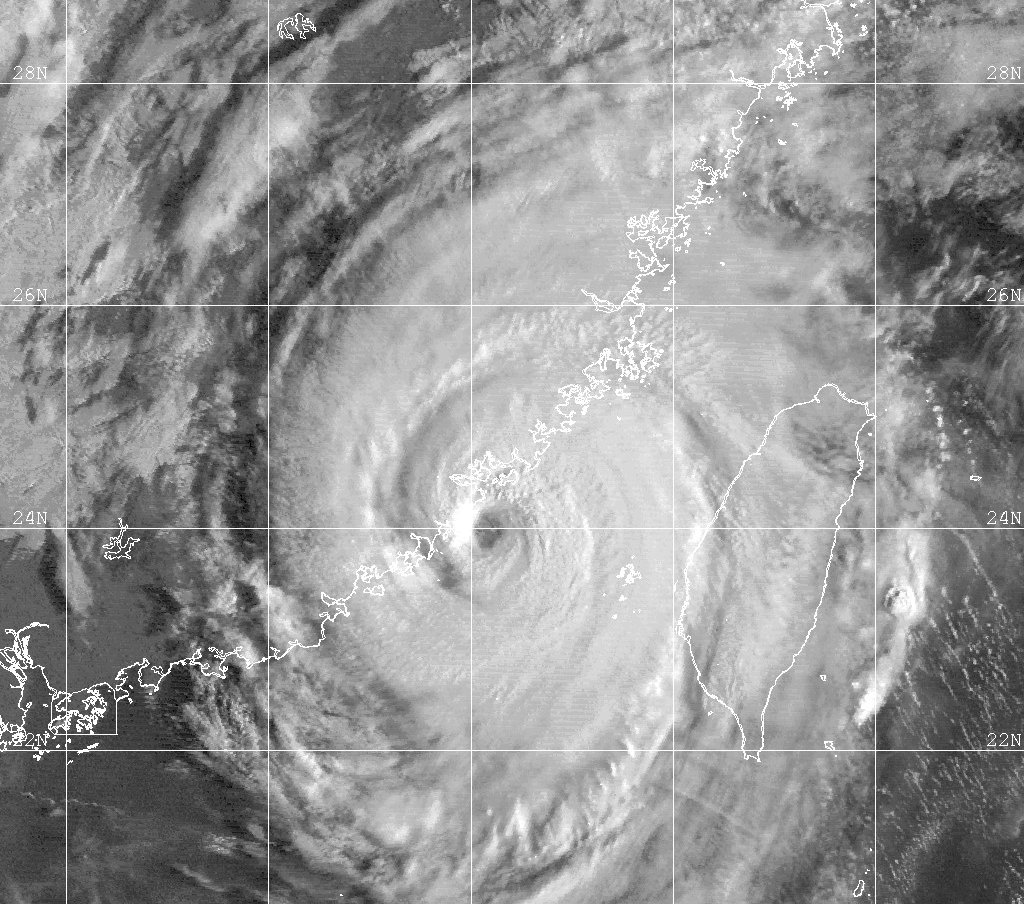
Track=Dan 1999 track.png
Dissipated=October 11
1-min winds=110
Pressure=933Luzon . The system intensified as it moved west-northwest, becoming Tropical Storm Dan on October 3 before reaching typhoon-strength the next day. Typhoon Dan reached its peak with 205 km/h (125 mph) early on October 5 and hit northern Luzon at that strength. The typhoon weakened as it entered the South China Sea, but re-intensified as it turned towards the north. Typhoon Dan made its second landfall nearXiamen ,China on October 9 and weakened overland. Dan turned to the northeast and weakened to a tropical depression before it moved over theYellow Sea late on October 10. The depression was absorbed by a frontal system over the Yellow Sea early the next day.cite web|url=http://metocph.nmci.navy.mil/jtwc/atcr/1999atcr/ch1/chap1_page31.html|author=Joint Typhoon Warning Center |title=Typhoon Dan (26W)|accessdate=2007-02-17|work=1999 Annual Tropical Cyclone Report] Both the JMA and PAGASA treated this storm as a typhoon, with PAGASA naming it "Pepang".cite web|url=http://www.australiasevereweather.com/cyclones/2000/summ9910.htm|author=Padgett, Gary|title=Monthly Global Tropical Cyclone Summary: October 1999|accessdate=2007-02-17]Typhoon Dan brought torrential rain of up to 500 mm (20 inches) to both northern Luzon and southern
Taiwan .cite web|url=http://www.cpc.ncep.noaa.gov/products/analysis_monitoring/GLOB_CLIM/archives/1999/10-09-1999.html|title=Weekly Global Climate Highlights|author=Climate Prediction Center|date=1999-10-09 |accessdate=2007-02-18] Flooding in the Philippines affected 2,600 homes and killed at least five people. There was more than $2 million of damage to agriculture in the Philippines.cite web|url=http://www.weather.gov.hk/publica/tc/tc1999.pdf#page=92|format=PDF|pages=pp. 92-95|title=Typhoon Dan (9920)|work=Tropical cyclones in 1999|author=Hong Kong Observatory |year=2000|month=April|accessdate=2007-02-18] Southern Taiwan was still recovering from theChi-Chi earthquake of the previous month and Dan set these back efforts back. The typhoon burst a dike inKaohsiung and another in Tainan, that had been damaged by the earthquake. Dan damaged a large number of trees onKinmen , which led to the disruption of 70% of the island's power supply. Several fishing boats were sunk and house damaged onPenghu .cite news|url=http://www.taipeitimes.com/News/local/archives/1999/10/10/5842|title=Typhoon Dan downs power lines, uproots trees in the south|date=1999-10-10 |author=Staff Writer|publisher=Taipei Times |accessdate=2007-02-18] 34 died and 1,400 people were injured as a result of the storm inFujian . 1,500 houses were destroyed and $240 million of damage occurred in the province. Dan was the worst typhoon to hitXiamen in 46 years, killing 5 and injuring over 100 in the city.Tropical Storm Eve (Rening)
Infobox Hurricane Small
Basin=WPac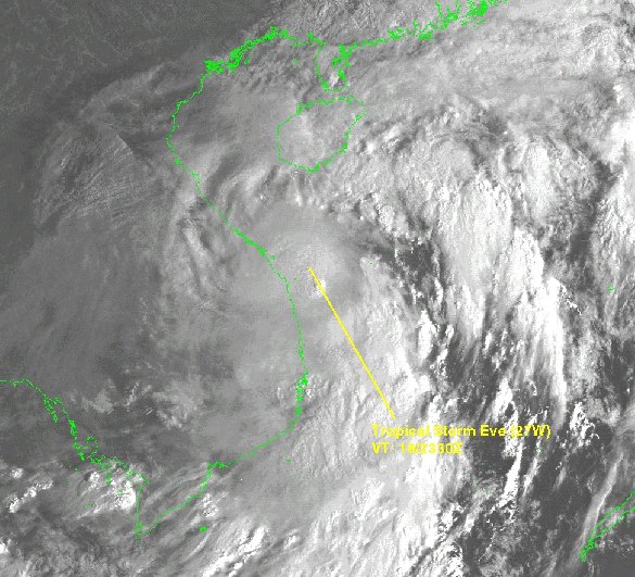
Track=Eve 1999 track.png
Dissipated=October 19
1-min winds=35
Pressure=997Mindanao over thePhilippine Sea began to develop on October 15 as it moved to the west, becoming Tropical Depression 27W. The depression made landfall onSamar Island the same day and moved to the northwest across the centralPhilippines throughout October 6. The depression turned to the west after it emerged into theSouth China Sea , and turned to the southwest on October 18 in response to increasing mid-level ridging over southeastern China. As it neared theVietnam ese coast the depression strengthened slightly and became Tropical Storm Eve. Eve made landfall 110 km (70 miles) southeast ofDa Nang as a minimal tropical storm on October 19 and quickly dissipated overland.cite web|url=http://metocph.nmci.navy.mil/jtwc/atcr/1999atcr/ch1/chap1_page32.html|author=Joint Typhoon Warning Center |title=Tropical Storm Eve (27W)|accessdate=2007-02-17|work=1999 Annual Tropical Cyclone Report] Both the JMA and PAGASA considered Eve a tropical storm, with PAGASA naming it "Rening".Tropical Storm Eve brought torrential rain to much of central Vietnam, with about 290 mm (13 inches) falling on
Hue City and as much as 470 mm (18.5 inches) of rain falling in parts ofHa Tinh Province .cite web|url=http://www.fao.org/docrep/007/ae080e/ae080e04.htm|date=2003-11-30 |work=The role of local institutions in reducing vulnerability to recurrent natural disasters and in sustainable livelihoods development: Vietnam case study|title=Local Institutions Response to 1999 Flood Event in Central Vietnam|author=Asian Disaster Preparedness Center|publisher=FAO|accessdate=2007-02-17] Eve was the first in a series of storms to bring torrential rain to the region, and the resulting floods killed 793 people and made over 55,000 homeless. The floods also caused nearly $300 million of damage directly.cite web|url=http://www.palestinercs.org/Downloads/report2001.pdf#page=103|format=PDF|pages=pp. 102-123|author=IFRC |title=Post-flood recovery in Viet Nam|work=World Disasters Report 2001|year=2001|accessdate=2007-02-17]Tropical Depression 28W
Infobox Hurricane Small
Basin=WPac
Track=28-W 1999 track.png
Dissipated=November 6
1-min winds=30
Pressure=1000Agrihan early on November 5, from the tail-end of shearline connected to a front that ran to Japan. It strengthened into Tropical Depression 28W early the next day and moved to the northeast along the shearline, reaching its peak with 55 km/h (25 mph) winds. The depression did not develop further, but its motion accelerated and it became anextratropical low 18 hours after forming. The depression had no effects on land.cite web|url=http://metocph.nmci.navy.mil/jtwc/atcr/1999atcr/ch1/chap1_page33.html|author=Joint Typhoon Warning Center |title=Tropical Depression 28W|accessdate=2007-02-17|work=1999 Annual Tropical Cyclone Report]Tropical Storm Frankie (Sedang)
Infobox Hurricane Small
Basin=WPac
Track=Frankie 1999 track.png
Dissipated=November 11
1-min winds=35
Pressure=997Koror in the Philippine Sea developed as it moved to the west on November 6, becoming Tropical Depression 29W. The depression moved rapidly to the west under the influence of thesubtropical ridge to the north, crossing Samar early on November 8. The system strengthened over the central Philippines, becoming Tropical Storm Frankie. The influence of a developing ridge to the southeast led to Frankie becoming quasi-stationary over theSibuyan Sea . The storm soon weakened due to increasing wind shear and interaction with land, and it dissipated on November 11.cite web|url=http://metocph.nmci.navy.mil/jtwc/atcr/1999atcr/ch1/chap1_page34.html|author=Joint Typhoon Warning Center |title=Tropical Storm Frankie (29W)|accessdate=2007-02-19|work=1999 Annual Tropical Cyclone Report] PAGASA tracked Frankie as a tropical storm, naming it "Sedang". The JMA considered this storm to have been a tropical depression.cite web|url=http://www.australiasevereweather.com/cyclones/2000/summ9911.htm|author=Padgett, Gary|title=Monthly Global Tropical Cyclone Summary: November 1999|accessdate=2007-02-17]Tropical Storm Frankie brought heavy rain of up to 300 mm (12 inches) to the central Philippines, that disrupted the rice harvest.cite web|url=http://usda.mannlib.cornell.edu/usda/waob/weather_weekly//1990s/1999/weather_weekly-11-16-1999.pdf#page=20|format=pdf|pages=p. 20|title=Weekly Weather and Crop Bulletin|author=USDA|coauthors=
NOAA |date=1999-11-16 |accessdate=2007-02-17] Flooding from the storm forced the evacuation of 300 families inCalbayog .cite news|url=http://www.cnn.com/NATURE/9911/12/diary.planet/index.html#Cyclone|author=Newman, Steve|title=Earthweek - A Diary of the Planet|date=1999-11-12 |accessdate=2007-02-18|publisher=CNN ]Typhoon Gloria (Trining)
Infobox Hurricane Small
Basin=WPac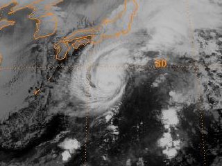
Track=Gloria 1999 track.png
Dissipated=November 16
1-min winds=65
Pressure=976extratropical . Typhoon Gloria became fully extratropical on November 16, having weakened back into a tropical storm. [cite web|url=http://metocph.nmci.navy.mil/jtwc/atcr/1999atcr/ch1/chap1_page35.html|author=Joint Typhoon Warning Center |title=Typhoon Gloria (30W)|accessdate=2007-02-17|work=1999 Annual Tropical Cyclone Report]Both the JMA and PAGASA monitored Gloria, with PAGASA naming the storm "Trining". The JMA assessed Gloria as being a severe tropical storm at its peak strength on November 15. Typhoon Gloria did not approach land closely.
Tropical Depression 31W
Infobox Hurricane Small
Basin=WPac
Track=31-W 1999 track.png
Dissipated=December 4
1-min winds=30
Pressure=1000Palawan became more organized as it moved to the northwest, away from the island, becoming Tropical Depression 31W early on December 1. A subtropical ridge to the north of the system determined the motion of the storm as it moved southwest through theSouth China Sea off theVietnam ese coast, with winds peaking at 55 km/h (35 mph). Early on, December 3, when the storm was to the south of Vietnam, it turned to the northwest and headed towards theMalay Peninsula . The depression made landfall inThailand to the northeast ofPhuket on December 4 and the JTWC ceased advisories as the storm weakened overland. The remnants entered theAndaman Sea but redevelopment did not occur.cite web|url=http://metocph.nmci.navy.mil/jtwc/atcr/1999atcr/ch1/chap1_page36.html|author=Joint Typhoon Warning Center |title=Tropical Depression 31W|accessdate=2007-02-17|work=1999 Annual Tropical Cyclone Report]Tropical Depression 32W
Infobox Hurricane Small
Basin=WPac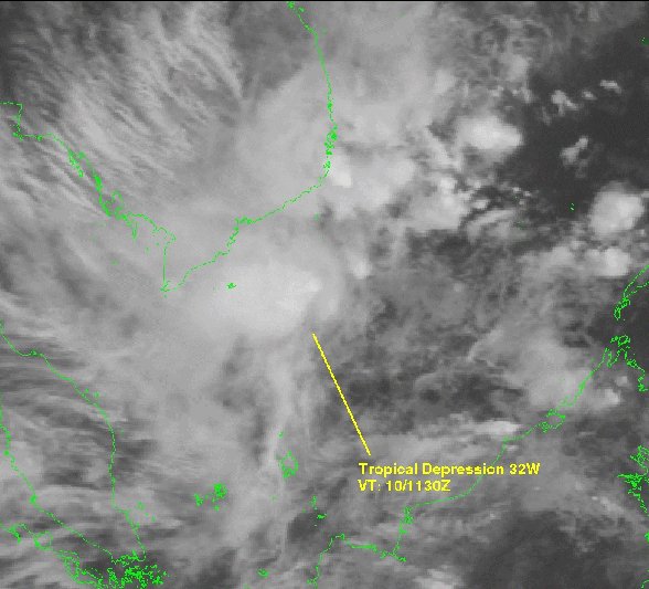
Track=32-W 1999 track.png
Dissipated=December 13
1-min winds=30
Pressure=1000South China Sea , betweenPalawan andBorneo and slowly moved to the west. After the depression reached its peak with 55 km/h (35 mph) winds it began to accelerate to the west. By December 11, when the storm was to the south ofVietnam , it became more sheared and the low-level circulation became exposed. The system dissipated soon afterwards, having never approached land.cite web|url=http://metocph.nmci.navy.mil/jtwc/atcr/1999atcr/ch1/chap1_page37.html|author=Joint Typhoon Warning Center |title=Tropical Depression 32W|accessdate=2007-02-17|work=1999 Annual Tropical Cyclone Report]Tropical Depression 33W
Infobox Hurricane Small
Basin=WPac
Track=33-W 1999 track.png
Dissipated=December 16
1-min winds=30
Pressure=1000Cam Ranh Bay ,Vietnam . A high level of wind shear restricted the storm's strength to 55 km/h (35 mph), which it maintained as it moved west towards Vietnam. The storm turned to the north shortly before it made landfall on December 16 and dissipated soon after over Vietnam under the influence of increased wind shear and interaction with land. It is unknown if the storm had any effects on land.cite web|url=http://metocph.nmci.navy.mil/jtwc/atcr/1999atcr/ch1/chap1_page38.html|author=Joint Typhoon Warning Center |title=Tropical Depression (TD) 33W|accessdate=2007-02-17|work=1999 Annual Tropical Cyclone Report]1999 storm names
Western North Pacific tropical cyclones were named by the
Joint Typhoon Warning Center until the end of the 1999 season. This was the last year the following lists were used. The first storm of 1999 was named Hilda and the final one was named Gloria. Basin suffix included to show for example Tropical Storm 01W Hilda and Auring are the same storm.One Eastern Pacific storm, Dora 07E, crossed into the Central Pacific and then into this basin. It became Tropical Storm Dora.
Philippines The
Philippine Atmospheric, Geophysical and Astronomical Services Administration (PAGASA) uses its own naming scheme for tropical cyclones within its area of responsibility. Lists are recycled every four years. This is the same list used for the 1995 season, with the exception of Rening, which replaces Rosing.ee also
*
1999 Pacific hurricane season
*1999 Atlantic hurricane season
*1999-00 Southern Hemisphere tropical cyclone season References
External links
* [http://www.typhoon2000.ph Typhoon2000 Philippine typhoon website] .
* [http://www.typhoon2000.ph/plotting/PhilippineTyphoonChart.gifPhilippine Area of Responsibility] .
* [http://metocph.nmci.navy.mil/jtwc.html Joint Typhoon Warning Center] .
* [http://www.weather.gov.hk/informtc/sound/tc_pronunciatione.htm Meaning of Tokyo Typhoon Centre names] .

Wikimedia Foundation. 2010.