- 1983 Pacific typhoon season
Infobox hurricane season
Basin=WPac
Year=1983
Track=1983 Pacific typhoon season summary.jpg
First storm formed=June 24
Last storm dissipated=December 18
Strongest storm name=Forrest
Strongest storm winds=150
Strongest storm pressure=883
Total storms=23
Total hurricanes=12
Total intense=4
Fatalities=742
five seasons=1981 1982 1983 1984 1985The 1983 Pacific typhoon season has no official bounds, but mosttropical cyclones tend to form in the northwesternPacific Ocean between May and November. [Gary Padgett. [http://www.typhoon2000.ph/garyp_mgtcs/may03sum.txt May 2003 Tropical Cyclone Summary.] Retrieved2007-01-05 .] These dates conventionally delimit the period of each year when most tropical cyclones form in the northwesternPacific Ocean .The scope of this article is limited to the Pacific Ocean, north of the equator and west of the
international date line . Storms that form east of the date line and north of the equator are called hurricanes; see1983 Pacific hurricane season . Tropical Storms formed in the entire west pacific basin were assigned a name by theJoint Typhoon Warning Center . Tropical depressions in this basin have the "W" suffix added to their number. Tropical depressions that enter or form in the Philippine area of responsibility are assigned a name by thePhilippine Atmospheric, Geophysical and Astronomical Services Administration or PAGASA. This can often result in the same storm having two names.torms
24 tropical depressions formed this year in the Western Pacific, of which 23 became tropical storms. 12 storms reached typhoon intensity, of which 4 reached super typhoon strength.
Tropical Storm Sarah (Goring)
infobox hurricane small
name=Tropical Storm Sarah/Goring
category=storm
type=tropical storm
track=Sarah 1983 track.png
dissipated=June 26
highest winds=35 knots (1-min)
lowest pressure=999 mbarSouth China Sea on June 24, it became the latest start of a western Pacific season since 1973. Sarah moved northwestward, hitVietnam , and dissipated on the 26th. [Joint Typhoon Warning Center. [https://metocph.nmci.navy.mil/jtwc/atcr/1983atcr/pdf/wnp/01.pdf Tropical Storm Sarah.] Retrieved on2007-01-06 .] Damage across thePhilippines totaled 2.77 billion Philippine Pesos (1983 pesos). [Philippine Atmospheric Geophysical and Astronomical Services Administration. [http://www.pagasa.dost.gov.ph/cab/dtc_06.htm Most Destructive Tropical Cyclones for the Month of June (1948-2000).] Retrieved on2007-02-04 .]Typhoon Tip
infobox hurricane small
name=Typhoon Tip
category=cat1
type=typhoon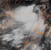
track=Tip 1983 track.png
dissipated=July 13
highest winds=65 knots (1-min)
lowest pressure=978 mbarPhilippines , the system moved through the archipelago as a tropical depression before strengthening briefly to a typhoon in theSouth China Sea . A combination of northeasterly verticalwind shear and proximity to land weakened the cyclone to a tropical storm before its landfall onHai-nan and struck Chan Chiang,China as a tropical depression. [Joint Typhoon Warning Center. [https://metocph.nmci.navy.mil/jtwc/atcr/1983atcr/pdf/wnp/02.pdf Typhoon Tip.] Retrieved on2007-01-06 .]Typhoon Vera
infobox hurricane small
name=Typhoon Vera
category=cat2
type=typhoon
track=Vera 1983 track.png
dissipated=July 18
highest winds=90 knots (1-min)
lowest pressure=952 mbarPhilippines . It headed westward, strengthening to a tropical storm that night and a typhoon on the 13th. Vera made landfall on the 14th as an convert|85|mi/h|km/h|0|abbr=on typhoon, weakened over the islands, and restrengthened over the South China Sea to a convert|100|mi/h|km/h|-1|abbr=on typhoon. Vera struckHainan Island on the 17th, crossed the Gulf of Tonkin, and dissipated over Vietnam on the 18th. Vera brought torrential flooding, resulting in the deaths of over 100 people. [Joint Typhoon Warning Center. [https://metocph.nmci.navy.mil/jtwc/atcr/1983atcr/pdf/wnp/03.pdf Typhoon Vera.] Retrieved on2007-01-06 .]uper Typhoon Wayne
infobox hurricane small
name=Super Typhoon Wayne
category=cat4
type=super typhoon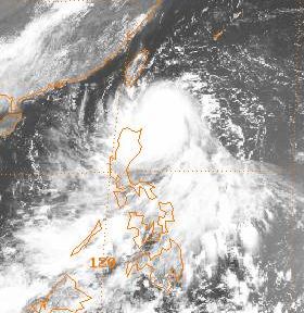
track=Wayne 1983 track.png
dissipated=July 25
highest winds=135 knots (1-min)
lowest pressure=920 mbarPhilippines , Wayne strengthened rapidly to become a tropical storm on July 22, a typhoon on July 23, and a super typhoon around midday on July 24 before moving south ofTaiwan into mainlandChina on July 25 and dissipating. In the Philippines, 20 perished due to flash flooding. [Joint Typhoon Warning Center. [https://metocph.nmci.navy.mil/jtwc/atcr/1983atcr/pdf/wnp/04.pdf Super Typhoon Wayne.] Retrieved on2007-01-07 .]uper Typhoon Abby
infobox hurricane small
name=Super Typhoon Abby
category=cat5
type=super typhoon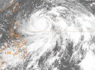
track=Abby 1983 track.png
dissipated=August 17
highest winds=145 knots (1-min)
lowest pressure=888 mbarGuam on July 31, this system slowly matured into the season's second super typhoon as it moved west-northwest over the following nine days. Intensification was most rapid as it was slowly recurving northward on August 7 and August 8. After peaking early on August 9, Abby slowly weakened as it interacted with the main belt of the Westerlies. It managed to remain a major typhoon, with winds at or above convert|100|kn|km/h|-1, for a week. Abby finally weakened back into a tropical storm on August 17 just before its landfall at Hamamatsu, Japan. By late that night, Abby completed the transition to anextratropical cyclone after moving through central Japan. Two perished from Abby in Japan. Its deluge led to numerous landslides and the destruction of 19 bridges. Commercial traffic by land, sea, and air was also paralyzed by the cyclone. [Joint Typhoon Warning Center. [https://metocph.nmci.navy.mil/jtwc/atcr/1983atcr/pdf/wnp/05.pdf Super Typhoon Abby.] Retrieved on2007-01-06 .]Tropical Storm Carmen
infobox hurricane small
name=Tropical Storm Carmen
category=storm
type=tropical storm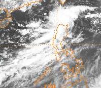
track=Carmen 1983 track.png
dissipated=August 15
highest winds=45 knots (1-min)
lowest pressure=992 mbarmonsoon trough in theSouth China Sea in early August, a low level circulation was first spotted about 370 km east ofVietnam on August 8. Slow development ensued, and the system became a tropical depression during the night of August 12. Tracking slowly north-northeast, Carmen began to accelerate to the east-northeast towards theLuzon Strait steered by Abby. This acceleration was likely a redevelopment of the low pressure area downshear. The system became a tropical storm early morning of August 14 as it continued to close the distance to Abby. By late morning on August 15, absorption into Abby was complete. [Joint Typhoon Warning Center. [https://metocph.nmci.navy.mil/jtwc/atcr/1983atcr/pdf/wnp/06.pdf Tropical Storm Carmen.] Retrieved on2007-01-07 .]Tropical Storm Ben
infobox hurricane small
name=Tropical Storm Ben
category=storm
type=tropical storm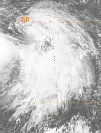
track=Ben 1983 track.png
dissipated=August 15
highest winds=50 knots (1-min)
lowest pressure=989 mbarwind shear from nearby Abby. It developed into a tropical storm that night and moved northwest due to Abby's influence on the steering across the western Pacific at that time. Turning to the west, Ben moved along the southern coast ofHonshū and made landfall west of Hamamatsu. Due to land interaction and increasing upper level westerly wind shear, Ben became an exposed low level circulation on August 14 in theSea of Japan , eventually dissipating late on August 15. [Joint Typhoon Warning Center. [https://metocph.nmci.navy.mil/jtwc/atcr/1983atcr/pdf/wnp/07.pdf Tropical Storm Ben.] Retrieved on2007-01-07 .]Tropical Storm Dom
infobox hurricane small
name=Tropical Storm Dom
category=storm
type=tropical storm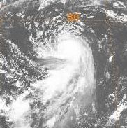
track=Dom 1983 track.png
dissipated=August 26
highest winds=55 knots (1-min)
lowest pressure=995 mbarGuam . Slow development ensued, and the system became a tropical storm late on August 19. As a deep cyclone nearJapan linked up with themonsoon trough , the cyclone turned sharply northeast on August 20. Persisitently sheared by strong northeasterly flow aloft initially, once Dom recurved its convection was left completely behind, weakening the system to a tropical depression on August 21. Thunderstorms began to redevelop near the center, and by midday on August 23 Dom was a tropical storm once more. At this point Dom was moving erratically as the trough nearJapan moved off to the east, and by August 24 Dom turned back to the north-northwest. By August 25 strong winds aloft weakened Dom once more, and the cyclone dissipated as atropical cyclone on August 26. [Joint Typhoon Warning Center. [https://metocph.nmci.navy.mil/jtwc/atcr/1983atcr/pdf/wnp/08.pdf Tropical Storm Dom.] Retrieved on2007-01-07 .]Tropical Depression 09W
infobox hurricane small
name=Tropical Depression 09W
category=depression
type=tropical depression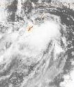
track=9-W 1983 track.png
dissipated=August 27
highest winds=30 knots (1-min)
lowest pressure=996 mbarmonsoon trough was similarly displaced. It was first noted on August 25, but showed no further development. Thunderstorms were located about convert|300|mi|km|-1 south of the center, but since the central pressure was under 1000 mb, it was considered a tropical depression while an exposed low level swirl. The system did develop some central convection, and moved northward intoSouth Korea , bringing showers to the region, and dissipated late on on August 27. [Joint Typhoon Warning Center. [https://metocph.nmci.navy.mil/jtwc/atcr/1983atcr/pdf/wnp/09.pdf Tropical Depression 09W.] Retrieved on2007-01-20 .]Typhoon Ellen
infobox hurricane small
name=Typhoon Ellen
category=cat4
type=typhoon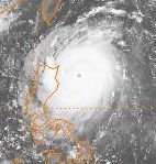
track=Ellen 1983 track.png
dissipated=September 9
highest winds=125 knots (1-min)
lowest pressure=928 mbarInternational Dateline on August 26. It became a tropical storm soon after crossing in the dateline on the morning of August 29. A strong high pressure ridge offshoreJapan led to no further development over the next 5 days, and the cyclone began to track south of west. Dropping down to a weak tropical depression late on September 1, conditions aloft finally improved and the cyclone strengthened into a typhoon on September 3 as it tracked west-northwest. ApproachingLuzon late on September 5, Ellen intensified rapidly into a strong typhoon before the terrain began to weaken the cyclone. Its final landfall was atMacau on the morning of September 9 as a minor typhoon. Hong Kong experienced extensive damage, with six killed and 277 injured. Twenty-two ships ran aground in the harbor. By late on the 9th, Ellen was rapidly dissipating in mainlandChina . [Joint Typhoon Warning Center. [https://metocph.nmci.navy.mil/jtwc/atcr/1983atcr/pdf/wnp/10.pdf Typhoon Ellen.] Retrieved on2007-01-20 .]uper Typhoon Forrest
infobox hurricane small
name=Super Typhoon Forrest
category=cat5
type=super typhoon.jpg)
track=Forrest 1983 track.png
dissipated=September 29
highest winds=150 knots (1-min)
lowest pressure=883 mbarHurricane Wilma in 2005. Forrest struck Japan as a tropical storm on the 28th, causing 21 casualties and moderate damage. [Joint Typhoon Warning Center. [https://metocph.nmci.navy.mil/jtwc/atcr/1983atcr/pdf/wnp/11.pdf Super Typhoon Forrest.] Retrieved on2007-01-06 .]Tropical Storm Georgia
infobox hurricane small
name=Tropical Storm Georgia
category=storm
type=tropical storm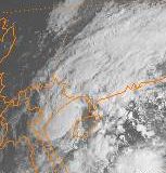
track=Georgia 1983 track.png
dissipated=October 1
highest winds=55 knots (1-min)
lowest pressure=987 mbarPhilippines . Rapidly organizing on September 28, Georgia became a tropical storm by the next morning. Moving westward, it tracked acrossHainan to the south ofChina . Ultimately the storm made its final landfall inVietnam before dissipating while enteringLaos . Georgia killed 26, damaged 7000 buildings, and led to a loss of convert|247000|acre|km2|0 of rice. The 13-14 inches of rainfall it brought to Vietnam relieved drought conditions. [Joint Typhoon Warning Center. [https://metocph.nmci.navy.mil/jtwc/atcr/1983atcr/pdf/wnp/12.pdf Tropical Storm Georgia.] Retrieved on2007-01-20 .]Tropical Storm Herbert
infobox hurricane small
name=Tropical Storm Herbert
category=storm
type=tropical storm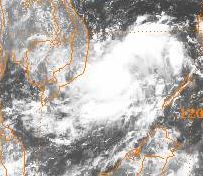
track=Herbert 1983 track.png
dissipated=October 8
highest winds=50 knots (1-min)
lowest pressure=987 mbarMindanao . Moving westward for the next few days without development, the system moved into theSouth China Sea . The system became a tropical storm on October 7 to due significantly increased low-level southwesterlies spinning up its circulation. The cyclone then moved west-northwest, striking Nha Trang,Vietnam . The convective pattern was slow to fade as it drifted westward across Indochina over the next few days. [Joint Typhoon Warning Center. [https://metocph.nmci.navy.mil/jtwc/atcr/1983atcr/pdf/wnp/13.pdf Tropical Storm Herbert.] Retrieved on2007-01-20 .]Typhoon Ida
infobox hurricane small
name=Typhoon Ida
category=cat1
type=typhoon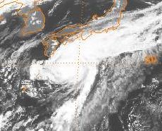
track=Ida 1983 track.png
dissipated=October 11
highest winds=65 knots (1-min)
lowest pressure=973 mbarSaipan on October 6, which appears to be linked with pre-existing convection within an upper-level cyclone, which appeared as early as October 3. By late on the 6th, a closed circulation formed. Continuing to develop, the system became a tropical depression on the morning of October 8 as it moved northwest. Becoming a typhoon on October 10 as it was recurving into the main belt of the Westerlies, the cyclone passed only 150 km southeast ofHonshū . Since it was a small cyclone, no damage occurred withinJapan . By late on October 11, Ida evolved into anextratropical cyclone which moved eastward through the northern Pacific. [Joint Typhoon Warning Center. [https://metocph.nmci.navy.mil/jtwc/atcr/1983atcr/pdf/wnp/14.pdf Typhoon Ida.] Retrieved on2007-01-22 .]Typhoon Joe
infobox hurricane small
name=Typhoon Joe
category=cat1
type=typhoon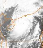
track=Joe 1983 track.png
dissipated=October 13
highest winds=65 knots (1-min)
lowest pressure=975 mbartropical cyclones to form in theSouth China Sea , the initial disturbance was first noted well south of Guam on October 6. The system moved westward, and developed a closed wind circulation by midday on October 9. A new center formed to the south, which complicated the system's development. Remaining poorly organized in thePhilippine Sea due to northerly verticalwind shear , the tropical depression crossed centralLuzon . Now in theSouth China Sea , the system became better organized and developed into a tropical storm and typhoon as it moved northwest. Soon after becoming a typhoon, Joe moved into southernChina about 190 km west ofHong Kong and quickly dissipated inland. [Joint Typhoon Warning Center. [https://metocph.nmci.navy.mil/jtwc/atcr/1983atcr/pdf/wnp/15.pdf Typhoon Joe.] Retrieved on2007-01-22 .]Tropical Storm Kim
infobox hurricane small
name=Tropical Storm Kim
category=storm
type=tropical storm
track=Kim 1983 track.png
dissipated=October 20
highest winds=40 knots (1-min)
lowest pressure=993 mbarBay of Bengal in the North Indian Ocean. Kim continued northwestward, and dissipated on October 20 overMyanmar . Kim, though a weak storm, caused 200 fatalities and extensive crop damage from heavy rainfall. [Joint Typhoon Warning Center. [https://metocph.nmci.navy.mil/jtwc/atcr/1983atcr/pdf/wnp/16.pdf Tropical Storm Kim.] Retrieved on2007-01-06 .]Typhoon Lex
infobox hurricane small
name=Typhoon Lex
category=cat1
type=typhoon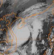
track=Lex 1983 track.png
dissipated=October 26
highest winds=70 knots (1-min)
lowest pressure=971 mbarMarshall Islands on October 14, the tropical disturbance moved westward for the next couple of days without and further development. An upper level ridge built over the system on October 16 while nearTruk , which encouraged slow development. The system developed a weak surface circulation which progressed across the centralPhilippines . Once it entered theSouth China Sea , development increased and it became a tropical depression, then tropical storm, on October 22. Transcribing a cyclonic loop, Lex continued to intensify and was a typhoon by October 25. Moving close toHainan , Lex weakened to a tropical storm while entering theGulf of Tonkin . The cyclone made landfall near Dong Hoi,Vietnam on October 26 as a moderate tropical storm, and then rapidly weakened after moving inland. Hundreds of people were killed, with 81 perishing from an oil drilling ship which was sunk during the storm. [Joint Typhoon Warning Center. [https://metocph.nmci.navy.mil/jtwc/atcr/1983atcr/pdf/wnp/17.pdf Typhoon Lex.] Retrieved on2007-01-06 .]uper Typhoon Marge
infobox hurricane small
name=Super Typhoon Marge
category=cat5
type=super typhoon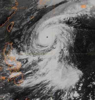
track=Marge 1983 track.png
dissipated=November 7
highest winds=145 knots (1-min)
lowest pressure=896 mbarPhilippines before recurving east ofJapan . During recurvature, its forward motion reached convert|54|kn|km/h|0, becoming one of the fastest known tropical cyclones on record. [Joint Typhoon Warning Center. [https://metocph.nmci.navy.mil/jtwc/atcr/1983atcr/pdf/wnp/18.pdf Super Typhoon Marge.] Retrieved on2007-01-06 .]Tropical Storm Norris
infobox hurricane small
name=Tropical Storm Norris
category=storm
type=tropical storm
track=Norris 1983 track.png
dissipated=November 11
highest winds=50 knots (1-min)
lowest pressure=994 mbar2007-01-22 .]Typhoon Orchid
infobox hurricane small
name=Typhoon Orchid
category=cat4
type=typhoon
track=Orchid 1983 track.png
dissipated=November 27
highest winds=125 knots (1-min)
lowest pressure=928 mbar2007-01-06 .]Typhoon Percy
infobox hurricane small
name=Typhoon Percy
category=cat1
type=typhoon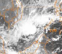
track=Percy 1983 track.png
dissipated=November 24
highest winds=70 knots (1-min)
lowest pressure=970 mbarSouth China Sea , and the system meandered due to the weakness in steering created by Orchid to its northeast. The cyclone managed 160 km of movement through November 23. Briefly becoming a typhoon, eventually Percy became entrained in Orchid's inflow band and began to be sheared by Orchid's opposing outflow pattern. Other than moving through thePhilippines while in the initial tropical depression phase, Percy affected no other land masses. [Joint Typhoon Warning Center. [https://metocph.nmci.navy.mil/jtwc/atcr/1983atcr/pdf/wnp/21.pdf Typhoon Percy.] Retrieved on2007-01-22 .]Tropical Storm Ruth
infobox hurricane small
name=Tropical Storm Ruth
category=storm
type=tropical storm
track=Ruth 1983 track.png
dissipated=November 30
highest winds=60 knots (1-min)
lowest pressure=993 mbarGuam on November 15. Moving slowly westward, there was little additional development until November 19. Thunderstorm activity significantly increased in coverage to a 1670 km east-west axis, with a center forming near 5N 147E. The system moved slowly northwest until November 23. Orchid acted to limit its development by robbing inflow from this disturbance. On the 23rd it became a tropical depression before executing an anticyclonic loop. Upper level conditions became hostile soon afterwards, and the depression weakened. Into November 27 the system moved erratically and went through cycles of convective development and shearing. When Orchid weakened into a tropical depression, Ruth began to develop rapidly and became a tropical storm early on November 28. A frontal zone on its northwest side led to an intense gale in that quadrant, which led to the upgrade. The cyclone nearly became a typhoon later that day before verticalwind shear returned, introduced by a fresh cold outbreak fromAsia . The cyclone degenerated to an exposed low-level swirl on November 30. [Joint Typhoon Warning Center. [https://metocph.nmci.navy.mil/jtwc/atcr/1983atcr/pdf/wnp/22.pdf Tropical Storm Ruth.] Retrieved on2007-01-22 .]Tropical Storm Sperry
infobox hurricane small
name=Tropical Storm Sperry
category=storm
type=tropical storm
track=Sperry 1983 track.png
dissipated=December 5
highest winds=55 knots (1-min)
lowest pressure=996 mbarGuam . By December 1, the system appeared to be forming into atropical cyclone but its thunderstorm activity shifted over 900 km to the northwest of the center. Taking a day to recover, the system attempted to reorganize and became a tropical storm early on December 3. Southerly verticalwind shear limited its development for much of its life cycle. Turning eastward, it reached its maximum intensity late on the 3rd before shearing apart on December 4. Early on December 5, the system degenerated into a weak area of low pressure. [Joint Typhoon Warning Center. [https://metocph.nmci.navy.mil/jtwc/atcr/1983atcr/pdf/wnp/23.pdf Tropical Storm Sperry.] Retrieved on2007-01-23 .]Tropical Storm Thelma
infobox hurricane small
name=Tropical Storm Thelma
category=storm
type=tropical storm
track=Thelma 1983 track.png
dissipated=December 18
highest winds=55 knots (1-min)
lowest pressure=990 mbarCaroline Islands on December 11 near 4N 170E. Over the next couple days, an upper cyclone to its north shifted westward, which helped lead to increased outflow and a low-level circulation. It moved rapidly westward for the next 60 hours as a poorly-defined low despite increasing convective organization. By late morning on December 16, it became a tropical storm. The system tracked along a smooth parabola east of thePhilippines becoming a moderately strong tropical storm. Intense verticalwind shear struck the cyclone as it moved northeast at a clip up to convert|27|kn|km/h|0, and the system rapidly weakened. [Joint Typhoon Warning Center. [https://metocph.nmci.navy.mil/jtwc/atcr/1983atcr/pdf/wnp/24.pdf Tropical Storm Thelma.] Retrieved on2007-01-23 .]1983 storm names
Western North Pacific tropical cyclones were named by the
Joint Typhoon Warning Center . The first storm of 1983 was named Sarah and the final one was named Thelma.ee also
*
1983 Pacific hurricane season
*1983 Atlantic hurricane season
*1983 North Indian cyclone seasonReferences
External links
* [http://www.typhoon2000.ph Typhoon2000 Philippine typhoon website] .
* [http://www.typhoon2000.ph/plotting/PhilippineTyphoonChart.gifPhilippine Area of Responsibility] .
* [https://metocph.nmci.navy.mil/jtwc.html Joint Typhoon Warning Center] .
* [http://www.weather.gov.hk/informtc/sound/tc_pronunciatione.htm Meaning of Tokyo Typhoon Centre names] .
Wikimedia Foundation. 2010.