- 1987 Pacific hurricane season
Infobox hurricane season
Basin=EPac
Year=1987
Track=1987 Pacific hurricane season map.png
Last storm dissipated=October 3, 1987
Strongest storm name=Max
Strongest storm winds=135
Strongest CPac name=Peke
Strongest CPac winds=90
Total storms=20
Total hurricanes=10
Total intense=4
Fatalities=1
five seasons=1985, 1986, 1987, 1988, 1989May 15 ,1987 in the eastern Pacific, andJune 1 ,1987 in the central Pacific, and lasted untilNovember 30 ,1987 . These dates conventionally delimit the period of each year when most tropical cyclones form in the northeasternPacific Ocean .Despite there being twenty cyclones, there were very few notable storms this year. Only three storms came anywhere near to threatening land. Hurricane Eugene was the first
Pacific hurricane to make landfall in Mexico in July since at least the 1949 season and caused the season's only known fatality. Tropical Storm Pilar and Hurricane Norma also came close to land. The remnants of Hurricanes Ramon and Norma caused rain in theContinental United States . Elsewhere, Peke was a central north Pacific hurricane that crossed the dateline and became a typhoon.easonal summary
This year, there were nine tropical storms, nine hurricanes, and four major hurricanes that reached Category 3 or higher on the
Saffir-Simpson Hurricane Scale .cite web|url=http://www.nhc.noaa.gov/tracks1949to2007_epa.txt|date=2008-03-21|title=Eastern North Pacific Tracks File 1949-2007|accessdate=2008-06-02|publisher=National Hurricane Center ] In the Central Pacific, one hurricane and one tropical storm formed. Two tropical storms entered this basin from the east by crossing 140°W.cite web|url=http://www.prh.noaa.gov/cphc/summaries/1987.php|title=The 1987 Central Pacific Tropical Cyclone Season|publisher=Central Pacific Hurricane Center |accessdate=2007-07-19]torms
Tropical Storm Adrian
Infobox Hurricane Small
Basin=EPac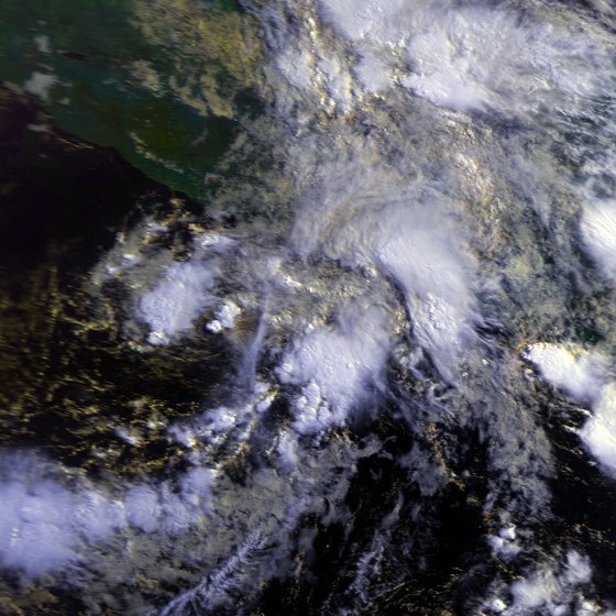
Track=Adrian 1987 track.pngJune 7
Dissipated=June 9
1-min winds=40June 7 , a tropical depression formed. It strengthened into a tropical storm immediately thereafter. After peaking with a windspeed of 40 knots, onJune 8 , Adrian slowly weakened. It fell to a tropical depression onJune 9 and dissipated later that day. During its life, Adrian paralleled the Mexican shoreline far offshore before looping counter-clockwise over its path when it was a depression.Tropical Storm Beatriz
Infobox Hurricane Small
Basin=EPac
Track=Beatriz 1987 track.pngJuly 3
Dissipated=July 7
1-min winds=45July 3 , a tropical depression formed. It strengthened into a tropical storm later that day. Beatriz slowly strengthened and moved generally northwest as it stayed far offshore. OnJuly 5 , Beatriz reached its peak wind speed of 45 knots. It weakened thereafter, falling to a depression onJuly 6 and dissipating the next day. Beatriz never approached land and its impact, if any, is unknown.Tropical Storm Calvin
Infobox Hurricane Small
Basin=EPac
Track=Calvin 1987 track.pngJuly 5
Dissipated=July 10
1-min winds=55July 5 and immediately strengthened into a tropical storm the next day. Calvin headed generally east. OnJuly 8 , it peaked with a windspeed of 55*nbsp;knots. It then gradually weakened, falling to a depression onJuly 9 and dissipating the next day. Tropical Storm Calvin stayed at sea, and thus it is unknown if there were casualties or damage.Tropical Storm Dora
Infobox Hurricane Small
Basin=EPac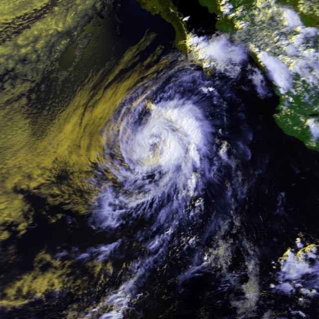
Track=Dora 1987 track.pngJuly 15
Dissipated=July 20
1-min winds=50July 15 strengthened into a tropical storm that same day. Dora headed east northeast and slowly strengthened. It reached its peak windspeed of 50 knots onJuly 17 . It then steadily weakened until it became a depression two days later. It dissipated onJuly 20 . Tropical Storm Dora's impact is not known.Hurricane Eugene
Infobox Hurricane Small
Basin=EPac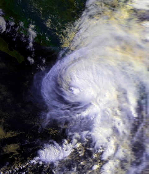
Track=Eugene 1987 track.pngJuly 22
Dissipated=July 26
1-min winds=85July 22 . It initially headed westward and strengthened into a tropical storm the same day it formed. It strengthened into a hurricane, the first of the season, onJuly 24 as an upper-level cyclone pulled the system north.cite web|url=http://www.hpc.ncep.noaa.gov/tropical/rain/eugene1987.html|publisher=Hydrometeorological Prediction Center|title=Hurricane Eugene - July 22-27, 1987|accessdate=2007-07-19] After peaking as a Category 2 hurricane with winds of 85 knots onJuly 25 , land interaction weakened the hurricane to Category 1 as it made landfall south ofManzanillo . The rough topography weakened Eugene, and the hurricane was only a depression when it emerged into theGulf of California . It promptly dissipated onJuly 26 .Hurricane Eugene caused extremely heavy rain in coastal parts of Mexico. The highest rain was 20.68 inches at
Aquila, Michoacán . Hurricane Eugene or its remnants are responsible for the highest tropical cyclone caused rainfall in the Mexican states ofAguascalientes ,Michoacán ,Querétaro ,Tlaxcala , andZacatecas between 1983 and 2007.cite web | author = David Roth | title = Tropical Cyclone Maxima Per Mexican State | work = Tropical Cyclone Rainfall Data| format = GIF | url = http://www.hpc.ncep.noaa.gov/tropical/rain/tcmexicostatemaxima.gif| publisher =Hydrometeorological Prediction Center | accessdate = 2007-07-21] In Manzanillo, at least 60 people were rendered homeless.cite news|url=http://www.thehurricanearchive.com/Viewer.aspx?|format=PDF|date=1987-07-26|publisher=Logansport Pharos-Tribune|accessdate=2008-05-24|title=Hurricane Hits Mexico's Pacific Coast] Most of the damage was the scattering of debris and mud. Two to three hundred houses were destroyed in
Colima . Elsewhere,Manzanillo Airport 's control tower was damaged, necessitating closure for a few days. Six people were injured, and a man inVenustiano Carrazano was killed when a palm tree was blown over.cite news|publisher=Del Rio News-Herald|url=http://www.thehurricanearchive.com/Viewer.aspx?|date=1987-07-28|format=PDF|accessdate=2008-05-24|title=Death attributed to Hurricane Eugene]
Hurricane Eugene was the first July hurricane to make landfall on the Pacific coast of
Mexico since the 1954 season. Since then, the only other one was 1993's Hurricane Calvin.cite web|page=3|url=http://www.nhc.noaa.gov/archive/storm_wallets/epacific/ep1993-prelim/calvin/prelim03.gif|author=Edward Rappaport |title=Preliminary Report Hurricane Calvin|page=3|format=GIF|date=1993-08-02|accessdate=2007-07-19]Tropical Storm Fernanda
Infobox Hurricane Small
Basin=EPac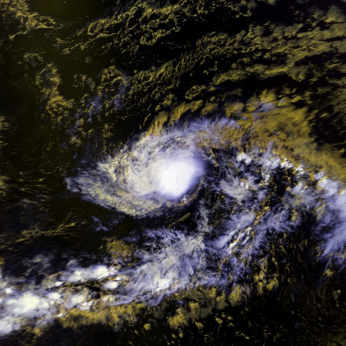
Track=Fernanda 1987 track.pngJuly 24
Dissipated=July 31
1-min winds=55July 24 . Heading west, the cyclone reached tropical storm intensity onJuly 25 . Fernanda strengthened and reached its peak intensity of 55 knots onJuly 26 , the same day it crossed 140°W and entered the central north Pacific.< Fernanda headed in the general direction of the Hawaiian Islands as a trough approached. The trough causedwind shear , which weakened the cyclone into a tropical depression onJuly 28 . Fernanda dissipated three days later.Tropical Storm Fernanda caused no reported impact in the Central Pacific Hurricane Center's
area of responsibility . It is unknown if there was impact elsewhere.Hurricane Greg
Infobox Hurricane Small
Basin=EPac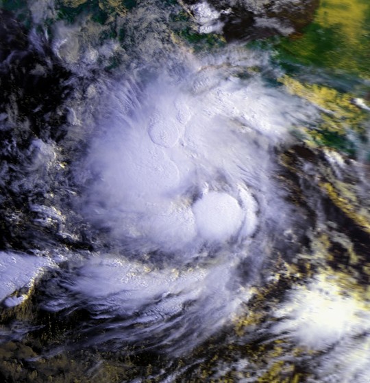
Track=Greg 1987 track.pngJuly 28
Dissipated=August 3
1-min winds=70July 28 strengthened into a tropical storm the day after it formed. The cyclone steadily intensified as it roughly paralleled the Mexican coast for offshore. Greg became a hurricane onJuly 31 and peaked with windspeeds of 70 knots onAugust 1 . It then weakened, falling to tropical storm intensity later onAugust 1 , falling to depression intensity onAugust 2 , and dissipating the next day. Greg stayed at sea and any impact it had is unknown.Hurricane Hilary
Infobox Hurricane Small
Basin=EPac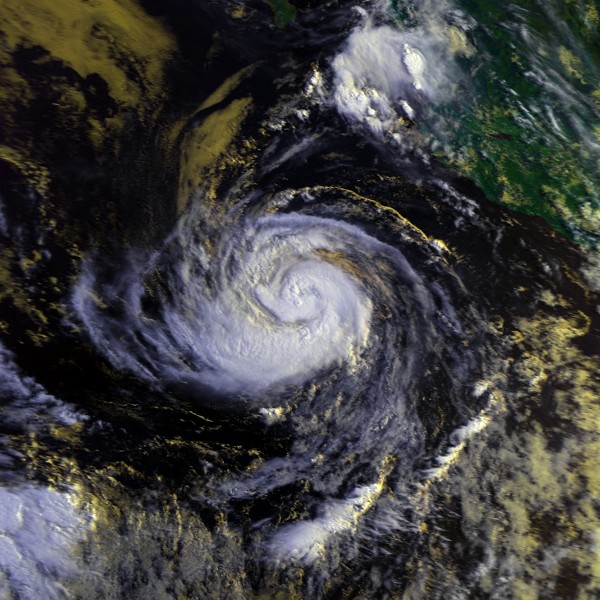
Track=Hilary 1987 track.pngJuly 31
Dissipated=August 9
1-min winds=105July 31 , a tropical depression formed and headed west-northwest, a heading it would maintain for its entire life. The cyclone strengthened at a regular pace and reached hurricane intensity on the first day of August. Hilary continued strengthening, and became a hurricane onAugust 2 . OnAugust 3 , the cyclone reached Category 3 status on theSaffir-Simpson Hurricane Scale , making it the first major hurricane of the season. At its peak strength, which it reached onAugust 4 , Hilary had winds of 105 knots. It then weakened, and had fallen to Category 1 intensity onAugust 5 . The hurricane then restrengthened, maintaining Category 2 intensity untilAugust 6 . The system then began a terminal weakening trend. ByAugust 7 it was only a tropical storm. After falling to depression strength, Hilary dissipated onAugust 9 . Whatever impact Hurricane Hilary might have had is unknown.Tropical Storm Irwin
Infobox Hurricane Small
Basin=EPac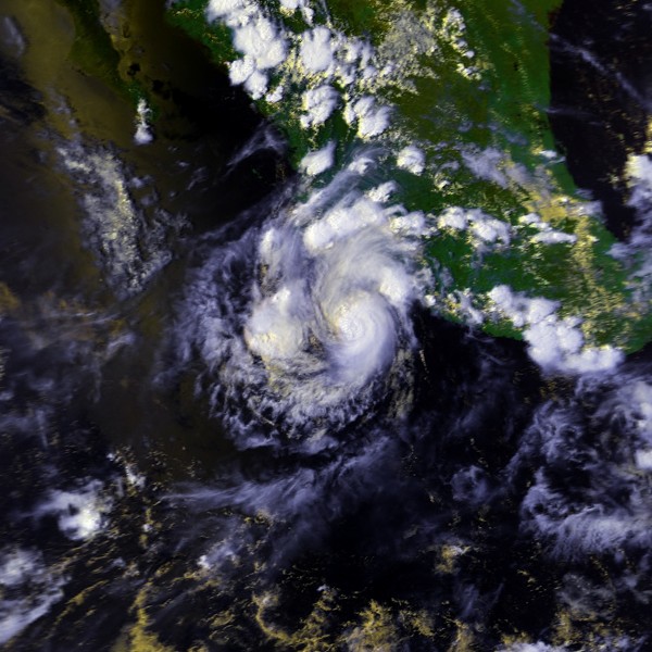
Track=Irwin 1987 track.pngAugust 3
Dissipated=August 9
1-min winds=55August 3 and immediately intensified into a tropical storm. Irwin fluctuated in strength, and closely paralleled the coast of Mexico. OnAugust 6 , Irwin reached its maximum windspeed of 55 knots; it maintained that velocity for over two days. AroundAugust 8 , Irwin turned nearly due west and headed out to sea. Irwin weakened to a depression onAugust 9 and immediately dissipated. Although Tropical Storm Irwin closely paralleled the Pacific coast of Mexico, any effects it might have had there are unknown.Hurricane Jova
Infobox Hurricane Small
Basin=EPac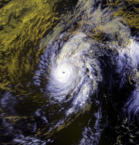
Track=Jova 1987 track.pngAugust 13
Dissipated=August 22
1-min winds=90August 13 and intensified into Tropical Storm Jova the next day. It headed more-or-less westerly, a direction maintained until dissipation. Jova steadily strengthened and reached hurricane intensity onAugust 16 . When it peaked onAugust 17 , Jova was a 90 knot Category 2 hurricane. After peaking, Jova slowly weakened as it continued westwards. It was in a decling state when it crossed 140°W and entered the central north Pacific. Jova continued to weaken, and was a depression byAugust 20 . Jova dissipated two days later while due south of theBig Island of Hawaii , although it remnants were still visible south ofJohnston Atoll until at leastAugust 24 .Hurricane Jova caused no impact in the Central Pacific Hurricane Center's area of responsibility. It is not known if there was impact elsewhere.
Tropical Storm Oka
Infobox Hurricane Small
Basin=EPac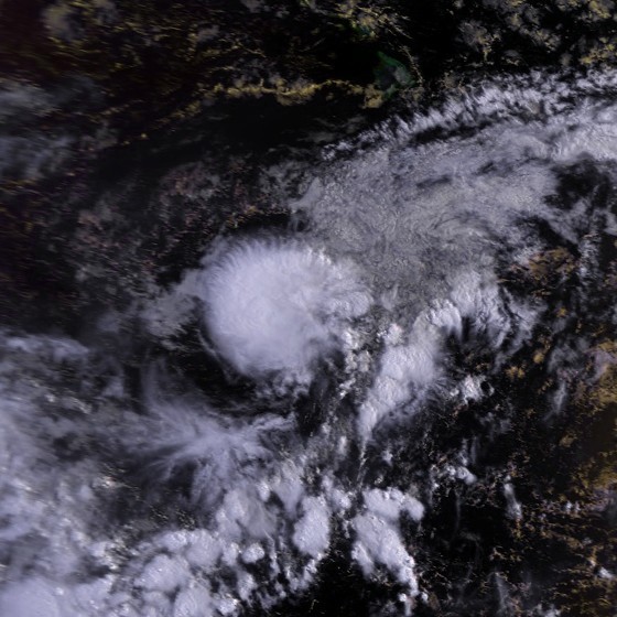
Track=Oka 1987 track.pngAugust 26
Dissipated=August 29
1-min winds=50intertropical convergence zone organized into Tropical Depression One-C onAugust 26 . Twelve hours later, it was upgraded to a tropical storm and named Oka, which is Hawaiian for . Oka slowly moved west-northwest and reached its peak windspeed of 50 knots onAugust 27 . The next day, troughing causedwind shear , which weakened Oka to a depression onAugust 29 and subsequently destroyed it.No reports of damage or casualties were received.
Tropical Storm Knut
Infobox Hurricane Small
Basin=EPac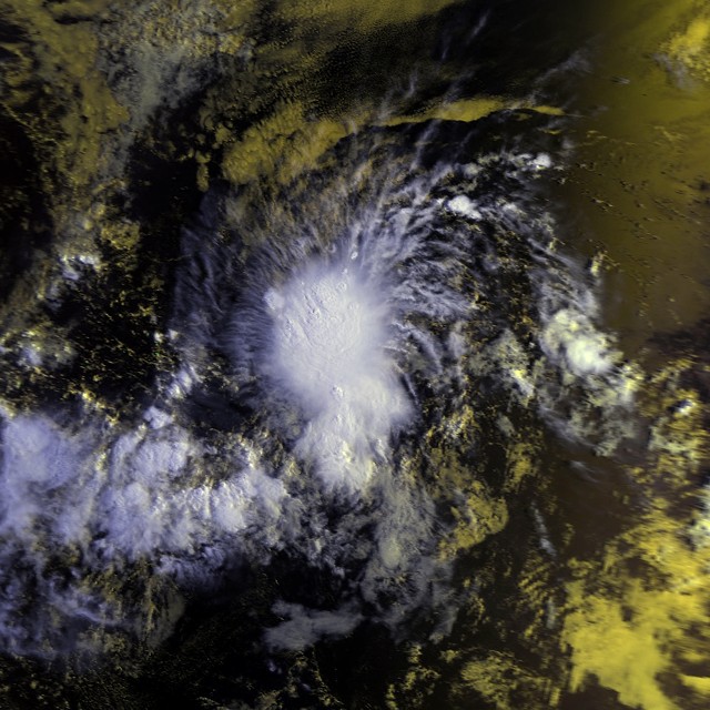
Track=Knut 1987 track.pngAugust 28
Dissipated=August 30
1-min winds=35August 28 , a tropical depression formed. Twelve hours later, it strengthened into a tropical storm and was named Knut. Never attaining winds stronger than 35 knots, Knut stayed a tropical storm for one day. It weakened to a tropical depression onAugust 30 and dissipated later that day. The cyclone stayed out at sea for its entire life, and never threatened land.Knut's impact is unknown. However, its name was retired after this season. Possible explanations include "practical reasons such as a pronunciationambiguity or a 'socially unacceptable' meaning in one of the languages" or "because theyrepresented a significant human disaster."cite web|url=http://www.wmo.int/pages/prog/www/TCP_vO/OperationPlans/TCP30-2006-EN.pdf|pages=9-5|publisher=
World Meteorological Organization |format=PDF|title=Regional Association IV (North America, Central America and the Caribbean) Hurricane Operational Plan|year=2006|accessdate=2007-07-19|format=PDF]Hurricane Lidia
Infobox Hurricane Small
Basin=EPac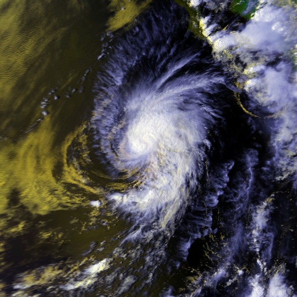
Track=Lidia 1987 track.pngAugust 29
Dissipated=September 3
1-min winds=75August 29 , a tropical despression formed and intensified into a storm the next day. Lidia headed northwest, paralleling the Mexican coast. It edged in a more westerly direction for a day before resuming its northwesterly path, and reached hurricane intensity onSeptember 1 . At its strongest windspeed, which was attained onSeptember 1 , Hurricane Lidia had a windspeed of 75 knots. Lidia then began weakening. It lost hurricane intensity onSeptember 2 , and dissipated onSeptember 3 , the same day it became a tropical depression. It is not known what Hurricane Lidia's effects were, if any.Hurricane Max
Infobox Hurricane Small
Basin=EPac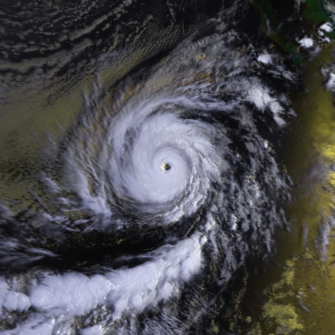
Track=Max 1987 track.pngSeptember 9
Dissipated=September 16
1-min winds=135September 10 , a tropical depression which had formed the previous day intensified into a tropical storm. Heading west-northwest, Max steadily intensified. It became a hurricane onSeptember 11 , reachedCategory 2 intensity the next day, and became a major hurricane six hours later. OnSeptember 12 , Hurricane Max reached Category 4 intensity. Max's maximum windspeed of 135 knots was the highest for the season, and the cyclone attained that strength onSeptember 13 . The hurricane's track then shifted north for a time, before turning to the west onSeptember 15 . That same day, the weakened to a tropical storm. The tropical cyclone dissipated onSeptember 16 . Hurricane Max stayed out to sea during its lifespan, and any impact it might have had is unknown.Hurricane Norma
Infobox Hurricane Small
Basin=EPac
Track=Norma 1987 track.pngSeptember 14
Dissipated=September 20
1-min winds=65September 14 . It took over a day to reach tropical storm strength. Norma paralleled the coast far offshore. OnSeptember 17 , Norma turned to the north, and became a hurricane for twelve hours before weakening again. Norma continued north, and then edged slightly east when it weakened to a depression onSeptember 19 . The next day, Tropical Depression Norma dissipated just south of theBaja California Peninsula ; it never made landfall.Hurricane Norma's remnants caused rainfall and
thunderstorm s inCalifornia onSeptember 22 andSeptember 23 . The rain was a record 0.70 inches atLindbergh Field , and 0.97 inches at Lemon Grove. There were numerous power outages and small fires, some road flooding, and some property damage.cite web|title=A History of Significant Local Weather Events|url=http://www.wrh.noaa.gov/sgx/research/Guide/weatherhistory.pdf|publisher=National Weather Service Forecast Office San Diego, California|pages=21|accessdate=2007-02-02|format=PDF] Whatever impact Norma had in Mexico, if any, is unknown.Hurricane Otis
Infobox Hurricane Small
Basin=EPac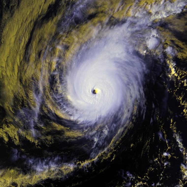
Track=Otis 1987 track.pngSeptember 20
Dissipated=September 26
1-min winds=100September 20 and strengthened into a storm later that day. Otis slowly tracked north-northwest. OnSeptember 21 , Otis became a hurricane. It also began to slowly turn to the northwest. The next day, Otis reached its peak windspeed of 100 knots. It would oscillate irregularly between that strength and Category 2 intensity untilSeptember 24 . That day, it began accelerating to the west as it lost strength. Otis fell to tropical storm strength onSeptember 25 and a depression onSeptember 26 , the same day it dissipated. Otis stayed at sea and whatever impact it might have had is unknown.Hurricane Peke
Infobox Hurricane Small
Basin=EPac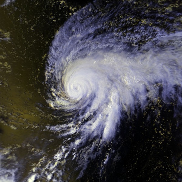
Track=Peke 1987 track.pngSeptember 21
Dissipated=September 27
1-min winds=90El Niño in progress at the time, a "cloud cluster" situated southeast of Hawaii gathered enough convection and a closed circulation to become Tropical Depression Two-C onSeptember 21 . It immediately strengthened into a storm and was named Peke, which is Hawaiian for . Peke continued to strengthen as it tracked north just east of thedateline . Peke intensified into a hurricane onSeptember 23 and reached Category 2 intensity the next day. Peke continued heading north and shortly after weakening into a Category 1 hurricane, it turned to the northwest and crossed the dateline. It reintensified, and peaked as a 100 knot typhoon onSeptember 23 . It accelerated to the northwest and began to take in drier air. This weakened Peke. OnOctober 2 , Peke recurved to the southeast. The last advisory on this tropical cyclone was issued onOctober 3 as it dissipated. Peke's remnants continued drifting erratically for over three days, first heading east, then northwest, and then southeast, at which time they were finally unidentifiable.cite web|title=Typhoon Peke (02C)|url=https://metocph.nmci.navy.mil/jtwc/atcr/1987atcr/pdf/cep/02c.pdf|publisher=Joint Typhoon Warning Center |format=PDF|pages=106-9|work=1987 Annual Tropical Cyclone Report|author=Capt. Steven B. Dreksler|accessdate=2007-07-24]Hurricane/Typhoon Peke caused no damages or deaths. It was also the first tropical cyclone of hurricane strength to cross the dateline since 1967's Hurricane/Typhoon Sara to cross the dateline at that strength. Regardless of strength, Peke was the third tropical cyclone in three years to exist on both sides of the dateline, after 1985's Typhoon Skipcite web|title=Previous Tropical Systems in the Central Pacific|url=http://www.prh.noaa.gov/cphc/summaries/|publisher=
Central Pacific Hurricane Center |accessdate=2007-07-21] and Typhoon Georgette.cite web|title=Typhoons Georgette (11E) and Tip (10W)|url=https://metocph.nmci.navy.mil/jtwc/atcr/1986atcr/pdf/cep/11e10w.pdf|publisher=Joint Typhoon Warning Center |format=PDF|pages=58-66|work=1986 Annual Tropical Cyclone Report|author=Lt. Steve J. Fatjo|date=1988-01-18|accessdate=2007-07-24]Tropical Storm Pilar
Infobox Hurricane Small
Basin=EPac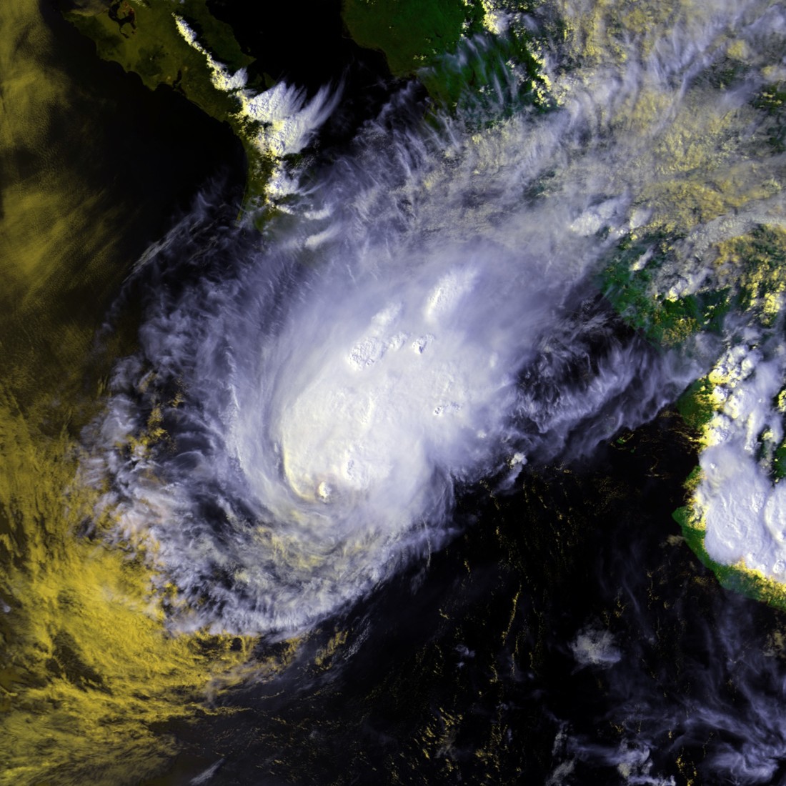
Track=Pilar 1987 track.pngSeptember 30
Dissipated=October 1
1-min winds=35September 30 while located south of theBaja California Peninsula . It headed north and peaked as a minimal, 35 knot tropical storm onOctober 1 . After being a tropical storm for only six hours, the minimum possible, Pilar weakened to a depression and dissipated that same day. It never made landfall, dissipating just south of the southern tip of theBaja California Peninsula . What ever impact it might have had after dissipating is unknown.Hurricane Ramon
Infobox Hurricane Small
Basin=EPac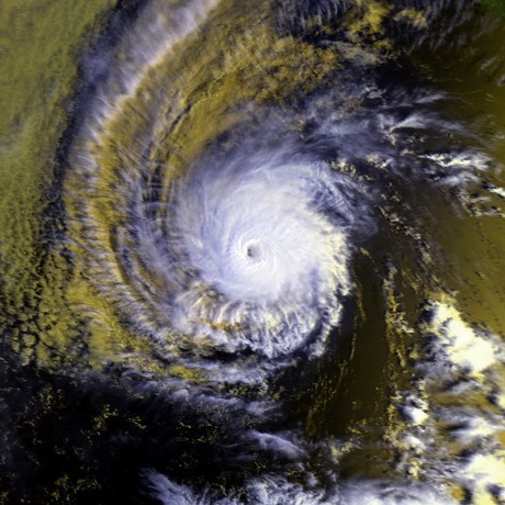
Track=Ramon 1987 track.pngOctober 5
Dissipated=October 12
1-min winds=120October 5 , a tropical storm formed, skipping the tropical depression stage. It headed gradually west-northwest. It intensified into a hurricane onOctober 7 and reached major hurricane status onOctober 8 . At its most intense, an event which was attained onOctober 9 andOctober 10 , Hurricane Ramon had winds of 120 knots. After peaking, Ramon turned to the northwest and steadily weakened. It became a tropical storm onOctober 11 and a depression onOctober 12 . It dissipated shortly after that.The remains of this
tropical cyclone caused moderate to heavy rains in southernCalifornia . The highest amount noted was 2.14 inches at Camp Pendelton. Ramon's impact elsewhere, if any, is unknown.Tropical Storm Selma
Infobox Hurricane Small
Basin=EPac
Track=Selma 1987 track.pngOctober 27
Dissipated=October 31
1-min winds=35October 27 , a tropical depression formed and headed northwest, gradually recurving north. It intensified into a 35 knot tropical storm onOctober 28 . Selma maintained that strength until the next day, when it weakened to a depression. Selma's recurving continued, and onOctober 29 , it again intensified into a 35 knot tropical storm. Without further strengthening, it weakened into a tropical depression, headed north northeast, and dissipated onOctober 31 . Whatever effects Tropical Storm Selma might have had are unknown.Other storms
Since Tropical Storm Fernanda, the sixth named system of the season, formed from Tropical Depression Nine-E, it follows that there were at least three other tropical depressions this year. Information about them is unavailable.
1987 storm names
The following names were used for named storms that formed in the eastern Pacific in 1987. The names not retired from this list were used again in the 1993 season. This is the same list used for the 1981 season. However, the names Xina, York, and Zelda were added to name lists for odd-numbered years sometime after 1985 due to that year's season threatening to exhaust the list.cite web|title=Monthly Global Tropical Cyclone Summary|year=2006|month=March|author=Gary Padgett|url=http://www.australiasevereweather.com/cyclones/2006/summ0603.htm|accessdate=2007-07-19] Storms were named Pilar and Ramon for the first time in 1987, as the name Selma had been used on the older lists. Names that were not assigned are marked in gray.
Two names from the Central Pacific list were used - Oka and Peke. This was the first usage for both names.
Retirement
The
World Meteorological Organization retired one Eastern Pacific name in the spring of 1988: Knut. It was replaced in the 1993 season by Kenneth.cite web|url=http://www.weather.unisys.com/hurricane/e_pacific/1993/index.html|title=1993 Hurricane/Tropical Data for Eastern Pacific|poublisher=Unisys|accessdate=2007-07-19]Administrative Changes
This is the last season that the
Eastern Pacific Hurricane Center inRedwood City, California was responsible for forecasting in this basin, a task it had performed since circa 1972.cite web|title=ds824.1 NOTES ON TROPICAL CYCLONE DATA|url=http://dss.ucar.edu/datasets/ds824.1/docs/format_ascii.html|publisher=CISL Data Research Archive|accessdate=2007-07-19] The EPHC was folded into theNational Hurricane Center , which took responsibility for this basin starting in spring, 1988.cite web|author=Robert Sheets |title=The National Hurricane Center—Past, Present, and Future|work=Weather and Forecasting|month=June|year=1990|pages=197|url=http://ams.allenpress.com/archive/1520-0434/5/2/pdf/i1520-0434-5-2-185.pdf|accessdate=2007-08-01]ee also
*
List of Pacific hurricanes
*List of Pacific hurricane seasons
*1987 Atlantic hurricane season
*1987 Pacific typhoon season
*1987 North Indian Ocean cyclone season
*Southern Hemisphere tropical cyclone seasons: 1986–87, 1987–88References
External links
* [http://weather.unisys.com/hurricane/e_pacific/1987/index.html Unisys Weather archive for the Eastern Pacific, 1987]
* [http://www.prh.noaa.gov/cphc/summaries/1987.php Central Pacific Hurricane Center archive]
Wikimedia Foundation. 2010.