- Crofton, British Columbia
-
Coordinates: 48°51′49.8″N 123°38′44.6″W / 48.863833°N 123.645722°W
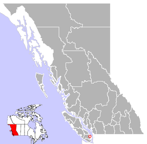
Crofton, British Columbia, Canada, is a small coastal town that is part of the District of North Cowichan on Vancouver Island in British Columbia. The population is estimated at 2,500 people. It is about 74 km north of Victoria.
Contents
History
Early History
According to tradition, the first people to live in the area around Osbourne Bay where Crofton is now situated were Native peoples known as the 'Tliyamen'. Their name has been interpreted as meaning 'people of the mountain' and is possibly a derivative of the Japanese word yama or 'hill'. The Tliyamen died out many hundreds of years before the Europeans arrived in the area.
In the mid-19th century, the area was cleared and settled by several homesteaders.[1] They farmed the land and cut lumber, as provided by the government. In 1873, what would become Crofton was incorporated as the District of North Cowichan.
Founding of the Town
Crofton was founded in 1902 by Henry Croft, who owned the nearby copper mine in Mt. Sicker. He built a smelter on the coast and exported the refined copper. Unfortunately the residue leftover from the smelter blackened the local beaches and the small glass particles often stuck to peoples' feet and hands. In 1906 Henry Croft sold the smelter to Britannia Mine. The smelter closed in January 1908, and soon after, rumours began that a large sawmill would be built. Nothing came of the rumours and when Henry Croft died in 1917, his namesake was struggling to survive.[2]
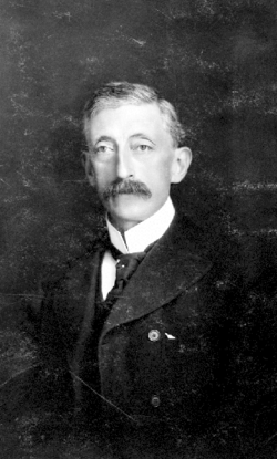 Henry Croft, founder of Crofton
After the Smelter
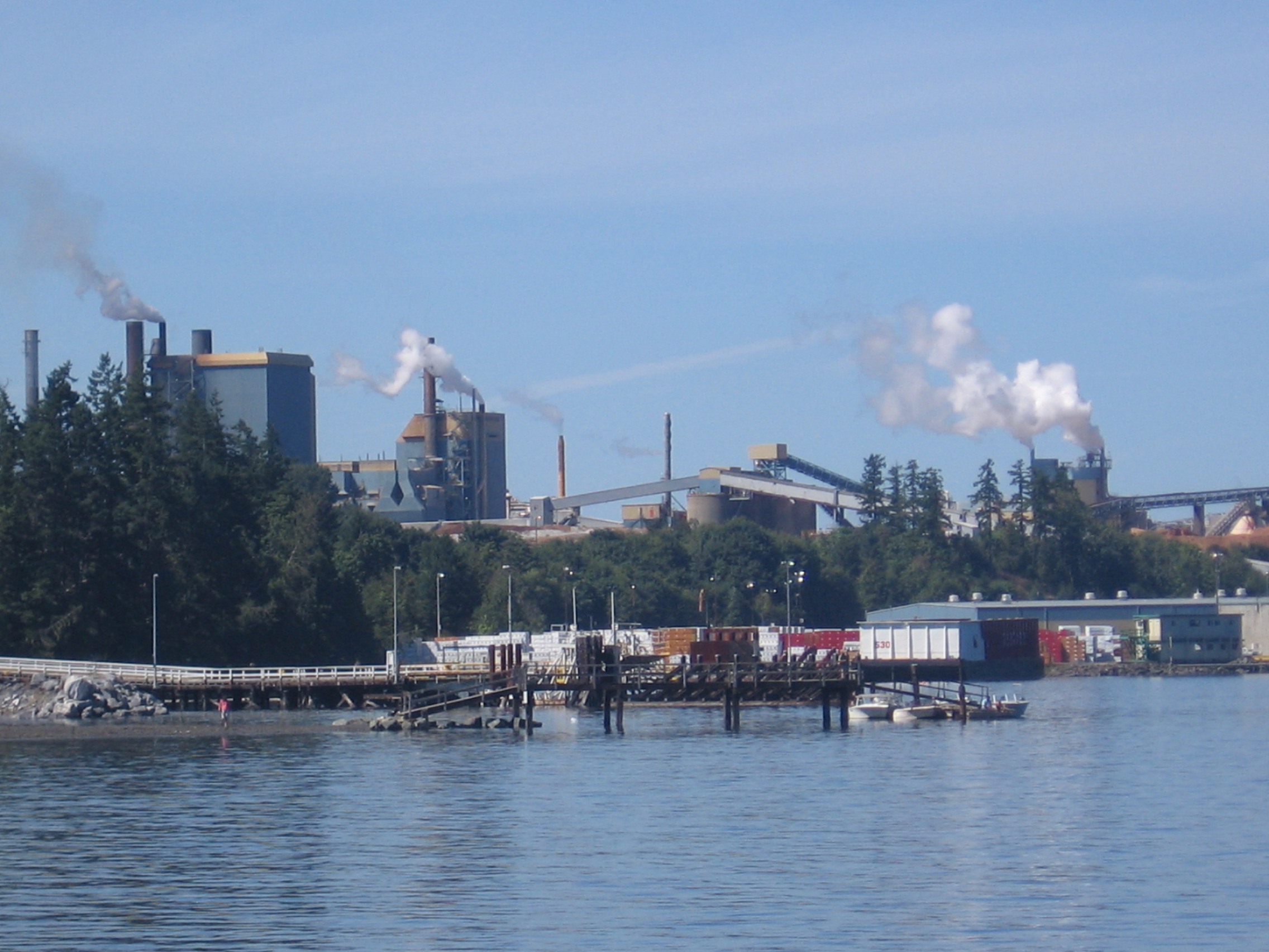
This stagnation lasted until the mid-1950s. British Columbia Forest Products Ltd. saw the potential of the area with its deep sea, stable workforce and abundance of lumber, and began construction of a pulp and paper mill in 1956. The mill opened in December 1957, and continues to operate today. Owned until 2001 by Fletcher Challenge, it is now owned by Catalyst Paper.
In 2001 a layer of ash fell upon the town staining nearly every house. The ash was determined to be a result of improper burning at the mill. Due to its fault in the incident, the mill owners paid the expenses for the extensive clean-up of Crofton and improved the burning process.
In 1955 a wharf was built and a ferry service to Saltspring Island began. BC Ferries now operates the route and in recent years has improved the local roads to reduce traffic congestion.
Seawalk
Early in the 1990s the Crofton Community Centre Society decided to create a scenic walkway along the Crofton shoreline. In 2002, Crofton's 100th anniversary, phase one of the seawalk was completed. As of 2007 the first two phases had been completed and a third phase was in the planning stage. When completed, the seawalk will stretch from the wharf and ferry terminal to Crofton Beach, a distance of over one kilometre.
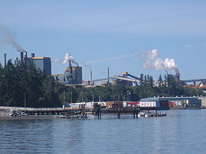 Crofton Mill
Modern Day
Crofton remains a small town after 100 years of existence. In 2000 the town water supply was changed from Crofton Lake to the Cowichan River. This is considered a great improvement since Crofton Lake has for years been rumoured to have been used as a dump site by local residents.
In September 2006 Crofton was included in a regional bus system connecting it to nearby Duncan and Chemainus. Prior to this the only public transportation was a bus between Victoria and Nanaimo without regional stops.
Because of the location of a BC Ferries terminal, Crofton continues to attract a small number of tourists each year, mostly on their way to Saltspring Island.
Crofton has a Saturday morning market from the first weekend in May to the first weekend in October located in the green space next to the ferry terminal.
Clean Air Concert
Concern about mill emissions prompted a Clean Air Concert on September 17, 2004, organized by Randy Bachman, to raise money for a study of those emissions. Among the groups participating in the concert were the Barenaked Ladies, Neil Young, Tal Bachman, and Randy Bachman himself. It was staged in nearby Duncan, which held the only venue suitable for the concert.
The high profile participants drew nation-wide coverage making the concert a success in that regard. There was, however, some local suspicion that Bachman had an ulterior motive for the concert. Bachman's property on Saltspring Island was on a direct line of sight of the mill prompting some people to accuse him of attempting to raise his property value by eliminating the mill. Bachman denied these accusations, stating he only wanted a study done to ensure the mill was following emissions standards.
The Elementary School
The first Crofton school was a one-room school house built in 1905 on two full lots donated by Henry Croft himself. The original school continued to serve the town until 1950 when it became an annex class room to the newly built elementary school.
The elementary school was expanded with a gymnasium and an open area classroom in the early 1970s and in 1985 the then derelict original school house was moved four blocks down the hill near the shoreline where it was restored and is now used as a museum. The school served students from Kindergarten to grade 7 after which they went to Chemainus Secondary School in nearby Chemainus for grades 8-12.
On September 11, 2006, the District of North Cowichan decided that a new school would be built in Crofton. The new school held its first day of classes on Tuesday, March 3, 2009 and is located in a different area from the original school grounds.
References
- ^ Crofton, British Columbia Official Website
- ^ Francis, Daniel (Editor) (2000). Encyclopedia of British Columbia. Madeira Park, BC: Harbour Publishing. p. 804. ISBN 1-55017-200-X.
Sources
- Crofton: The Early Years by P. Haley and D. Killick, 1977 and 1988, Duncan Print-Craft Ltd.
- Daniel Francis (Editor) (1999). Encyclopedia of British Columbia. Harbour Publishing. ISBN 1-55017-200-X.
- British Columbia Official Page on Crofton
External links
- "Crofton". BC Geographical Names. http://apps.gov.bc.ca/pub/bcgnws/names/35135.html.
 Subdivisions of British Columbia
Subdivisions Regions · Regional districts · Forest Regions and Forest Districts · School districts · Land DistrictsSettlements Urban centres Detached communities
within district municipalitiesAgassiz · Albion · Aldergrove · Ardmore · Brackendale · Brentwood Bay · Carr's Landing · Chemainus · Cloverdale · Crofton · Deep Cove · Dollarton · Fort Langley · Hatzic · Horseshoe Bay · Ladner · Lakeview Heights · North Delta · Okanagan Centre · Oyama · Ruskin · Saanichton · Silverdale · Stave Falls · Swartz Bay · Tsawwassen · Walnut Grove · Westbank · Whonnock · Winfield · YarrowCategories:- Populated places on the British Columbia Coast
- Populated places in the Cowichan Valley Regional District
- Populated places established in 1902
- Ports and harbours of British Columbia
- Southern Vancouver Island


Wikimedia Foundation. 2010.