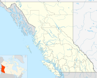
- Oyster River, British Columbia
-
 Oyster River
Oyster River is a small community located between Campbell River, BC (12 km to the north) and Black Creek, BC (100m to the south) mainly along or shortly off of Highway 19A. Located just north of the estuary of the Oyster River,[1] it is home to around 1500 people and a very small commercial sector.
Contents
Location
Oyster River is named after the river that draws its southerly border with Black Creek. Three bridges cross the river and signify the entrance into Oyster River when traveling north. The northerly border is somewhat ambiguous as the similar community of Willow Point occupies the land between Oyster River and Campbell River and there is no clear line between the two. The "Driftwood Restaurant," a Chinese-food establishment, is located on the coastal strip of the highway about where most people consider Oyster River to end.
Businesses and Commerce
Small campgrounds and resorts dominate the small community's economy with some notable ones being Salmon Point Resort and Pacific Playgrounds (technically located in Black Creek, but on the banks of the Oyster River.) The only major business in the area is a small grocery store, Discovery Foods. It is owned and operated by three local families and it provides part time and full time employment for many local residents of both Black Creek and Oyster River. In the same complex as Discovery Foods, a restaurant, a liquor store, and a medical clinic have been set up.
Notable Features
The Oyster River itself is a popular swimming and fishing spot all throughout the summer months. There is access at highway 19, 19a, 19b (old bridge), York rd., Macaulay Road, and various other smaller, private locations.
The Oyster River estuary, as well as the entire oceanfront of the community are home to a large run of pink salmon that return every second year.Climate
Climate data for Oyster River Month Jan Feb Mar Apr May Jun Jul Aug Sep Oct Nov Dec Year Record high °C (°F) 15.6
(60.1)17
(63)19
(66)28.5
(83.3)29.5
(85.1)33.5
(92.3)34.5
(94.1)34.5
(94.1)30
(86)23
(73)17.2
(63.0)20
(68)34.5
(94.1)Average high °C (°F) 5.3
(41.5)7.1
(44.8)9.5
(49.1)12.9
(55.2)16.8
(62.2)19.7
(67.5)22.5
(72.5)22.4
(72.3)18.7
(65.7)12.8
(55.0)8.1
(46.6)5.6
(42.1)13.5 Average low °C (°F) −0.6
(30.9)0.2
(32.4)1.2
(34.2)3.3
(37.9)6.6
(43.9)9.6
(49.3)11.4
(52.5)11.5
(52.7)8.2
(46.8)4.8
(40.6)1.9
(35.4)0.3
(32.5)4.9 Record low °C (°F) −16.7
(1.9)−13
(9)−8
(18)−3.3
(26.1)−2.5
(27.5)1.7
(35.1)4.4
(39.9)3.9
(39.0)−1.1
(30.0)−6
(21)−15
(5)−16.1
(3.0)−16.7
(1.9)Precipitation mm (inches) 179.5
(7.067)162.2
(6.386)141.6
(5.575)77.6
(3.055)61.9
(2.437)53.9
(2.122)37.7
(1.484)41.4
(1.63)54.2
(2.134)142.9
(5.626)227.4
(8.953)207.4
(8.165)1,387.4
(54.622)Source: Environment Canada[2] References
- ^ "Oyster River (community)". BC Geographical Names. http://apps.gov.bc.ca/pub/bcgnws/names/15171.html.
- ^ Environment Canada—Canadian Climate Normals 1971–2000, accessed 27 March 2010
Coordinates: 49°52′22″N 125°07′48″W / 49.87278°N 125.13°W
Categories:- Populated places in the Strathcona Regional District
- Mid Vancouver Island
- Unincorporated settlements in British Columbia

Wikimedia Foundation. 2010.