- Cloverdale, British Columbia
-
Cloverdale, British Columbia 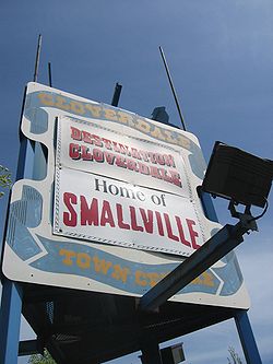
Country Canada Province British Columbia Government - Mayor Dianne Watts Time zone PST Highways 10 Website http://www.cloverdale.bc.ca/ 
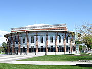

The Surrey Museum. Cloverdale is an historic town and designated town centre of Surrey, British Columbia, Canada, located near Langley, which is east of Vancouver. The town was founded initially as a small farm community in 1870 for its fertile land and temperate climate, and has since become enveloped by suburban sprawl from Surrey, making it a small town in the suburbs.[1] Cloverdale is known by some as the historic centre of Surrey, B.C., and is home to many heritage sites. One of its oldest buildings, Christ Church,[2] was built in 1882 and still stands today, and though it is no longer used for worship, it is a popular location for weddings.[3] Cloverdale is also the home to the City of Surrey's official Museum.
Contents
History
William Shannon (1843-1928) was one of the first settlers to the Surrey region, homesteading at this location 1875.[4] He was inspired to name the area from the clover that grew there in abundance.[5]
Climate
Climate data for Cloverdale Month Jan Feb Mar Apr May Jun Jul Aug Sep Oct Nov Dec Year Record high °C (°F) 15.5
(59.9)19.4
(66.9)25.0
(77.0)29.0
(84.2)34.5
(94.1)33.3
(91.9)35.0
(95.0)34.5
(94.1)34.5
(94.1)29.0
(84.2)21.0
(69.8)16.7
(62.1)35.0
(95.0)Average high °C (°F) 6.0
(42.8)8.4
(47.1)11.1
(52.0)14.3
(57.7)17.6
(63.7)20.0
(68.0)23.0
(73.4)23.2
(73.8)20.5
(68.9)14.5
(58.1)8.7
(47.7)6.1
(43.0)14.5 Average low °C (°F) 0.2
(32.4)1.3
(34.3)2.8
(37.0)4.9
(40.8)7.6
(45.7)10.3
(50.5)12.1
(53.8)12.2
(54.0)9.6
(49.3)6.0
(42.8)2.7
(36.9)0.5
(32.9)5.9 Record low °C (°F) −17.2
(1.0)−13.5
(7.7)−8.3
(17.1)−2.8
(27.0)−1.1
(30.0)2.2
(36.0)2.8
(37.0)−1.1
(30.0)−2.2
(28.0)−6.5
(20.3)−15
(5)−18.9
(−2.0)−18.9
(−2.0)Precipitation mm (inches) 185.7
(7.311)136.1
(5.358)128.7
(5.067)100.5
(3.957)81.6
(3.213)68
(2.68)50
(1.97)48.7
(1.917)64.2
(2.528)131.4
(5.173)212.3
(8.358)202.1
(7.957)1,409.2
(55.48)[citation needed] Film industry
Cloverdale is best known[citation needed] outside its immediate vicinity as the primary "main street" and "downtown" sets for the television show Smallville. A billboard on the edge of the community reads, "Destination Cloverdale - Home of Smallville."
The community has been home to other filming, including one of Coca-Cola's Christmas commercials. Despite filming during summer, the town square was decked with Christmas decorations, including fake snow.
In June 2006, a film titled Deck The Halls was filmed, and the area was once again decorated in Christmas decorations and fake snow.
In September 2006 the feature film Postal was filmed in Cloverdale.
The 2007 film Hot Rod, starring Andy Samberg, was also filmed in Cloverdale. A portion of 176th Street was shut down to accommodate a riot scene and a motorcycle stunt involving jumping over fifteen school buses was filmed at the Cloverdale Fairgrounds.
In addition to being filmed there, the town of Cloverdale was a fictional setting of Stargate Universe episode entitled "Cloverdale".
Rodeo
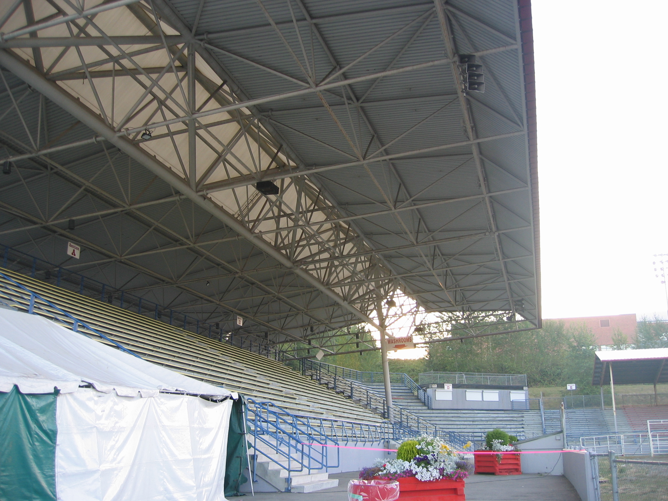
 The Stetson Bowl Stadium, the main rodeo venue.
Cloverdale is also known for the yearly Cloverdale Rodeo and Country Fair on the Victoria Day long weekend, which attracts visitors from all over western North America. It is the second largest rodeo in Canada after the Calgary Stampede. Its location, the Cloverdale Fairgrounds, is also home to Fraser Downs, which is a popular racetrack and casino.
Notable natives
- George Royal - Thoroughbred racehorse
See also
- Surrey-Cloverdale, provincial electoral district
- Cloverdale Fairgrounds
References
- ^ http://www.surrey.ca/Living+in+Surrey/Heritage/Heritage+Services+and+Facilities/Surrey+Archives/Community+Profiles/Cloverdale.htm
- ^ Christ Church
- ^ http://ctrchurch.com/
- ^ BCGNIS entry "Cloverdale (urban community)"
- ^ History of Surrey and Clover Valley, Cloverdale Business Improvement Association website
External links
- Destination Cloverdale: The Cloverdale District Chamber of Commerce
- Cloverdale Business Improvement Association
Neighbourhoods in Surrey, British Columbia Town centres Main neighbourhoods Anniedale • Beaver Creek Heights • Bridgeview • Bolivar Heights • Brownsville • Burke Road • Cedar Hills • Clayton • Colebrook • Crescent Beach • Crescent Heights • Douglas • Elgin • Fraser Heights • Fraser Shops • Grandview Heights • Hazelmere • Johnson Heights • Kennedy Heights • Kensington • Ocean Park • Panorama Ridge • Port Kells • Port Mann • Pratt • Reedville • River Junction • Semiahmoo • South Westminster • Strawberry Hill • Sullivan • Sunnyside • Willowbrook • Woodward's HillFirst Nations Categories:- Neighbourhoods in Surrey, British Columbia


Wikimedia Foundation. 2010.