- Cloverdale Fairgrounds
-
The Cloverdale Fairgrounds (also known as the Cloverdale Exhibition Grounds) are located in the town of Cloverdale in Surrey, British Columbia. Since 1938, it has been the host site of Canada's second largest rodeo, the Cloverdale Rodeo and Country Fair.
Contents
The Fairgrounds
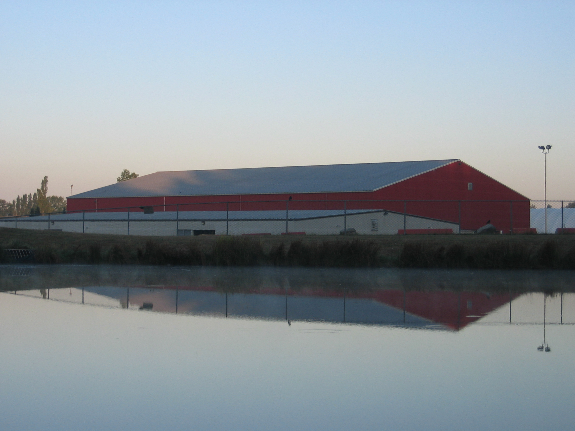
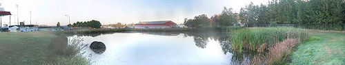 The Fairgrounds at dawn. To the left is the Stetson Bowl Stadium; the Show Barn (white) and the Agriplex (red) are at centre.
The Fairgrounds consist of approximately 138 acres (0.6 km2) of land. It is bordered by 60th Avenue, 64th Avenue, 176th Street (which, in turn, is part of Highway 15, which leads to the United States), residential properties and Lord Tweedsmuir Secondary School. The Fraser Downs casino and racetrack leases 48 acres (190,000 m2) of the Fairgrounds. [1]
Notable facilities
Agriplex
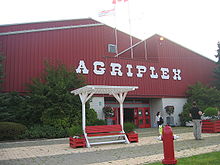 The Agriplex.
This arena features a dirt floor measuring 218 feet (66 m) by 103 feet (31 m). It can seat up to 1530 spectators. It commonly hosts horse shows, concerts, trade shows, fundraisers and dances. [2]
Alice McKay Building
This building seats 350 people for banquets and 750 in the stands. It is commonly used for boxing, wrestling, dog training, swap meets and children's dances. The Fairgrounds' administration offices are located here. [3]
Cloverdale Millennium Amphitheatre
The amphitheatre is located at the corner of 64th Avenue and 176th Street. It is commonly used for company picnics, festivals, dog shows and theatre groups. [4] Recently, the city of Surrey has held Canada Day festivities there. [5]
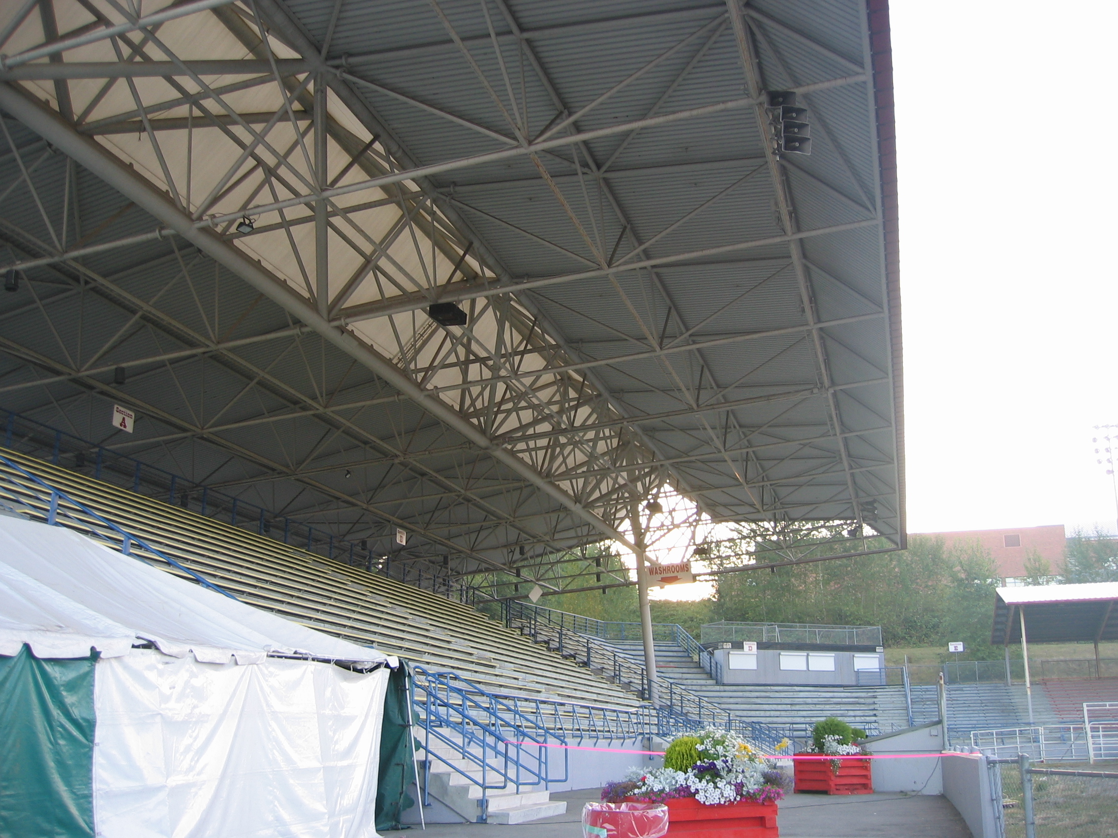
Stetson Bowl Stadium
 The Stetson Bowl Stadium.
The Stetson Bowl Stadium is home to most of the Cloverdale Rodeo performances each year. Its total area is around 36,400 square feet (3,380 m2) and its performance surface is made of sand. The bleachers can hold 4000 spectators and portable seating can accommodate 800 additional spectators. Besides the rodeo, the stadium is commonly used for filming, festivals, concerts, sporting events and dog training classes. [6]
Shannon Hall
This 7,000-square-foot (700 m2) building houses 480 people for banquet-style seating and 700 for theatre-style seating. It is commonly used for weddings, dances, swap meets and memorials. [7]
Show Barn
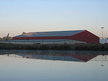 The Show Barn (white) and the Agriplex (red).
The Show Barn is an 18,000-square-foot (1,700 m2) building that seats 750 people for banquets and 900 for its theatre-style seating. Commonly, it hosts kennel shows, trade shows and auctions. It also houses 89 horse stalls. [8]
Cloverdale Arena
The Cloverdale Arena is a skating arena that is home to mostly ice hockey (including sledge hockey) and figure skating events [9], as well as the occasional concert and lacrosse game. It provides 15,000 square feet (1,400 m2) of exhibition space and seats 250 spectators. [10]
Fraser Downs
Fraser Downs is a racetrack and casino located on the Fairgrounds but leased to the separately owned Great Canadian Gaming, the largest casino operator in British Columbia. There are harness racing events there nine months per year, from September to May. [11] [12]
References
- ^ City of Surrey - Plans & Policies - Plans in Progress - Cloverdale Fairgrounds
- ^ Facilities at Cloverdale Rodeo
- ^ Facilities at Cloverdale Rodeo
- ^ Facilities at Cloverdale Rodeo
- ^ http://www.surrey.ca/Visiting+Surrey/Events/Event+Pages/City+Events/Canada+Day+Celebration+at+Cloverdale+Millenium+Amphitheatre.htm
- ^ Facilities at Cloverdale Rodeo
- ^ Facilities at Cloverdale Rodeo
- ^ Facilities at Cloverdale Rodeo
- ^ BC Sport Hosting and Resource Guide: Facility Details
- ^ City of Surrey - Arenas - Visit Your Local Arena - Cloverdale Arena
- ^ Great Canadian Casinos
- ^ Fraser Downs. Horse Racing. Open year round
See also
External links
Horse racing venues in Canada Assiniboia Downs · Charlottetown Driving Park · Fort Erie Race Track · Fredericton Raceway · Grand River Raceway · Hastings Racecourse · Blue Bonnets Raceway · Marquis Downs · Mohawk Raceway · Northlands Park · Stampede Park · Woodbine Racetrack · Fraser Downs · Rideau Carleton Raceway · Western Fair
Categories:- Surrey, British Columbia
- Parks in British Columbia
- Fairgrounds


Wikimedia Foundation. 2010.