- Modi'in Illit
-
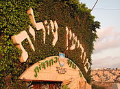
Modi'in Illit Hebrew transcription(s) – Hebrew מוֹדִיעִין עִלִּית – ISO 259 Modiˁin ʕillit Arabic transcription(s) – Arabic موديعين عيليت Overview of Kiryat Sefer

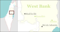
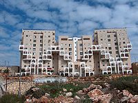
LogoCoordinates: 31°55′50″N 35°2′30″E / 31.93056°N 35.04167°ECoordinates: 31°55′50″N 35°2′30″E / 31.93056°N 35.04167°E Region West Bank District Judea and Samaria Area Founded 1994 Government – Type City (from 2008) – Mayor Yaakov Gutterman Area – Total 4,746 dunams (4.7 km2 / 1.8 sq mi) Population (2010)[1] – Total 48,100 Name meaning Upper Modi'in Modi'in Illit (Hebrew: מוֹדִיעִין עִלִּית; Arabic: موديعين عيليت, lit. "Upper Modi'in") is a Haredi Israeli settlement and a city in the West Bank, situated midway between Jerusalem and Tel Aviv. Modi'in Illit was granted city status by the Israeli government in 2008. It is located six kilometres northeast of Modi'in-Maccabim-Re'ut and is often referred to as Kiryat Sefer (lit. "Book Town"), the name of its first neighborhood, established in 1994. Modi'in Illit encompasses the neighborhoods of Kiryat Sefer and Achuzat Brachfeld (Brachfeld Estates). As of December 2009, it had a total population of 46,200,[1] making it the largest Jewish community in the area.[2][3] The international community considers Israeli settlements illegal under international law, but the Israeli government disputes this.[4] [5][6][7] The Israeli government believes that Modi'in Illit would remain within Israeli jurisdiction in a final-status agreement with the Palestinians.[8]
Contents
History
Kiryat Sefer is mentioned in the Book of Judges, allegedly destroyed by the Romans in the first century, rebuilt, and destroyed again in the second century in the Bar Kokhba revolt.[citation needed] The barrier surrounding the city divides the nearby village of Bil'in. The homes in Kiryat Sefer were completed in 1994, and the local council of Modi'in Illit was given city status on March 7, 2008.[9]
In keeping with its name, which means "Book Town," each of Kiryat Sefer's streets is named after a landmark sefer (book) written by Gedolei Yisrael. These include: Chofetz Chaim, Noda BiYehuda, Meshech Chochma, Avnei Nezer and Sdei Chemed.
Geography and climate
Situated north of Modi'in, Modi'in Illit lies 2.3 kilometres (1.4 mi) from the 1967 Green Line, and 5 kilometres (3.1 mi) from the 443 highway. Located in the foothills of the Judean Mountains 286 meters (938 feet) above sea level, Modi'in Illit has mild winters and hot, dry summers with temperatures averaging 30 °C (86 °F) during the day. Modi'in Illit's immediate neighbors are moshav Matityahu and Hashmonaim.
Demographics
According to the Israel Central Bureau of Statistics (CBS), as of the end of 2009, the city had a total population of 46,200,[1] making it the largest Israeli settlement in the West Bank.[10] The city had an annual growth rate of 13.2 percent in 2009,[1] due to new home construction and natural population growth. An estimated 80 percent of the population is under age 30,[11] and in 2006 the city's median age stood at 10, the lowest of all Israeli municipalities.[12] There are many immigrants, mostly from England, France, Switzerland and the United States.[citation needed] The entire population of Modi'in Illit are observant Jews. Most residents are Ashkenazi Jews in the Lithuanian tradition, but there are also Sephardi Jews.[citation needed]
Age distribution Age 0 - 4 5 - 9 10 - 14 15 - 19 20 - 29 30 - 44 45 - 59 60 - 64 65 - 74 75+ Percentage 28.8 19.4 8.6 4.8 19.4 14 3.3 0.6 0.7 0.4 Source: Israel Central Bureau of Statistics[11] Education
Modi'in Illit has 30 elementary schools and 20 secondary schools (seminaries and yeshivas). Achuzat Brachfeld (Brachfeld Estates) is home to a branch of the famous Mir Yeshiva.
The city is home to many commercial enterprises. Because of its sizable English-speaking immigrant population, it has become a center for high-quality outsourcing by American companies. There are approximately 80 synagogues. A significant number of men study the Torah full time.
Rabbinate
The Chief Rabbi of Modi'in Illit is Rabbi Moshe Mordechai Karp.
Local politics
Yaakov Gutterman, a rabbi, is the town's mayor.[9] The first head of council of Modi'in Illit was Yosef Schwinger, appointed by the Ministry of the Interior. Yaakov Gutterman replaced him in 2002, and has been reinstated twice when he ran for election uncontested.
Israeli–Palestinian conflict
Legal status of the settlement
The international community considers Israeli settlements to violate the Fourth Geneva Convention's prohibition on the transfer of an occupying power's civilian population into occupied territory and are as such illegal under customary international law.[13] Israel disputes that the Fourth Geneva Convention applies to the Palestinian territories as they had not been legally held by a sovereign prior to Israel taking control of them. This view has been rejected by the International Court of Justice and the International Committee of the Red Cross.[14][15]
Modi'in Illit was granted city status in 2008, by Aluf Gadi Shamni. The Israeli NGO B'Tselem appealed the decision to the Ministry of Interior. B'Tselem claimed that the upgrading of Modi'in Illit's status to that of a municipality was of concern because the land on which Mod'in Illit was built was declared state land through a manipulative application of Ottoman Law, resulting in the confiscation of lands belonging to neighbouring Palestinian villages. B'Tselem also stated that the upgraded status would lead to an increase of the settler population of Modi'in Illit, and thus the change in status would be illegal. For these reasons, B'Tselem expressed "vehement opposition" to the change of status.[16] In connection with separate allegations that the city has allowed illegal construction to take place, the Israel Defence Forces told Israel's Interior Ministry in May 2008 that Modi'in Illit was "in a state of lawlessness."[17]
Israel's West Bank Barrier passes just east of Modi'in Illit. The barrier's section in this area was built to separate the Modi'in bloc settlements of Mattityahu, Modi'in Illit and Hashmona'im from the Palestinian villages of Bil'in and others.[18] It is the site of weekly protests by Palestinian villagers and their supporters against the construction of the wall and against the settlement. These protests often involve rock throwing by the Palestinians, and the firing of tear gas and rubber-coated bullets by Israeli security forces, which in one case led to death of a protester when a tear gas grenade hit him in the chest. The IDF said that there was no intention to fire the tear gas grenade directly at any protesters.[19][20]
Attacks on residents
On Monday morning, December 29, 2008 around 8 am, an Arab worker fixing a heating system on a 6th story apartment on Rebbi Yehuda HaNasi Street in Ahuzat Brachfeld struck his supervisor with a sledgehammer to his head.[21] The attacker then proceeded to the street and attacked several passersby, stabbing several of them. After he managed to stab four Jews and beat up several others, he was shot and seriously wounded by an emergency response team member.[22]
References
- ^ a b c d "Table 3 - Population of Localities Numbering Above 2,000 Residents". Israel Central Bureau of Statistics. 2009-12-31. http://www.cbs.gov.il/population/new_2010/table3.pdf. Retrieved 2010-11-18.
- ^ Bronner, Ethan and Kershner, Isabel. Unsettled; In West Bank Settlements, Sign of Hope for a Deal, NY Times, July 26, 2009.
- ^ Cook, 2008, p. 92.
- ^ "The Geneva Convention". BBC. 2009-12-10. http://news.bbc.co.uk/2/hi/middle_east/1682640.stm.
- ^ "Anger at Israeli settlement plan". BBC. 2009-09-07. http://news.bbc.co.uk/2/hi/middle_east/8241247.stm. Retrieved 16 August 2010.
- ^ Kraft, Dina (2009-06-02). "How a settlement’s ‘natural growth’ appears at ground level". JTA. http://jta.org/news/article/2009/06/02/1005566/how-a-settlements-natural-growth-appears-at-ground-level. Retrieved 17 August 2010.
- ^ Asser, Martin. Obstacles to peace: Borders and settlements, BBC News, May 25, 2007.
- ^ "'Settler population rose 4.9% in 2009'". Jerusalem Post. 2010-03-10. http://www.jpost.com/Israel/Article.aspx?id=170595. Retrieved 17 August 2010.
- ^ a b Fendel, Hillel (March 11, 2008). "New Religious City in Israel: Modiin Illit". Arutz 7. http://www.israelnationalnews.com/News/News.aspx/125534. Retrieved 2009-08-18.
- ^ Lazaroff, Tovah (January 10, 2007). "Report: 12,400 New Settlers in 2006". The Jerusalem Post. http://fr.jpost.com/servlet/Satellite?cid=1167467697743&pagename=JPost/JPArticle/ShowFull. Retrieved 2009-08-18.
- ^ a b "Local Authorities in Israel 2007, Publication #1358 - Municipality Profiles - Modi'in Illit". Israel Central Bureau of Statistics. http://www.cbs.gov.il/publications/local_authorities2007/pdf/552_3797.pdf. Retrieved 2009-08-15. (Hebrew)
- ^ "Table 1 – Local Councils and Municipalities – Rank, Cluster Membership, Population, Variable Values, Standardized Values and Ranking for the Variables Used in the Computation of the Index". Israel Central Bureau of Statistics. 2006. http://cbs.gov.il/www/publications/local_authorities06/pdf/t01.pdf. Retrieved 2010-11-13.
- ^ The settlers' struggle BBC News. 19 December 2003
- ^ Legal Consequences of the Construction of a Wall in the Occupied Palestinian Territory International Court of Justice, 9 July 2004. pp. 44-45
- ^ Opinion of the International Court of Justice B'Tselem
- ^ B'Tselem's position on turning Modi'in Illit into a municipality, B'Tselem - The Israeli Information Center for Human Rights in the Occupied Territories, November 4, 2005.
- ^ Eldar, Akiva. Panel: Ultra-Orthodox settlement should be city, despite illegal construction , Haaretz, June 5, 2008.
- ^ [1]
- ^ IDF won't investigate death of Bil'in activist from tear gas grenade – 04 Jan 10
- ^ [2] Israeli soldiers fire on Al Jazeera correspondent - 04 Sep 09 (Al Jazeerah English, 04 Sep 09)
- ^ http://www.israelnationalnews.com/News/News.aspx/129080
- ^ Sharon, Ronny; Matzik, Ilan (December 29, 2008). "Modi'in Illit: Four Stabbed in Attack". Maariv. http://www.nrg.co.il/online/1/ART1/832/232.html?hp=0&loc=3&tmp=6958. Retrieved 2009-08-18. (Hebrew)
External links
 Judea and Samaria Area
Cities 
Regional committee Local councils Alfei Menashe · Beit Aryeh-Ofarim · Beit El · Efrat · Elkana · Giv'at Ze'ev · Har Adar · Immanuel · Karnei Shomron · Kedumim · Kiryat Arba · Ma'ale Efrayim · OranitRegional councils Region: West Bank
Other sub-divisions: Center District · Haifa District · Jerusalem District · North District · South District · Tel Aviv District
See also: Population statistics · Israeli settlement · Violence · International law · Israeli settlement timeline · Israeli West Bank barrierCategories:- West Bank
- Judea and Samaria
- Religious Israeli settlements
- Cities in the West Bank
Wikimedia Foundation. 2010.


