- Oranit
-
Oranit Hebrew transcription(s) - Hebrew אֳרָנִית, אורנית - ISO 259 ʔoranit 
Logo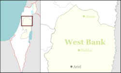
 Oranit
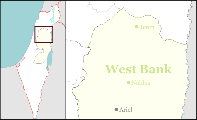
Coordinates: 32°7′45.5″N 34°59′42.76″E / 32.129306°N 34.9952111°ECoordinates: 32°7′45.5″N 34°59′42.76″E / 32.129306°N 34.9952111°E District Judea and Samaria Area Founded 1982 Government - Type Local council (from 1990) - Head of Municipality Shlomi Langer Population (2007) - Total 6,000 Oranit (Hebrew: אֳרָנִית) is an Israeli settlement and local council located off Highway 5 adjacent to Kafr Qasim, north of Rosh HaAyin on the western edge of the West Bank. On the Seam Zone, a sizable amount of the town's land is located within the Green Line.
As of 2007, Oranit has a population of over 6000 people,[1] consisting of approximately 1400 families.
Oranit is ranked moderately high on the Israeli socio-economic scales, at 7/10.[2]
The town, built by a private initiative called the 'Delta Company', was first settled in 1985. In 1990, it achieved Local Council status. The name Oranit comes from the pine trees of the Horashim Forest lining the western side of the town.
References
- ^ "Table 3 - Population of Localities Numbering Above 1,000 Residents and Other Rural Population". Israel Central Bureau of Statistics. 2007-12-31. http://www.cbs.gov.il/population/new_2009/table3.pdf. Retrieved 2008-06-23.
- ^ "Local Authorities in Israel 2009, Publication #1451 - Municipality Profiles - Oranit". Israel Central Bureau of Statistics. http://www.cbs.gov.il/publications11/local_authorities09/pdf/357_3760.pdf. Retrieved 2011-09-7.(Hebrew)
See also
- Oranit local council web site (Hebrew)
 Judea and Samaria Area
Cities 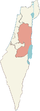
Regional committee Local councils Alfei Menashe · Beit Aryeh-Ofarim · Beit El · Efrat · Elkana · Giv'at Ze'ev · Har Adar · Immanuel · Karnei Shomron · Kedumim · Kiryat Arba · Ma'ale Efrayim · OranitRegional councils Region: West Bank
Other sub-divisions: Center District · Haifa District · Jerusalem District · North District · South District · Tel Aviv District
See also: Population statistics · Israeli settlement · Violence · International law · Israeli settlement timeline · Israeli West Bank barrierCategories:- West Bank
- Judea and Samaria
- Israel geography stubs
- Local councils in Israel
- Mixed Israeli settlements
- Populated places established in 1985
Wikimedia Foundation. 2010.