- Church Mountain
-
Church Mountain Sliabh an Chodaigh 
Church Mountain from the southElevation 544 m (1,785 ft) Location Location Wicklow,  Ireland
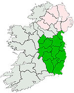
Range Wicklow Mountains Coordinates 53°03′12″N 6°35′09″W / 53.05334°N 6.585697°W Topo map OSi Discovery 56 OSI/OSNI grid N948012 Church Mountain, sometimes called Slievegad (Irish: Sliabh an Chodaigh, meaning "mountain of the covenant"),[1] is the most westerly of the Wicklow Mountains in Ireland.[1] At the summit are the remains of a large cairn and an old triangulation pillar. Just east of the N81 national route, it lies roughly halfway between Hollywood to the north and Donard to the south.
See also
References
- ^ a b "Church Mountain". Mountainviews.ie. http://mountainviews.ie/mv/index.php?mtnindex=367. Retrieved 2007-04-15.
Coordinates: 53°03′12″N 6°35′13″W / 53.05334°N 6.58697°W
There is another Church Mountain in Whatcom County, Washington State, USA. It lies in the extreme northwest section of the Mount Baker-Snoqualmie National Forest north of Mount Baker. The national forest link to the trail on this Church Mountain is http://www.fs.usda.gov/wps/portal/fsinternet/!ut/p/c4/04_SB8K8xLLM9MSSzPy8xBz9CP0os3gjAwhwtDDw9_AI8zPwhQoY6BdkOyoCAPkATlA!/?ss=110605&navtype=BROWSEBYSUBJECT&cid=FSE_003853&navid=091000000000000&pnavid=null&position=BROWSEBYSUBJECT&ttype=main&pname=Mt.%20Baker-Snoqualmie%20National%20Forest-%20HomeCategories:- Mountains and hills of County Wicklow
- County Wicklow geography stubs
Wikimedia Foundation. 2010.

