Mullaghcleevaun

Mullaghcleevaun
Mullaghcleevaun
Mullach Cliabháin

Mullaghcleevaun summit and Lough Cleevaun
Elevation 849 m (2,785 ft) [1][2]
Prominence 374 m (1,227 ft) [1]
Listing Hewitt, Marilyn
Translation summit of the cradle/basket (Irish)
Pronunciation Irish: [ˈmˠʊl̪ˠəx ˈclʲiəwaːnʲ]
Location
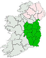
Location County Wicklow, Republic of Ireland
Range Wicklow Mountains
Coordinates 53°06′13″N 6°24′24″W / 53.103626°N 6.406724°W / 53.103626; -6.406724
Topo map OSi Discovery 56
OSI/OSNI grid O067070

Mullaghcleevaun (from Irish: Mullach Cliabháin meaning "summit of the cradle")[3] is a mountain in County Wicklow, Republic of Ireland. At 849 m (2,785 ft) tall, it is the second highest of the Wicklow Mountains and the 20th highest in Ireland.[1]

Mullaghcleevaun is believed to have been named after the rounded depression near the summit, which has a small lake (Lough Cleevaun) inside it.[1] Mullaghcleevaun sits roughly in the middle of the Wicklow Mountains and 3 km west of the Military Road. The massif also includes the summit of Mullaghcleevaun East Top (795 m).[1]

The most common ascent of the mountain is made via Black Hill from the carpark 3 km uphill from the small hillside town of Lacken. The hills of Wales can be seen on a clear day from the triangulation pillar on the summit.

See also

External links

References

  1. ^ a b c d e MountainViews.ie
  2. ^ Peakbagger
  3. ^ Placenames Database of Ireland

Wikimedia Foundation. 2010.

Игры ⚽ Поможем решить контрольную работу

Look at other dictionaries:

  • Mullaghcleevaun — Mullach Cliabháin Mullaghcleevaun Géographie Altitude 849 m Massif Montagnes de Wicklow …   Wikipédia en Français

  • Mullaghcleevaun — Wicklow Mountains Die Wicklow Mountains (irisch Sléibhte Chill Mhantáin) sind ein Gebirgszug im Osten und Südosten von Irland. Sie verlaufen in Nord Süd Richtung, direkt vom Süden Dublins über die Grafschaft Wicklow in die Grafschaft Wexford …   Deutsch Wikipedia

  • Wicklow Mountains — Coordinates: 53°04′52″N 6°23′24″W / 53.08111°N 6.39°W / 53.08111; 6.39 …   Wikipedia

  • Mount Leinster — Stua Laighean Mount Leinster with its TV transmitter Elevation …   Wikipedia

  • Mountain peaks of the Wicklow Mountains — 1 Lugnaquilla 2 Mullaghcleevaun …   Wikipedia

  • Lugnaquilla — Wicklow Mountains Die Wicklow Mountains (irisch Sléibhte Chill Mhantáin) sind ein Gebirgszug im Osten und Südosten von Irland. Sie verlaufen in Nord Süd Richtung, direkt vom Süden Dublins über die Grafschaft Wicklow in die Grafschaft Wexford …   Deutsch Wikipedia

  • Montagnes de Wicklow — Géographie Altitude 925 m, Lugnaquilla Longueur 66 km Largeur …   Wikipédia en Français

  • Уиклоу (горы) — У этого термина существуют и другие значения, см. Уиклоу. Горы Уиклоу англ. Wicklow Mountains ирл. Sléibhte Chill Mhantáin …   Википедия

  • List of mountains in Ireland — This is a list of mountains and mountain ranges on the island of Ireland. The list works around the island, beginning in Munster, and working anti clockwise. County allocations are based on where the majority of the mountain range lies.… …   Wikipedia

  • List of Marilyns in Ireland — A list of the Marilyns of the Republic of Ireland. In the British Isles, a Marilyn is a hill with a relative height of at least 150 metres.*Carrauntoohil 1,038 m *Cnoc na Péiste 988 m *Brandon Mountain 951 m *Lugnaquilla 924 m *Galtymore 917 m… …   Wikipedia

Share the article and excerpts

Direct link
Do a right-click on the link above
and select “Copy Link”