Mullacor

Mullacor
Mullacor
Mullach Mhór
Elevation 657 m (2,156 ft)
Location
Location Wicklow, Ireland
Range Wicklow Mountains
Coordinates 52°59′6″N 6°22′26″W / 52.985°N 6.37389°W / 52.985; -6.37389Coordinates: 52°59′6″N 6°22′26″W / 52.985°N 6.37389°W / 52.985; -6.37389
Geology
Type Granite

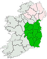
Mullacor (Irish: Mullach Mhór, meaning "Big summit") is a mountain in Wicklow Mountains in County Wicklow, Ireland. Mullacor stands at 657 metres (2,156 ft) making it the 22nd highest mountain in the Wicklow Mountains and the 177th highest in Ireland.

See also

References

[1]


Wikimedia Foundation. 2010.

Игры ⚽ Нужно сделать НИР?

Look at other dictionaries:

  • Wicklow Mountains — Coordinates: 53°04′52″N 6°23′24″W / 53.08111°N 6.39°W / 53.08111; 6.39 …   Wikipedia

  • Mount Leinster — Stua Laighean Mount Leinster with its TV transmitter Elevation …   Wikipedia

  • Clermont Carn — Clermont Carn, variously spelt as Clermont Cairn , Clairmont Carn/Cairn or other variations is a 510m [1] high peak in the Cooley Mountains in County Louth which is also home to a main RTÉ Network Limited transmission site[2] …   Wikipedia

  • Dalkey Hill — (Irish: Cnoc Dheilginse) is the northernmost of the two hills which form the southern boundary of Dublin Bay (the other being Killiney Hill). Dalkey Hill is 140 metres high and offers beautiful views over the surrounding areas : Dublin to… …   Wikipedia

  • Djouce — Dioghais Northern slope of Djouce Elevation …   Wikipedia

  • Mullaghcleevaun — Mullach Cliabháin Mullaghcleevaun summit and Lough Cleevaun …   Wikipedia

  • Church Mountain — Sliabh an Chodaigh Church Mountain from the south Elevation …   Wikipedia

  • Mullaghmeen — Hill Mullaghmeen Hills, County Westmeath, viewed from Coole Elevation 25 …   Wikipedia

  • Croghan Hill — Croghan Hill, from the southwest Elevation 234 m (768 ft) …   Wikipedia

  • Maulin — Málainn North face Elevation 570 m ( …   Wikipedia

Share the article and excerpts

Direct link
Do a right-click on the link above
and select “Copy Link”