- Donard
-
Not to be confused with Slieve Donard.
Donard
Dún Ard— Town — Location in Ireland
 Donard
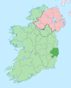
Coordinates: 53°01′00″N 6°37′00″W / 53.016667°N 6.616667°WCoordinates: 53°01′00″N 6°37′00″W / 53.016667°N 6.616667°W Country Ireland Province Leinster County County Wicklow Elevation 180 m (591 ft) Population (2002) - Urban 201 Time zone WET (UTC+0) - Summer (DST) IST (WEST) (UTC-1) Irish Grid Reference S929977 Donard (historically Dunard, from Irish: Dún Ard, meaning "high fort")[1] is a small village in County Wicklow, Ireland located at the northern end of the Glen of Imaal, in the western part of the Wicklow Mountains.
Donard takes its name from Dún Ard - High Fort - the ruins of which are still somewhat visible on a rise above the town. The tranquil village is surrounded by Table Mountain (702m), Church Mountain (546m), Lugnaquilla (924m) and Keadeen (655m).
Nearby in Derrynamuck is a cottage dedicated to the memory of Michael Dwyer, a celebrated 1798 leader. It is now well known as the Dwyer-McAllister cottage for it was here that a group of Irish rebels led by Michael Dwyer were hiding when they were surrounded by British troops. Samuel McAllister died when he drew enemy fire to allow Dwyer to escape, and thereby prevent further bloodshed as the British troops were killing innocent farmers in nearby cottages to reach Dwyer.
The highest mountain in Wicklow and one of the highest mountains in Ireland, Lugnaquilla, can be accessed near here. It is advisable to remember that Lugnaquilla requires some hill-walking experience to climb, and should not be attempted alone, nor when there is a possibility of dense fog. The Wicklow Mountain Rescue team[2] ask that those climbing alone alert the Rescue team as to their estimated time of climbing, to avoid false-emergencies due to delays in return.
Much of the surrounding Glen of Imaal (5,948 acres) has been used as an army artillery range since 1900, and caution is advised when attempting to use areas within the army range. However, notices are regularly posted at key entry points as to when the army are out on manoeuvres.
References
- ^ Placenames Database of Ireland (see archival records)
- ^ "Dublin & Wicklow Mountain Rescue Team". Dwmrt.ie. http://www.dwmrt.ie. Retrieved 2008-10-31.
Places in County Wicklow County town: Wicklow Towns Arklow · Bray · Greystones · Wicklow
Villages Aghavannagh · Annamoe · Ashford · Aughrim · Avoca · Ballinaclash · Baltinglass · Blessington · Carnew · Charlesland · Coolafancy · Coolboy · Delgany · Donard · Dunlavin · Enniskerry · Glendalough · Glenealy · Grangecon · Greenan · Hollywood · Kilcoole · Killincarrig · Kilmacanogue · Kilpedder · Kilquade · Kiltegan · Knockananna · Lacken · Laragh · Newcastle · Newtownmountkennedy · Rathdangan · Rathdrum · Rathnew Redcross · Roundwood · Shillelagh · Stratford-on-Slaney · Tinahely · Valleymount · Woodenbridge
Townlands List of townlands in County Wicklow · Category:Mountains and hills of County Wicklow · Category:Rivers of County Wicklow · Category:Geography of County Wicklow Categories:- Towns and villages in County Wicklow


Wikimedia Foundation. 2010.