- Dorogomilovo District
-
Dorogomilovo District (English)
райо́н Дорогоми́лово (Russian)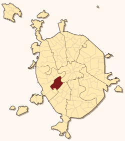
Location of Dorogomilovo District on the map of Moscow
Coat of arms Flag Administrative status Country Russia Federal subject Moscow Statistics Time zone MSD (UTC+04:00)[1] Dorogomilovo District (Russian: райо́н Дорогоми́лово) is a district in Western Administrative Okrug of Moscow, Russia. The district, adjacent to Presnensky, Arbat, and Khamovniki Districts of Central Administrative Okrug, contains a prestigious five-kilometer strip of land along Kutuzovsky Prospekt, Victory Park, and Kiyevsky Rail Terminal. District's population: 68,079 (2010 Census preliminary results);[2] 59,732 (2002 Census).[3] Postal codes: 113000 through 119000.
Contents
History
This section is based on P.V.Sytin's "History of Moscow Streets"[4]
Original Dorogomilovo sloboda was located on the opposite (eastern) bank of the Moskva River, between Khamovniki and Novodevichy Monastery. Peasants of this sloboda, personally free, were paying their taxes with Yam (mail coach) service on the old road to Smolensk, the main link between Moscow and Poland. Smolensk was annexed by Moscow in the course of the Russo-Polish War, and as a result the road was straightened and a new river crossing emerged on site of present-day Borodinsky Bridge. Dorogomilovo sloboda relocated to the western bank, to present-day Dorogomilovo. For the next two hundred years, the new and the old settlements shared the same name. The only other settlement on the western bank was a fishing village owned by Patriarch.
In 1731–1742, when Moscow city boundary expanded to Kamer-Kollezhsky Val limits, Dorogomilovo sloboda was incorporated into Moscow. Gradually, the once-free coach-drivers were stripped of their liberties and reduced to taxpayer peasant status. Former sloboda population decreased from 117 households in 1699 to 24 in 1801. Instead, Dorogomilovo acquired one of Moscow's largest cemeteries (Orthodox, 1771, Jewish, 1788[5]).
In 1812, old Smolensk road witnessed the retreat of Russian troops and Napoleon's conquest of Moscow. The village of Fili, where Kutuzov made his decision to abandon Moscow, is situated just outside of the modern Dorogomilovo District boundary. The French marched to Moscow in three columns, crossing the river in Fili, Dorogomilovo, and Luzhniki. Meanwhile, wounded at Battle of Borodino where dying and buried at Dorogomilovo cemeteries.[6]
Industrial development of the 19th century was slow, due to the regular floods. The main employers in the area was a brewery set on a hill in 1875, still operating as Badayev Brewery (19th century postcard), a dye factory (1883), and a cement plant (1894). Newspapers, describing 1879 flood, wrote that "brewery workers managed to roll out a beer barrel and floated away from the site"...[7] Development was boosted by construction of Bryansky (now Kiyevsky) railroad terminal, originally built in wood (1900 postcard). In 1912, the city built new Borodinsky Bridge, which still stands. New Kiyevsky Terminal, designed by Ivan Rerberg and Vladimir Shukhov in 1912–1914, was completed during the Russian Civil War, in 1920.
Dorogomilovo Cathedral
Dorogomilovo used to have Moscow's second largest temple (after Christ the Saviour, photo), rated for 10,000 worshippers. It was set on the site of present-day corner block at 1 Bolshaya Dorogomilovskaya; there are no reliable explanations why it was built in such a remote and scarcely populated place. Construction of Byzantine Revival Bogoyavlensky Temple proceeded from 1898 to 1910. Originally modelled after Christ the Saviour, the design was later changed from five-domed to a single dome, and externally was the most austere of Moscow cathedrals.
Starting in 1918, Bolshevik authorities began harassing the clergy, and in 1922 stripped the church of all silver and gold, causing the Dorogomilovo Riot (April 5–7, 1922). After the demolition of Christ the Saviour (1931), Dorogomilovo Cathedral was the main operating temple of Russian Orthodox Church, until its destruction in 1938.[8]
Modern history
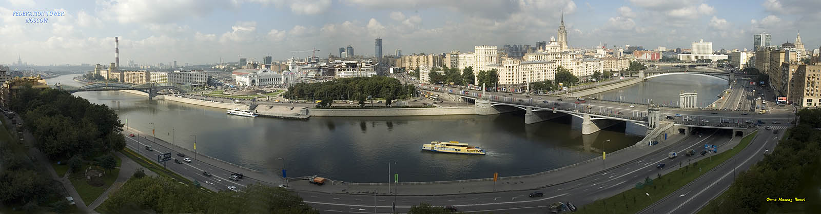
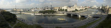 Dorogomilovo river bend, view from the west
 Kutuzovsky 26, Leonid Brezhnev's home
 Triumphal Arch, with Victory Park behind
In the 1920s, Dorogomilovo housed some of Moscow's post-war firsts, notably, the first new school (School No. 56 at 22 Kutuzovsky, 1927), the first new hotel (Kiyevskaya, 1934),[9] and a student campus that gave it name to Studencheskaya Street and a metro station.
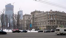
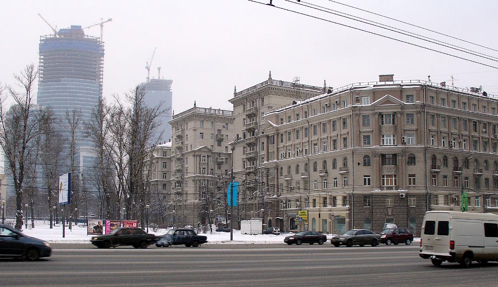
In 1935, Dorogomilovo became the site of a major stalinist architecture project. A 2.7-kilometer long stretch of Dorogomilovskaya Street and Mozhaysk highway was zoned for first-rate housing construction; half of the project was actually completed before June 1941. One of these apartment blocks, 26 Kutuzovsky, is known as Leonid Brezhnev's Mikhail Suslov's and Yuri Andropov's home. Construction was completed during post-war years.
In 1938–1950s, Dorogomilovo cemeteries were gradually destroyed and redeveloped; however, for a short time in 1938–1940 and in 1946, relatives were allowed to re-bury the remains at out-of-town cemeteries. Remains of Isaac Levitan were relocated from Jewish cemetery to Novodevichy Cemetery.[10] A railroad track to the brewery was severed from the main line, as a result one can see an IS20 steam locomotive stranded behind factory gates[citation needed].
Post-war construction was concentrated on the embankments and the beginning of Kutuzovsky Prospect, notably, the Ukraina Hotel Skyscraper (1947–1952). Grand stalinist buildings completed the perimeters of large city blocks; inside, wooden shacks (photo) survived until the 1970s and were replaced with Brezhnev-era standard housing (of better-than-average variety).
Notable buildings, cultural, and educational facilities
- Ukraina Hotel
- German-Soviet War museum in Victory Park
- Borodino Panorama (1962, painting 1912) and Kutuzov monument (1973)
- Triumphal Arch (1968), replica of 1829–1834 original by Joseph Bove that was razed in 1936
- Bagration monument (1999) and Bagration Bridge (1997)
Public transportation access
- Kievskaya-Koltsevaya, Kievskaya (Arbatsko-Pokrovskaya), Kievskaya (Filyovskaya) - west
- Studencheskaya, Kutuzovskaya - center
- Fili - north (industrial grounds only)
- Park Pobedy - west, Victory Park and Borodino Panorama
References
- ^ Правительство Российской Федерации. Постановление №725 от 31 августа 2011 г. «О составе территорий, образующих каждую часовую зону, и порядке исчисления времени в часовых зонах, а также о признании утратившими силу отдельных Постановлений Правительства Российской Федерации». Вступил в силу по истечении 7 дней после дня официального опубликования. Опубликован: "Российская Газета", №197, 6 сентября 2011 г. (Government of the Russian Federation. Resolution #725 of August 31, 2011 On the Composition of the Territories Included into Each Time Zone and on the Procedures of Timekeeping in the Time Zones, as Well as on Abrogation of Several Resolutions of the Government of the Russian Federation. Effective as of after 7 days following the day of the official publication).
- ^ Федеральная служба государственной статистики (Federal State Statistics Service) (2011). "Предварительные итоги Всероссийской переписи населения 2010 года (Preliminary results of the 2010 All-Russian Population Census)" (in Russian). Всероссийская перепись населения 2010 года (All-Russia Population Census of 2010). Federal State Statistics Service. http://www.perepis-2010.ru/results_of_the_census/results-inform.php. Retrieved 2011-04-25.
- ^ Федеральная служба государственной статистики (Federal State Statistics Service) (2004-05-21). "Численность населения России, субъектов Российской Федерации в составе федеральных округов, районов, городских поселений, сельских населённых пунктов – районных центров и сельских населённых пунктов с населением 3 тысячи и более человек (Population of Russia, its federal districts, federal subjects, districts, urban localities, rural localities—administrative centers, and rural localities with population of over 3,000)" (in Russian). Всероссийская перепись населения 2002 года (All-Russia Population Census of 2002). Federal State Statistics Service. http://www.perepis2002.ru/ct/doc/1_TOM_01_04.xls. Retrieved 2010-03-23.
- ^ Russian: П.В.Сытин, "Из истории московских улиц", М, 1948
- ^ Russian: Official site, history page, 18th century www.dorogomilovo.ru
- ^ Russian: Official site, history page, 1812 www.dorogomilovo.ru
- ^ Russian: "Рабочие пивоваренного завода ухитрились для этой цели употребить в дело чан, вытащили его из ворот и поплыли". Сытин, стр.274, цитирует "Современные известия", N97 и 103, 1879
- ^ Russian: Лебедева, Елена, "Храм богоявления Господня в Дорогомилове", www.pravoslavie.ru
- ^ Russian: Александров, Ю.Н., Жуков, К.В., "Силуэты Москвы", М, 1978, стр.16,23
- ^ Russian: official site www.dorogomilovo.ru
External links
Administrative divisions of Moscow Zelenogradsky Administrative Okrug Matushkino · Savyolki · Staroye Kryukovo · Silino · Kryukovo
Northern Administrative Okrug Aeroport · Begovoy · Beskudnikovsky · Dmitrovsky · Golovinsky · Khoroshyovsky · Khovrino · Koptevo · Levoberezhny · Molzhaninovsky · Savyolovsky · Sokol · Timiryazevsky · Vostochnoye Degunino · Voykovsky · Zapadnoye Degunino
North-Eastern Administrative Okrug Alexeyevsky · Altufyevsky · Babushkinsky · Bibirevo · Butyrsky · Lianozovo · Losinoostrovsky · Marfino · Maryina roshcha · Ostankinsky · Otradnoye · Rostokino · Severnoye Medvedkovo · Severny · Sviblovo · Yaroslavsky · Yuzhnoye Medvedkovo
North-Western Administrative Okrug Central Administrative Okrug Arbat · Basmanny · Khamovniki · Krasnoselsky · Meshchansky · Presnensky · Tagansky · Tverskoy · Yakimanka · Zamoskvorechye
Eastern Administrative Okrug Bogorodskoye · Golyanovo · Ivanovskoye · Izmaylovo · Kosino-Ukhtomsky · Metrogorodok · Novogireyevo · Novokosino · Perovo · Preobrazhenskoye · Severnoye Izmaylovo · Sokolinaya gora · Sokolniki · Veshnyaki · Vostochnoye Izmaylovo · Vostochny
Western Administrative Okrug Dorogomilovo · Filyovsky park · Fili-Davydkovo · Krylatskoye · Kuntsevo · Mozhaysky · Novo-Peredelkino · Ochakovo-Matveyevskoye · Prospekt Vernadskogo · Ramenki · Solntsevo · Troparyovo-Nikulino · Vnukovo
Southern Administrative Okrug Biryulyovo Vostochnoye · Biryulyovo Zapadnoye · Brateyevo · Chertanovo Severnoye · Chertanovo Tsentralnoye · Chertanovo Yuzhnoye · Danilovsky · Donskoy · Moskvorechye-Saburovo · Nagatino-Sadovniki · Nagatinsky Zaton · Nagorny · Orekhovo-Borisovo Severnoye · Orekhovo-Borisovo Yuzhnoye · Tsaritsyno · Zyablikovo
South-Eastern Administrative Okrug Kapotnya · Kuzminki · Lefortovo · Lyublino · Maryino · Nekrasovka · Nizhegorodsky · Pechatniki · Ryazansky · Tekstilshchiki · Vykhino-Zhulebino · Yuzhnoportovy
South-Western Administrative Okrug Akademichesky · Cheryomushki · Gagarinsky · Konkovo · Kotlovka · Lomonosovsky · Obruchevsky · Severnoye Butovo · Tyoply Stan · Yasenevo · Yuzhnoye Butovo · Zyuzino


Wikimedia Foundation. 2010.