- Maryina roshcha District
-
Not to be confused with Maryino District.
 Coat of arms of Maryina roshcha District
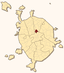 Location in Moscow
Maryina roshcha (Russian: Ма́рьина ро́ща, lit. Mary's grove) is a district in North-Eastern Administrative Okrug of Moscow, Russia. Population: 66,055 (2010 Census preliminary results);[1] 60,194 (2002 Census).[2]
The historical area of Maryina roshcha, which emerged in the middle of the 19th century on the site of Sheremetev family lands, retained its low-rise, country style until the 1960s.
Contents
History
The village of Maryino (Ма́рьино), also known as Boyarkino (Боя́ркино), appears in official registers since 1678, when it had a population of 102 people in 22 households. Maryino and the adjacent Ostankino village and a park were owned by the Cherkassky family. In the middle of the 18th century, the last Princess Cherkassky married Count P. B. Sheremetev, and the land passed into Sheremetev family possession. The main north-south street of the area, Sheremetevskaya, is still named after these past landlords.
After the Great Fire of 1812, the groves between Moscow and Maryino were felled for timber, but quickly recovered and became a popular picnic destination. Entertainment established the name of "Maryina roshcha" (lit. Mary's Grove) as a toponym independent of the old Maryino village. Vasily Zhukovsky wrote a romantic poem of the same name; his version of the etymology of the name "Maryina roshcha" is pure fiction, as well as the legend linking Maryina roshcha to a female highway robber called Marya.
Between 1851 and 1882, railroad construction isolated Maryina roshcha from Moscow (south) and Ostankino (north). In the 1880s, a French real estate developer signed a long-term lease with the Sheremetev family, cleared the trees, and leveled the area for cheap lowrise construction, creating the rectangular grid of streets and alleys that still exists today. However, they did not bother to set up water supply or a sewage system. The proximity of railroads quickly attracted industrialists like Gustav List, who built factories on the edges of Maryina roshcha. Wooden houses were occupied by workers of these factories, including an ethnic minority of Mordvin laborers, who settled in the area in 1901. The existing orthodox church of Unexpected Joy (photographs) was built by public subscription in 1899-1904 and operated continuously through the Soviet years.
Mariyna roshcha, located outside of Moscow city limits, was inadequately policed by the country administration. This attracted shady persons, and the area was considered a criminal ghetto, especially after World War I and Russian Civil War, when law-abiding men where drafted and perished in the army, and the Bolshevik administration expropriated all livestock from the residents. The area remained unsafe until the 1960s. The post-World War II Maryina roshcha underworld was featured in The Meeting Place Cannot Be Changed mini-series.
Joseph Stalin's master plan of 1935 proposed building a north-south highway through Maryina roshcha, which would lead to demolition of the 19th-century housing. This plan did not materialize, and wooden Maryina roshcha was demolished gradually only in the 1960s. The remainder was cleared in the late 1970s in preparation for the 1980 Summer Olympics. The last remaining tram lines were closed in 2002 (see 2002 photographs [1] [2]), when the district's southern boundary was converted into the Third Ring highway.
Public transportation access
Moscow Metro had expanded the Lyublinskaya Line to Maryina roshcha station on June 19, 2010.[3] Also the district is accessible via Savyolovskaya, Rizhskaya (south), and Alexeyevskaya (north) stations.
References
- ^ Федеральная служба государственной статистики (Federal State Statistics Service) (2011). "Предварительные итоги Всероссийской переписи населения 2010 года (Preliminary results of the 2010 All-Russian Population Census)" (in Russian). Всероссийская перепись населения 2010 года (All-Russia Population Census of 2010). Federal State Statistics Service. http://www.perepis-2010.ru/results_of_the_census/results-inform.php. Retrieved 2011-04-25.
- ^ Федеральная служба государственной статистики (Federal State Statistics Service) (2004-05-21). "Численность населения России, субъектов Российской Федерации в составе федеральных округов, районов, городских поселений, сельских населённых пунктов – районных центров и сельских населённых пунктов с населением 3 тысячи и более человек (Population of Russia, its federal districts, federal subjects, districts, urban localities, rural localities—administrative centers, and rural localities with population of over 3,000)" (in Russian). Всероссийская перепись населения 2002 года (All-Russia Population Census of 2002). Federal State Statistics Service. http://www.perepis2002.ru/ct/doc/1_TOM_01_04.xls. Retrieved 2010-03-23.
- ^ МАРЬИНА РОЩА (Russian)
- P. V. Sytin. History of Moscow Streets (1948).
External links
- Official website of Maryina roshcha District (Russian)
- 1929 map of Maryina roshcha
- 1929 map of the villages of Maryino and Ostankino
Administrative divisions of Moscow Zelenogradsky Administrative Okrug - Matushkino
- Savyolki
- Staroye Kryukovo
- Silino
- Kryukovo
Northern Administrative Okrug - Aeroport
- Begovoy
- Beskudnikovsky
- Dmitrovsky
- Golovinsky
- Khoroshyovsky
- Khovrino
- Koptevo
- Levoberezhny
- Molzhaninovsky
- Savyolovsky
- Sokol
- Timiryazevsky
- Vostochnoye Degunino
- Voykovsky
- Zapadnoye Degunino
North-Eastern Administrative Okrug - Alexeyevsky
- Altufyevsky
- Babushkinsky
- Bibirevo
- Butyrsky
- Lianozovo
- Losinoostrovsky
- Marfino
- Maryina roshcha
- Ostankinsky
- Otradnoye
- Rostokino
- Severnoye Medvedkovo
- Severny
- Sviblovo
- Yaroslavsky
- Yuzhnoye Medvedkovo
North-Western Administrative Okrug Central Administrative Okrug Eastern Administrative Okrug - Bogorodskoye
- Golyanovo
- Ivanovskoye
- Izmaylovo
- Kosino-Ukhtomsky
- Metrogorodok
- Novogireyevo
- Novokosino
- Perovo
- Preobrazhenskoye
- Severnoye Izmaylovo
- Sokolinaya gora
- Sokolniki
- Veshnyaki
- Vostochnoye Izmaylovo
- Vostochny
Western Administrative Okrug - Dorogomilovo
- Filyovsky park
- Fili-Davydkovo
- Krylatskoye
- Kuntsevo
- Mozhaysky
- Novo-Peredelkino
- Ochakovo-Matveyevskoye
- Prospekt Vernadskogo
- Ramenki
- Solntsevo
- Troparyovo-Nikulino
- Vnukovo
Southern Administrative Okrug - Biryulyovo Vostochnoye
- Biryulyovo Zapadnoye
- Brateyevo
- Chertanovo Severnoye
- Chertanovo Tsentralnoye
- Chertanovo Yuzhnoye
- Danilovsky
- Donskoy
- Moskvorechye-Saburovo
- Nagatino-Sadovniki
- Nagatinsky Zaton
- Nagorny
- Orekhovo-Borisovo Severnoye
- Orekhovo-Borisovo Yuzhnoye
- Tsaritsyno
- Zyablikovo
South-Eastern Administrative Okrug - Kapotnya
- Kuzminki
- Lefortovo
- Lyublino
- Maryino
- Nekrasovka
- Nizhegorodsky
- Pechatniki
- Ryazansky
- Tekstilshchiki
- Vykhino-Zhulebino
- Yuzhnoportovy
South-Western Administrative Okrug - Akademichesky
- Cheryomushki
- Gagarinsky
- Konkovo
- Kotlovka
- Lomonosovsky
- Obruchevsky
- Severnoye Butovo
- Tyoply Stan
- Yasenevo
- Yuzhnoye Butovo
- Zyuzino

Wikimedia Foundation. 2010.