- Aldbourne
-
Coordinates: 51°28′N 1°37′W / 51.47°N 1.62°W
Aldbourne 
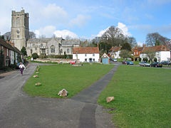
St. Michael's parish church and village green
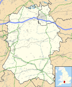
 Aldbourne shown within Wiltshire
Population 1,782 (2001 census)[1] OS grid reference SU265756 Unitary authority Wiltshire Ceremonial county Wiltshire Region South West Country England Sovereign state United Kingdom Post town Marlborough Postcode district SN8 Dialling code 01672 Police Wiltshire Fire Wiltshire Ambulance Great Western EU Parliament South West England UK Parliament Devizes Website The Aldbourne Net List of places: UK • England • Wiltshire Aldbourne is a village and civil parish about 6 miles (10 km) northeast of Marlborough in Wiltshire, England. It is in a valley in the south slope of the Lambourn Downs, part of the North Wessex Downs Area of Outstanding Natural Beauty. From here an unnamed winterbourne flows and joins the River Kennet 4 miles (6.4 km) south near the village of Ramsbury.
Contents
Church of St Michael
The Church of England parish church of Saint Michael overlooking the village green is medieval and a Grade I listed building.[2] The nave and aisles were built around 1200, although some earlier Norman arches and other traces remain. There are four arches on the north arcade and three on the south. The chancel is Early English, with north and south chapels, and a sanctuary with lancet windows.
The Perpendicular Gothic three-stage tower was added in 1460. It is ashlar, has angled buttresses and transomed three-light bell openings, with gargoyles above. There are also transepts with three-light windows, a tall south porch – originally two-storey – and a bay between the porch and south transept. There was also formerly a north porch. The external walls are of flint and limestone with some chequer work and sarsen, and are crenellated. The roofs are lead and slate. The interior contains a number of monuments and monumental brasses.
Bell foundry
For at least 130 years Aldbourne had a bell foundry. Master-founders at Aldbourne included Robert Cor (active 1694-1724), William Cor (active 1696-1722), Oliver Cor (active 1725-27), John Cor (active 1728-50), John Stares (active 1744-46), Edward Read (active 1751-57), Edne Witts (active 1759-74), Robert Wells (I) (active 1760-81), Robert Wells (II) (active 1781-93), James Wells (active 1792-1826).[3] Bells cast by the Wells family survive at parish churches including St. Nicolas', East Challow, All Saints', East Lockinge, All Saints', Faringdon, St. Giles', Great Coxwell, St. Giles', Horspath, St. Peter's, Marsh Baldon, Holy Cross, Seend, St. James the Great, West Hanney and others.
History
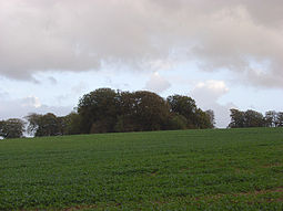
Lewisham Castle is a small medieval ringwork about 1.5 miles (2.4 km) south-west of the village.[4] It is not certain whether it was in fact a castle.[4]
During the English Civil War Prince Rupert and his Cavaliers fought the Parliamentarian Army in a skirmish at Aldbourne Chase on the 18th September 1643, two days before the First Battle of Newbury.[5]
Easy Company of the US Army 101st Airborne Division was based at Aldbourne in the weeks before D-Day.[6] Easy Company was featured in the HBO series Band of Brothers.
In 1971 BBC Television used Aldbourne extensively as a location for the village of Devil's End in its science fiction drama Doctor Who in a series called The Daemons. St Michael's parish church was destroyed at the climax of the series and one viewer wrote to complain about this wanton piece of destruction for the sake of drama, but the BBC had used a model for this special effect.[7]
Amenities
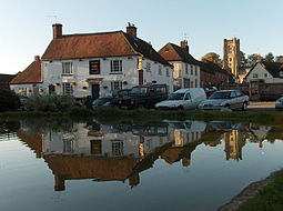
Aldbourne has two public houses: the Blue Boar[8] and The Crown.[9]
People
People from Aldbourne are nicknamed "Dabchicks", after the Little Grebe. This is said to have begun as an insult by the residents of nearby Ramsbury, but it has been adopted as a badge of pride.
The Aldbourne Band is an award-winning brass band that has won many national competitions.[10]
See also
References
- ^ "Area selected: Kennet (Non-Metropolitan District)". Neighbourhood Statistics: Full Dataset View. Office for National Statistics. http://neighbourhood.statistics.gov.uk/dissemination/viewFullDataset.do;jsessionid=ac1f930b30d8251a33137b414aacb8d5d1a9029f24bf?instanceSelection=03070&productId=779&$ph=60_61&datasetInstanceId=3070&startColumn=1&numberOfColumns=4&containerAreaId=790549. Retrieved 10 June 2010.
- ^ Details from listed building database (310499) . Images of England. English Heritage.
- ^ Dovemaster (25 June 2010). "Bell Founders". Dove's Guide for Church Bell Ringers. http://dove.cccbr.org.uk/founders.php. Retrieved 7 October 2011.
- ^ a b Pevsner & Cherry, 1975, page 82
- ^ Money, Walter (1881). The First and Second Battles of Newbury and the Siege of Donnington Castle During the Civil War, AD 1643-6. The Naval and Military Press. p. 25.
- ^ Ambrose, Stephen E. (2001). Band of Brothers. New York: Simon & Schuster. p. 43–56. ISBN 0743216385.
- ^ Haining, Peter (1983). Doctor Who – A Celebration. London: W.H. Allen. p. 196. ISBN 0491033516.
- ^ The Blue Boar, 'The Pub on the Green', Aldbourne
- ^ The Crown at Aldbourne
- ^ "Aldbourne Band". Aldbourne Band. 2010-09-07. http://www.aldbourne-band.co.uk. Retrieved 2011-01-06.
Sources & further reading
- Crowley, D.A. (ed.); Baggs, A.P.; Freeman, Jane; Stevenson, Janet H. (1983). A History of the County of Wiltshire: Volume 12: Ramsbury and Selkey hundreds; the Borough of Marlborough. Victoria County History. pp. 67–86. http://www.british-history.ac.uk/report.aspx?compid=66518.
- Pevsner, Nikolaus; Cherry, Bridget (revision) (1975) [1963]. Wiltshire. The Buildings of England. Harmondsworth: Penguin Books. pp. 81–82. ISBN 0 14 0710.26 4.
External links
Categories:- Villages in Wiltshire
- Civil parishes in Wiltshire
Wikimedia Foundation. 2010.


