- Mollahat Upazila
-
Mollahat
মোল্লাহাট— Upazila — Location in Bangladesh
 Mollahat
Coordinates: 22°56.5′N 89°42′E / 22.9417°N 89.7°ECoordinates: 22°56.5′N 89°42′E / 22.9417°N 89.7°E Country  Bangladesh
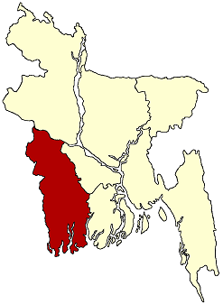
Division Khulna Division District Bagerhat District Area - Total 187.88 km2 (72.5 sq mi) Population (1991) - Total 116,729 - Density 621/km2 (1,608.4/sq mi) Time zone BST (UTC+6) Website Official Map of Mollahat Mollahat (Bengali: মোল্লাহাট) is an Upazila of Bagerhat District in the Division of Khulna, Bangladesh.
Contents
Geography
Mollahat is located at 22°56′30″N 89°42′00″E / 22.9417°N 89.7000°E . It has 21465 units of house hold and total area 187.88 km².
Demographics
As of the 1991 Bangladesh census, Mollahat has a population of 116729. Males constitute are 50.52% of the population, and females 49.48%. This Upazila's eighteen up population is 56893. Mollahat has an average literacy rate of 31.6% (7+ years), and the national average of 32.4% literate.[1]
Mollahat Upazila (bagerhat district) with an area of 187.44 sq km, is bounded by kalia upazila on the north, fakirhat and chitalmari upazilas on the south, Chitalmari, tungipara and gopalganj sadar upazilas on the east, terokhada and rupsa upazilas on the west. Main rivers are madhumati, Atharbanki, Chitra; noted depressions: Kenduar Beel and Kodaliar Beel.
Mollahat (Town) consists of 8 mouzas with an area of 8.79 sq km. It has a population of 10708; male 51.83%, female 48.17%. The density of population is 1218 per sq km. The literacy rate among the town people is 36%. The town has one dakbungalow.
Administration Mollahat thana was established in 1967 and was turned into an upazila in 1983. It consists of 7 union parishads, 58 mouzas and 102 villages.
Archaeological heritage Single domed mosque at Kulia union.
Historical events During the War of Liberation (1971) a battle between the freedom fighters and the Pakistani troops was fought at Chakulia in which about 200 Pakistani soldiers including a captain were killed.
Marks of the War of Liberation Memorial monument at Chakulia.
Religious institutions Mosque 267, temple 72 and church 2, most noted of which are Single Dome Mosque and Matiargati temple.
Population 116729; male 51.52%, female 49.48%; Muslim 75.01%, Hindu 24.87% and others 0.12%.
Literacy and educational institutions Average literacy 31.6%; male 36.8% and female 26.2%. Educational institutions: college 3, high school 13, government primary school 58, non-government primary school 19 and madrasa 8, noted of which are Angra Government Primary School (1918) and Madartali Model Government Primary School (1928).
Cultural organisations Rural club 8, playground 20.
Main occupations Agriculture 53.61%, fishing 1.71%, agricultural labourer 22.15%, wage labourer 2.02%, industries 1.6%, commerce 5.93%, transport 1.21%, service 6.2%, others 5.57%.
Land use Cultivable land 14602.53 hectares, fallow land 2287.05 hectares; single crop 35%, double crop 47% and treble crop land 18%.
Land control Among the peasants, 10% are landless, 27% small, 25% marginal, 30% intermediary and 8% rich.
Value of land Market value of first grade of land is Tk 5000 per 0.01 hectare.
Main crops Paddy, jute, sugarcane, wheat, til, pulse, kumra and sweet potato.
Extinct and nearly extinct crops Tobacco, masnia.
Main fruits Mango, jackfruit, banana, coconut and papaya.
Fisheries, dairies and poultries Fishery (shrimp cultivation) 10000, poultry 159.
Communication facilities Roads: pucca 34.41 km, semi pucca 12 km and mud road 269 km.
Traditional transport Palanquin and horse carriage, bullock curt. These means of transport are either extinct or nearly extinct.
Manufactories Ice factory 2
Cottage industries Bamboo work 235, goldsmith 50, blacksmith 35, potteries 15, wood work 150, tailoring 225 and bidi 2.
Hats, bazars and fairs Hats and bazars are 23, fairs 4, most noted of which are Mollahat, Udaypur and Nagarkandi.
Main exports Betel leaf, sugarcane, date molasses, coconut, betel nut, banana, papaya and shrimp.
NGO's activities brac, CARE, asa, Gonoshahajjo Sangstha, Proderpon, Ganasahijya Sangstha and Srijanee.
Health centres Upazila health complex 1 and union health family planning centre 6.
See also
References
- ^ "Population Census Wing, BBS.". Archived from the original on 2005-03-27. http://web.archive.org/web/20050327072826/http://www.bangladeshgov.org/mop/ndb/arpc91_v1/tables04.htm. Retrieved November 10, 2006.
Categories:- Upazilas of Bagerhat District

Wikimedia Foundation. 2010.