- New York State Route 189
-
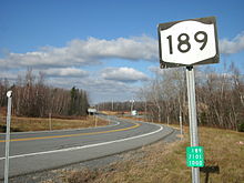
NYS Route 189
Route information Maintained by NYSDOT Length: 5.70 mi[2] (9.17 km) Existed: 1930[1] – present Major junctions South end:  US 11 in Clinton
North end:  Route 209 at Clinton
Location Counties: Clinton Highway system Numbered highways in New York
Interstate • U.S. • N.Y. (former) • Reference • County←  NY 188
I-190  →
→New York State Route 189 (NY 189) is a north–south state highway located near the northern border of New York in the United States. It extends for 5.70 miles (9.17 km) through the Clinton County town of Clinton from a junction with U.S. Route 11 (US 11) to the Canadian border, where it continues into Quebec as Route 209. In between, the two-lane NY 189 serves the small hamlet of Churubusco. Outside of Churubusco, the highway passes through rural, undeveloped areas. NY 189 was assigned to its current alignment as part of the 1930 renumbering of state highways in New York and has remained untouched since.
Contents
Route description
NY 189 starts at an intersection with US 11 in the town of Clinton. The route progresses northward as a two-lane highway, passing a lone farm just after US 11. Over the next 1.5 miles (2.4 km), NY 189 passes through highly isolated areas of Clinton County dominated by patches of forests interspersed with small clearings. After Lagree Road and Swamp Road, two local roads maintained by the town of Clinton, the route passes by a small handful of residences on its way into the hamlet of Churubusco, the only community along NY 189. Here, it intersects with County Route 8 (CR 8), named Looby Road west of NY 189 and Clinton Mills Road east of the highway. The route continues north through the western portion of the small community,[3] passing by the former site of NY 189's U.S. Customs and Border Protection station, once located in what is now a clearing south of Broad Street.[3][4]
The route's second and last intersection in Churubusco is with Broad Street, which links NY 189 to the more populated eastern half of the hamlet. North of Churubusco, NY 189 passes through more forests and fields and serves only a small amount of isolated residences and farms. As it heads toward the Canadian border, it crosses roads of mostly local importance, beginning with Merchia Road just north of Churubusco and concluding with CR 9 (Frontier Road) and Liberty Pole Road at a junction less than 1 mile (1.6 km) from the border. NY 189 continues north to the border, where it ends upon passing through an international customs station. Past the station, the highway continues north into the Canadian province of Quebec as Route 209.[3]
History
What is now NY 189 was originally taken over by the state of New York in the late 1920s.[5][6] Work to improve the highway to state highway standards began around this time and was completed ca. 1930.[1][6] In the 1930 renumbering of state highways in New York, several of the routes assigned during the 1920s were renumbered or modified. At the same time, hundreds of state-maintained highways that did not yet have a route number were assigned one.[7] One of these was the north–south highway connecting US 11 to the Canadian border via Churubusco, which was designated as NY 189.[1][6] The route has not been altered since that time.[8][9]
Major intersections
The entire route is in Clinton, Clinton County.
Mile[2] Destinations Notes 0.00 US 115.70 Route 209Continuation into Quebec 1.000 mi = 1.609 km; 1.000 km = 0.621 mi References
- ^ a b c Standard Oil Company of New York (1930). Road Map of New York (Map). Cartography by General Drafting.
- ^ a b "2008 Traffic Volume Report for New York State" (PDF). New York State Department of Transportation. June 16, 2009. p. 181. https://www.nysdot.gov/divisions/engineering/technical-services/hds-respository/NYSDOT%20TVR%202008%20by%20Route.pdf. Retrieved February 1, 2010.
- ^ a b c Yahoo! Inc. Yahoo! Maps – overview map of NY 189 (Map). Cartography by NAVTEQ. http://maps.yahoo.com/#mvt=h&lat=44.99846&lon=-73.937649&zoom=18&q1=44.916823%2C-73.927585&q2=44.997967%2C-73.938743. Retrieved December 6, 2008.
- ^ United States Geological Survey (1964). Churubusco Quadrangle – New York – Quebec (Map). 1:24,000. 7.5 Minute Series (Topographic). http://www.nysgis.state.ny.us/gisdata/quads/drg24/usgspreview/index.cfm?code=o44073h8. Retrieved December 1, 2010.
- ^ State of New York Department of Public Works (1926). Official Map Showing State Highways and other important roads (Map). Cartography by Rand McNally and Company.
- ^ a b c Standard Oil Company of New York (1929). New York in Soconyland (Map). Cartography by General Drafting.
- ^ Dickinson, Leon A. (January 12, 1930). "New Signs for State Highways". The New York Times: p. 136.
- ^ New York State Department of Transportation (January 2009) (PDF). Official Description of Highway Touring Routes, Bicycling Touring Routes, Scenic Byways, & Commemorative/Memorial Designations in New York State. https://www.nysdot.gov/divisions/operating/oom/transportation-systems/repository/2009%20tour-bk.pdf. Retrieved December 1, 2010.
- ^ I Love New York (2008). New York State Map (Map). Cartography by Map Works.
External links
Categories:- State highways in New York
- Transportation in Clinton County, New York


Wikimedia Foundation. 2010.