- New York State Route 218
-
This article is about the current alignment of NY 218. For the former alignment of NY 218 in Chenango County, see New York State Route 218 (1930 – early 1940s).
NYS Route 218
Route information Maintained by NYSDOT Length: 10.81 mi[3] (17.40 km) Existed: early 1940s[1][2] – present Major junctions South end:  US 9W in Highland Falls
North end: US 9W near Cornwall-on-HudsonLocation Counties: Orange Highway system Numbered highways in New York
Interstate • U.S. • N.Y. (former) • Reference • County←  NY 217
US 219  →
→New York State Route 218 (NY 218) is a state highway located within Orange County, New York, in the United States. It loops off U.S. Route 9W to run closer to the Hudson River between Highland Falls and Cornwall-on-Hudson. North of Highland Falls, it is briefly concurrent with US 9W.
NY 218 sees much traffic despite its short length. Not only does it bring most of the United States Military Academy's traffic to Thayer Gate, its main entrance, it attracts many who drive it just for the sake of its most renowned portion: the cliffside drive alongside Storm King Mountain. In good weather during the summer months many cars can be seen taking in the views of the river and the Hudson Highlands here (however, this section can be gated off and closed in times of high rockslide danger).
Contents
Route description
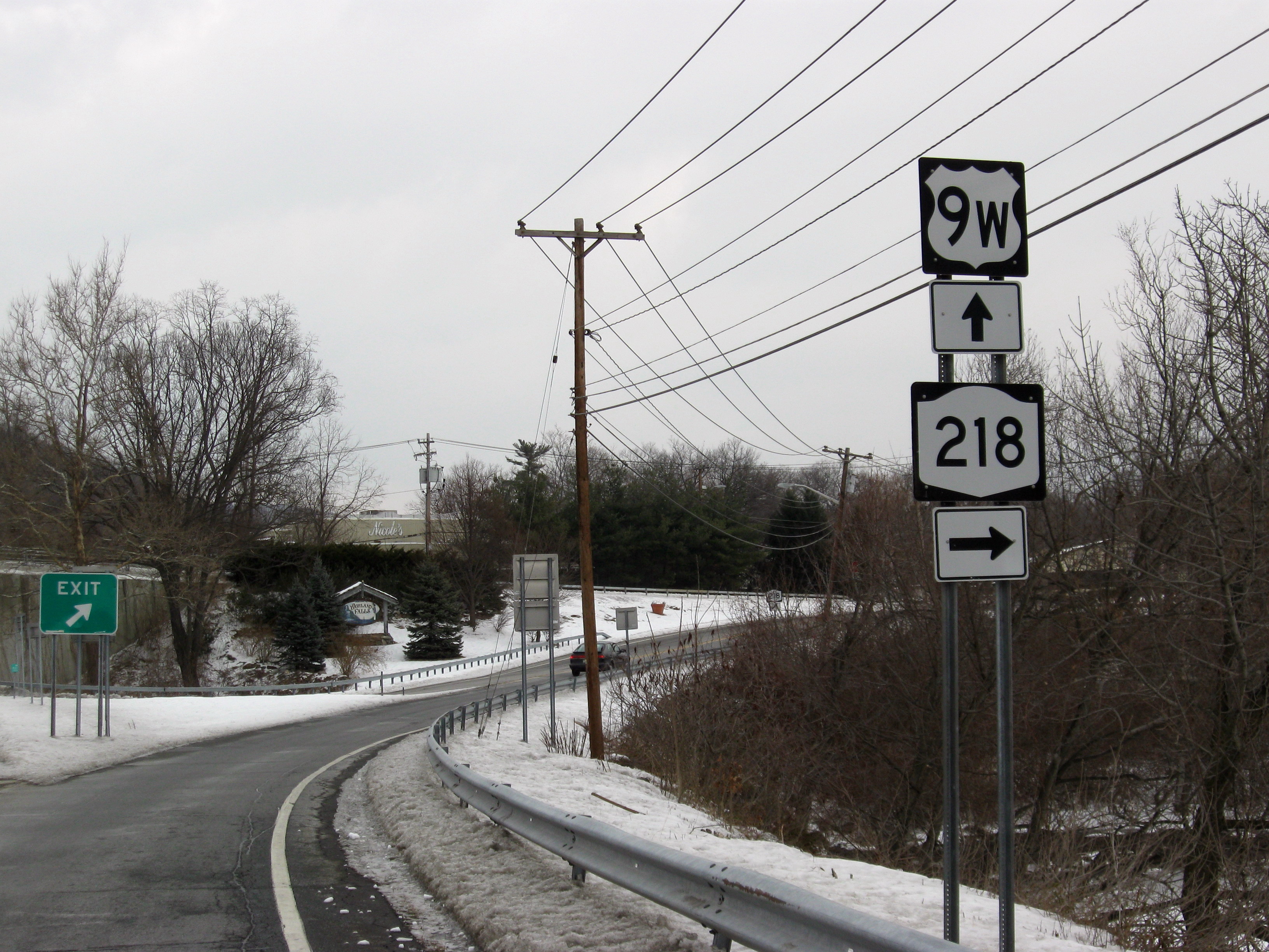
 NY 218 begins at US 9W in Highland Falls.
NY 218 forks off 9W a short distance north of the Bear Mountain Traffic Circle, near the ruins of the old Fort Montgomery. A mile from that junction, it turns from northeast to more northerly and reaches downtown Highland Falls. After several blocks USMA's Thayer Gate becomes apparent, and instead of entering the academy grounds the state highway veers northwestward and uphill, rejoining 9W in Highlands, at this point a four-lane divided highway.
After going up and down one of the rises in this area, NY 218 again splits off at the exit where NY 293 comes in from the west, just adjacent to West Point's Washington Gate. This section passes through less developed, woodsier property before reaching the southern of two gates that block access to the Storm King section in bad weather.
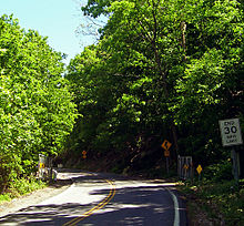 Gates on NY 218 at the Cornwall-on-Hudson village line
The next mile and a half wind leisurely along a narrow roadway where a picturesque stone wall serves to prevent drivers from tumbling into the river. There are several small parking areas where it is possible to stop and take in the vistas that stretch from the Newburgh-Beacon Bridge to the north over Pollopel Island to West Point and the USMA buildings at the southern end. Breakneck Ridge and other mountains of the Highlands tower across the river. The view and the walls led this section to be added to the National Register of Historic Places in 1982 as "Storm King Highway".
The northern gate heralds re-entry into populated areas as the houses of Cornwall-on-Hudson begin alongside the road not long afterwards, and it takes the name Bayview Avenue. After becoming Hudson Street in the village's downtown section, NY 218 then follows Academy Avenue (the former Route 307 once had its eastern terminus at that intersection). Appropriately enough, it passes the New York Military Academy, a private secondary school, and reaches its northern terminus at US 9W immediately afterward.
History
In 1908, the New York State Legislature created Route 3, an unsigned legislative route extending from the New Jersey state line in Rockland County to Albany by way of the Hudson River's west bank. The route mostly followed what is now U.S. Route 9W; however, from Highland Falls to Cornwall-on-Hudson, it used modern NY 218 instead.[4][5] Much of legislative Route 3 became part of NY 10 when the first set of posted routes in New York were assigned in 1924[6][7] and part of US 9W when it was originally assigned in 1927.[8]
In the early 1930s, plans were made by the state of New York to construct a new highway between the Bear Mountain Bridge and Cornwall-on-Hudson that would bypass both Cornwall-on-Hudson and Highland Falls and bypass the narrow Storm King Highway. On April 8, 1934, three people were killed by a rockslide on the Storm King Highway, expediting plans for the new highway, known as the Storm King Cut-off. It was constructed in stages from 1937 to 1941,[9][10] with the final segment of the highway (from Angola Road north to Blooming Grove Turnpike north of Cornwall-on-Hudson) opening to traffic on May 31, 1941. US 9W was realigned to follow the cut-off[11] while its old route via the Storm King Highway became NY 218.[1]
During the forest fires on Storm King during the summer of 1999, NY 218 was closed for many weeks.[citation needed]
Major intersections
The entire route is in Orange County.
Location Mile[3] Destinations Notes Highland Falls 0.00 US 9WHighlands 2.45 US 9W southTrumpet interchange; southern terminus of US 9W / NY 218 overlap 3.21  US 9W north / NY 293
Interchange; northern terminus of NY 293; northern terminus of US 9W / NY 218 overlap Cornwall 9.90  CR 107 (Hudson Street)
Former eastern terminus of NY 307 10.81 US 9W1.000 mi = 1.609 km; 1.000 km = 0.621 mi References
- ^ a b Esso (1942). New York with Pictorial Guide (Map). Cartography by General Drafting.
- ^ Esso (1940). New York (Map). Cartography by General Drafting.
- ^ a b "2008 Traffic Volume Report for New York State" (PDF). New York State Department of Transportation. June 16, 2009. p. 189. https://www.nysdot.gov/divisions/engineering/technical-services/hds-respository/NYSDOT%20TVR%202008%20by%20Route.pdf. Retrieved February 1, 2010.
- ^ State of New York Department of Highways (1909). The Highway Law. Albany, New York: J. B. Lyon Company. p. 54. http://books.google.com/books?id=jZ0AAAAAMAAJ&pg=PA54. Retrieved July 12, 2010.
- ^ New York State Department of Highways (1920). Report of the State Commissioner of Highways. Albany, New York: J. B. Lyon Company. pp. 499–500. http://books.google.com/books?id=Sj4CAAAAYAAJ&pg=PA499. Retrieved July 12, 2010.
- ^ "New York's Main Highways Designated by Numbers". The New York Times: p. XX9. December 21, 1924.
- ^ State of New York Department of Public Works (1926). Official Map Showing State Highways and other important roads (Map). Cartography by Rand McNally and Company.
- ^ Automobile Blue Book. 1 (1927 ed.). Chicago: Automobile Blue Book, Inc. 1927. This edition shows U.S. Routes as they were first officially signed in 1927.
- ^ Mathieu, George M. (August 6, 1939). "Storm King Cut-Off Pushed". The New York Times: pp. XX1, XX10.
- ^ "Route U.S. 9W Improved". The New York Times: p. 196. November 21, 1937.
- ^ Mathieu, George M. (May 25, 1941). "A Cut-Off With Views". The New York Times: p. XX2.
External links
Categories:- State highways in New York
- Transportation in Orange County, New York
- Hudson River
- Cornwall, New York
- Highlands, New York


Wikimedia Foundation. 2010.