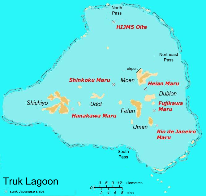
- Truk Lagoon
-
Truk Lagoon, also known as Chuuk, is a sheltered body of water in the central Pacific. North of New Guinea, it is located mid-ocean at 7 degrees North latitude. The atoll consists of a protective reef, 225 kilometres (140 mi) around, enclosing a natural harbour 79 by 50 kilometres (49 by 30 mi), with an area of 2,130 square kilometres (820 sq mi).[1] It has a land area of 127.4 square kilometres (49.2 sq mi), with a population of 47,871 people. [2]
The area consists of eleven major islands (corresponding to the eleven municipalities of Truk lagoon, which are Tol, Udot, Fala-Beguets, Romanum, and Eot of Faichuk group, and Moen, Fefan, Dublon, Uman, Param, and Tsis of Namoneas group) and forty-six smaller ones within the lagoon, plus forty-one on the fringing coral reef, and is known today as the Chuuk islands, part of the Federated States of Micronesia in the Pacific Ocean.
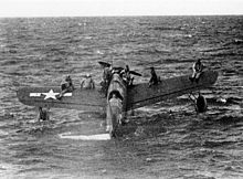 Downed American airmen near Truk await rescue by USS Tang
Its first colonial experience was as part of the Spanish Empire, then control was shifted to Germany after the Spanish-American War. It became a Japanese possession under a mandate from the League of Nations following Germany's defeat in World War I.
Contents
World War II
During World War II Truk Lagoon served as the forward anchorage for the Japanese Imperial Fleet. The place was considered the most formidable of all Japanese strongholds in the Pacific. On the various islands, the Japanese Civil Engineering Department and Naval Construction Department had built roads, trenches, bunkers and caves. Five airstrips, seaplane bases, a torpedo boat station, submarine repair shops, a communications center and a radar station were constructed during the war. Protecting these various facilities were coastal defense guns and mortar emplacements. At anchor in the lagoon were the Imperial Japanese Navy’s giant battleships, aircraft carriers, cruisers, destroyers, tankers, cargo ships, tugboats, gunboats, minesweepers, landing craft, and submarines. Some have described it as Japan's equivalent of the Americans' Pearl Harbor.
Once the American forces captured the Marshall Islands, they used it as a base from which they launched an early morning attack on February 17, 1944 against Truk Lagoon. The Japanese withdrew most of their heavy units. Operation Hailstone lasted for three days, with an American bombardment of the Japanese wiping out almost anything of value - 60 ships and 275 airplanes were sent to the bottom of the lagoon. The superior force of United States ships and planes made the Truk lagoon the biggest graveyard of ships in the world.[3]
The attacks for the most part ended Truk as a major threat to Allied operations in the central Pacific; the Japanese garrison on Eniwetok was denied any realistic hope of reinforcement and support during the invasion that began on February 18, 1944, greatly assisting U.S. forces in their conquest of that island. Truk was isolated by Allied (primarily U.S.) forces as they continued their advance towards Japan by invading other Pacific islands such as Guam, Saipan, Palau, and Iwo Jima. Cut off, the Japanese forces on Truk and other central Pacific islands ran low on food and faced starvation before Japan surrendered in August 1945. (Stewart, 1986)
Today
 Chuuk Atoll
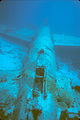
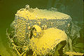
In 1969, French oceanographer Jacques Cousteau and his team explored Truk Lagoon. Following Cousteau's 1971 television documentary about the lagoon and its ghostly remains, the place became a scuba diving paradise, drawing wreck diving enthusiasts from around the world to see its numerous, virtually intact sunken ships. The shipwrecks and remains are sometimes referred to as the "Ghost Fleet of Truk Lagoon". Scattered mainly around the Dublon, Eten, Fefan and Uman islands within the Truk group, a number of the shipwrecks lie in crystal clear waters less than fifteen meters below the surface. In waters devoid of normal ocean currents, divers can easily swim across decks littered with gas masks and depth charges and below deck can be found numerous human remains. In the massive ships' holds are row upon row of fighter aircraft, tanks, bulldozers, railroad cars, motorcycles, torpedoes, mines, bombs, boxes of munitions, radios, plus thousands of other weapons, spare parts, and other artifacts. Of special interest is the wreck of the submarine I-169 Shinohara which was lost when diving to avoid the bombing. The sub had been part of the attack on Pearl Harbor.
The coral encrusted wrecks attract a diverse array of marine life, including manta-rays, turtles, sharks and corals. In 2007, 266 species of reef fish were recorded by an Earthwatch team and in 2006 the rare coral Acropora pichoni was identified.[4]
On 12 April 2011, the Australian Broadcasting Corporation (ABC) program "Foreign Correspondent" screened a report on Chuuk Lagoon likening the effect of the impending massive release of tens of thousands of tonnes of oil from the rusting Japanese warships into the coral reef to that of the Exxon Valdez spill in Alaska. The ships are classified as a Japanese war grave, requiring Japanese government involvement in the eventual clean-up.
Notes
- ^ 1989 Census p. 1
- ^ 1989 Census p ii
- ^ Trumbull, Robert. "The 'Graveyard' Lure of Truk Lagoon," New York Times (US). April 30, 1972.
- ^ Scientists Find Oil Leak Threatening Chuuk Lagoon Newswise, Retrieved on August 28, 2008.
References
External links
- Shipwrecks of Chuuk Lagoon
- Submarine I-169
- Aviation: From Sand Dunes to Sonic Booms, a National Park Service Discover Our Shared Heritage Travel Itinerary
- Underwater picture gallery
- Chuuk Islands - The Blue and the Black ABC Foreign Correspondent
Gallery
-
Mitsubishi "Betty" bomber
-

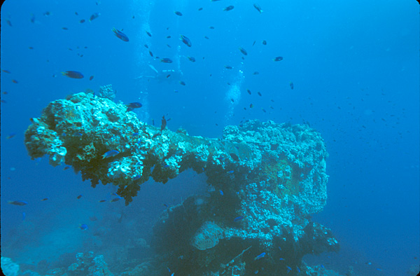
Bow gun of the Fujikawa Maru
-
1930's truck in the hold of the Hoki Maru
-

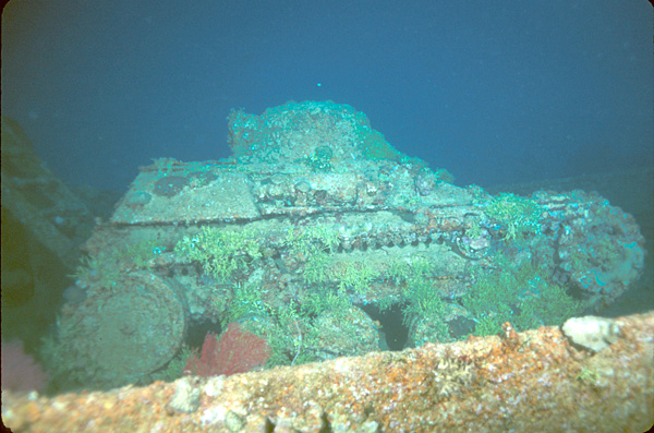
2-man tank on the deck of the Nippo Maru
-

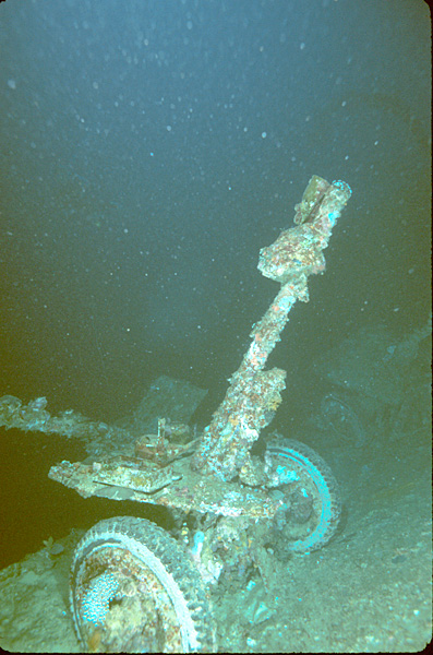
Light artillery piece on the deck of the Nippo Maru
-

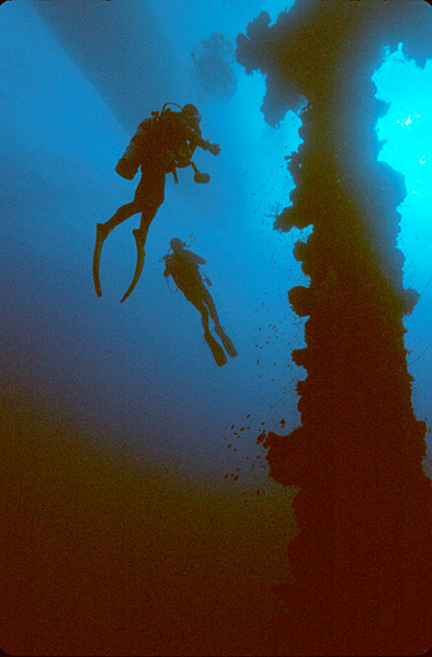
Divers next to the mast of the Unkai Maru
-

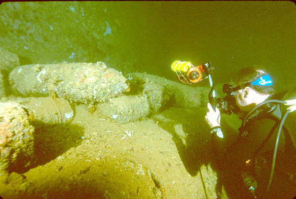
Diver photographing 14-inch artillery shells in the Yamagiri Maru
-

Diver and soft corals next to the mast of the Hoki Maru
Categories:- Chuuk
- Landforms of the Federated States of Micronesia
- Wreck diving sites
- Maritime incidents in 1944


Wikimedia Foundation. 2010.