- M-100 (Michigan highway)
-
M-100
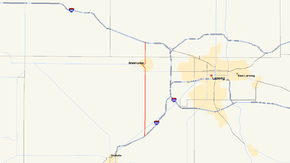
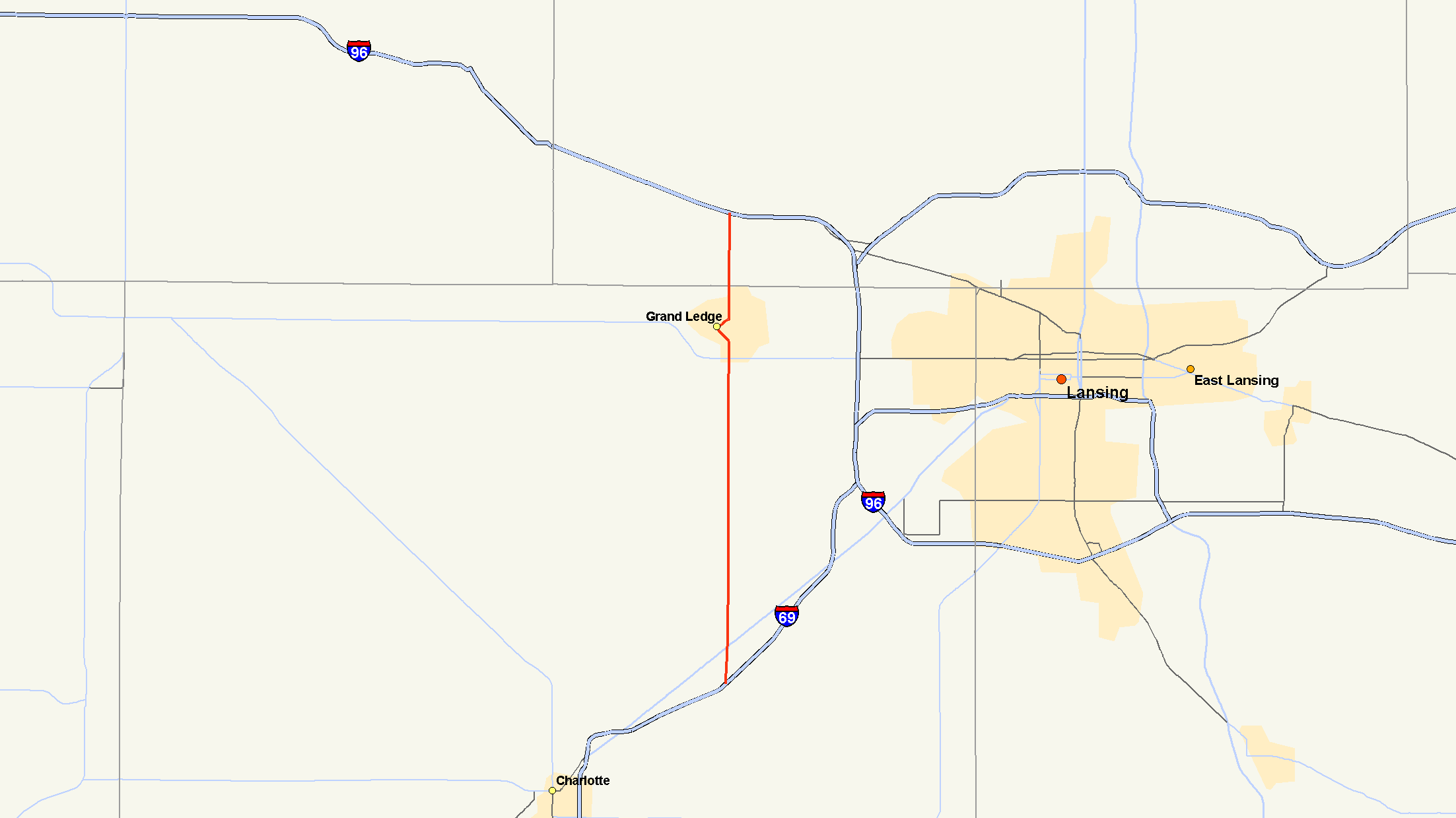
M-100 highlighted in redRoute information Maintained by MDOT Length: 12.460 mi[2] (20.05 km) Existed: ca. 1927[1] – present Major junctions South end:  I-69 Exit 66 south of Potterville
 M-43 in Grand Ledge
North end:  I-96 Exit 86 north of Grand Ledge
Location Counties: Eaton, Clinton Highway system Michigan State Trunkline Highway System
Interstate • US • State←  M-99
M-99M-101  →
→M-100 is a north–south state trunkline highway in the central region of the U.S. state of Michigan. It runs between Potterville and Grand Ledge, connecting Interstate 69 (I-69) and Interstate 96 (I-96) west of the state capitol, Lansing.
The highway was previously a section of M-16. After M-16 was realigned, M-100 was created by 1927. Three extensions in the 1930s, 1950s and 1990s resulted in the current highway routing.
Contents
Route description
M-100 starts at exit 66 on Interstate 69 (I-69) in Potterville. The highway runs north along Hartel Road, intersecting Lansing Road, the former route of US Highway 27 (US 27) south of downtown. Hartel Road runs due north from Potterville to Grand Ledge. North of M-43/Saginaw Highway, M-100 follows Clinton Street, jogging northwest along Jefferson Street north of Willow Highway. Crossing the Grand River on Bridge Street, M-100 returns to Clinton Street north of the river. North of town, the roadway is once again known as Hartel Road before changing to Wright Road near the Abrams Municipal Airport. North of Grand River Highway, which is the former route of US 16, M-100 meets I-96 and ends. Wright Road continues to the north of the interchange.[3]
History
M-100 was created by 1927 when M-16 was rerouted directly between Lansing and Eagle.[1] M-100 started at M-39 in Grand Ledge and ran north to M-16 in Eagle. The highway was extended southward in 1932 to end at US 27/M-78 in Potterville.[4][5] The northern end was extended to meet the US 16 (now I-96) freeway in 1958.[6] The south was similarly extended in 1991 with the completion of the I-69/US 27 freeway south of Potterville.[7]
Major intersections
County Location Mile[2] Destinations Notes Eaton Potterville 0.000 I-69 – Charlotte, LansingExit 66 on I-69 Grand Ledge 10.314 M-43 – Kalamazoo, LansingClinton Eagle Township 12.460 I-96 – Grand Rapids, LansingExit 86 on I-96 1.000 mi = 1.609 km; 1.000 km = 0.621 mi References
- ^ a b Michigan State Highway Department (December 1, 1927). Official Highway Service Map (Map). Cartography by MSHD.
- ^ a b Michigan Department of Transportation (2001). Control Section/Physical Reference Atlas (Map). http://mdotwas1.mdot.state.mi.us/public/maps/pr/. Retrieved January 25, 2008.
- ^ Google, Inc. Google Maps – Potterville, MI to Grand Ledge, MI (Map). Cartography by Google, Inc. http://maps.google.com/maps?f=d&saddr=M-100+%26+Lansing+Rd,+Potterville,+MI+48876&daddr=M-100+%26+W+Grand+River+Hwy,+Clinton,+Michigan&hl=en&geocode=&mra=pe&mrcr=0&sll=42.710766,-84.739193&sspn=0.320887,0.464172&ie=UTF8&ll=42.710696,-84.742355&spn=0.320887,0.464172&z=11. Retrieved November 15, 2008.
- ^ Michigan State Highway Department (July 1, 1932). Official Highway Service Map (Map). Cartography by H.M. Gousha.
- ^ Michigan State Highway Department (October 1, 1932). Official Highway Service Map (Map). Cartography by H.M. Gousha.
- ^ Michigan State Highway Department (1958). Official Highway Map (Map). (Includes all changes through July 1, 1958)
- ^ Michigan Department of Transportation (1991). Michigan Department of Transportation Map (Map). 1 in.:14.5 mi./1 in.:23 km..
External links
Categories:- State highways in Michigan

Wikimedia Foundation. 2010.